Striding Edge

A photo diary of Lake District fell walks

  • Walks
  • Fells
    • Wainwrights
      • Eastern Fells
      • Far Eastern Fells
      • Central Fells
      • Southern Fells
      • Northern Fells
      • North Western Fells
      • Western Fells
      • Outlying Fells
    • Birketts
  • Dogs
  • Love The Lakes
  • Contact

Boat How

Height: 337 metres / 1105 feet Grid reference: NY 17728 03401 Category: The Outlying Fells
The summit of Boat How, Great Gable now visible between Kirk Fell and Scafell

The summit of Boat How, Great Gable now visible between Kirk Fell and Scafell

Boat How

Walked on 23/05/2006

Start point: Boot (NY 176 011)

Boot – Burnmoor Tarn – Maiden Castle – Boat How (OF) – Boot

Distance: 6 miles     Total Ascent: 350 metres     Time Taken: 2 hours 30 minutes

Weather: Overcast and cold. 10oC.

This morning’s walk was the gentle ascent of Burnmoor Tarn and Boat How from the small village of Boot in Eskdale. Burnmoor Tarn, of course, lies in the midst of the Wasdale high fells and there are some good views from here, especially from Maiden Castle which is the col to the north. Boat How itself has similar views as well as south west along Miterdale. Angus and Casper certainly seemed to enjoy themselves up there today and Angus braved a swim in Burnmoor Tarn, even though the wind was pretty cold.

a Boat How

b 23.05.06-001

Looking back over Boot and Eskdale from the start of the walk.

b 23.05.06-006

Bookends?

c 23.05.06-013

Scafell and Great How.

d 23.05.06-015

Harter Fell and Green Crag over Eel Tarn.

e 23.05.06-020

Scafell from above Burnmoor Tarn.

f 23.05.06-024

I think some RAF Tucano's were using us as target practice this morning as we were constantly buzzed by them. Here is one approaching from Wasdale over Burnmoor Tarn...

g 23.05.06-025

...and right over us.

h 23.05.06-027

Illgill Head across Burnmoor Tarn.

i 23.05.06-028

Looking over to Wasdale.

j 23.05.06-030

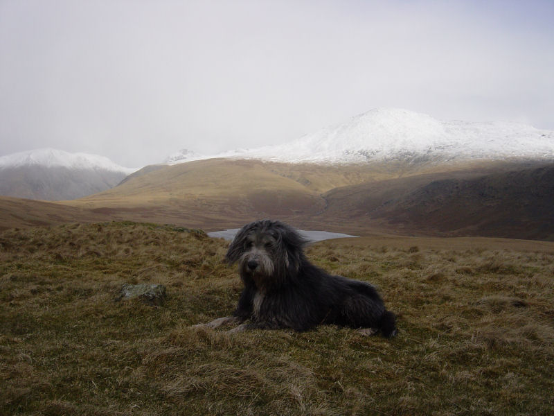
Angus braves the water while Casper looks on.

k 23.05.06-042

Burnmoor Lodge across Burnmoor Tarn. Boat How is the hump on the right.

l 23.05.06-107

Seatallan and Haycock across Wasdale.

m 23.05.06-109

Kirk Fell.

n 23.05.06-112

The summit of Kirk Fell.

o 23.05.06-111

Yewbarrow.

p 23.05.06-113

Scafell.

q 23.05.06-121

Angus and Casper hide in the long grass.

r 23.05.06-134

Great Gable peeps above the lower slopes of Lingmell.

s 23.05.06-046

Returning to Burnmoor Tarn above an old enclosure.

t 23.05.06-048

Room with a view - Burnmoor Lodge.

u 23.05.06-054

Angus and Casper on Boat How.

v 23.05.06-056

Looking along Miterdale to Muncaster Fell and the Ravenglass Estuary.

w 23.05.06-059

The summit of Boat How.

x 23.05.06-062

One of the (many) ancient stone circles on Eskdale Moor. Scafell has caught the cloud now...

y 23.05.06-066

...but there's some rare blue sky for us looking over to Whin Rigg.

z 23.05.06-073

Eskdale Mill, Boot - taken from the bridge.

zz 23.05.06-075

Whillan Beck.

Boat How

Walked on 04/03/2005

Start point: Boot (NY 176 011)

Boot – Burnmoor Tarn – Boat How (312) (OF) – Boot

Distance: 4.5 miles     Total Ascent: 393 metres     Time Taken: 1 hour 30 minutes

Weather: Cold, some sunny and snow showers

There was a mixed bag of weather this morning for the gentle walk from Boot in Eskdale, out to Burnmoor Tarn for a view of the high fells, and back to Boot via Boat How. There were frequent snow showers with plenty of snow in evidence above 500m.

This walk follows the one described in Wainwright’s Boat How chapter in his book ‘The Outlying Fells of Lakeland’, page 178.

Boat How

Boat How route map.

Elevation

Elevation profile of the route.

Boat How 3D

3D image of the walk route.

Boat How - 04.03.05 001

Eskdale Mill and the bridge at Boot.

Boat How - 04.03.05 003

Scafell appears over Eskdale Fell.

Boat How - 04.03.05 006

Harter Fell, Great Barrow and Little Barrow from Gill Bank.

panorama2_annotated_small

Looking over Burnmoor Tarn to Mosedale.

Boat How - 04.03.05 027

Kirk Fell.

Boat How - 04.03.05 026

Scafell.

Boat How - 04.03.05 035

Highly des res, nice if you can get it! - Burnmoor Lodge.

Boat How - 04.03.05 040

The summit of Boat How, Great Gable now visible between Kirk Fell and Scafell.

Boat How - 04.03.05 043

Looking along Miterdale to Muncaster Fell.

Boat How - 04.03.05 052

One of the many stone circles in the area. Scafell is caught in a snowstorm now.

Boat How - 04.03.05 055

Harter Fell.

Boat How - 04.03.05 057

Boot.

Walking Diary

  • The Mosedale Horseshoe 01/03/2022
  • Caw 18/01/2022
  • Coniston sunset 17/01/2022
  • Blencathra 15/01/2022
  • Scafell Pike 14/01/2022

Social

  • Facebook
  • Twitter

Information

  • Striding Edge
  • T&C’s
  • Privacy
  • Links