Height: 405 metres / 1327 feet Grid reference: NY 30282 02167
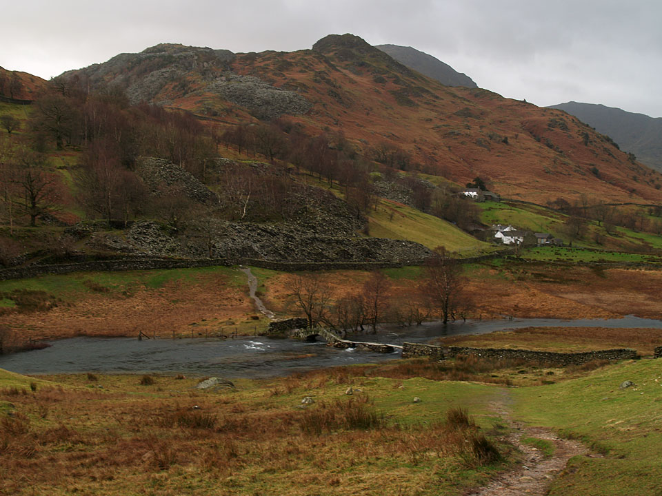
Great Intake over Slaters Bridge
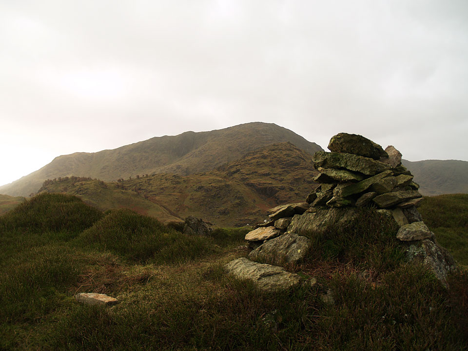
Wetherlam from the summit of Great Intake
Height: 405 metres / 1327 feet Grid reference: NY 30282 02167
Great Intake over Slaters Bridge
Wetherlam from the summit of Great Intake
Start point: Little Langdale (NY 316 034)
Little Langdale – Slaters Bridge – Great Intake on Low Fell – Slaters Bridge – Little Langdale
Distance: 3.3 miles Total Ascent: 250 metres Time Taken: 1 hour 30 minutes
Weather: Wild and windy with showers. 9°C
I had envisaged going for a longer walk today but the conditions were a bit off putting for walking the high fells to say the least – the wind was howling and the driving rain put paid to thoughts of any longer walks. Instead, I had a shorter walk around Tilberthwaite, heading up to Great Intake which is a relatively small fell yet one which commands fine views.


Lakeland cottage, Little Langdale.

Today's objective, Great Intake over Slaters Bridge

An approximation of the route taken - up to the left and down on the right.

Slaters Bridge...

...the River Brathay moving at a fair pace


Lingmoor Fell.

Casper looking alert on one of the quarry spoil heaps.

Lingmoor Fell and Little Langdale Tarn from the climb up to Great Intake

Looking into Greenburn, Great Carrs at the head.

Wetherlam from the summit of Great Intake.

Angus and Casper (caught mid victory roll!) on the summit. It was relatively calm in this hollow on the summit - just how windy is it today, Angus?

Very windy...

...indeed!

Cold Pike, Crinkle Crags and Bow Fell beyond Pike o' Blisco.

Wetherlam.

The Langdale Pikes beyond Blea Tarn and Side Pike.

There was lots of water and waterfalls around today!
Start point: Tilberthwaite car park (NY 306 010)
Tilberthwaite – Tilberthwaite Gill – Blake Rigg (261) – Haystacks (Tilberthwaite) (262) – Hawk Rigg (263) – High Fell (264) – Great Intake on Low Fell (265) – Kitty Crag (266) – Long Crag on Yewdale Fells (267) – High Wythow (268) – Low Wythow (269) – Brackeny Crag (270) – Tilberthwaite
Weather: Cool and clear.
Today’s walk is a round of the Tilberthwaite Fells. Nestling between Coniston and Langdale and bearing the scars of an industrial past, this route with fells of small stature offers some excellent and surprising views.

Tilberthwaite Fells route map.

Elevation profile of the route. Key: BR=Blake Rigg, H=Haystacks (Tilberthwaite), HR=Hawk Rigg, HF=High Fell, GI=Great Intake, KC=Kitty Crag, LC=Long Crag, HW=High Wythow, LW=Low Wythow, BF=Brackeny Fell

High Tilberthwaite Farm.

Wetherlam from Blake Rigg.

The Langdale Pikes from Haystacks (the Tilberthwaite one!).

Haystacks and Blake Rigg from Hawk Rigg.

Red Screes and Caudale Moor flank the Kirkstone Pass in the centre distance, the near hummock is Great Intake from High Fell.

The Langdale Pikes and Blea Tarn from Great Intake.

Looking across to Pike O' Blisco and The Crinkle Crags - annotated.

Looking across to Pike O' Blisco and The Crinkle Crags.

Crossing and un-named beck above Tilberthwaite Gill, Wetherlam is behind.

Looking back to the sunlit Tilberthwaite Fells.

Hole Tarn.

Levers Hawse and the Brim Fell - Swirl How ridge from Kitty Crag.

Kitty Crag and the Coniston fells from Long Crag.

Windermere and the eastern fells from High Wythow.

The full length of Coniston Water can be seen from Low Wythow.

The south face of Wetherlam from Brackeny Crag.