Striding Edge

A photo diary of Lake District fell walks

  • Walks
  • Fells
    • Wainwrights
      • Eastern Fells
      • Far Eastern Fells
      • Central Fells
      • Southern Fells
      • Northern Fells
      • North Western Fells
      • Western Fells
      • Outlying Fells
    • Birketts
  • Dogs
  • Love The Lakes
  • Contact

Great Paddy Crag

Height: 532 metres / 1745 feet Grid reference: SD 15046 90853

Great Paddy Crag ahead
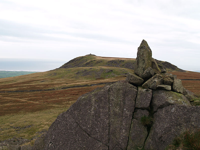
Great Paddy Crag ahead

Kinmont Buck Barrow from Great Paddy Crag

Kinmont Buck Barrow from Great Paddy Crag

Corney Fell

Walked on 08/10/2006

Start point: Corney Fell road (SD 150 896)

Corney Fell road – Buck Barrow – Kinmont Buck Barrow – Great Paddy Crag – Corney Fell road

Distance: 2.5 miles     Total Ascent: 200 metres     Time Taken: 1 hour

Weather: Generally overcast. 14oC.

Just a short, late afternoon onto Corney fell today, climbing three rocky turrets which are really quite exposed due to their position of proximity to the west coast of Cumbria – the wind fairly howls off the sea here! The sun came out at odd intervals with some nice illumination on the sea and all in all, this was a pleasant – and easy going – walk.
01 Corney Fell

08.10.06-001

Today's objectives - Kinmont Buck Barrow, Great Paddy Crag and Buck Barrow.

08.10.06-004

Kinmont Buck Barrow.

08.10.06-007

The sun lights up Stickle Pike and the Dunnerdale Fells.

08.10.06-010

Great Paddy Crag ahead - we veered right to Buck Barrow and returned over Great Paddy Crag.

08.10.06-035

Whitfell from Buck Barrow.

08.10.06-041

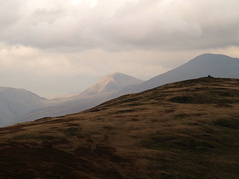
Kirk Fell picks up the sun 12 miles to the north-east with the silhouette of Scafell to the right beyond Whitfell.

08.10.06-045

The Scafell range over Whitfell.

08.10.06-052

The sunrays illuminate the Irish Sea.

08.10.06-065

Casper, tongue a-wagging!

08.10.06-070

Angus - his hair is growing and he's nearly ready for winter now!

08.10.06-077

Its exposed on Kinmont Buck Barrow, the wind blowing straight off the sea.

08.10.06-079

Looking to Ravenglass and the River Esk as it winds its way seaward. The Eskmeals Viaduct is visible carrying the railway line across the river and further along the coast is Sellafield nuclear power station.

08.10.06-080

The fell view from Kinmont Buck Barrow.

08.10.06-087

Black Combe.

08.10.06-097

These two have spotted something down below.

08.10.06-110

Kinmont Buck Barrow from Great Paddy Crag.

Stoneside Pike

Walked on 20/12/2004

Start point: Corney Fell road (SD 150 896)

Corney Fell road – Stoneside Hill (251) – Great Paddy Crag – Buck Barrow – Kinmont Buck Barrow – Corney Fell road and then Burney (OF)

Weather: Overcast, cold.

Today’s walk was a short one from the Corney Fell road – no views whatsoever from any of the peaks visited, in complete contrast to the weather round here yesterday.

Stoneside Hill

Dsc03346

Stoneside Hill from the Corney Fell road.

Dsc03348

Looking towards the west Cumbrian coast from Stoneside Hill summit.

Dsc03355

Which way down from Buck Barrow? On the way home, I could see the clouds hanging in the Crake valley - it was worth a short ascent to Wainwright Outlying fell Burney for a better view.

Dsc03365

Beacon Fell to the left and the clouds forming in the Crake Valley.

Dsc03366

The southern end of the Crake Valley.

Dsc03381

The Duddon Estuary.

Dsc03373

Windmills on Kirkby Moor from Great Burney.

Elevation

Stoneside Hill 3D

Whitfell Group

Walked on 13/05/2004

Start point: Hole House (SD 181 930)

Hole House – The Pike (9) – Hesk Fell (10) – Seat How (Birker Moor) (11) – Rough Crag (Birker Moor) (12) – Water Crag (13) – The Knott on Stainton Fell (14) – White Pike on Birkby Fell (15) – Woodend Height (16) – Yoadcastle (17) – Stainton Pike (18) – Whitfell (19) – Burn Moor (20) – Kinmont Buck Barrow (21) – Great Paddy Crag (22) – Buck Barrow (23) – Plough Fell (24) – Bigert (25) – Hole House

Weather: Dull and overcast with hill fog and sunny spells.
Whitfell1

Whitfell2

Whitfell3

13th May - Whitfell Group 007

The Pike...

13th May - Whitfell Group 011

and Hesk Fell summit.

13th May - Whitfell Group 010

'The detour to The Pike' - AW 'The Outlying Fells of Lakeland' page 141.

13th May - Whitfell Group 017

Whin Rigg, Illgill Head and The Scafell range from Seat How.

13th May - Whitfell Group 019

Devoke Water from Seat How.

13th May - Whitfell Group 020

The summits of Rough Crag....

13th May - Whitfell Group 023

and Water Crag - AW 'The Outlying Fells of Lakeland' page 146.

13th May - Whitfell Group 027

Two views of Linbeck Gill, Devoke Water outfall..

13th May - Whitfell Group 028

Seat How behind and Caw in the distance.

13th May - Whitfell Group 031

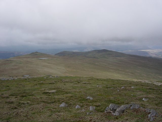
Stainton Pike from The Knott - 'Seen from The Knott, Stainton Pike assumes the pyramidal shape of Bowfell..'. AW
13th May - Whitfell Group 032

The impressive cairn on White Pike

13th May - Whitfell Group 042

Stainton Pike summit.

13th May - Whitfell Group 036

The summit of Woodend Height

13th May - Whitfell Group 038

Yoadcastle.

13th May - Whitfell Group 044

Holehouse Tarn.

13th May - Whitfell Group 050

Stainton Pike, White Pike, Woodend Height and Yoadcastle from the ascent of Whitfell. Holehouse Tarn is in the foreground.
13th May - Whitfell Group 049

The Duddon Estuary from the summit of Whitfell.

13th May - Whitfell Group 053

The summit of Burn Moor looking south to Buck Barrow and Kinmont Buck Barrow.

13th May - Whitfell Group 056

Overlooking the Duddon Estuary from Kinmont Buck Barrow summit

13th May - Whitfell Group 058

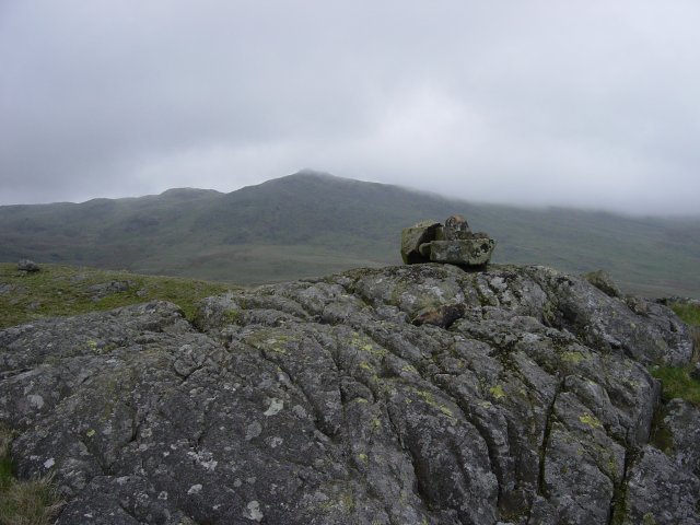
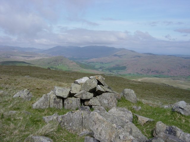
Great Paddy Crag summit.

13th May - Whitfell Group 060

Kinmont Buck Barrow from Buck Barrow summit

13th May - Whitfell Group 063

The first time I have ever seen cows on a summit, on Bigert!

13th May - Whitfell Group 061

The sun shines! The Coniston range from Plough Fell summit - Grey Friar and Swirl How to the left of the dip, then Brim Fell, Dow Crag, Coniston Old Man, Buck Pike and Brown Pike.

13th May - Whitfell Group 062

Another view from Plough Fell summit, The Scafells to the left, Esk Pike and Bowfell in the centre with the Crinkle Crags and Harter Fell to the right.

13th May - Whitfell Group 065

The Pike from the descent of Bigert.

Walking Diary

  • The Mosedale Horseshoe 01/03/2022
  • Caw 18/01/2022
  • Coniston sunset 17/01/2022
  • Blencathra 15/01/2022
  • Scafell Pike 14/01/2022

Social

  • Facebook
  • Twitter

Information

  • Striding Edge
  • T&C’s
  • Privacy
  • Links