Striding Edge

A photo diary of Lake District fell walks

  • Walks
  • Fells
    • Wainwrights
      • Eastern Fells
      • Far Eastern Fells
      • Central Fells
      • Southern Fells
      • Northern Fells
      • North Western Fells
      • Western Fells
      • Outlying Fells
    • Birketts
  • Dogs
  • Love The Lakes
  • Contact

Harrop Pike

Height: 637 metres / 2090 feet Grid reference: NY 50074 07809
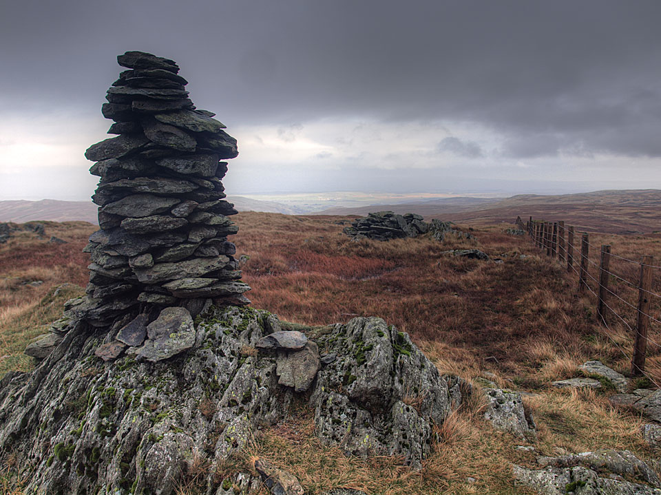
The cairn on Harrop Pike

The cairn on Harrop Pike

Branstree

Walked on 28/11/2011

Start point: Sadgill Bridge, Longsleddale (NY 483 057)

Sadgill Bridge, Longsleddale – Gatesgarth Pass – Branstree – Tarn Crag (Longsleddale) – Harrop Pike – Grey Crag(Longsleddale) – Great Howe (Longsleddale) – Sadgill Bridge, Longsleddale

Distance: 7.5 miles     Total Ascent: 767 metres     Time Taken: 3 hour 30 minutes     Start Time: 09:00

Weather: Cold, wet and windy. 6C

Today I had a walk in Longsleddale, one of the remotest valleys around and I certainly saw no-one today. It was wild on the tops today with a strong wind and some heavy showers which coupled with boggy terrain made the going arduous at times – nice to be out for a longer walk once more though and I enjoyed it.
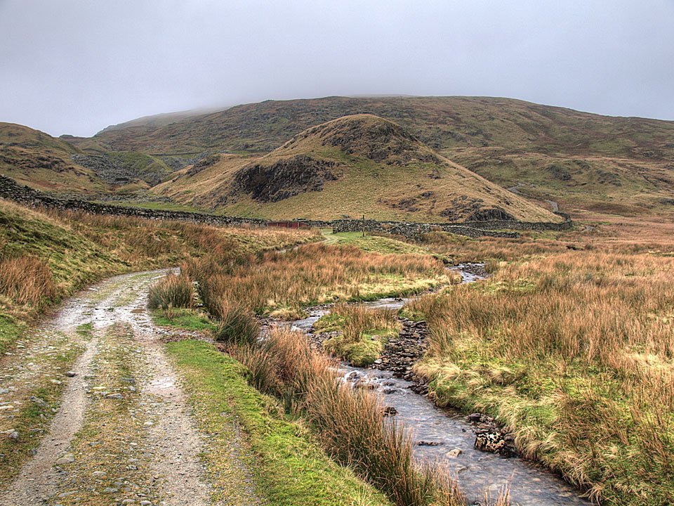
Branstree

Branstree route map.

PB287353

Longsleddale from Sadgill - it all looks a bit ominous ahead.

PB287359

Beautiful Longsleddale and the River Sprint.

PB287365

Following the track, Goat Scar to the left and Buckbarrow Crag to the right.

PB287371

The head of Longsleddale.

PB287389

Buckbarrow Crag.

PB287392

Looking back into Longsleddale, the wind picking up and blowing some rain in now.

PB287401

Cleft Ghyll.

PB287413

The top of Branstree is in cloud, looking across Wrengill Quarry. Once through the quarry the wind really started to pick up and the cloud was almost down to Gatescarth Pass.

PB287420

Casper puts the handy dog water bowl to good use on the summit of Branstree.

PB287426

Out of the clag once more on Selside Brow heading for Tarn Crag with more layers on than an onion, plus the obligatory hat and gloves.

PB287444

Boggy...

PB287447

...peat hags, typical terrain in these parts, looking into Mosedale.

PB287462

Branstree looks pretty clear of cloud now looking back from the climb to Tarn Crag.

PB287468

Mosedale.

PB287480

The survey post on Tarn Crag, the wind is whipping up the water in that puddle.

PB287502

Tarn Crag summit.

PB287505

The cairn on Harrop Pike is clearly visible from the descent of Tarn Crag.

PB287514

The cairn on Harrop Pike.

PB287535

Dougal is getting used to the windswept look.

PB287529

The summit of Grey Crag.

PB287538

Dougal and Casper on Grey Crag.

PB287550

Three old men of the fells.

PB287561

Grey Crag and the survey post on Great Howe.

PB287564

Tarn Crag from Great Howe.

PB287579

The easy gully leading back to Sadgill.

PB287585

A great view of Longsleddale from the descent.

PB287591

Sadgill Bridge.

Mosedale East

Walked on 18/06/2007

Start point: Swindale Lane (NY 516 133)

Truss Gap – Swindale Head – Harrop Pike – Grey Crag – Tarn Crag – Branstree – Artle Crag – High Howes (Mardale) – Selside Pike – Captain Whelter Bog – High Blake Dodd – Old Corpse Road – Swindale Head – Truss Gap

Distance: 11.5 miles     Total Ascent: 800 metres     Time Taken: 4 hours 30 minutes

Weather: Overcast and dull. 19oC.

It has been very wet of late and the weather didn’t promise much today either but I managed to escape the rain for a walk starting from the remote valley of Swindale circling the even remoter valley of Mosedale. There were no views today, the skies were leaden with the merest peep of sunshine. The terrain is generally boggy in this area and I certainly got a good bootful of water today! The remoteness of this area has some advantages though as I only saw one other person all day.
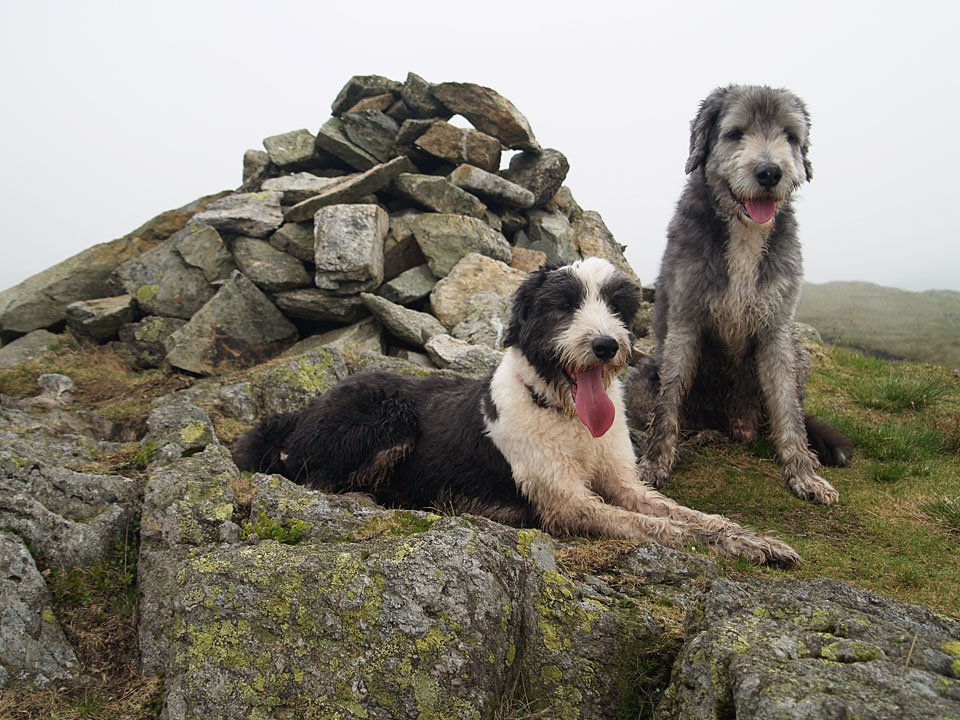
Mosedale-East

18.06.07-003

Truss Gap above Swindale Beck.

18.06.07-009

Swindale Head with Selside Pike up to the right, the route of return.

18.06.07-011

Following Mosedale Beck.

18.06.07-014

The gash of Hobgrumble Gill.

18.06.07-020

Moraine in the glacial valley of Mosedale.

18.06.07-025

The footbridge across Mosedale Beck.

18.06.07-036

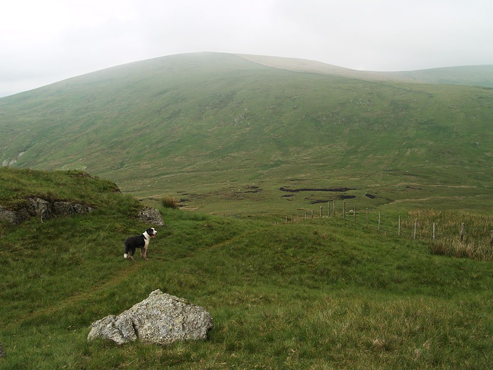
Following the fence to Harrop Pike - it looks a bit gloomy up there today.

18.06.07-038

The summit cairn on Harrop Pike.

18.06.07-043

Casper and Angus on Grey Crag. If you find a red collar up here it belongs to Casper - he managed to lose it shortly after this photo.
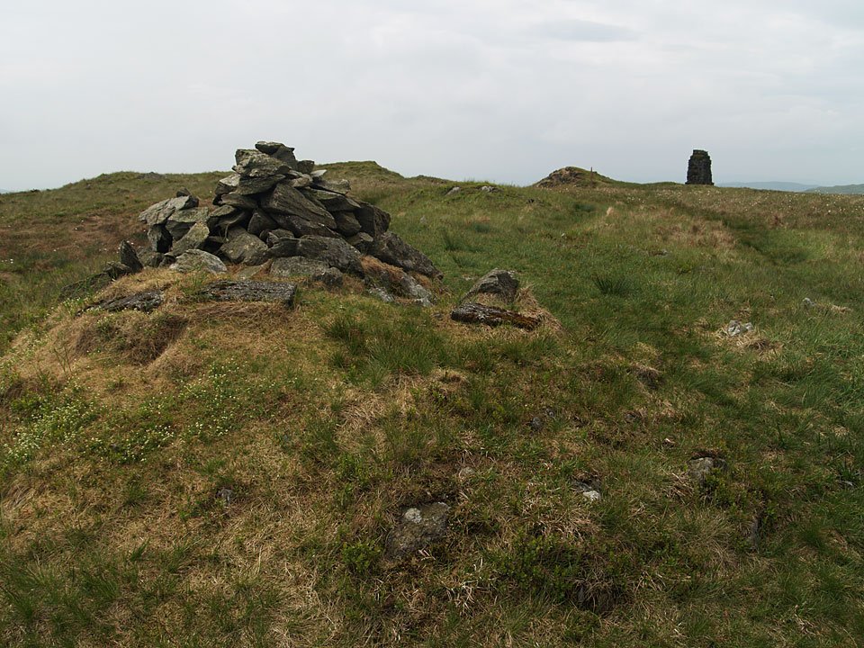
18.06.07-054

Heading for a gloomy Tarn Crag across the bog.

18.06.07-060

The summit of Tarn Crag with a survey column, a remnant from construction of the Haweswater aqueduct, beyond.
18.06.07-064

The survey column.

18.06.07-074

Branstree - the route is following the fence steeply up to the wall, the summit lying at the end of the wall.
18.06.07-084

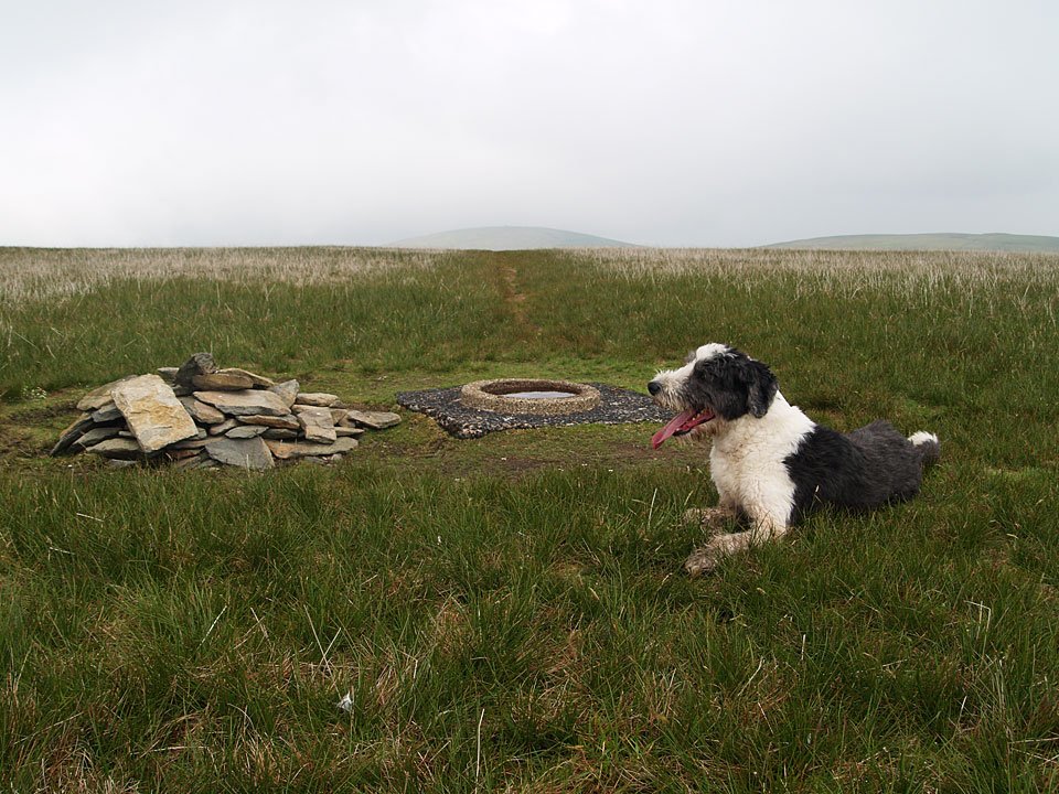
Casper on the summit of Branstree. Angus thought the sunken dish of the trig. station made a good water bowl! You may have heard about the plague of caterpillars that has struck the Lake District recently. After seeing great swathes of them near Skiddaw House last week I can report that there were even more on the south-eastern slopes of Branstree today.

18.06.07-088

One of the cairns on Artlecrag Pike, Selside Pike beyond.

18.06.07-092

The O.S un-named top (Birkett - High Howes) from Artlecrag Pike. In the centre is another survey column with a couple of un-named tarns beyond. I don't know about a plague of caterpillars but there was a plague of gulls on the slopes of this fell seen as white dots in this photo.

18.06.07-094

Selside Pike.

18.06.07-095

The merest glimpse of Haweswater.

18.06.07-102

Angus and Casper manage a quick swim in the tarns beyond the survey column.

18.06.07-115

Heading for Selside Pike.

18.06.07-125

Cascades on the descent to Swindale Head.

18.06.07-130

Swindale.

18.06.07-131

Descending to Swindale Head.

18.06.07-137

This ancient walled track is the Old Corpse Road between Swindale and Mardale.

Branstree

Walked on 09/06/2005

Start point: Sadgill Bridge, Longsleddale (NY 483 057)

Sadgill Bridge, Longsleddale – Gatesgarth Pass – Branstree (364) – Artlecrag Pike – Selside Pike (365) – High Howes (Mardale) (366) – Tarn Crag (Longsleddale) (367) – Harrop Pike (368) – Grey Crag (Longsleddale) (369) – Great Howe (Longsleddale) (370) – Sadgill Bridge, Longsleddale

Distance: 10.1 miles     Total Ascent: 972 metres     Time Taken: 3 hour 45 minutes

Weather: Overcast and hazy, a warm 17°C.

Today’s walk was a visit to some of the far eastern fells that I haven’t visited for a good while, starting from Longsleddale. Longsleddale is a lovely valley which is very quiet and Sadgill seems very remote at the end of the long valley road. The weather promised much but failed to deliver any sunshine although it was warm. Indeed, there were more than a few spots of rain towards the end.

Branstree

Branstree route map.

Branstree - 9th June 001

Longsleddale from Sadgill Bridge.

Branstree - 9th June 003

Looking back to Sadgill on the way to Gatesgarth Pass, the River Sprint meandering down the valley.

Branstree - 9th June 006

Harter Fell from the summit tarn on Branstree.

Branstree - 9th June 008

Selside Pike from Artle Crag.

Branstree - 9th June 030

A glimpse of Haweswater from the survey column between Branstree and High Howes.

Branstree - 9th June 036

Where HAVE you been?!

Branstree - 9th June 042

The survey tower on Tarn Crag, Windermere is in the centre distance.

Branstree - 9th June 052

Harrop Pike.

Branstree - 9th June 057

Bannisdale from Grey Crag.

Branstree - 9th June 060

Grey Crag from yet another survey column on Great Howe.

Branstree - 9th June 063

Goat Scar across Longsleddale from Great Howe.

Branstree - 9th June 068

Longsleddale from Great Howe.

Branstree - 9th June 071

Sadgill.

Branstree - 9th June 074

Angus in the River Sprint beneath Sadgill Bridge.

Walking Diary

  • The Mosedale Horseshoe 01/03/2022
  • Caw 18/01/2022
  • Coniston sunset 17/01/2022
  • Blencathra 15/01/2022
  • Scafell Pike 14/01/2022

Social

  • Facebook
  • Twitter

Information

  • Striding Edge
  • T&C’s
  • Privacy
  • Links