Striding Edge

A photo diary of Lake District fell walks

  • Walks
  • Fells
    • Wainwrights
      • Eastern Fells
      • Far Eastern Fells
      • Central Fells
      • Southern Fells
      • Northern Fells
      • North Western Fells
      • Western Fells
      • Outlying Fells
    • Birketts
  • Dogs
  • Love The Lakes
  • Contact

Helvellyn Lower Man

Height: 925 metres / 3033 feet Grid reference: NY 33744 15545
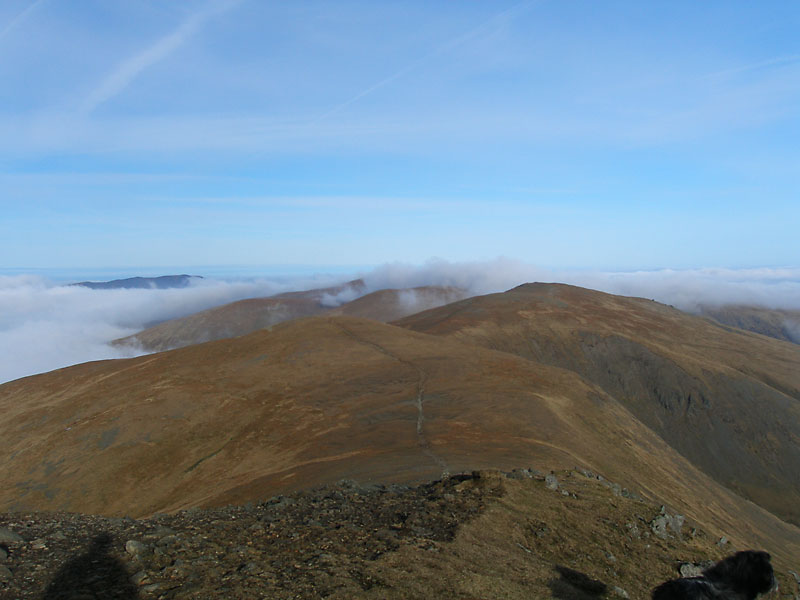
White Side, Raise and the Dodd's from Helvellyn Lower Man

White Side, Raise and the Dodd’s from Helvellyn Lower Man
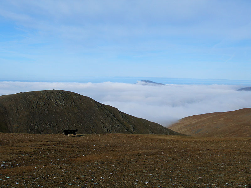
Approaching Helvellyn Lower Man

Approaching Helvellyn Lower Man

Helvellyn

Walked on 26/01/2009

Start point: Lay by opposite Swirls Car Park (NY 315 170)

Swirls – Browncove Crags – Helvellyn – Helvellyn Lower Man – White Side – Raise – Swirls

Distance: 6.3 miles     Total Ascent: 920 metres     Time Taken: 4 hours

Weather: Cold and clear with temperature inversion. 5°C

It ended up being a day of two halves with the weather, but I really couldn’t have expected anything better than the cold and clear weather complete with a temperature inversion that covered the whole of the south Lakes that I managed to see from the summit of Helvellyn. Later the inversion lifted and completely enveloped me making it a completely different walk during the latter stages.
Helvellyn

Helvellyn route map.

26.01.09-002

Sunlight on Blencathra along St John's in the Vale.

26.01.09-017

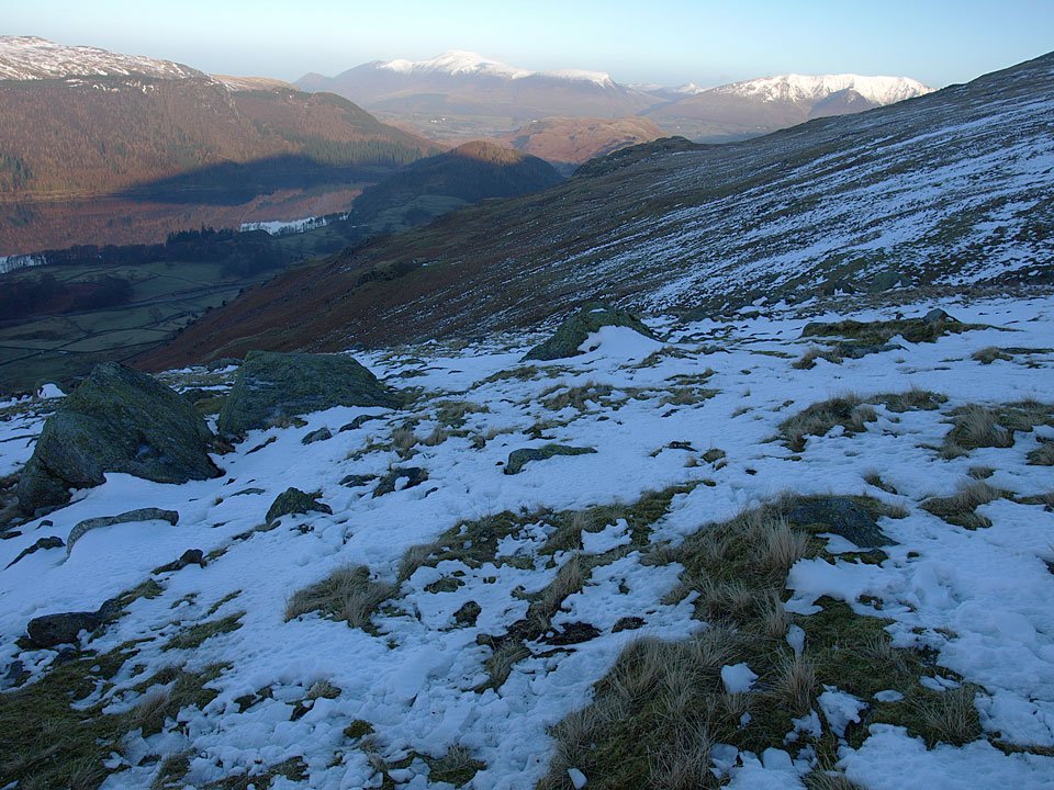
As soon as the snowline was reached it was time for the crampons as everything was iced over making the going slippery. This is the view from where I put them on and all is clear to the north over Skiddaw and Blencathra.
26.01.09-023

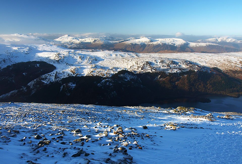
Looking across Thirlmere to the western fells.

26.01.09-027

White Side from the climb to Browncove Crags.

26.01.09-031

Ice axe definitely required for this steep section to Browncove Crags.

26.01.09-040

Finally up into the sunshine and the first view of a big inversion to the south.

26.01.09-041

Great Gable is clear towards the left but there is cloud forming now on some of the other fells around it.

26.01.09-048

Climbing higher - can't wait to get to the top.

26.01.09-050

Stybarrow Dodd, Raise and White Side. Blencathra in the left distance has a covering of cloud now.

26.01.09-056

The mist clearing from Helvellyn.

26.01.09-062

The view to the south west...

26.01.09-064

...and the contrasting view to the north west.

26.01.09-073

All clear now on Helvellyn.

26.01.09-074

It was a fantastic day to be on the fells today.

26.01.09-075

Casper living on the edge.

26.01.09-077

Swirral Edge, Catstycam with Ullswater beyond.

Edges_small

The Edges and Red Tarn from the summit of Helvellyn.

26.01.09-088

Swirral Edge.

26.01.09-092

The icy trig. column on Helvellyn.

26.01.09-094

The southern half of the Lake District is completely covered in cloud today.

26.01.09-097

Not many people around today.

26.01.09-100

In fact I am on my own now, here looking at the snow corniced edge of Helvellyn.

26.01.09-103

Looking to Nethermost Pike and Dollywaggon Pike.

26.01.09-105

Swirral Edge and Catstycam with Raise distant left - that's the way I am going today.

26.01.09-107

Frozen boulders and the cross shelter with Fairfield beyond.

26.01.09-114

The Master of the Universe.

26.01.09-116

Not much chance of getting a seat in the cross shelter today, it is 'full'.

26.01.09-119

The mighty Striding Edge.

26.01.09-125

The half buried Gough Memorial.

26.01.09-131

Beautiful sunshine, beautiful inversion, beautiful snow.

26.01.09-133

Casper in the winter wonderland.

26.01.09-136

Helvellyn.

26.01.09-141

A final view to the south as I head across the summit to Helvellyn Lower Man.

360_small

A 360 degree panorama from Helvellyn.

26.01.09-170

White Side and Raise from Helvellyn Lower Man.

26.01.09-171

The mist was starting to form in the Thirlmere Valley below, in fact it felt as though the inversion was moving towards me from the north and west.

26.01.09-173

The cloud starts to pour over Browncove Crags.

26.01.09-177

Still clear over Brown Cove to Sheffield Pike and Ullswater, Catstycam to the right.

26.01.09-179

White Side and Raise from the descent of Lower Man.

26.01.09-181

Swirral Edge.

26.01.09-185

It's all catching me up now.

26.01.09-189

The cloud is now pouring across Helvellyn and engulfing Swirral Edge.

26.01.09-192

I've a feeling it is going to get me pretty soon.

26.01.09-197

It certainly did! A glimmer of winter sun on White Side.

26.01.09-199

A skier on Raise.

26.01.09-200

Raise summit.

26.01.09-211

Descending from Raise the weather had completely changed and it was now a rather dull day.

26.01.09-218

A brief glimmer of blue sky once ,more on the final descent.

Helvellyn

Walked on 24/06/2008

Start point: Lay-by on the A591 (NY 316 173)

Thirlspot – Swirls – Browncove Crags – Helvellyn – Helvellyn Lower Man – White Side – Brown Crag (540) – Thirlspot

Distance: 5.6 miles     Total Ascent: 860 metres     Time Taken: 3 hours

Weather: Overcast but clear. 15ºC.

It has been fantastic over the last few weeks to receive so much support from everyone about our new venture in Bowness, both by e-mail and in person at the shop – really lovely to meet everyone who has visited. We all know that fell walking people are warm hearted! Special mention must be made of the Gunter family from Florida in the USA who have followed the site almost since the beginning – I would love to say they flew in specially to see me, but that’s not quite true although the whole family did make a special journey during their holidays to visit the shop – thanks for coming and I’m sorry I missed you that day.

Today’s walk was to Helvellyn for the second time during June; the reason for that was to climb my penultimate Birkett peak, Brown Crag. The clarity today was quite striking even though it was overcast with long clear views for mile after mile.
Helvellyn.jpg

24.06.08-002.jpg

Browncove Crags on the north-western slopes of Helvellyn from the A591.

24.06.08-003.jpg

Helvellyn Gill.

24.06.08-018.jpg

Early morning sunshine on Skiddaw.

24.06.08-021.jpg

Skiddaw and Blencathra from higher up. That was the last of the sunshine this morning.

24.06.08-031.jpg

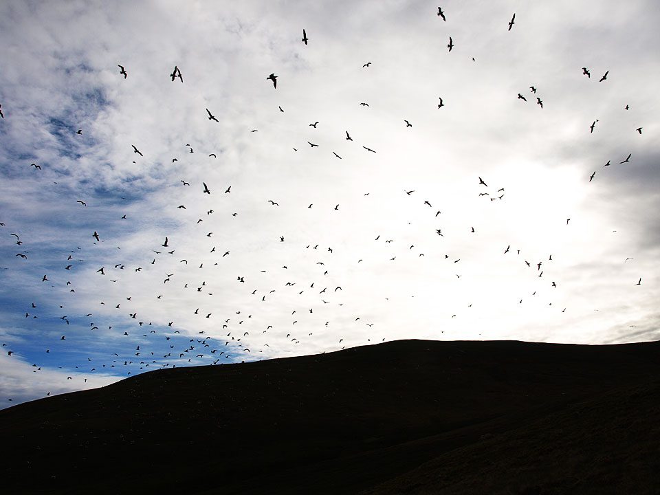
I don't know what was going on here but there were thousands of gulls below Browncove Crags - perhaps they were after the caterpillars that are emerging at the moment.
24.06.08-040.jpg

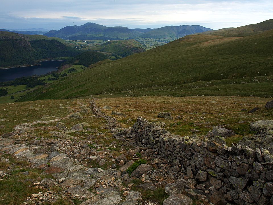
Looking back down the steep climb. It was really clear today, look how far you can see at the top left.

24.06.08-042.jpg

That is Criffel across the Solway Firth, easily discernible today.

24.06.08-047.jpg

The north-western fells across Thirlmere, Bassenthwaite Lake to the right.

24.06.08-055.jpg

Catstycam and Swirral Edge across Brown Cove from the Helvellyn ridge.

24.06.08-065.jpg

Looking down Swirral Edge to Catstycam and Ullswater.

24.06.08-068.jpg

Red Tarn.

24.06.08-081.jpg

Helvellyn is all ours this morning Casper lad, there's not a soul around.

24.06.08-084.jpg

Looking south from the summit cairn across the cross shelter.

24.06.08-087.jpg

Looks like a big party coming across Striding Edge.

24.06.08-088.jpg

The view from Helvellyn.

24.06.08-090.jpg

Looking to Morecambe Bay across Nethermost Pike with Windermere, Esthwaite Water and Coniston Water in view.

24.06.08-093.jpg

He's spotted something down below.

24.06.08-097.jpg

The view from Helvellyn Lower Man to White Side, Raise and the Dodds.

24.06.08-101.jpg

The Scottish hills across the Solway Firth and Bassenthwaite Lake.

24.06.08-105.jpg

Ullswater.

24.06.08-109.jpg

Someone has been busy building this handsome cairn on White Side, here looking back to Helvellyn.

24.06.08-117.jpg

The view from Brown Crag.

24.06.08-118.jpg

The wooded Great How at the head of Thirlmere, one of the quartet I did last week.

24.06.08-119.jpg

High Rigg.

24.06.08-125.jpg

The steep descent to Thirlspot.

24.06.08-133.jpg

Thirlmere aqueduct.

Helvellyn

Walked on 03/02/2006

Start point: Wythburn (NY 324 136)

Wythburn – High Crag – Nethermost Pike – Helvellyn – Helvellyn Lower Man – Swirls – Wythburn

Distance: 8.2 miles     Total Ascent: 1233 metres     Time Taken: 3 hours 20 minutes

Weather: Misty and murky, valley level. Clear above 700m. 3°C.

The conditions looked right for a temperature inversion today, so I was determined to get high enough to get above the cloud. Thankfully I did and was rewarded with splendid views across the low lying clouds.

Helvellyn

03.02.06-003

The path through the forest from Wythburn.

03.02.06-014

Icy and misty on the way up - a bit grim.

03.02.06-016

Suddenly out of the mist into sunshine and blue sky.

03.02.06-019

Looking south from the path to High Crag.

03.02.06-029

Bow Fell and the Scafells.

03.02.06-031

Looking south into the sun from High Crag to Dollywagon Pike with Fairfield behind. Beyond is a sea of cloud.

03.02.06-035

The Coniston fells and Harrison Stickle with the Crinkle Crags behind.

03.02.06-038

The view from High Crag.

03.02.06-040

Nethermost Pike and Helvellyn.

03.02.06-043

Saint Sunday Crag across Grisedale, Hard Tarn below.

03.02.06-056

On the path to Helvellyn.

03.02.06-058

Striding Edge.

03.02.06-064

03.02.06-062

Catstycam.

03.02.06-068

The cirque of Helvellyn summit with Skiddaw beyond.

03.02.06-075

A panoramic view from Helvellyn - select on the image for a larger version.

03.02.06-075_Annotated_small

Select on the image above to see a larger, annotated version.

03.02.06-081

Swiiral Edge, Catstycam, a frozen Red Tarn and Striding Edge.

03.02.06-082

Bow Fell.

03.02.06-083

Great Gable.

03.02.06-087

Not bothered about the view?

03.02.06-096

Approaching Helvellyn Lower Man.

03.02.06-099

White Side, Raise and the Dodd's.

03.02.06-100

Skiddaw.

03.02.06-103

Great Gable and Pillar.

03.02.06-104

Bow Fell, Esk Pike and the Scafells.

03.02.06-110

Descending from Helvellyn Lower Man.

03.02.06-117

Angus.

03.02.06-123

A fleeting Brocken Spectre in the centre distance (couldn't get a decent shot of it!).

03.02.06-128

Helvellyn Gill.

03.02.06-137

The cloud clears in the forest above Thirlmere.

03.02.06-140

Wythburn Church.


Raise

Walked on 08/11/2004

Start point: Glenridding car park (NY 385 169)

Glenridding – Glenridding Dodd (199) – Heron Pike (Glenridding) (200) – Sheffield Pike (201) – Sticks Pass – Raise (202) – White Side (203) – Helvellyn Lower Man (204) – Helvellyn – Swirral Edge – Catstycam – Glenridding

Weather: Cloudy.

Today’s walk takes in a circuit of the Eastern Fells with a high point of Helvellyn. The weather wasn’t the best but a temperature inversion was always threatened but didn’t quite materialise, although there were some interesting views from Helvellyn.
Raise

Dsc02695

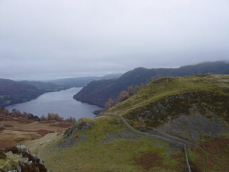
Looking along Glenridding Screes to Raise from the steep climb up to Glenridding Dodd.

Dsc02700

Ullswater and Gowbarrow Park from the summit of Glenridding Dodd.

Dsc02704

View from the climb to Heron Pike; Ullswater and Glenridding Dodd with Place Fell behind on the right.

Dsc02708

The iron marker post that marks the summit of Heron Pike. The 'M' marks the boundary of the Marshall estate of Patterdale, the reverse is marked 'H 1912' and marks the boundary of the Howard estate of Greystoke.

Dsc02722

Waterfall on Sticks Gill.

Dsc02731

Catstycam through the mist from White Side.

Dsc02736

Looking along Glenridding Common to Ullswater from Whiteside Bank.

Dsc02743

The Crinkle Crags and Bow Fell from Helvellyn.

Dsc02745

The westerly view from Helvellyn.

Dsc02749

The fearsome fangs of Swirral Edge.

Dsc02751

Catstycam - no view!

Dsc02755

Old mine workings at Swart Beck.

raise3d

Walking Diary

  • The Mosedale Horseshoe 01/03/2022
  • Caw 18/01/2022
  • Coniston sunset 17/01/2022
  • Blencathra 15/01/2022
  • Scafell Pike 14/01/2022

Social

  • Facebook
  • Twitter

Information

  • Striding Edge
  • T&C’s
  • Privacy
  • Links