Striding Edge

A photo diary of Lake District fell walks

  • Walks
  • Fells
    • Wainwrights
      • Eastern Fells
      • Far Eastern Fells
      • Central Fells
      • Southern Fells
      • Northern Fells
      • North Western Fells
      • Western Fells
      • Outlying Fells
    • Birketts
  • Dogs
  • Love The Lakes
  • Contact

High Hartsop Dodd

Height: 519 metres / 1703 feet Grid reference: NY 39357 10766 Category: The Eastern Fells
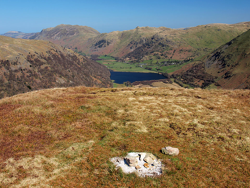
Brothers Water from High Hartsop Dodd
Brothers Water from High Hartsop Dodd

High Hartsop Dodd

High Hartsop Dodd

Dovedale

Walked on 08/04/2011

Start point: Bottom of Kirkstone Pass (NY 402 113)

Kirkstone Pass – Hartsop Hall – Dovedale – Dove Crag – High Bakestones – Scandale Tarn – Little Hart Crag – High Hartsop Dodd – Kirkstone Pass

Distance: 7.9 miles     Total Ascent: 915 metres     Time Taken: 3 hours 15 minutes     Start Time: 09:30

Weather: Sunny. 17°C

Wow, what a day today – it seems summer has arrived and it  was the first time this year that my shorts had an airing. Fantastic views all around as well, you can’t beat it.
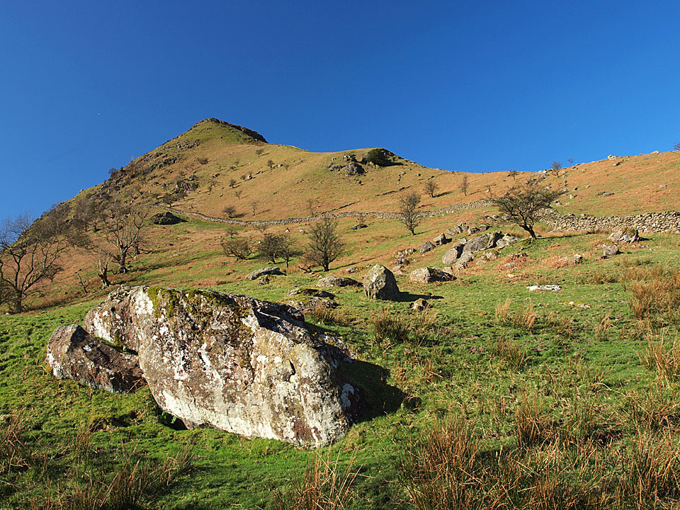
Dovedale

Dovedale route map.

08.04.11-002

Middle Dodd.

08.04.11-003

Place fell and Angletarn Pikes reflected in a new tarn.

08.04.11-005

High Hartsop Dodd.

08.04.11-008

High Hartsop Dodd again and the this will be the route of descent later.

08.04.11-009

Dove Crag and Hart Crag.

P4086414_stitch

A panoramic view from the Settlement.

08.04.11-022

Into Dovedale (after negotiating the cows at Hartsop Hall with the two 'cow magnets'!).

08.04.11-035

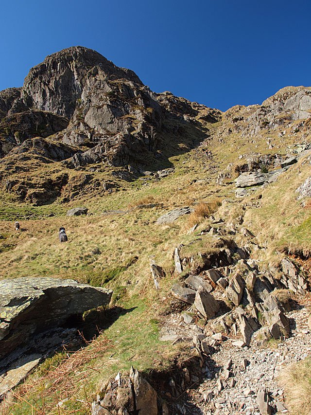
Climbing to Dove Crag.

08.04.11-037

The start of the stone stairway. Dougal and Casper are going the wrong way but you can make out some people climbing the path in the distance.
08.04.11-041

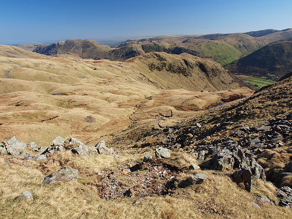
The view from the top of the climb.

08.04.11-043

Hartsop above How and the far eastern fells. I got talking on the climb and managed to miss the Priest Hole - next time!
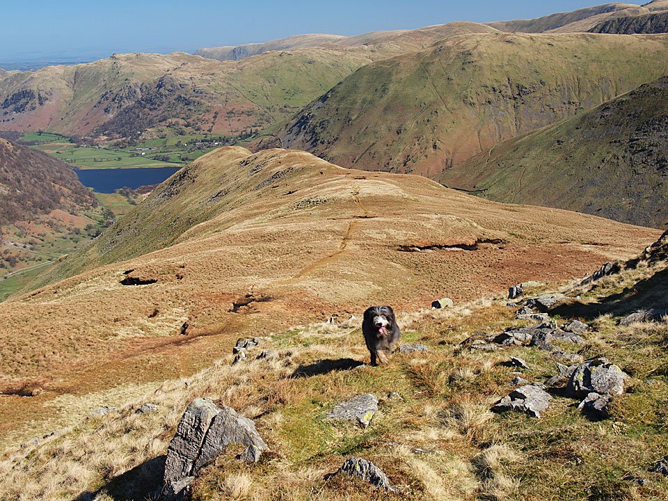
08.04.11-056

Windermere and Coniston Water from Dove Crag.

08.04.11-064

It looks hazy to the south east.

P4086462_stitch

Westerly wall panorama including the opposite leg of the Fairfield Horseshoe.

08.04.11-085

The cairn on High Bakestones.

08.04.11-089

Little Hart Crag and Scandale Tarn.

08.04.11-097

Little Hart Crag reflected in Scandale Tarn.

08.04.11-101

High Bakestones and Dove Crag across Scandale Tarn.

08.04.11-117

Hot, hot, hot for Casper and Dougal on Little Hart Crag.

08.04.11-119

Little Hart Crag.

08.04.11-121

Red Screes from Little Hart Crag.

08.04.11-122

The view from the secondary summit on Little Hart Crag.

08.04.11-126

Heading for High Hartsop Dodd - it looks like Dougal has been already and is coming back to see where we are!

08.04.11-128

Dove Crag from the ridge to High Hartsop Dodd.

08.04.11-130

Brothers Water from High Hartsop Dodd. Someone's ashes have been put on the summit cairn, a fine place to end up.

08.04.11-136

The start of the descent.

08.04.11-138

The steep drop.

08.04.11-142

Caiston Beck.

Dovedale

Walked on 01/12/2008

Start point: Bottom of Kirkstone Pass (NY 402 113)

Kirkstone Pass – Hartsop Hall – Dovedale – Dove Crag – Bakestones Moss – Little Hart Crag – High Hartsop Dodd – Kirkstone Pass

Distance: 6.4 miles     Total Ascent: 730 metres     Time Taken: 3 hours 30 minutes

Weather: Strong wind, snow flurries. -2ºC.

It was really cold this morning again but the blue sky and crisp clearness of the weekend was gone to be replaced by strong winter weather. All was icy and frozen around Kirkstone Pass with heavy snow flurries at first. Once on the climb to Dovedale the wind really picked up and on the Dove Crag ridge it was severe and walking was difficult at times. When I got back to valley level I felt like I had taken a real pounding up there.
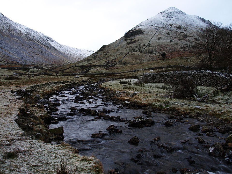
Dovedale.jpg

01.12.08-011.jpg

Blimey, it was cold this morning when I set off. This photo of Middle Dodd and Kirkstone Beck looks cold too.
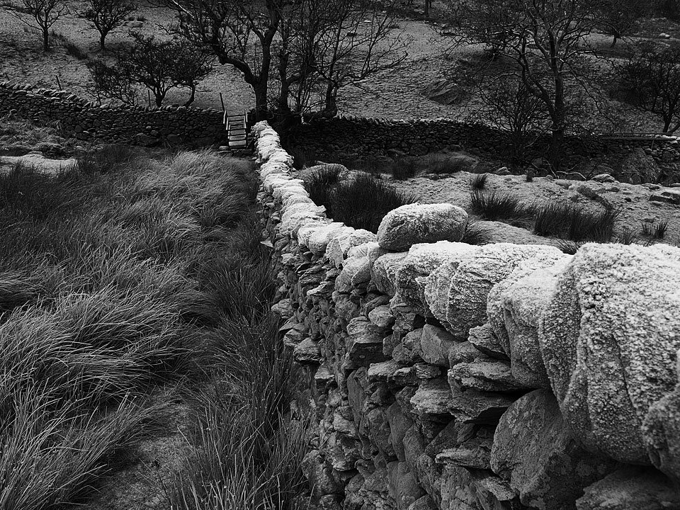
01.12.08-018.jpg

A frosty wall - mono photos seemed to match the conditions better than colour a lot of the time I thought.
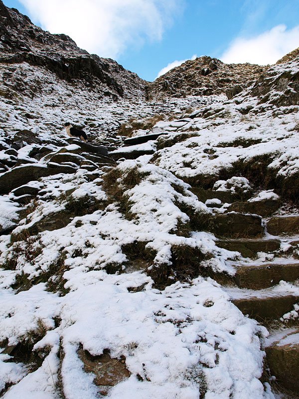
01.12.08-022.jpg

Middle Dodd and Caiston Glen.

01.12.08-033.jpg

Heading into Dovedale.

01.12.08-041.jpg

Icy Dovedale Beck.

01.12.08-046.jpg

Dove Falls.

01.12.08-049.jpg

01.12.08-054.jpg

A ray of sunshine looking back into Dovedale.

01.12.08-058.jpg

Dove Crag.

01.12.08-063.jpg

Getting closer to Dove Crag.

01.12.08-068.jpg

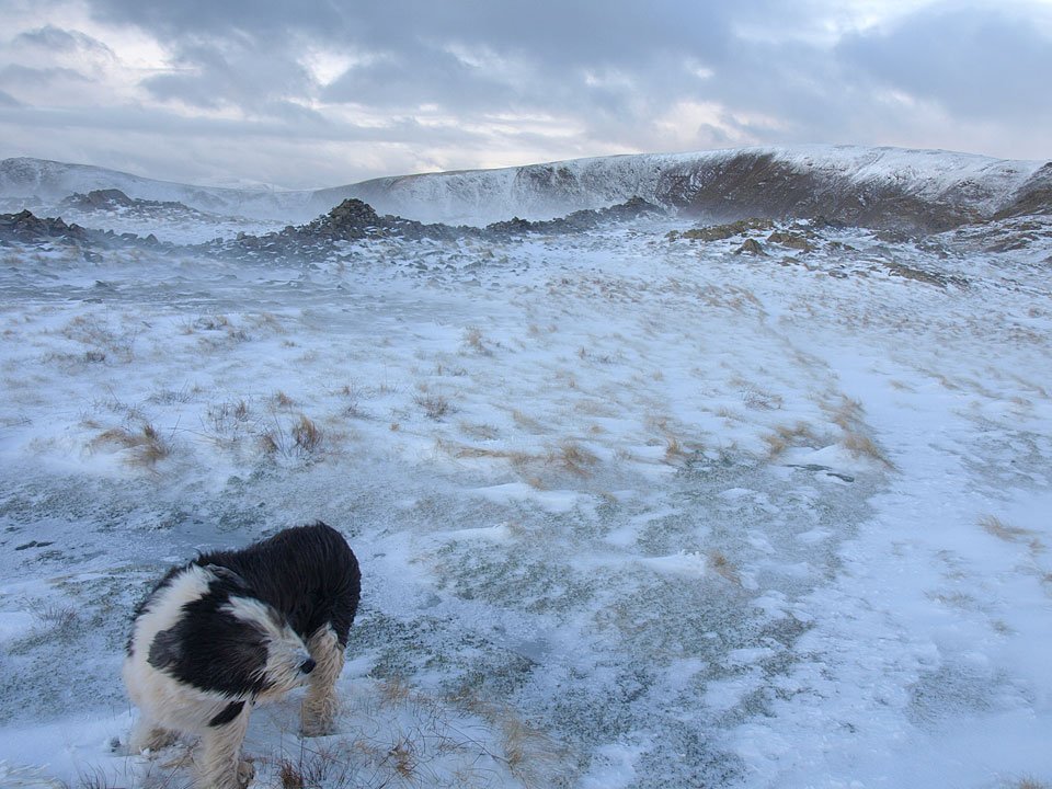
A bit of blue sky up there on the final part of the climb to Dove Crag. It all looks calm in this photo but the wind was picking up now making it feel even colder.
01.12.08-071.jpg

Looking across to the High Street ridge.

01.12.08-075.jpg

The Far Eastern fells - there seemed to be less snow around to the north.

01.12.08-086.jpg

All hell was let loose once up onto the Dove Crag ridge with very strong winds and painful spindrift.

01.12.08-087.jpg

It was as cold as it looks up there.

01.12.08-090.jpg

Looking back to Hart Crag and Fairfield.

01.12.08-096.jpg

Tough going following the wall.

01.12.08-108.jpg

A bit of sunshine to the west through the spindrift.

01.12.08-109.jpg

The summit of Dove Crag.

01.12.08-112.jpg

A quick descent to Bakestones Moss now to try and get out of the wind.

01.12.08-115.jpg

A view of Brothers Water from the descent.

01.12.08-118.jpg

Windswept Casper.

01.12.08-126.jpg

Place Fell from a frozen pool on Bakestones Moss.

01.12.08-135.jpg

Scandale with Scandale Tarn below from Little hart Crag.

01.12.08-138.jpg

St. Sunday Crag from the summit of Little Hart Crag.

01.12.08-140.jpg

Casper on Little Hart Crag.

01.12.08-165.jpg

Red Screes from the tarn on the summit of Little Hart Crag. I had intended going there but not today, it was too wild.

01.12.08-167.jpg

Escape route to High Hartsop Dodd.

01.12.08-170.jpg

Dovedale from High Hartsop Dodd.

01.12.08-178.jpg

It all looks a bit brighter than it did earlier from the steep descent from High Hartsop Dodd.

High Hartsop Dodd

Walked on 05/02/2008

Start point: Cow Bridge (NY 402 134)

Cow Bridge – Brothers Water – Hartsop Hall – High Hartsop Dodd – Hartsop Hall – Brothers Water – Cow Bridge

Distance: 3.7 miles     Total Ascent: 420 metres    Time Taken: 2 hours

Weather: Grey, wind and rain. 5°C.

It was a bit grim this lunchtime when I set off for High Hartsop Dodd, in fact it was bucketing down with rain and there was a really strong wind so I ended up making it and ‘out and back’ walk, or rather an ‘up and down’ walk! It is a very steep climb straight up the front of High Hartsop Dodd and once on the top the wind was really wild and I was completely drenched. Lo and behold if the sky didn’t clear as soon as I made it back to valley level!
HHD

05.02.08-002

Brothers Water looking a bit full with Hartsop Dodd and a snow-topped Caudale Moor behind.

05.02.08-008

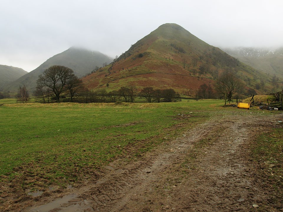
Middle Dodd and High Hartsop Dodd. This is a snatched photo taken in strong wind and heavy rain at Hartsop Hall.

05.02.08-015

Hartsop Valley from the start of the climb to High Hartsop Dodd.

05.02.08-021

It's a steep one this - Angus is mootching about and Casper is rolling about by the looks of things.

05.02.08-028

Angus stops for a breather.

05.02.08-032

It was wild on the summit of High Hartsop Dodd and we didn't hang around for long here.

05.02.08-044

Heading back down towards Brothers Water.

05.02.08-047

Brock Crags towering above Brothers Water.

05.02.08-054

Dovedale.

05.02.08-065

Caudale Moor - look how ominous it is over on Kirkstone Pass to the right.

05.02.08-071

Hartsop with Place Fell and Angletarn Pikes beyond Brothers Water.

05.02.08-080

High Hartsop Dodd and Dovedale.

05.02.08-082

The weather is a bit better than it was on the way up now!

05.02.08-090

Hartsop Dodd.

05.02.08-091

Hartsop above How.

05.02.08-116

Back at Brothers Water.


Red Screes

Walked on 06/12/2004

Start point: Bottom of Kirkstone Pass (NY 402 113)

Kirkstone Pass – Middle Dodd (237) – Smallthwaite Band – Red Screes (238) – Scandale Pass – Little Hart Crag (239) – High Hartsop Dodd (240) – Kirkstone Pass

Weather: Dull, overcast – rain and strong wind on the tops.

Today’s walk is a steep ascent up to Middle Dodd and Red Screes from the bottom of Kirkstone Pass, across the Scandale Pass and a lovely ridge walk from Little Hart Crag to Hartsop Dodd, then a steep descent back to Kirkstone Pass. The weather wasn’t brilliant again today but the high winds meant that there was the odd clearing of the mist to give fleeting glimpses of a view.
Red Screes

Dsc03105

Middle Dodd at the start of the walk.

Dsc03109

Following the wall up the steep ascent.

Dsc03116

Little Hart Crag from Middle Dodd.

Dsc03119

Two misty summits; Middle Dodd...

Dsc03126

and Red Screes

Dsc03120

The mist clears briefly on Smallthwaite Band on the way to Red Screes.

Dsc03128

A fleeting glimpse of Little Hart Crag from Scandale Pass.

Dsc03132

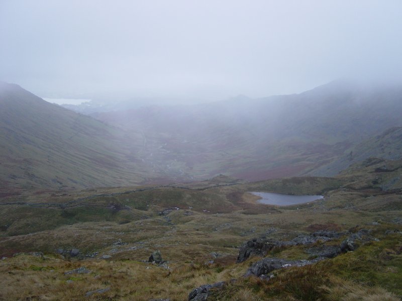
A misty view of Scandale from Little Hart Crag. Windermere is up to the left, Scandale Tarn to the right.

Dsc03140

Looking back along the ridge to Little Hart Crag from High Hartsop Dodd.

Dsc03152

Brothers Water and Hartsop from the steep descent from High Hartsop Dodd. See below for an annotated version of this photo.

Dsc03152 Annotated

Dsc03155

Twin peaks - Middle Dodd and High Hartsop Dodd.

Red Screes 3D

Red Screes

Walked on 04/06/2003

Cow Bridge – Hartsop Dodd (33) – Caudale Moor (34) – Middle Dodd (35) – Red Screes (36) – Little Hart Crag (37) – High Hartsop Dodd (38) – Cow Bridge

Dsc00388

Brothers Water from the ascent of Hartsop Dodd.

Dsc00389

View from Hartsop Dodd. L-R : Middle Dodd, Low Pike, High Pike, Dove Crag, Hart Crag with High Hartsop Dodd in the near distance on the right.

Dsc00390

Ullswater from Hartsop Dodd, Arnison Crag on the left and Place Fell to the right.

Dsc00391

Gray Crag from Hartsop Dodd.

Hartsop Dodd

Hartsop Dodd summit, High Raise, Rampsgill Head and Gray Crag behind.

Dsc00394

Looking along the wall to Caudale Moor from Hartsop Dodd. Red Screes is to the right.

Dsc00396

Caudale Quarry on the side of Caudale Moor, Red Screes behind.

Dsc00398

Stony Cove Pike, Caudale Moor summit.

Dsc00402

Atkinson's Monument on Caudale Moor.

Dsc00404

Middle Dodd summit complete with sleeping man!

Dsc00413

Red Screes summit cairn and shelter.

Dsc00421

Little Hart Crag summit with High Pike and Low Pike behind.

Dsc00425

High Hartsop Dodd summit.

Dsc00429

High Hartsop Dodd from Caudalebeck Farm.

Walking Diary

  • The Mosedale Horseshoe 01/03/2022
  • Caw 18/01/2022
  • Coniston sunset 17/01/2022
  • Blencathra 15/01/2022
  • Scafell Pike 14/01/2022

Social

  • Facebook
  • Twitter

Information

  • Striding Edge
  • T&C’s
  • Privacy
  • Links