Height: 354 metres / 1161 feet Grid reference: SD 26356 94917
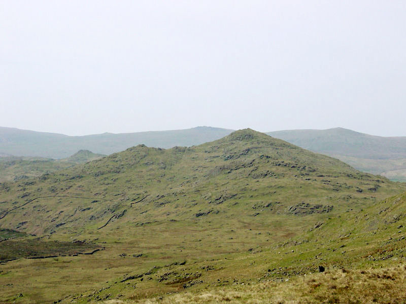
Caw and Stickle Pike from the summit of High Pike Haw
Height: 354 metres / 1161 feet Grid reference: SD 26356 94917
Caw and Stickle Pike from the summit of High Pike Haw
Start point: Torver (SD 285 945)
Torver – Bleaberry Haws – High Pike Haw – White Maiden – White Pike – Walna Scar (OF) – Walna Scar Road – Brown Pike – Buck Pike on Seathwaite Fell – Dow Crag – Goat’s Haws – Tranearth – Torver
Distance: 8.9 miles Total Ascent: 992 metres Time Taken: 3 hours 20 minutes
Weather: Sunny and hazy. 17°C.
The sun was shining again today, with temperatures up to a pleasant 17°C at valley level, although at times it was quite chilly in the cold breeze on the tops. I had a walk up to the Coniston fells from Torver, using the gradual ascent up to Walna Scar via the ‘ignored by Wainwright’ south western fells. The view becomes increasingly better using this route with unrivalled views of the southern Coniston fells and great views along the Duddon Valley to Harter Fell and the Sca Fells beyond.

Dow Crag route map.

Brown Pike, Buck Pike, Dow Crag and The Old Man of Coniston from the Torver path.

Caw with Stickle Pike behind from White Pike. In the distance is Black Combe.

Harter Fell from the approach to Walna Scar. In the distance, behind Scafell on the right, is Pillar, the depression of Wind Gap, Scoat Fell and Haycock.

Dow Crag, Buck Pike and Brown Pike from Walna Scar.

There was a stiff breeze on Walna Scar!

Blind Tarn.

The path to Dow Crag.

The view towards the Sca Fells from Dow Crag.

Goat's Water from Dow Crag.

Looking back along the ridge from Dow Crag, the Duddon Estuary in the distance.

The rocky face of Dow Crag from Goat's Hawse.

Goat's Water.

The big hole, Banishead Quarry.

Torver Beck.

Bluebells in the woods near Torver.
Start point: Torver (SD 285 945)
Torver – Bleaberry Haws – High Pike Haw (205) – White Maiden (206) – White Pike (207) – Walna Scar (208) (OF) – Walna Scar Road – Cove Bridge – Tranearth – Torver
Weather: Rain, rain (go away!)
Today’s walk takes in a circuit of Torver High Common and is truncated from what I originally planned due to the rather inclement weather. As it rained from start to finish, there are no promised great views of the Coniston Fells or the Sca Fells, but there are some nice water shots – seeing as there was so much of it around!


An old afforested lane through High Torver Park.

Ash Gill Beck and old spoil heaps.

The shapely peak of High Pike Haw. In the foreground is an ancient cairn on Bleaberry Haws which is marked on the map. It consists of a circular hollow approximately 1.5 metres in diameter and 0.5 metres deep, surrounded by stones. This area yields much evidence of a Bronze Age settlement.

Bleaberry Haws from the summit of High Pike Haws. The summit of Bleaberry Haws is topped with a hoary old cairn, also marked on the map in antiquarian lettering. I think Bleaberry Haws is another Birkett omission.

A rocky gulley en-route to White Maiden.

Two summit cairns in the mist; White Maiden...

and White Pike

Walna Scar summit.

The force of Torver Beck under Cove Bridge...

...and the thunder of the waterfall further downstream.

The damp sign at Torver...it just about sums up the day!
