Height: 703 metres / 2306 feet Grid reference: NY 18491 22744
Hopegill Head and Ladyside Pike
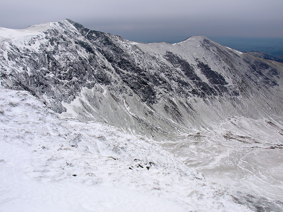
Hopegill Head from the summit of Ladyside Pike
Height: 703 metres / 2306 feet Grid reference: NY 18491 22744
Hopegill Head and Ladyside Pike
Hopegill Head from the summit of Ladyside Pike
Start point: Revelin Moss Car Park (NY 249 242)
Comb Bridge – Grisedale Pike – Hobcarton Head – Hopegill Head – Ladyside Pike – Swinside Plantation – Hobcarton Plantation – Comb Bridge
Distance: 6.2 miles Total Ascent: 744 metres Time Taken: 3 hours 30 minutes
Weather: Cold but overcast. 2°C.
It was a completely different day to yesterday as it was overcast and the sky was grey and flat. Things were a lot warmer as it was very still and today I was joined by Andy Lang on this circuit of Hobcarton. The ice was treacherous once again in places, notably on the climb to Hopegill Head and then the rocky descent to join the Ladyside Pike ridge.


At the foot of the steep climb to Grisedale Pike from Comb Bridge. There is even a little bit of blue sky up there.

Looking across Hospital Plantation to Skiddaw in cloud.

Still plenty of snow around and not a breath of wind today making it feel much warmer than yesterday.

Casper shows how steep the route is. Easy enough to navigate though, just follow the wall.

Heading for Grisedale Pike.

Looking across to the Sleet How ridge to Grisedale Pike.

All is icy up here.

Wind blown ice on an old fence post.

An icy close up.

Hobcarton Head from the summit of Grisedale Pike.

Crag Hill across Coledale.

Casper on Grisedale Pike.

Looking along the ridge to Hobcarton End.

Hobcarton Head, Sand Hill and Hopegill Head.

Descending the path to Hobcarton head.

Casper leads the way.

Looking back to Grisedale Pike.

Hobcarton.

Hopegill Head and Ladyside Pike, our route of descent today.

Following the invisible men?

Grisedale Pike and Hobcarton Head from the climb to Hopegill Head. It was crampons time once more for this section of the icy climb.

Hobcarton Crag looks a bit black and white today.

Casper wonders why Andy has crampons on. Get away from the edge boy (and you Casper!).

The Crag Hill - Sail - Causey Pike ridge over Sand Hill with a big snow cornice in the foreground.

Hopegill Head.

The mist swirling around Ladyside Pike.

Andy shows how to descend the tricky, steep and icy section from Hopegill Head's summit.

A view through the mist into Hopegill.

Ladyside Pike.

A cold looking Hopegill Head from Ladyside Pike.

Swinside from Ladyside Pike.

At the foot of the descent from the Swinside ridge. It was into Swinside Plantation now to head back to the car.

Back on the straight and narrow.
Start point: Hopebeck (NY 169 241)
Hopebeck – Dodd (Lorton) (523)– Gasgale Crag – East Top of Whiteside – Hopegill Head – Ladyside Pike (524) – Swinside (525) – High Swinside Farm – Hopebeck
Distance: 4.6 miles Total Ascent: 677 metres Time Taken: 2 hours 30 minutes
Weather: Gale force winds and snow. 3°C
It was really rough weather today with a strong, freezing wind making the going tough for much of the route. The calmest part was surprisingly the high level ridge to Hopegill Head between the outward leg of Dodd and the homeward leg of Ladyside Pike. Coupled with the really strong wind was treacherous ice covered which had a thin veneer of snow on top – that meant we certainly had to watch our step today.


Heading for Dodd - the Lorton one.

Hope Gill and Hopegill Head.

Crossing Hope Beck.

The Hopegill Head - Whiteside ridge at the head of the valley

On the summit of Dodd the wind started to get stronger.

As we climbed above the snowline it became much stronger making walking quite difficult. Two steps forward, one step back.

Looking back down the route just ascended to Dodd.

Ladyside Pike and Hopegill Head with Grisedale Pike beyond.

Whiteside from Gasgale Crags with Crummock Water and Mellbreak visible.

Casper on Gasgale Crags, Grasmoor beyond.

Grisedale Pike beyond Hopegill Head with the magnificent arête yet to climb.

Sail and Crag Hill over Coledale Hause.

Looking back to Whiteside.

It almost looks like a drawing this photo, climbing to Hopegill Head.

Again from further along the ridge. It was a toss up as to whether I would get blown off by the gale force wind or slip and fall on the ice along here.

Climbing the icy ridge.

Looking back to Whiteside.

Nearly there Casper! (He is not superimposed on there either!).

Dark and brooding Grasmoor from Hopegill Head.

Grisedale Pike across Hobcarton.

Skiddaw from Hopegill Head. The descent from here to the Ladyside Pike ridge was unbelievably treacherous as it was all ice for the initial section, meaning there was lots of zig-zagging and shuffling around.

Looking back to the descent from Hopegill Head. Phew! Finally made it.

Ladyside Pike ahead.

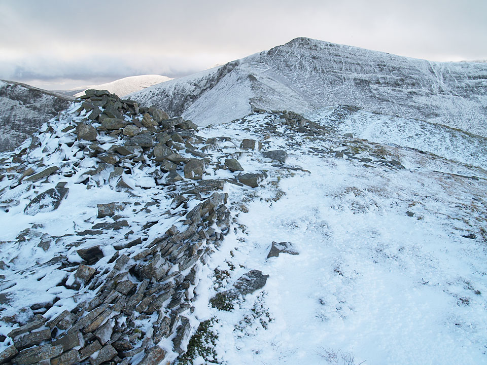
Hopegill Head from the summit of Ladyside Pike.

If anything the wind picked up even more during the descent as Casper ably demonstrates here.

The top of Swinside was a vague one, somewhere around here. The route of descent from Ladyside Pike to here was along the line of the wall.

Lorton Vale and Loweswater get some sunshine with Blake Fell directly ahead and Loweswater Fell to the right.

Looking north to Cockermouth from the steep descent.