Height: 247 metres / 810 feet Grid reference: SD 30150 90087 Category: The Outlying Fells
Low Light Haw
Height: 247 metres / 810 feet Grid reference: SD 30150 90087 Category: The Outlying Fells
Low Light Haw
Start point: High Nibthwaite (SD 295 897)
High Nibthwaite – Brock Barrow (OF) – Low Light Haw (OF) – High Light Haw (OF) – Stang Hill – Arnsbarrow Hill – Top o’ Selside(OF)– High Nibthwaite
Distance: 4.1 miles Total Ascent: 347m metres Time Taken: 1 hours 30 minutes Start Time: 09:20
Weather: Sunny spells. A cool 9oC.
It may be May (!) but it doesn’t particularly feel like it, the shorts and tee shirt are still not in evidence yet. Dougal (and Casper) have gone for it though having lost their winter coats ready for the long hot summer ahead. It was just me and Dougal again today for a jaunt along the east side of Coniston Water up on Bethecar Moor, a fairly relaxed walk with some great views.


Caught in a shower heading for Brock Barrow.

Lo and behold! The sun is shining on the climb.

They made me do it.

Looking back down on the climb.

The Coniston fells from Brock Barrow.

A panoramic view of the Crake Valley and the foot of Coniston Water.

Very dapper Dougal!

The Old Man and Wetherlam beyond the second summit...

...and the view from it.

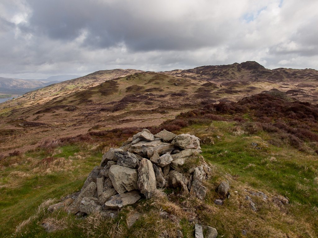
The rest of the tops in this walk can be spotted from Low Light Haw - directly ahead to High Light Haw, Stang and Arnsbarrow Hill to the right and Top o' Selside distant left.

Coniston Water, Beacon Fell and Caw from High Light Haw.

The route to Stang Hill.

Heading across Stang Moss.

Helvellyn to Fairfield to Red Screes to Ill Bell from Stang Hill.

Arnsbarrow Tarn, Top o' Selside beyond.

A panorama of Arnsbarrow Tarn.

A little bit of sunshine on Top o' Selside.

Looking in the opposite direction to distant Morecambe Bay and Black Comb.

A Coniston panorama on the way back to Low Nibthwaite.
Start point: High Nibthwaite (SD 295 897)
High Nibthwaite – Brock Barrow – Low Light Haw (OF) – High Light Haw (OF) – High Nibthwaite
Distance: 2 miles Total Ascent: 225 metres Time Taken: 45 minutes
Weather: Wet! 8°C.
Regular viewers will remember the last time we visited these fells on the eastern shore of Coniston Water, for it was here that Angus had a disappearance for an hour or two! Oh, how I wish the weather was the same but it was a bit damp and dreary up there today, so no views to speak of. At least Angus was safe this time.


Looking down on the southern end of Coniston Water from Brock Barrow with Beacon Fell beyond.

Heading for the second summit on Brock Barrow.

Angus and Casper.

Low lying mist over Coniston Water.

A bit damp Casper?

Park Nab and Oak Isle on Coniston Water.

The mist is settling over the water.

Water Park.

I found an interesting series of cascades on the way down. I've never noticed them before.
Start point: High Nibthwaite (SD 295 897)
High Nibthwaite – Brock Barrow – Low Light Haw (OF) – High Light Haw (OF) – High Nibthwaite
Distance: 2 miles Total Ascent: 225 metres Time Taken: Hours!
Weather: Bright and sunny. 20oC.
It started out as just a nice, short walk today – Angus had other plans though, see below for further details! Superb views from a lovely, heathery ridge today although the going was fairly tough along the mainly pathless tussocky and boggy ridge.


Allan Tarn and High Nibthwaite.

Approaching Brock Barrow. We ascended round the back rather than the steep scree run on the face.

Looking to the Coniston fells from the summit of Brock Barrow - a magnificent view from this impressive summit cairn.

Coniston Water and the Coniston fells.

Caw.

The Old Man of Coniston.

Dow Crag.

Coniston view.

Yachts on Coniston.

Casper - glad to be back out on the fells.

There is heather in abundance on the fells now.

A heathery Bethecar Moor.

The view to the west, Caw in the centre.

A final Coniston view. Things went somewhat downhill (and uphill!) from here. Descending the eastern ridge down to the bridleway from Parkamoor, I managed to lose Angus in the bracken. The head height weed was really thick - normally it is not a problem as Angus usually barks and that is enough to spot him. Today, however, was a different story - try as I might I could not hear or see him - he had disappeared! The search for him took me 3 hours and Casper and I walked that ridge in descent and ascent a good few times, I can tell you! Finally a farmer shouted me from below as he had heard me shouting (my voice was hoarse after 3 hours - in that time I had only heard Angus barking once). Angus was stuck in an intake (a walled field) - I don't know he got in there as the walls were so high but he could not get out. I don't know who was more relieved, me or Angus!

Flippin' 'eck Angus!
Start point: High Nibthwaite (SD 295 897)
High Nibthwaite – Brock Barrow – Low Light Haw (OF) – High Light Haw (OF) – Stang Hill –Arnsbarrow Hill – Top o’ Selside (OF)– High Nibthwaite
Distance: 5 miles Total Ascent: 474 metres Time Taken: 1 hour 50 minutes
Weather: Cold, cloud at valley level. 3oC.
It was cold and misty on the drive up to the east side of Coniston. Would it be cold enough at valley level to create a temperature inversion, where the cloud remains at a very low level and you can climb above it to clear skies? Well let’s see….


Ascending to a cold looking Brock Barrow through the mist.

Wow! The temperature inversion was there. This view shows the Coniston Fells from Brock Barrow, a thick layer of cloud covers Coniston Water.

Looking across to Beacon Fell.

Coniston Old Man and Wetherlam.

Panoramic view of Coniston Water.

Southwards to the Crake Valley.

Woodland and the Southern Outlying fells.

Soaking up the rays.

The valleys to the south east and the Kent Estuary are lying under a blanket of cloud too.

Dow Crag.

A frozen Arnsbarrow Tarn.

The Coniston fells from Top o' Selside.

Top o' Selside.

The clouds start to lift on the descent and Coniston Water is once again visible.

Coniston Water and the Coniston fells from the descent.
Start point: High Nibthwaite (SD 295 897)
High Nibthwaite – Brock Barrow – Low Light Haw (OF) – High Light Haw (OF) – Stang Hill (37) – Arnsbarrow Hill (38) – Top o’ Selside (39) (OF)- High Nibthwaite
Weather: Bright at first turning to drizzle.


Brock Barrow. This is the Wainwright nameless summit 748' (P.93 'The Outlying Fells'). The route of ascent is the steep left diagonal groove.

Allan Tarn from Brock Barrow with Blawith Knott behind, right.

Dow Crag, Coniston Old Man, Swirl How and Wetherlam from Brock Barrow.

View from the second cairn.

Low Light Haw

High Light Haw

Stang Hill summit. Fairfield, Hart Crag, Dove Crag and Red Screes can be seen through the drizzle.

Looking towards the Howgills from Arnsbarrow Hill summit.

Arnsbarrow Tarn.

Summit cairn, Top o' Selside with the Coniston range behind.

Beacon Fell across Coniston Water.