Three Shire Stone – Black Crag – Pike o’ Blisco – Red Tarn – Cold Pike – Red Tarn – Three Shire Stone
Distance: 6.6 km Total Ascent: 490 metres Time Taken: 2 hours 45 minutes Start Time: 07:10 (sunrise 08:00)
I must be a sucker for getting up early but once again it was well worth the effort to get up and witness this spectacular sunrise from Pike o’ Blisco. What a fantastic morning it was, freezing hanging around at the top but the advancing red sky was a sight to witness. It is a long time since I have been up this way but nice to be back and it was as good as I remember.
(Spoiler alert and apology – there are lots of ‘sky’ photos in this post!)

Dawn on the climb from Wrynose Pass - it was looking promising with clearer skies to the east.

Just before sunrise.

...and a panoramic view.

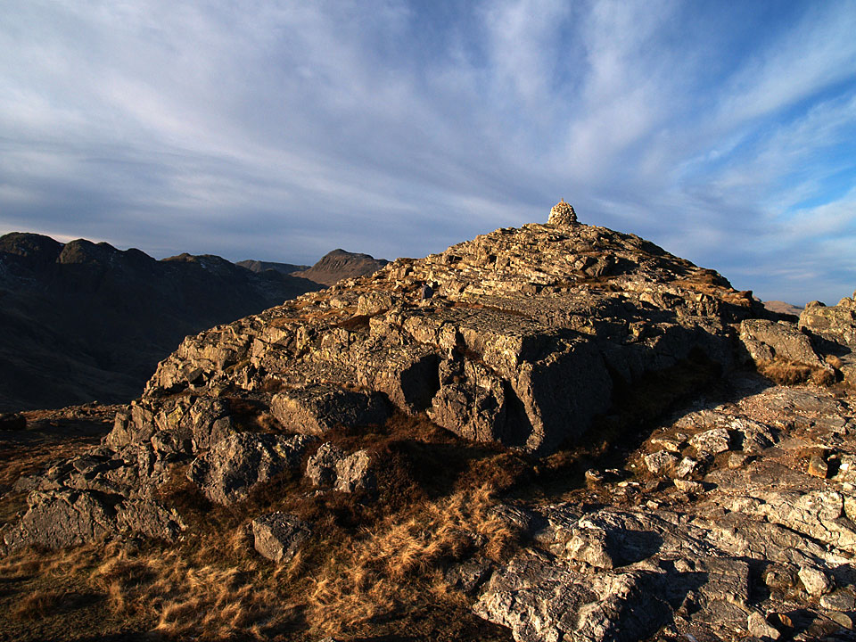
The secondary southern summit cairn.

Wow! Under a blood red sky!

Sunrise panorama.

Pike o' Blisco sunrise.

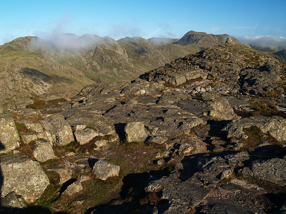
Crinkle Crags and Bowfell lit up by the rising sun.

Like a martian scene in the early morning light, looking across to the Langdales with Skiddaw in the distance.

Diffused light as the sun rises.

Moon, Bowfell and Pike o' Blisco summit.

Langdale zoom.

Even Fletcher gets the sunrise treatment.

Daylight now.

After the sunrise, there was oddly diffused light with the cloud cover. This is Pike o'Blisco main summit.

Hell Gill and Bowfell.

Fletcher takes it all in on the descent to Red Tarn. The light hadn't made it this far yet with Red Tarn being surrounded by fells and neither had any warmth. Two pairs of gloves required for this section, especially with all the 'gloves off, gloves on' going on with the camera.

There it is! First light makes it to Red Tarn as we reach the bottom of the path.

Looking across to The Langdale Pikes as we climb towards Cold Pike; Helvellyn has a dusting of snow.

Fletcher.

It its still the Golden Hour as we are on Cold Pike.

Crinkle Crags and Bowfell from Cold Pike.

looking towards the Duddon Valley with distant Black Combe in view and nearer Harter Fell.

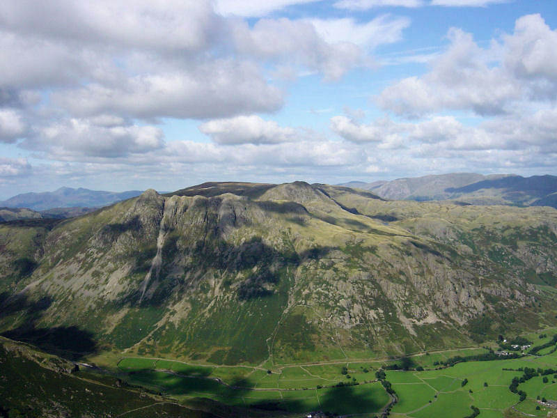
Harter Fell - Devoke Water to the right.

Pike o' Blisco across Red Tarn. We did a direct descent from here which was steep but mainly grassy.

Bowfell across Red Tarn - I love this view.

A fantastic view of Red Tarn, a great vista when climbing this way (the opposite way to me!) and the path rounds the corner.

Harter Fell from the approach to Wrynose Pass.

The Three Shire Stone.

The stone about the stone.