Height: 711 metres / 2333 feet Grid reference: NY 45021 15180
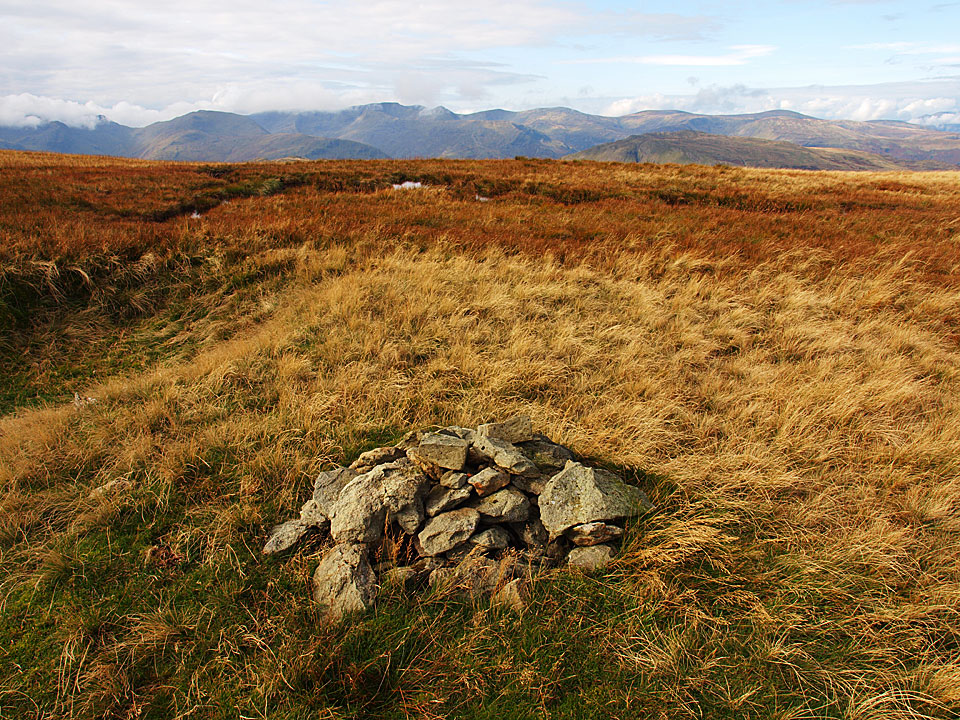
Looking over to Helvellyn from Red Crag
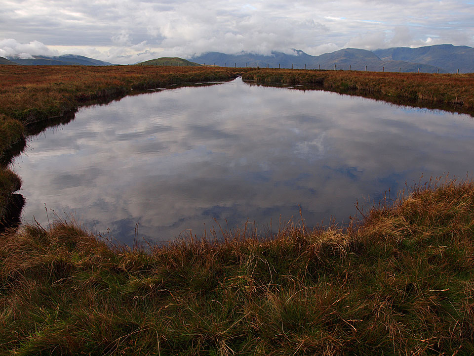
Red Crag Tarn
Height: 711 metres / 2333 feet Grid reference: NY 45021 15180
Looking over to Helvellyn from Red Crag
Red Crag Tarn
Start point: Martindale Old Church (NY 434 184)
Martindale Old Church – Beda Fell – Angletarn Pikes – Angle Tarn – Brock Crags – Satura Crag – Rest Dodd – The Knott – Rampsgill Head – Kidsty Pike – High Raise – Red Crag – Martindale Old Church
Distance: 10.6 miles Total Ascent: 1048 metres Time Taken: 5 hours 40 minutes
Weather: Long sunny spells. 13C.
Today I was joined by StridingEdge stalwarts Andy Lang and Gary Jones for a circuit of Martindale. The occasion was to take in my final two Wainwrights to complete my third time round them, namely Beda Fell and High Raise. After the early mist lifted, the sun shone making it a great end to the walk and of course to completion of the 642!

Martindale Round route map.

Dawn at Martindale Old Church.

Beda Fell beyond Christy Bridge.

Howe Grain from the climb to Beda Fell. There was a definite nip in the air this morning.

The view to Ullswater along Boredale from the ridge to Beda head.

The mist is forming over Ullswater and creeping up the valleys.

As we climb higher the mist completely circles Hallin Fell, here with Winter Crag in the foreground.

The view from higher up the ridge.

Place Fell and St. Sunday Crag from the first cairn on the summit ridge.

Beda Head, the summit of Beda Fell with Hallin Fell, Bonscale Pike and Steel Knotts in view.

A bit of sunshine on Place Fell.

Looking back to Beda Head now drenched in early morning sun.

Walking the ridge to Angletarn Pikes.

Bannerdale just before the mist started pouring over the tops from the south and obliterated everything for a while.

Looking towards Glenridding and Ullswater from Angletarn Pikes.

The mist starting to clear at Angle Tarn.

Angletarn Pikes from the climb to Brock Crags - all clear now!

Angle Tarn in sunshine but Angletarn Pikes in mist again, showing how quickly conditions were changing.

Brothers Water from Brock Crags.

Gray Crag and Hayeswater with some dramatic clouds pouring over High Street and Caudale Moor.

Martindale from Satura Crag.

Today's walk was to a background chorus of rutting stags bellowing around Martindale. We saw many smaller herds of deer but were fortunate to see this stag on the horizon.

Brock Crags from the climb to Rest Dodd.

Casper on the summit of Rest Dodd.

Rest Dodd from the start of the climb to the Knott.

High Street from The Knott.

Hayeswater Gill and Hayeswater from The Knott.

Looking across to The Knott from the crossing to Rampsgill Head.

High Street from the summit of Rampsgill Head.

High Raise and blue skies ahead.

Andy, Gary and Casper crossing to Kidsty Pike.

Riggindale and a glimpse of Haweswater from Kidsty Pike.

No sign of the Golden Eagle but the Casper has landed.

Still tarn below High Raise.

Golden sunshine once more on the summit of High Raise.

Me with Casper on High Raise, my third completion of the 214 Wainwrights.

Following the High Street ridge to Red Crag.

Redcrag Tarn.

Looking over to Helvellyn from Red Crag.

The descent back into Martindale.

Ullswater along Fusedale Beck.

Steel Knotts ahead but we descended the path to the left of the summit.

Beda Fell across Martindale.

All is lovely now on Steel Knotts.

Beda Fell from Martindale Old Church.

Ullswater on the way home.
Start point: Moorahill Farm (NY 494 182)
Moorahill Farm – Low Kop (516) – High Kop – Red Crag (517) – Wether Hill – Loadpot Hill – Hart Hill – The Pen – Moorahill Farm
Distance: 8.5 miles Total Ascent: 513 metres Time Taken: 3 hours
Weather: Cloudy with drizzle. 7oC.
It was up into the clouds this morning with accompanying drizzle and a biting wind. There were no views of anything today (so not many photos) but the going was easy and I managed to complete this one in super quick time. I’m not sure there would be a lot going for this walk in good weather as the area is quite bleak, although the views from High Street Roman Road are usually pretty good.


Cawdale looking a bit dull in early morning light with Low Kop and High Kop up on the ridge. The clouds look ominously low on Wether Hill at the head of the valley.

Crossing Cawdale Beck on the old stone footbridge. Annoyingly, the bridge is not on the footpath so I had to follow the beck to find it. I was quickly into the murk and drizzle climbing The Hause up to Low Kop. Low Kop was totally unremarkable and I could not find any sort of marker although I wandered around in the mist for a while. I always took 'Kop' to be of South African derivation, being the word for a hill in Afrikaan (and used at many football stadiums as a name for the home terraces). Could Low Kop and High Kop be named by soldiers returning from The Boer War at the turn of the 20th century?

The summit of Red Crag was also unmarked so Casper will have to do instead. Oddly there is a large cairn to the north of the highest point.

Crossing a gap in the wall following the old Roman Road.

The remains of Lowther House, an old hunting lodge, on the climb to Loadpot Hill. These ruins seem to reduce in size every time you pass.

The trig. column on Loadpot Hill.

The briefest glimpse of sunshine descending The Pen.

Back to the start, cold and wet. Cawdale and Cawdale Beck.