Start Point: Blea Tarn Car Park (NY 296 043)
Blea Tarn – Bleatarn House – Lingmoor Fell – Lingmoor Tarn – The Squeeze – Side Pike – Blea Tarn
Distance: 5.7 km Total Ascent: 365 metres Time Taken: 2 hours Start Time: 10:10
Weather: Cold wind, clear spells, 5°C
This is a great little walk, the scenery is fabulous throughout with the Langdale Pikes dominating the scene for most of the time. The view from Side Pike is possible the best view you can get of the Langdales and well worth squeezing through ‘The Squeeze’ to get to it. Blea Tarn is ever popular and offers great views with an easy path around it.
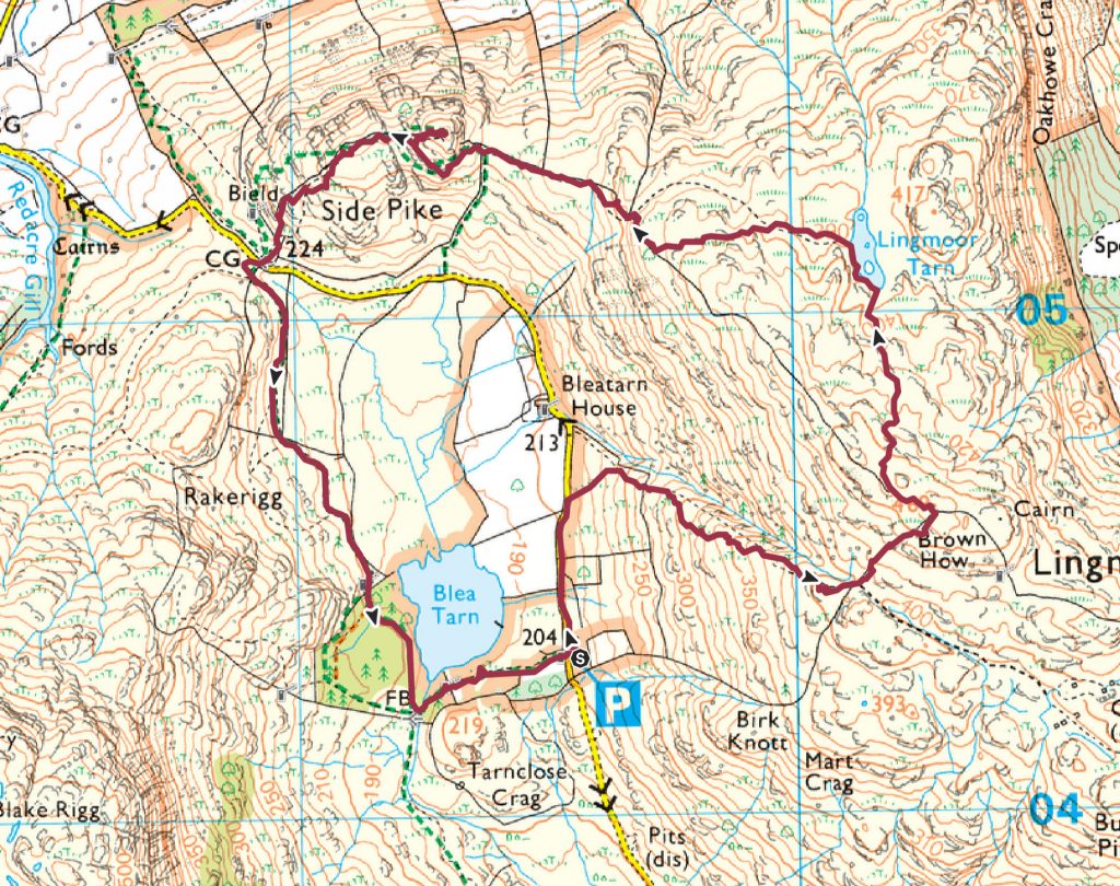
Lingmoor Fell and Side Pike route map.

Straight from the car park above Blea Tarn, there is a great view of the Langdales from the Side Gates road.

Heading a little further down the road towards Bleatarn House, there is a large stone next to the road known as the echo stone.

Looking across Blea Tarn to Blake Rigg on the eastern side of Pike o' Blisco.

Bowfell and The Band.

A fabulous view to Mickleden and the Langdale Pikes from the larches looking over Bleatarn House. Blea Tarn and Bleatarn House are described in Wordsworth's 1814 poem 'The Solitary' (which itself is part of a longer poem 'The Excursion': ...to the south Was one small opening, where a heath-clad ridge Supplied a boundary less abrupt and close; A quiet treeless nook, with two green fields, A liquid pool that glittered in the sun, and one bare Dwelling; one Abode, no more ! It seemed the home of poverty and toil Though not of want: the little fields, made green By husbandry of many thrifty years, Paid cheerful tribute to the moorland House.

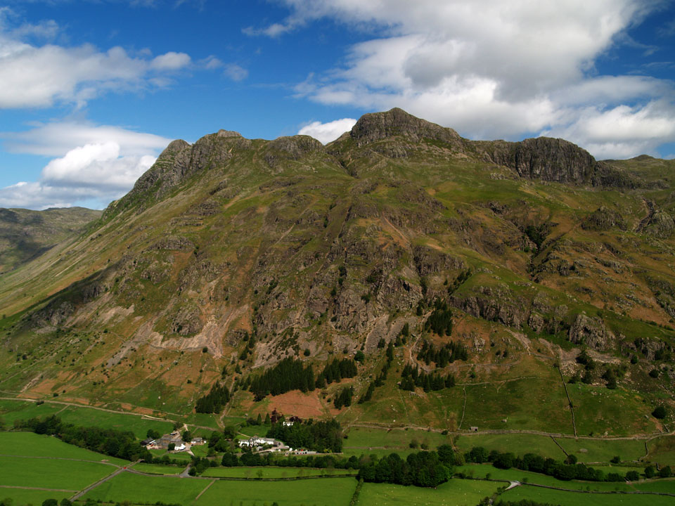
Side Pike with the Langdales beyond.

Fletcher basking in the sunshine.

Blake Rigg and Pike o' Blisco across Blea Tarn. Crinkle Crags are silhouetted beyond.

Looking south to the Coniston fells with Wetherlam dominating and the long ridge of Wet Side Edge leading to Great Carrs.

Looking directly along Mickleden - what a view!

It doesn't look as though I am alone of this fell today! I passed this large group on the final part of the ascent,

Lingmoor Fell summit.

The Langdale Pikes and Lingmoor Tarn, the next target.

Down at Lingmoor Tarn.

The Langdlae pIkes are looking larger as I descend.

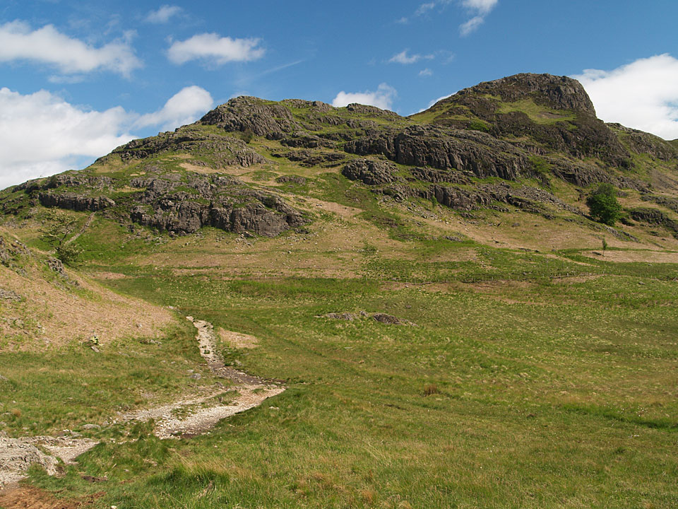
The 'Great Wall of Lingmoor' leads to Side Pike. It looks impenetrable from here but there is a way to get through.

Getting closer.

Looking back to Lingmoor Fell.

This is the key to climbing Side Pike - known as The Squeeze for obvious reasons. This is taken from the far side of it; it required bag removal and a deep breath to get through here!

A great view of Blea Tarn from the path skirting the foot of Side Pike.

Pike o' Blisco seems close from here.

There is probably the best view of the Langdale Pikes from Side Pike.

From Bowfell to Esk Pike.

A wide view of Oxendale and Mickleden.

A beautiful panorama from the top of the Blea Tarn Pass.

The Langdale Pikes across Blea Tarn.

Footnote: A then and now photo - Fletcher sitting on the very same stone that Mr A.Wainwright himself sat on in 1990!
Wainwright photo © Chris Butterfield/Estate of Kenneth Shepherd.
Check out Chris Butterfield’s fantastic Alfred Wainwright Books & Memorabilia website, it is a mine of useful information about all things Wainwright related!