Striding Edge

A photo diary of Lake District fell walks

  • Walks
  • Fells
    • Wainwrights
      • Eastern Fells
      • Far Eastern Fells
      • Central Fells
      • Southern Fells
      • Northern Fells
      • North Western Fells
      • Western Fells
      • Outlying Fells
    • Birketts
  • Dogs
  • Love The Lakes
  • Contact

Sourfoot Fell

Height: 411 metres / 1348 feet Grid reference: NY 13487 23355
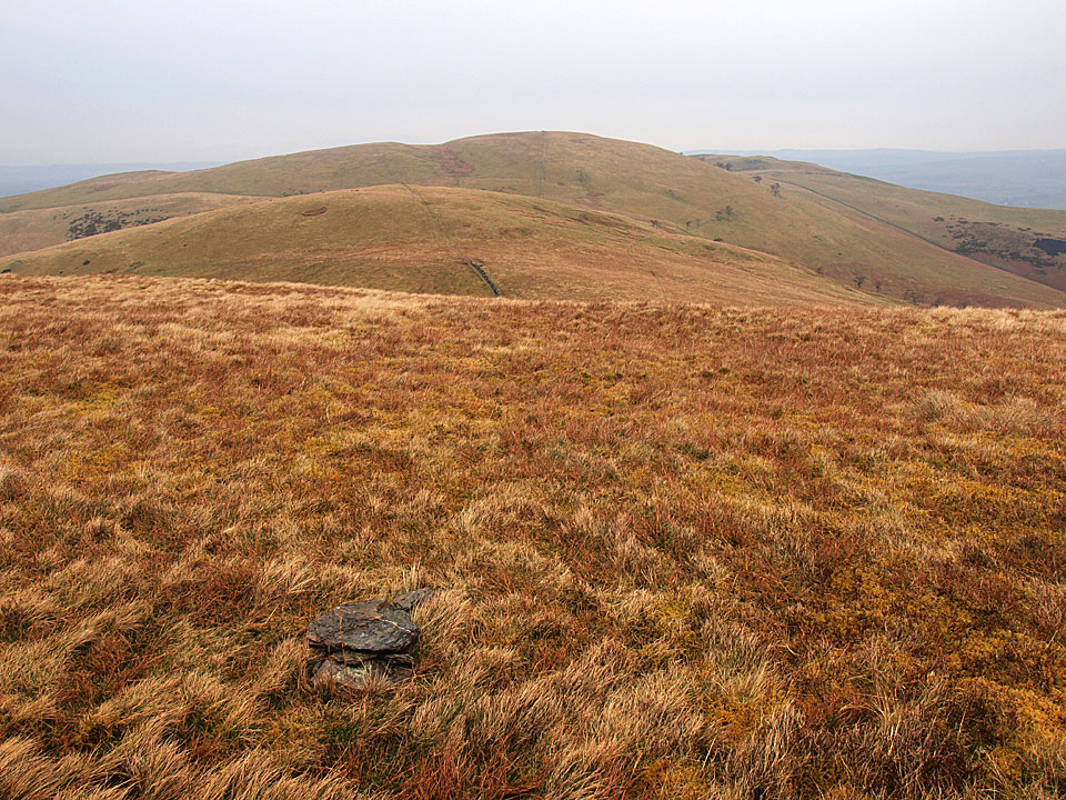
The uninspiring top (and cairn!) on Sourfoot Fell looking to Smithy Fell and Fellbarrow beyond

The uninspiring top (and cairn!) on Sourfoot Fell looking to Smithy Fell and Fellbarrow beyond

Fellbarrow

Walked on 29/03/2011

Start point: Loweswater (NY 128 217)

Loweswater – Darling Fell – Loweswater Fell – Low Fell – Sourfoot Fell – Smithy Fell – Fellbarrow – Askill Knott – Loweswater

Distance: 5 miles     Total Ascent: 526 metres     Time Taken: 2 hours 15 minutes     Start Time: 10:10

Weather: Grey and showery. 7°C

It was a grey old morning and I ended up not doing the walk I expected to but a shorter – and lower – one around the Fellbarrow group of fells. The rain came not long after the start of the walk but at least it dried up before the end. It always seems to be damp when I come this way so I must try and get here on a good day!

Fellbarrow

Fellbarrow route map.

29.03.11-006

Carling Knott.

29.03.11-007

Hen Comb across Loweswater.

29.03.11-008

Burnbank Fell.

29.03.11-009s

Loweswater panoramic.

29.03.11-013

Loweswater from the Mosser Road.

29.03.11-018

Looking northwards across the Solway Firth it seems brighter with Criffel standing proud.

29.03.11-022

A rest on Darling Fell after the steep climb, beyond is Low Fell Whiteside and Grasmoor.

29.03.11-028

Before reaching Low Fell there is a steep descent to Crabtree Beck then a re-ascent. The rain was coming in heavily now and I had to stop on the climb to put my waterproofs on.

29.03.11-031

Mellbreak and Crummock Water from Low Fell (this south top is the Wainwright summit, Birkett calls this Loweswater Fell).

29.03.11-033

Heading for the north top of Low Fell.

29.03.11-034

The view from the north top in the pouring rain (Birkett - 'Low Fell').

29.03.11-038

Lorton Vale from Watching Crag.

29.03.11-039

Whiteside and Grasmoor.

29.03.11-041

The uninspiring top (and cairn!) on Sourfoot Fell looking to Smithy Fell and Fellbarrow beyond.

29.03.11-045

Damp Dougal-Doo!

29.03.11-052

Getting a 'hurry up' look on Smithy Fell, Fellbarrow ahead.

29.03.11-063

Casperoo.

29.03.11-065

Looking back from the climb to Fellbarrow.

29.03.11-067

The summit of Fellbarrow.

29.03.11-092s

Loweswater from Askill Knott.

29.03.11-099

A touching sentiment, hidden on a fence on the return.

Fellbarrow

Walked on 31/01/2005

Start point: Loweswater (NY 128 217)

Loweswater – Darling Fell (276) – Loweswater Fell (277) – Low Fell (278) – Sourfoot Fell (279) – Smithy Fell (280) – Fellbarrow (281) – Hatteringill Head on Whin Fell (282) – Loweswater

Weather: Overcast throughout the walk.

A visit to the north western fells above Loweswater today – not much luck with the weather though as the clag stubbornly clung to the fells all day despite their relatively low stature.

01 Fellbarrow

Fellbarrow route map.

02 Elevation

Elevation profile of the route. Key: DF=Darling Fell, LWF=Loweswater Fell, LF=Low Fell, SF=Sourfoot Fell, SMF=Smithy Fell, F=Fellbarrow, HH=Hatteringill Head on Whin Fell.

03 Fellbarrow 3D

3D image of the walk route.

Dsc04037

Loweswater from the ascent of Darling Fell. For completeness, summit shots without a view...

Dsc04043

Darling Fell.

Dsc04047

Low Fell.

Dsc04048

Sourfoot Fell.

Dsc04049

Smithy Fell. ....and the view on a clearer day...

Dsc04049a

Dsc04050

Where are we?

Dsc04062

There was a better view over the Solway Firth to Scotland than anywhere else today...

Dsc04071

Loweswater.

Dsc04073

Mellbreak.

Dsc04074

Rannerdale Knotts across Crummock Water.

Walking Diary

  • The Mosedale Horseshoe 01/03/2022
  • Caw 18/01/2022
  • Coniston sunset 17/01/2022
  • Blencathra 15/01/2022
  • Scafell Pike 14/01/2022

Social

  • Facebook
  • Twitter

Information

  • Striding Edge
  • T&C’s
  • Privacy
  • Links