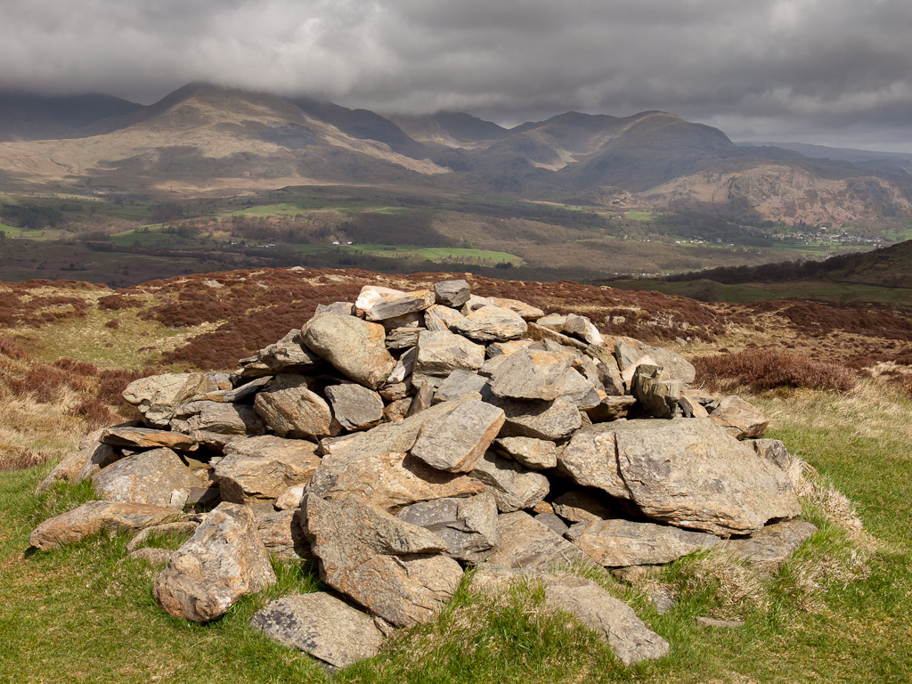
Height: 335 metres / 1099 feet Grid reference: SD 30806 91857 Category: The Outlying Fells

The Old Man and Wetherlam from Top o’ Selside
Height: 335 metres / 1099 feet Grid reference: SD 30806 91857 Category: The Outlying Fells

The Old Man and Wetherlam from Top o’ Selside
Walked on
Start point: High Nibthwaite (SD 295 897)
High Nibthwaite – Brock Barrow (OF) – Low Light Haw (OF) – High Light Haw (OF) – Stang Hill – Arnsbarrow Hill – Top o’ Selside(OF)– High Nibthwaite
Distance: 4.1 miles Total Ascent: 347m metres Time Taken: 1 hours 30 minutes Start Time: 09:20
Weather: Sunny spells. A cool 9oC.
It may be May (!) but it doesn’t particularly feel like it, the shorts and tee shirt are still not in evidence yet. Dougal (and Casper) have gone for it though having lost their winter coats ready for the long hot summer ahead. It was just me and Dougal again today for a jaunt along the east side of Coniston Water up on Bethecar Moor, a fairly relaxed walk with some great views.
Walked on
Start point: Dodgson Wood (NY 246 016)
Dodgson Wood – Low Parkamoor – Great Hill – Top o’ Selside – Low Parkamoor – Dodgson Wood
Distance: 2.6 miles Total Ascent: 295 metres Time Taken: 1 hour
Weather: Overcast. 15oC.
This morning it was surprisingly warm for the time of year, but with that went the low cloud and general dullness. On the way up the east side of Coniston, I stopped to have a look at a metal statue that I have seen a few times peeping over the wall, but have never been close to. The autumn colours are really showing now, especially when the sun shines.
Walked on
Start point: Dodgson Wood (NY 246 016)
Dodgson Wood – Low Parkamoor – Great Hill – Top o’ Selside – Low Parkamoor – Dodgson Wood
Distance: 2.6 miles Total Ascent: 295 metres Time Taken: 1 hour
Weather: Heavy rain. 12oC.
My waterproofs have been getting some use on the last few walks, that is for sure! Today was no exception as the rain never let up all morning for our short walk on the east side of Coniston Water up to Top o’ Selside. There were no views and the photos were snatched ones in the rain, but the lower sections of the walks through the ancient woods were pleasant enough. We were all glad of the fresh air, whatever the weather.
Walked on
Start point: High Nibthwaite (SD 295 897)
High Nibthwaite – Brock Barrow – Low Light Haw (OF) – High Light Haw (OF) – Stang Hill –Arnsbarrow Hill – Top o’ Selside (OF)– High Nibthwaite
Distance: 5 miles Total Ascent: 474 metres Time Taken: 1 hour 50 minutes
Weather: Cold, cloud at valley level. 3oC.
It was cold and misty on the drive up to the east side of Coniston. Would it be cold enough at valley level to create a temperature inversion, where the cloud remains at a very low level and you can climb above it to clear skies? Well let’s see….
Walked on
Start point: High Nibthwaite (SD 295 897)
High Nibthwaite – Brock Barrow – Low Light Haw (OF) – High Light Haw (OF) – Stang Hill (37) – Arnsbarrow Hill (38) – Top o’ Selside (39) (OF)- High Nibthwaite
Weather: Bright at first turning to drizzle.
