Striding Edge

A photo diary of Lake District fell walks

  • Dogs
  • Contact
  • Fells
    • Wainwrights
      • Eastern Fells
      • Far Eastern Fells
      • Central Fells
      • Southern Fells
      • Northern Fells
      • North Western Fells
      • Western Fells
      • Outlying Fells
    • Birketts
  • Information
    • About Striding Edge
    • Striding Edge
    • T&C’s
    • Privacy
    • Links
  • Walking Diaries
    • 2026 Walking Diary
    • 2025 Walking Diary
    • 2024 Walking Diary

Little Langdale, Slater Bridge & Cathedral Cave

Walked on 16/01/2026

Skelwith Bridge – Skelwith Force – Elterwater – Slater Bridge – Cathedral Cave – Colwith Force – Skelwith Bridge

Distance: 10.7 km
Total Ascent: 226 metres     
Time Taken: 2 hours 40 minutes
Start Time: 10:15
Weather: Overcast, some mizzle. 3ºC
Finlay’s Wainwright count: 18/214 (0 new this walk)

Route map with GPX Download.

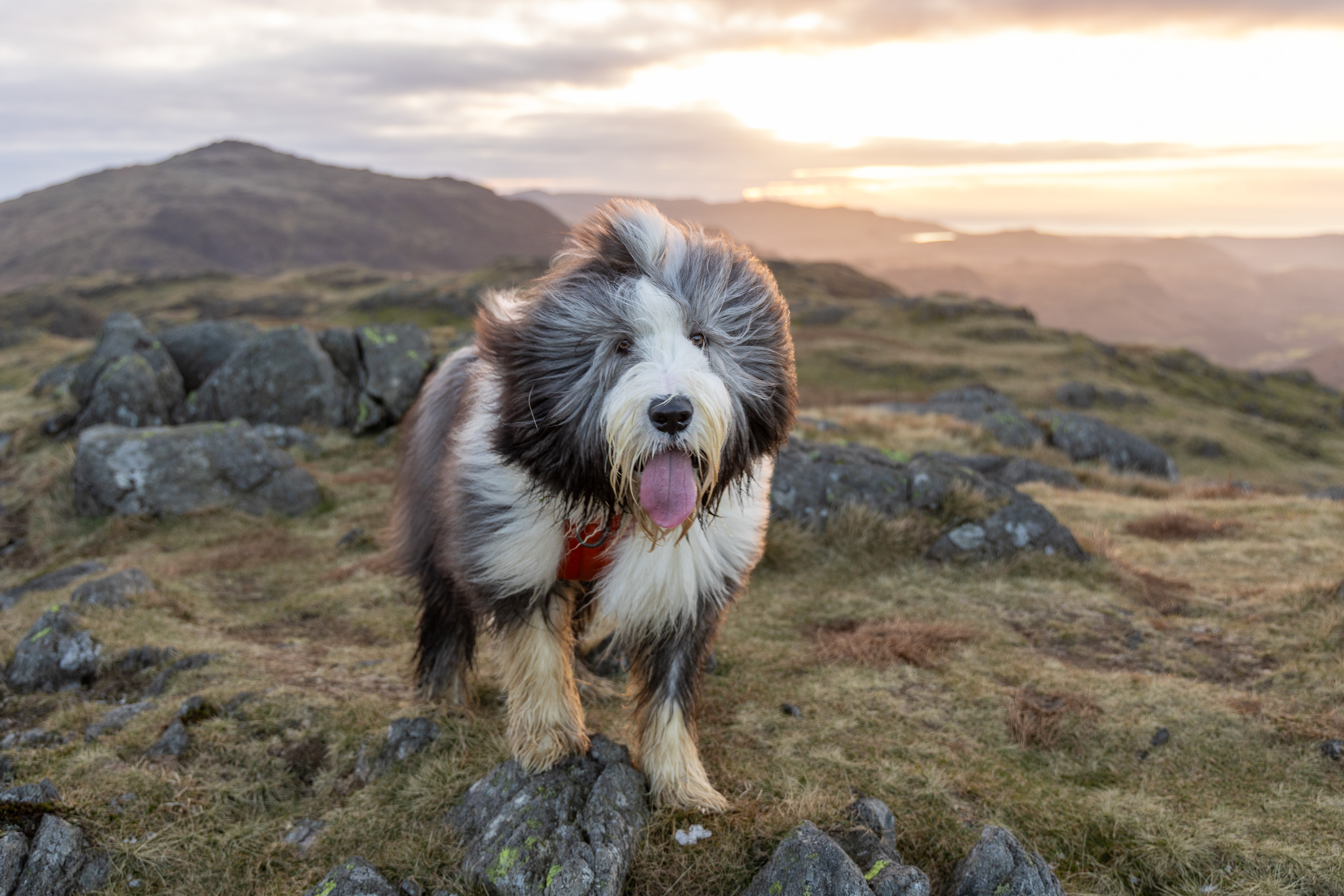
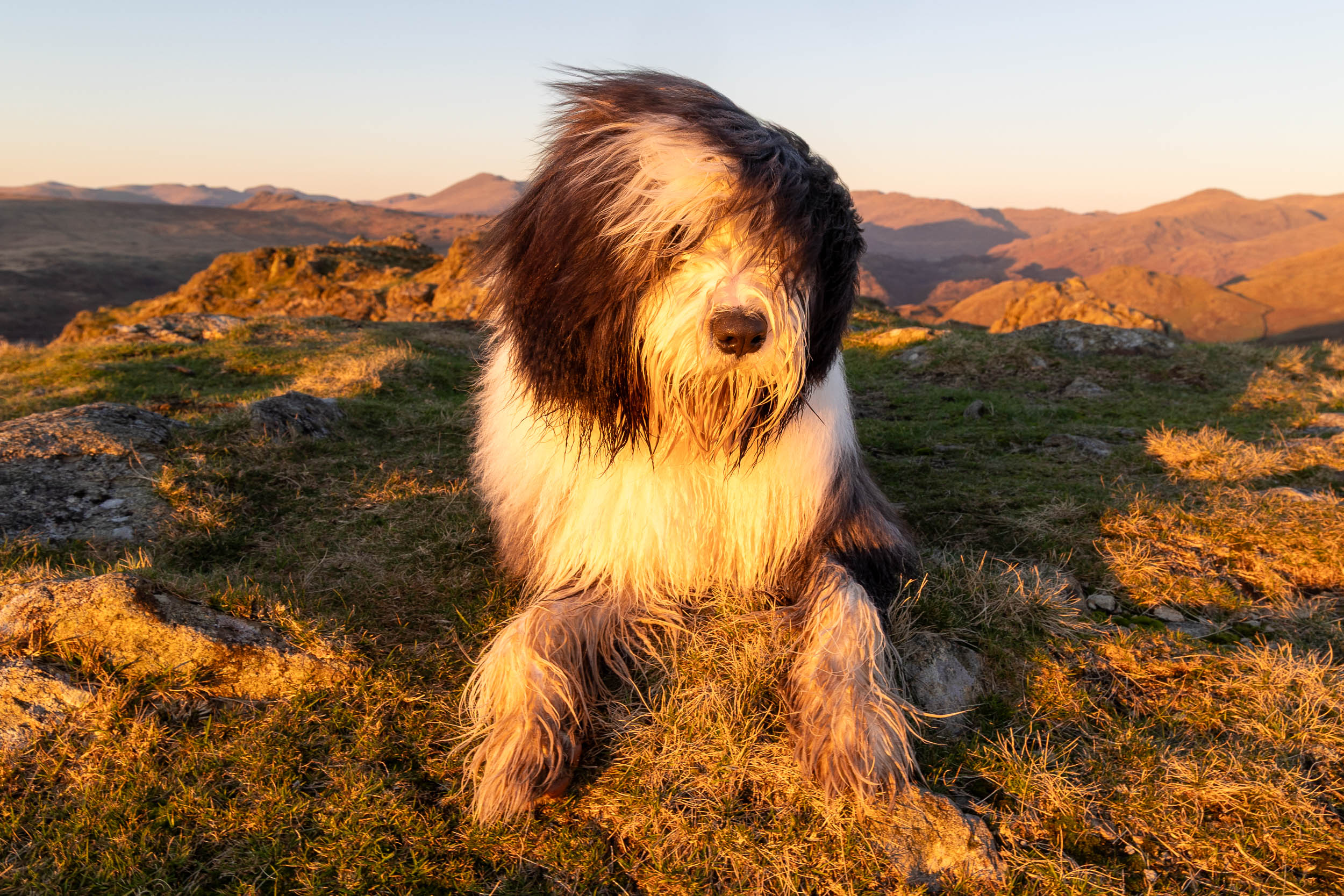
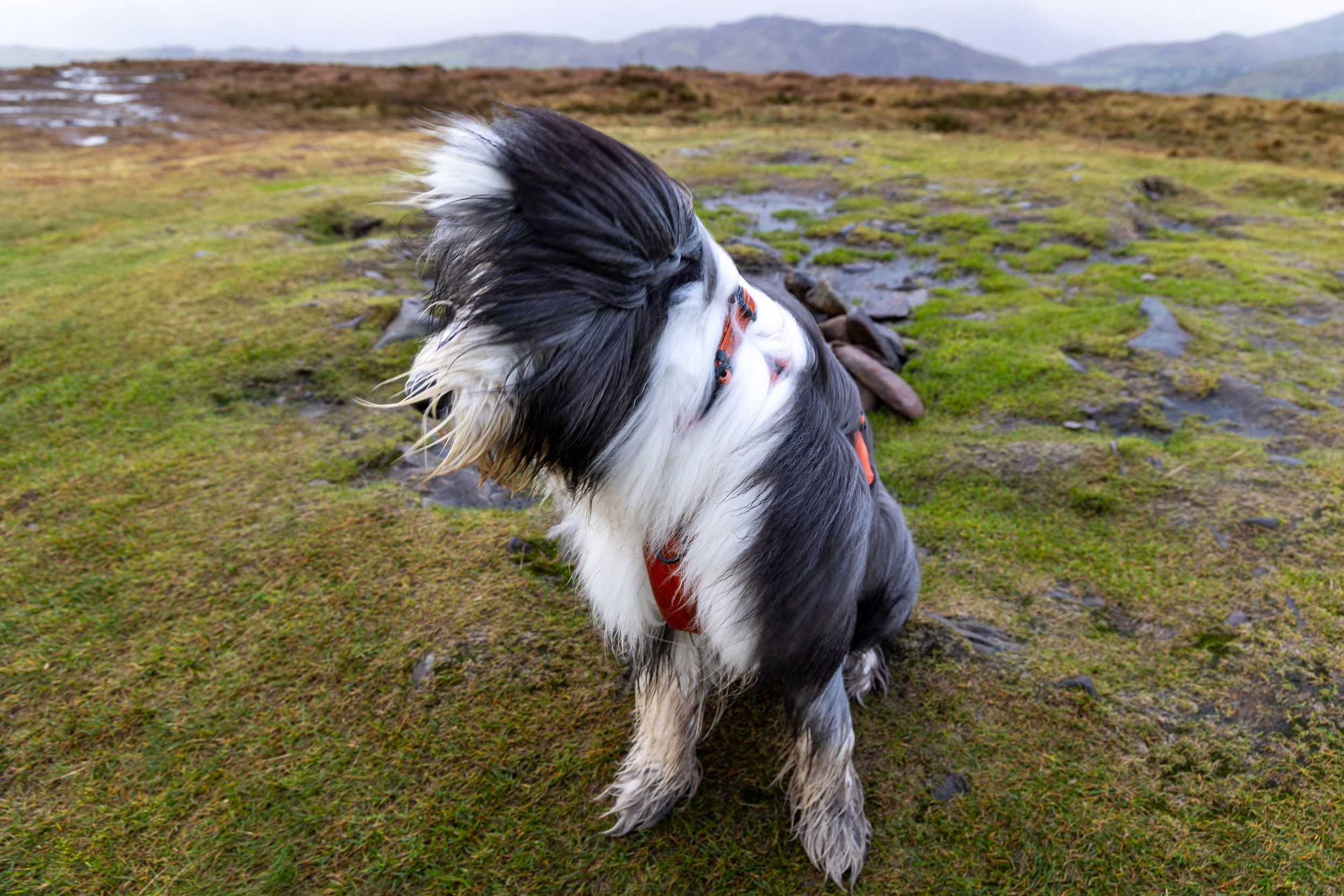
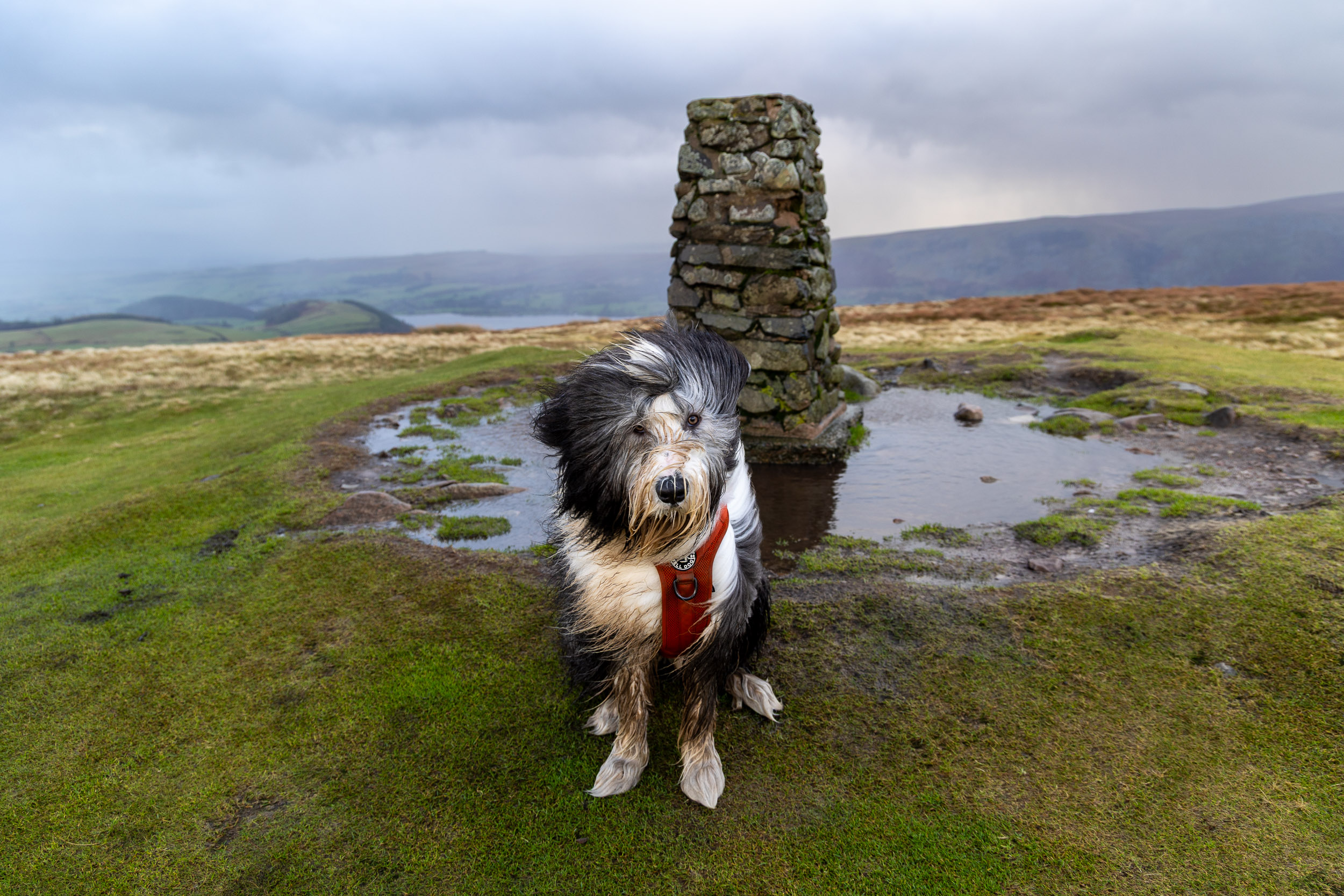
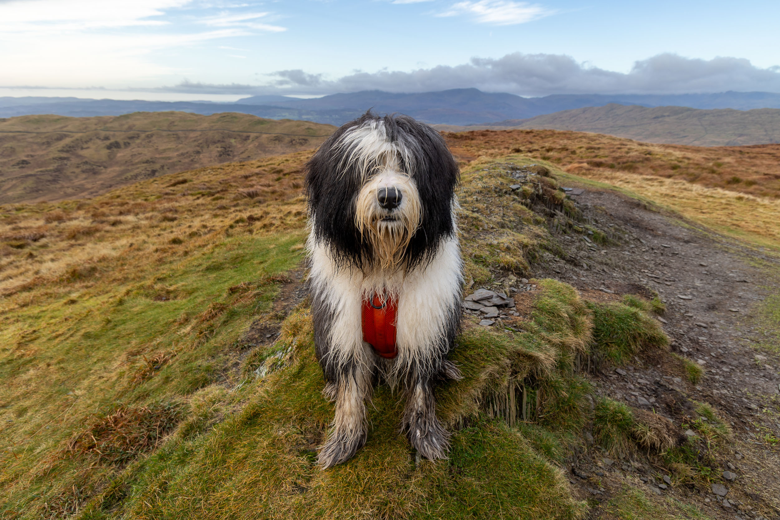
I thought the weather was supposed to be better today (perhaps it was better elsewhere?) and I had planned on going higher but looking at the clouds and the mizzle I didn’t think it was worth getting up onto the fells. I have had this circuit in my back pocket for a while and for just such a day and especially when it is not holiday season as it seems to be so popular around Skelwith these days. It was a great little walk, a bit damp at times but the scenery, as ever, was beautiful. I do wonder what I have unleashed in Finlay as I had him jumping stiles and when he got the hang of it he showed he can jump over them without even touching – yikes!

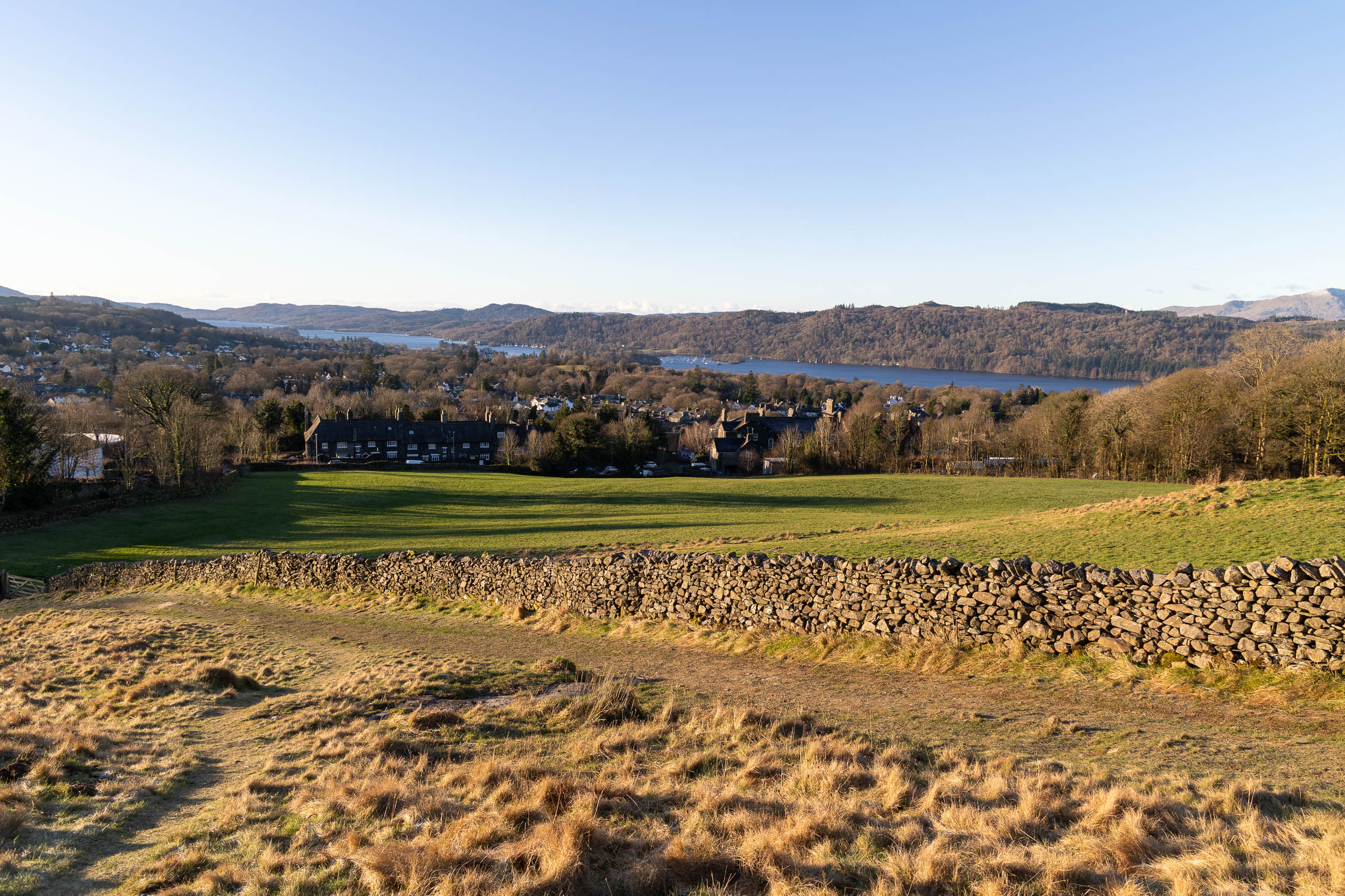
Almost as soon as the walk started from Skelwith Bridge I was at Skelwith Force falls. The falls were if fine form today with plenty of water flowing over them. I left Finlay tied to the fence a little further up the path, the slippery rocks were too dangerous to risk taking him down there, plus of course he would no doubt pull me in with him!

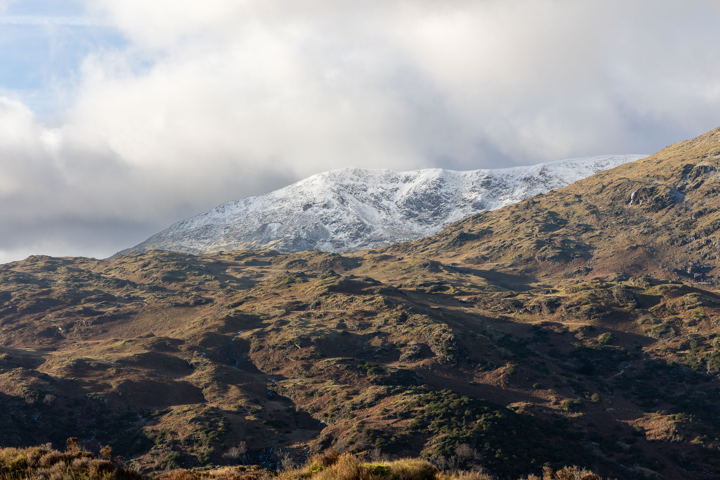
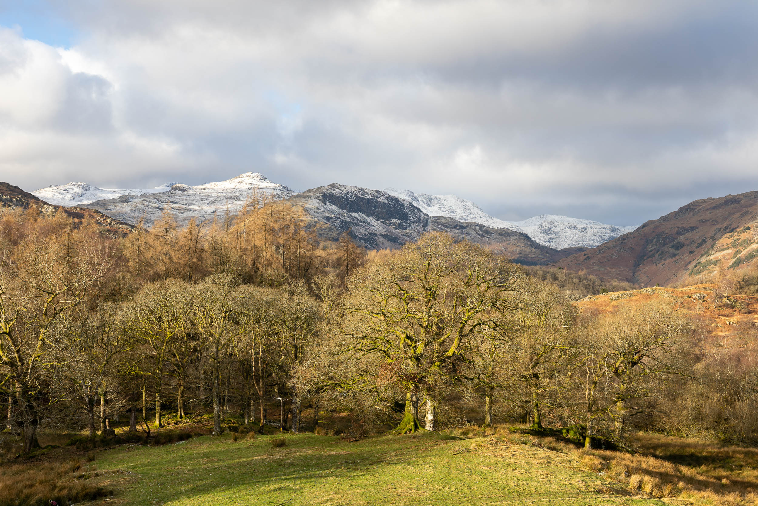
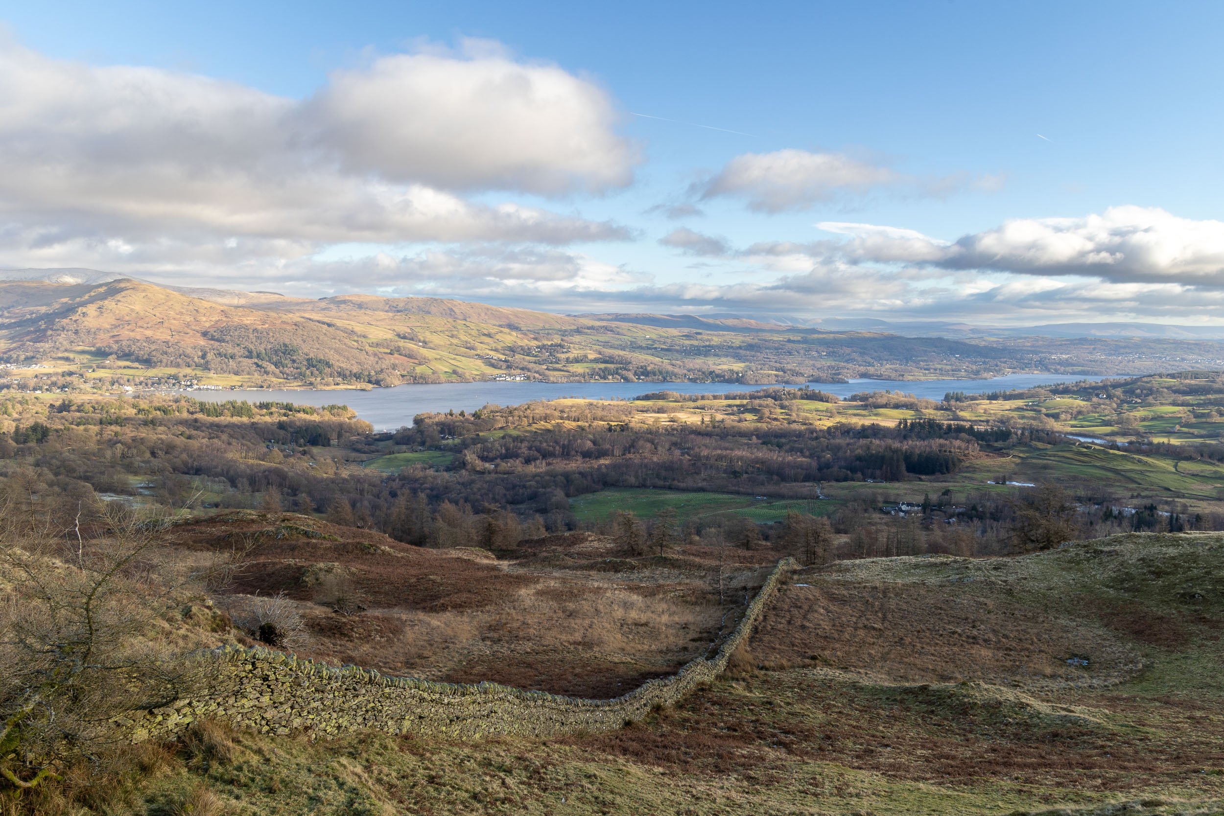
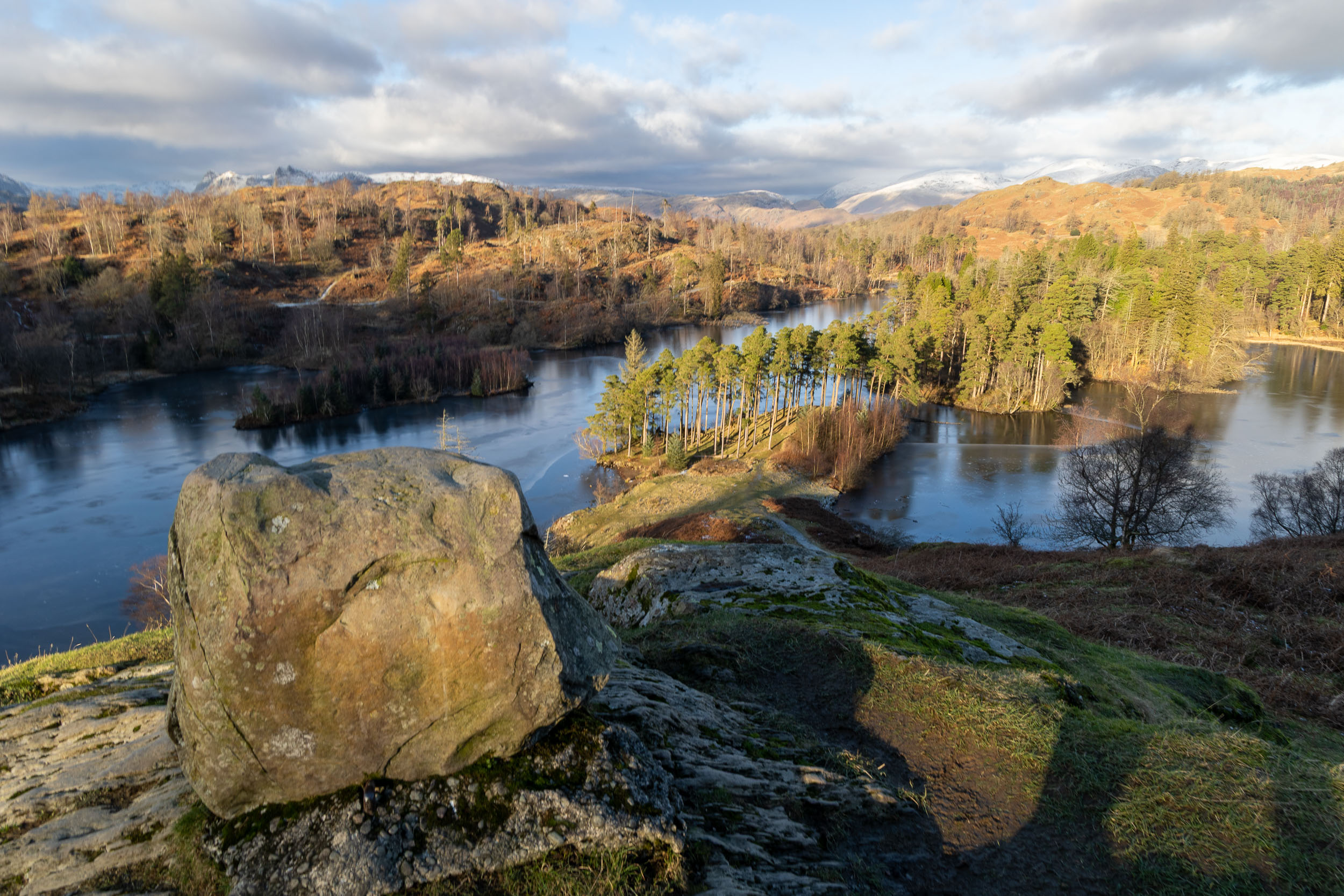
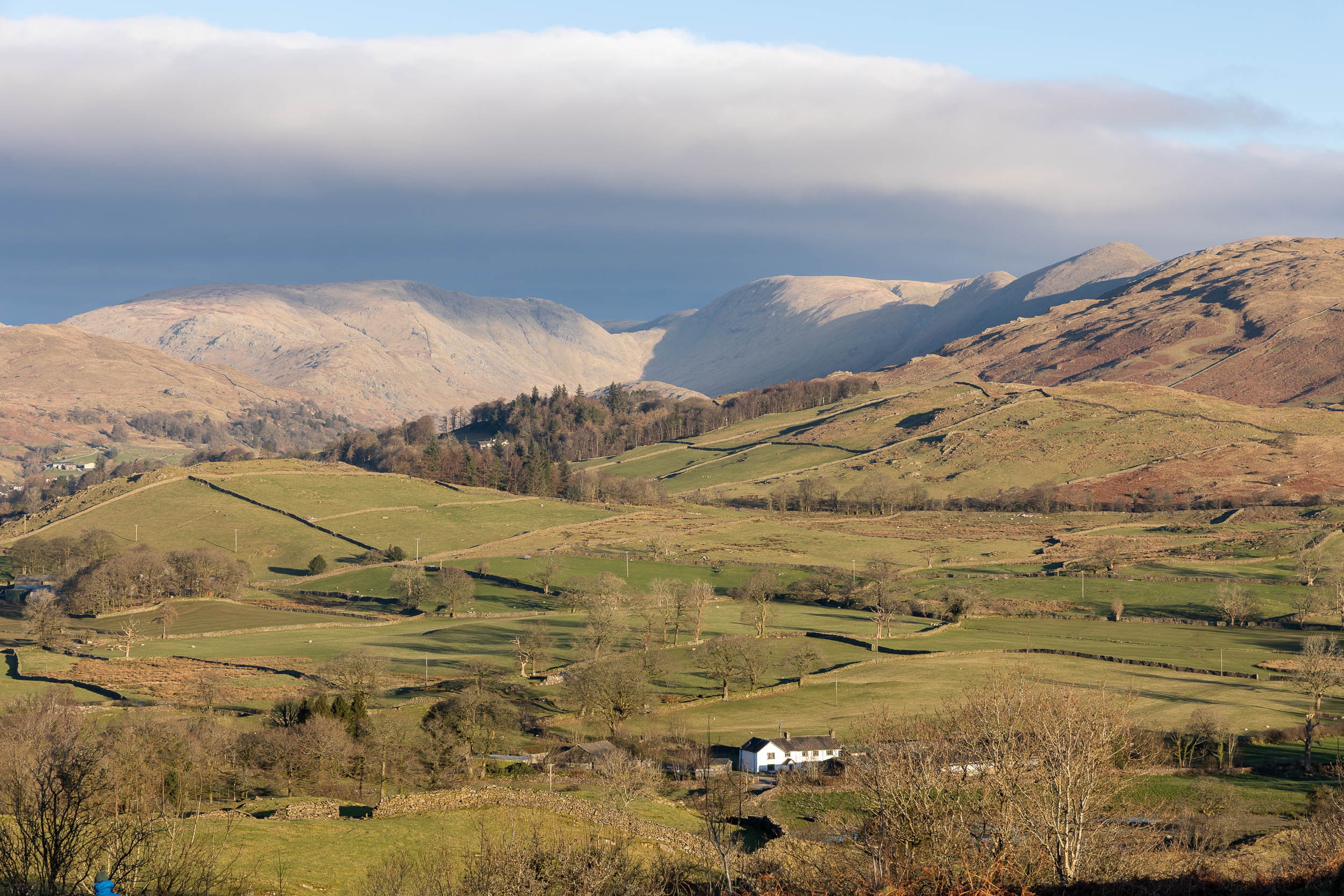
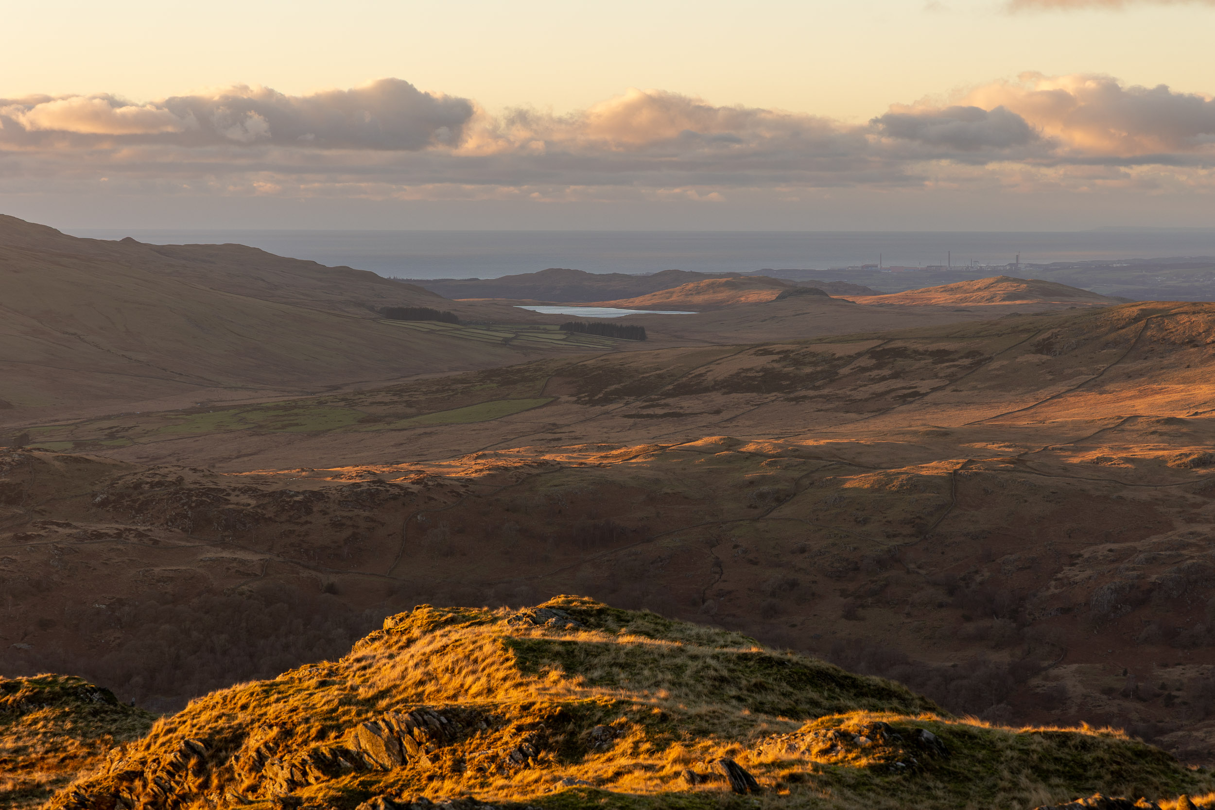
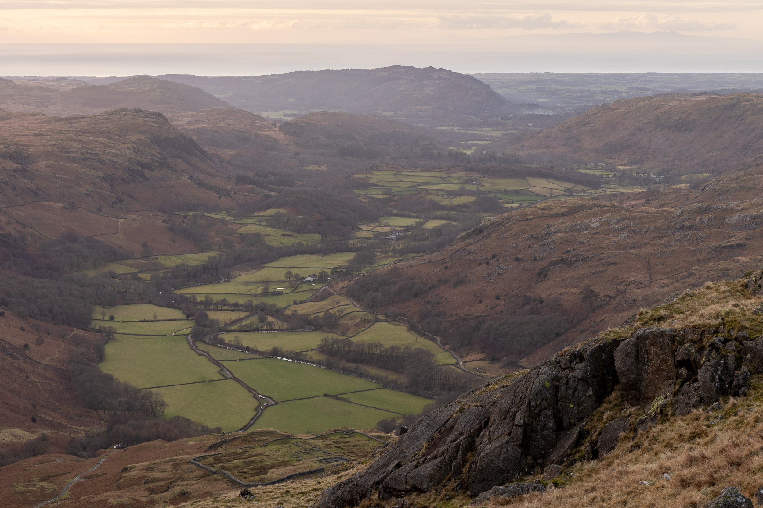
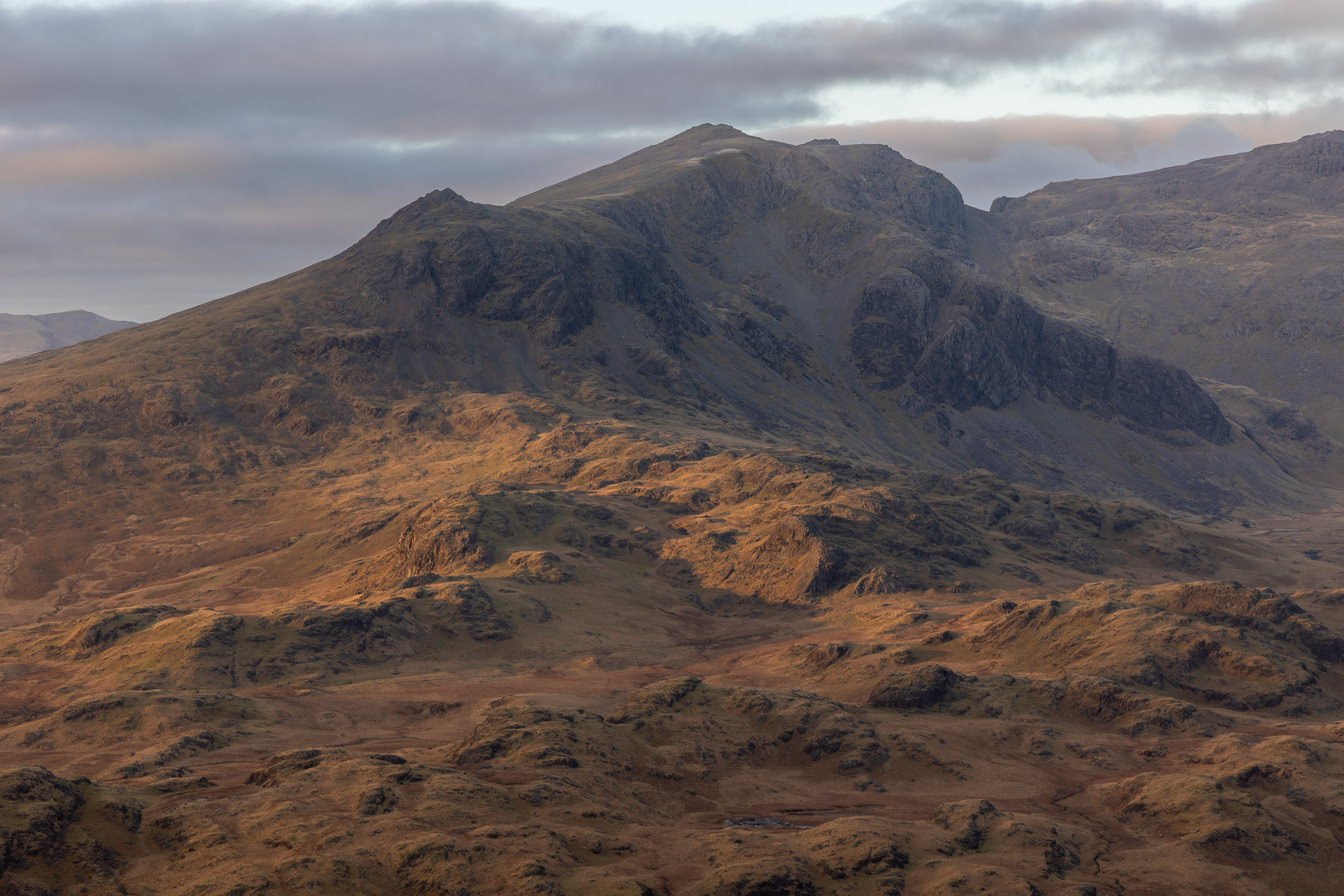
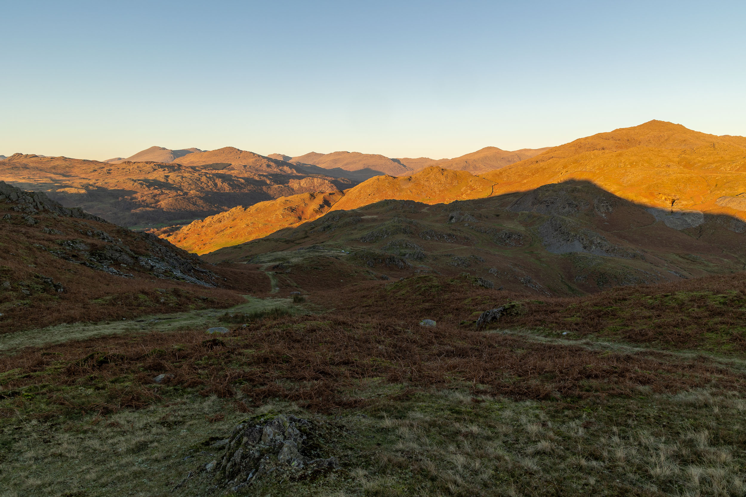
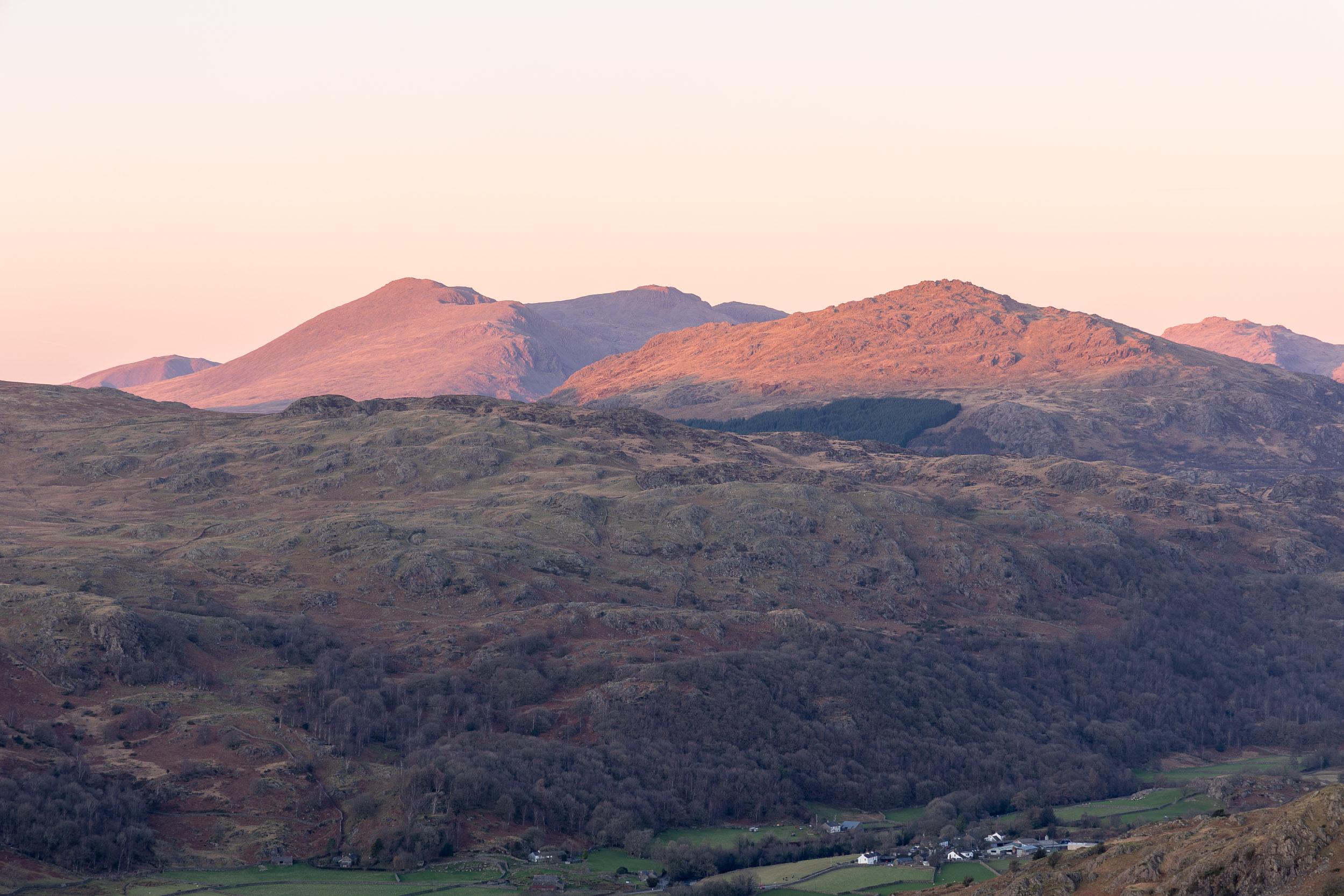
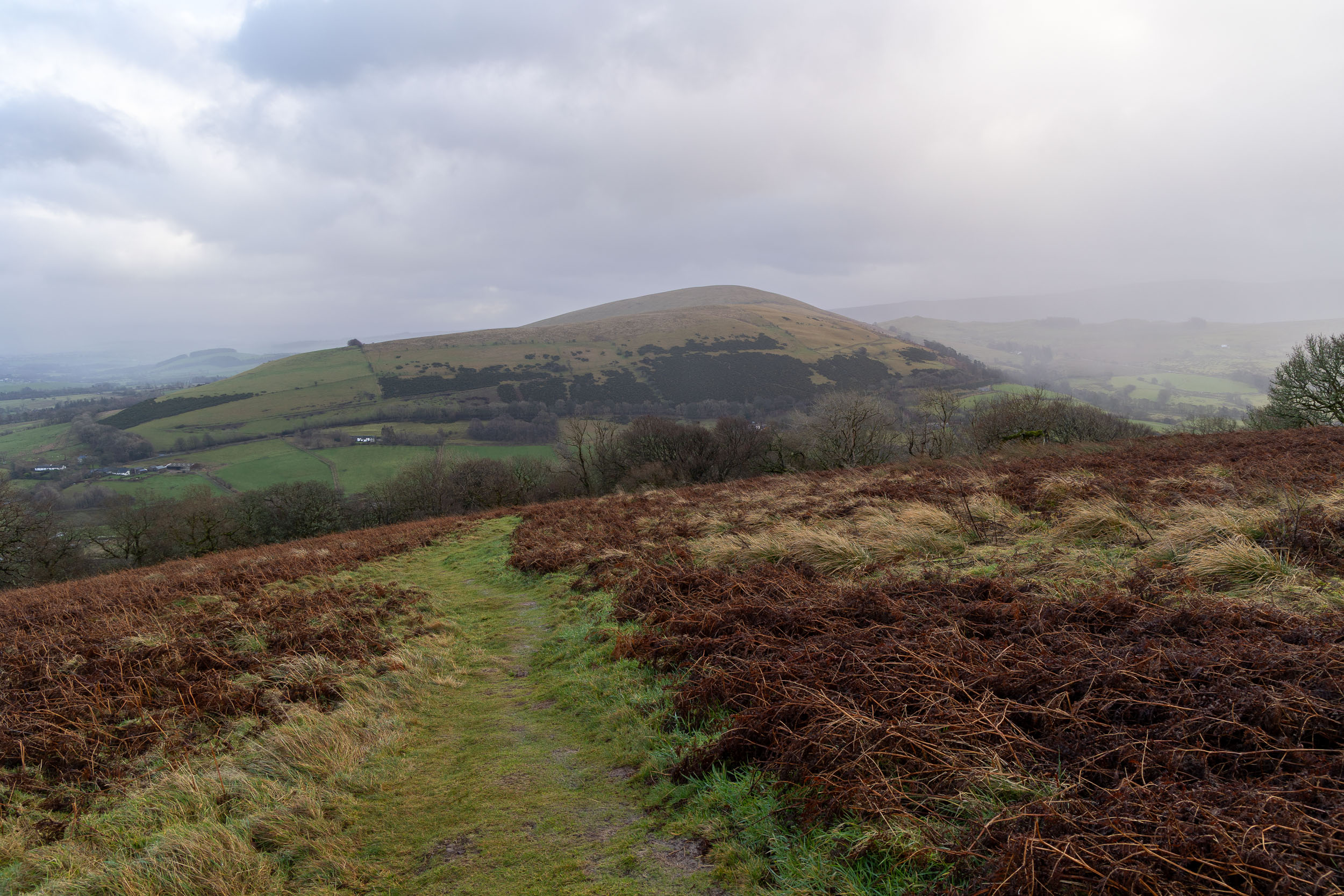
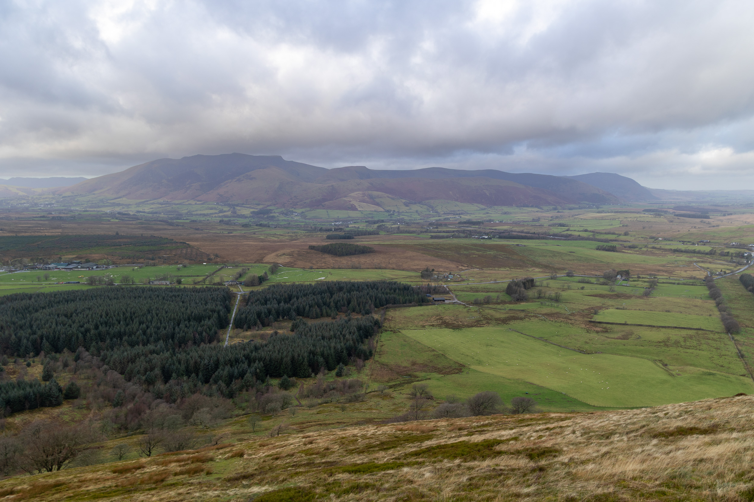
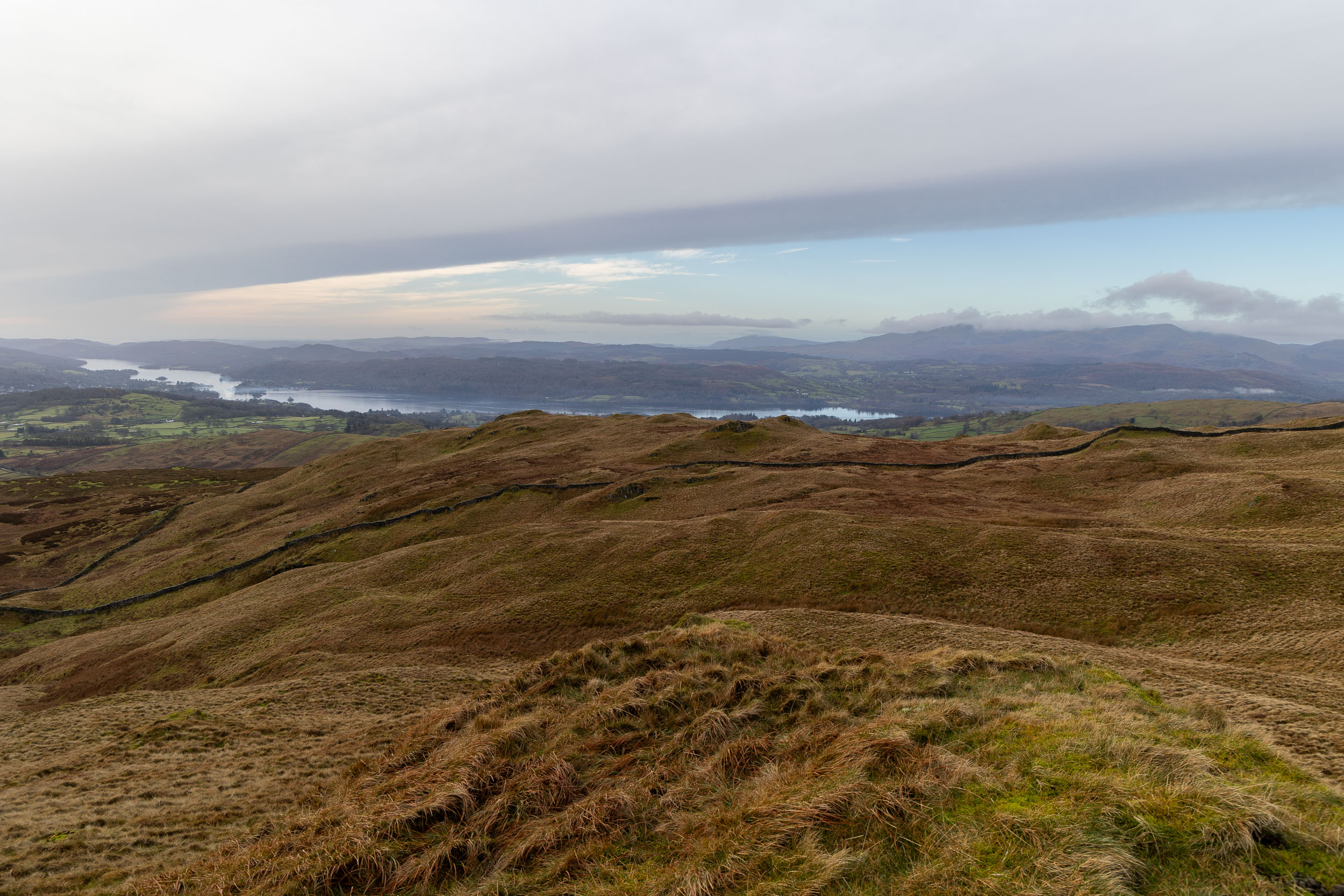
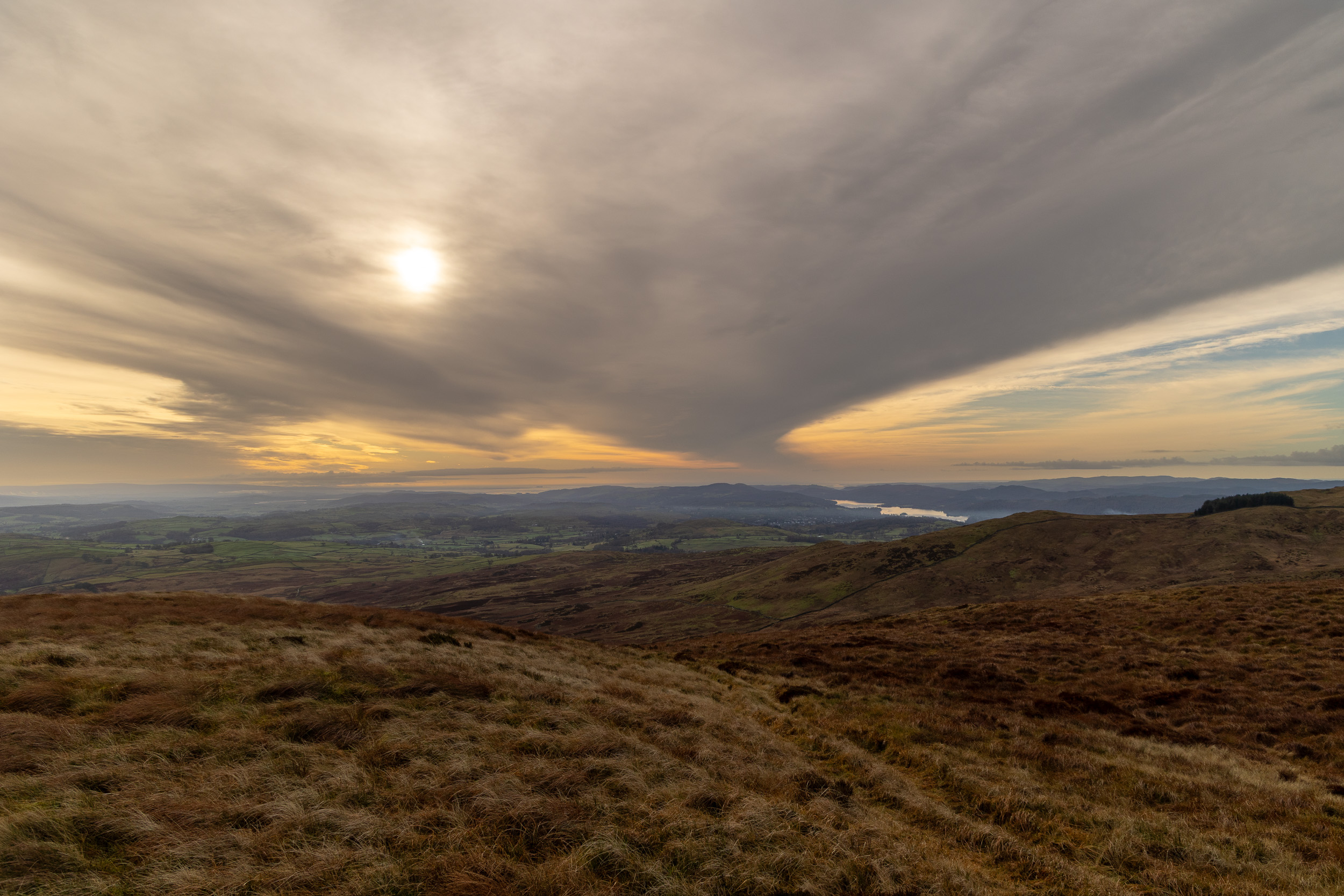
The clouds were really low down passing Elter Water with not a lot in the way of views. It was, however, very quiet and I suppose it is not often you can say that about this popular area.

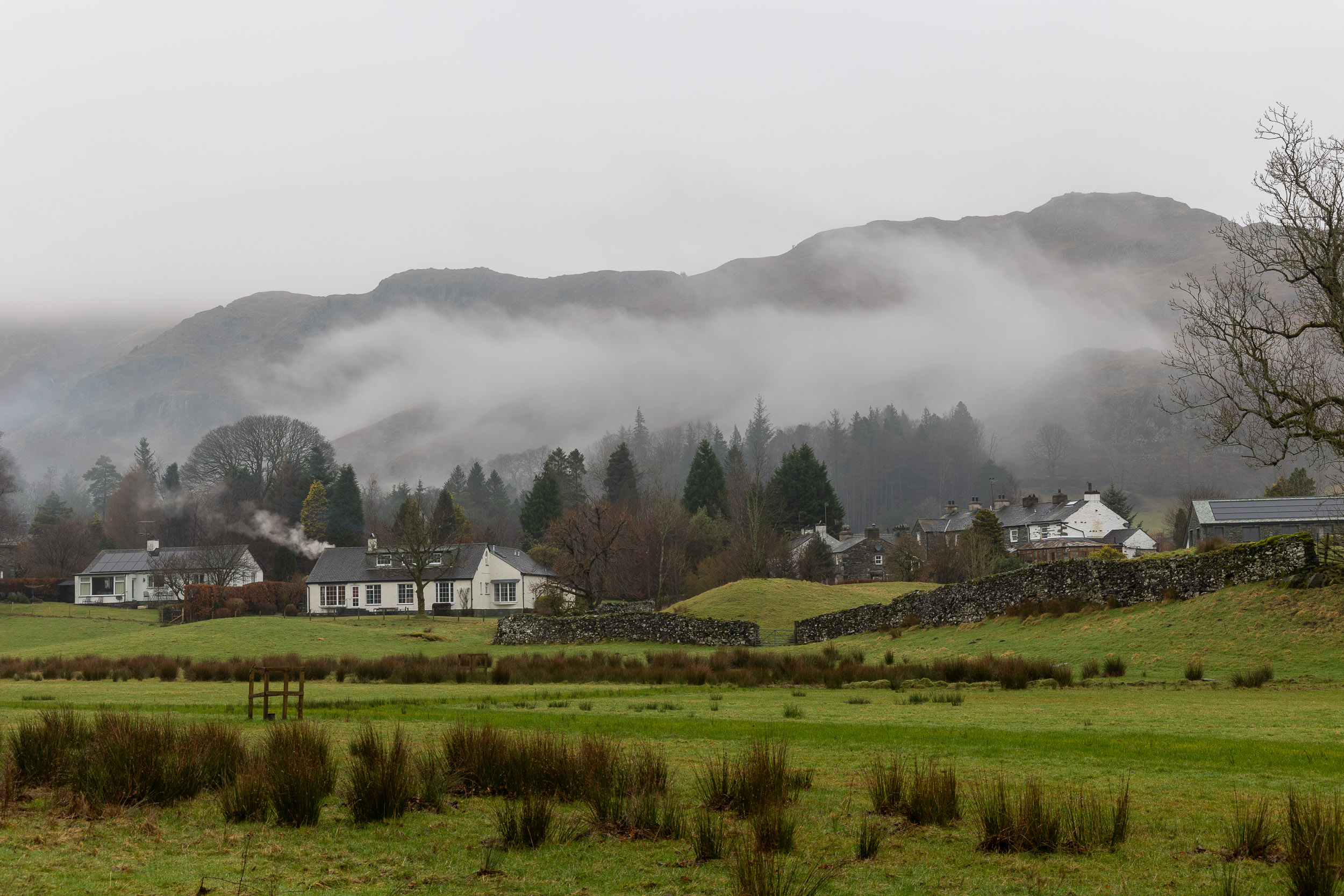
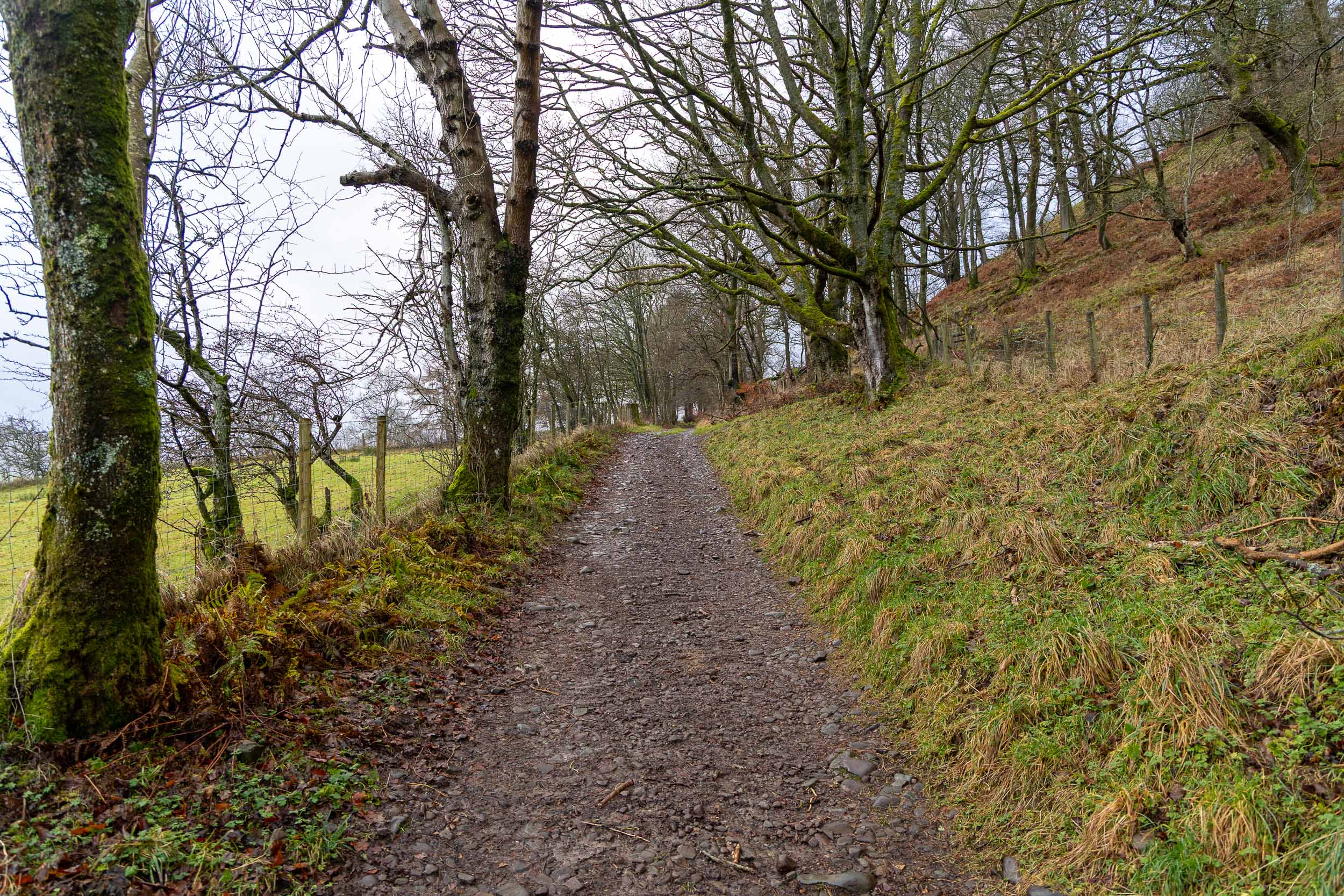
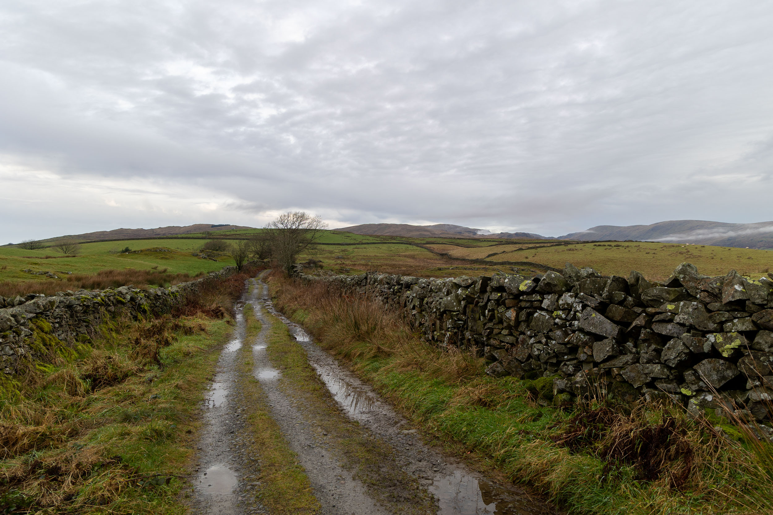
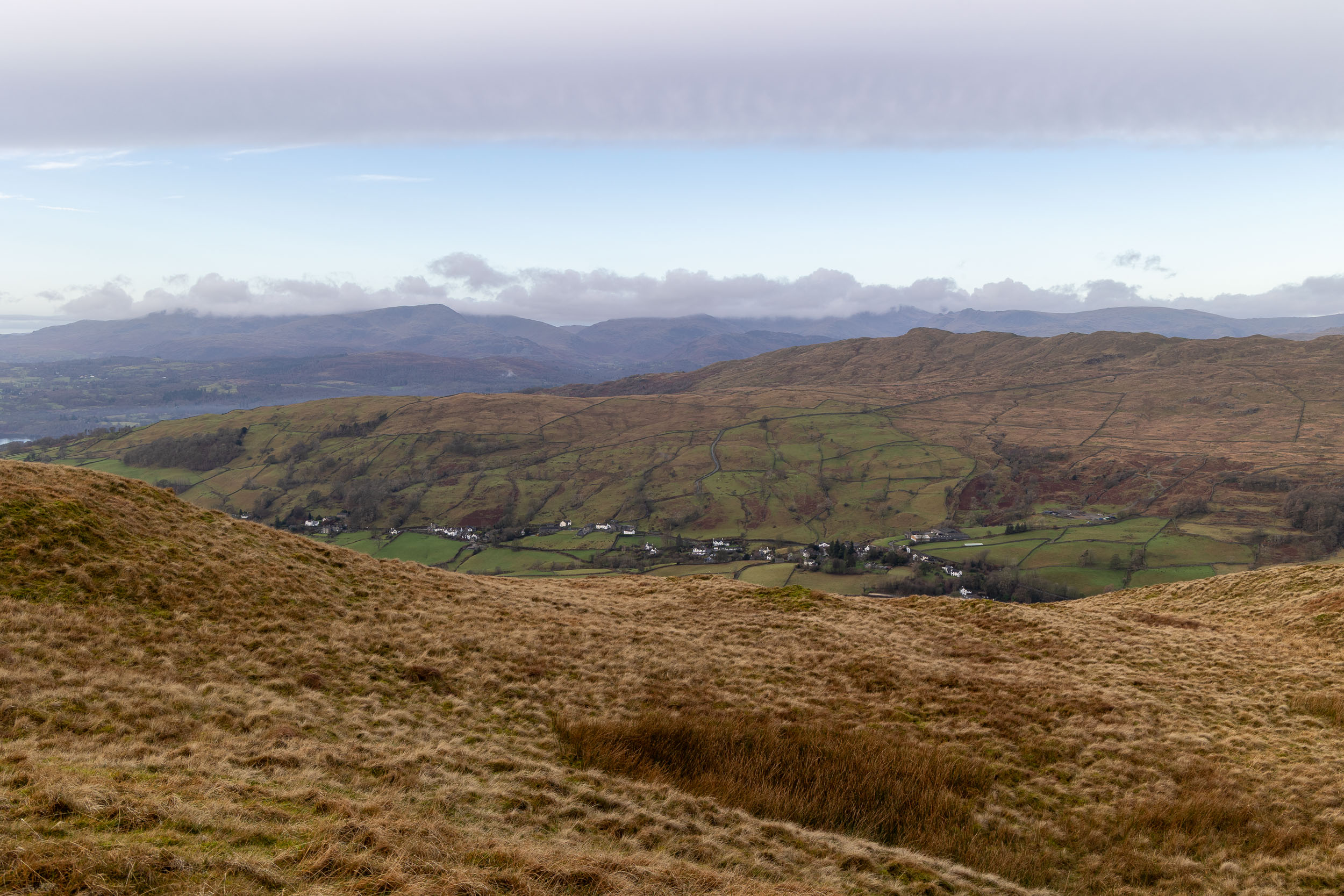
Approaching Elterwater village. From the village there is a steep climb up towards Little Langdale on a rough track and I passed two for three walking groups on the way up there.

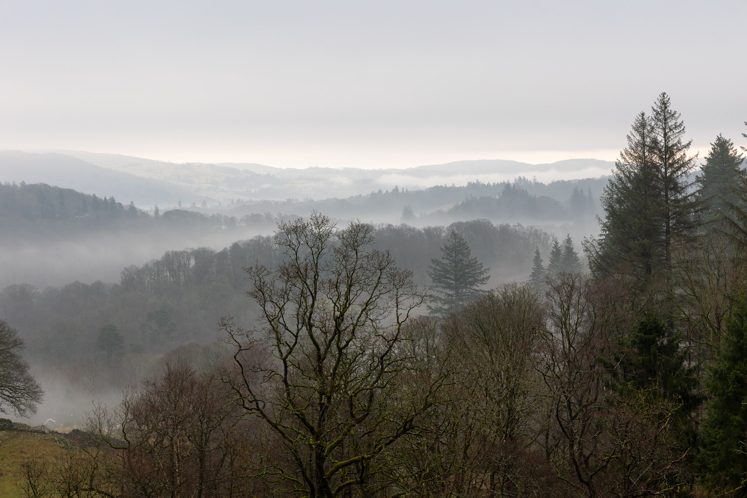
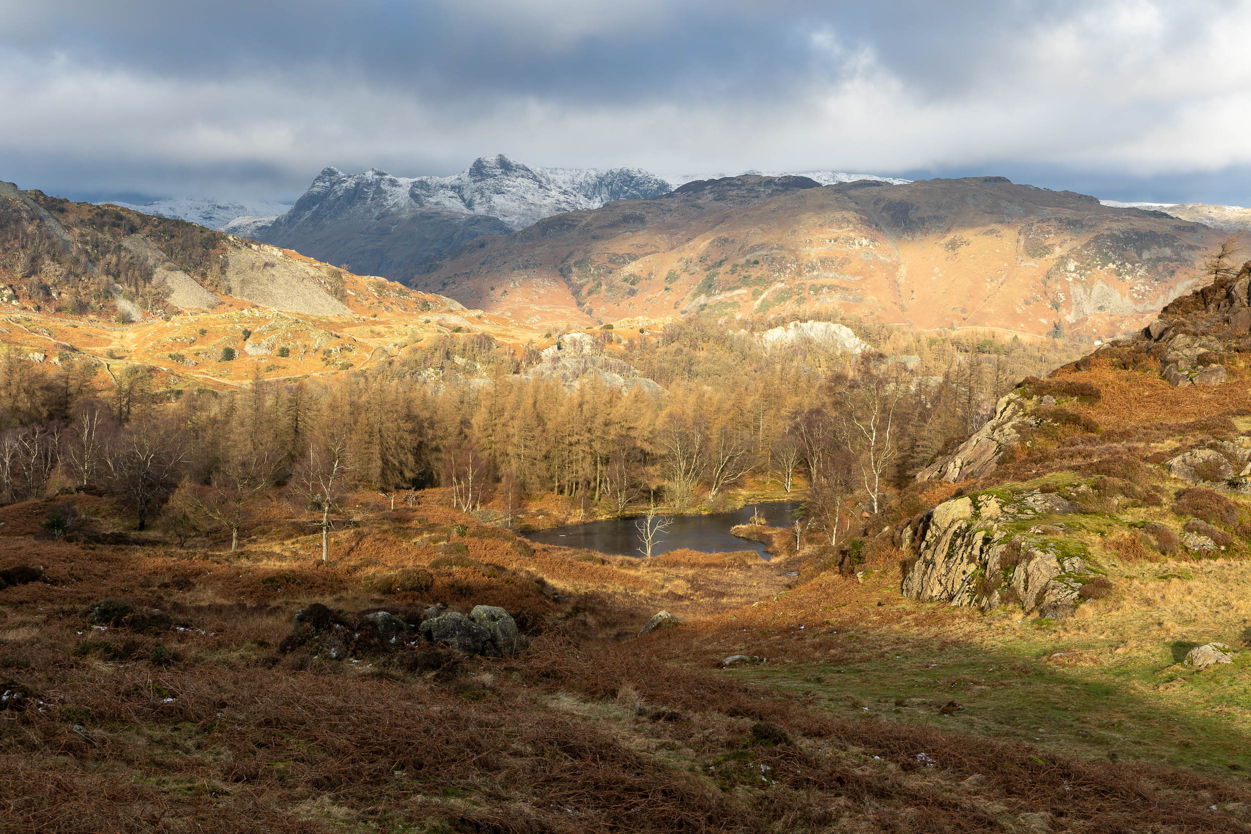
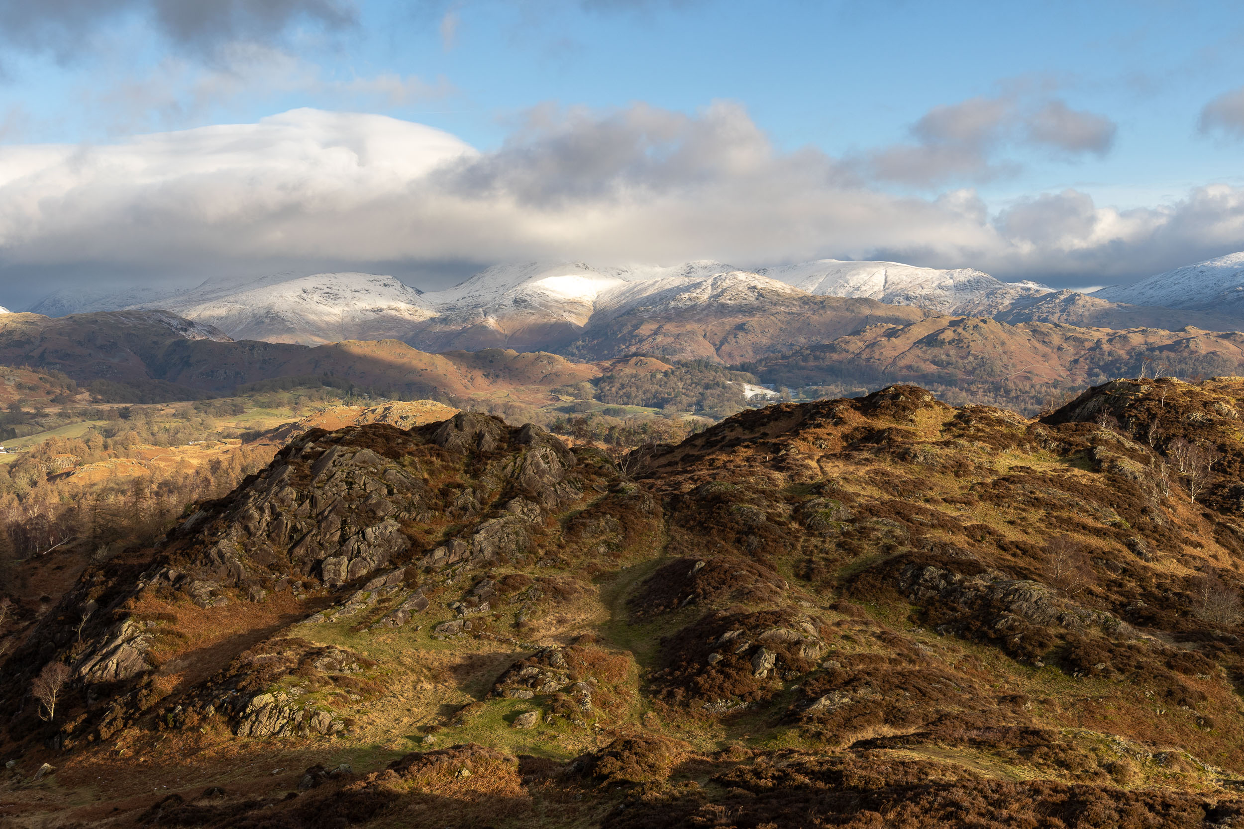
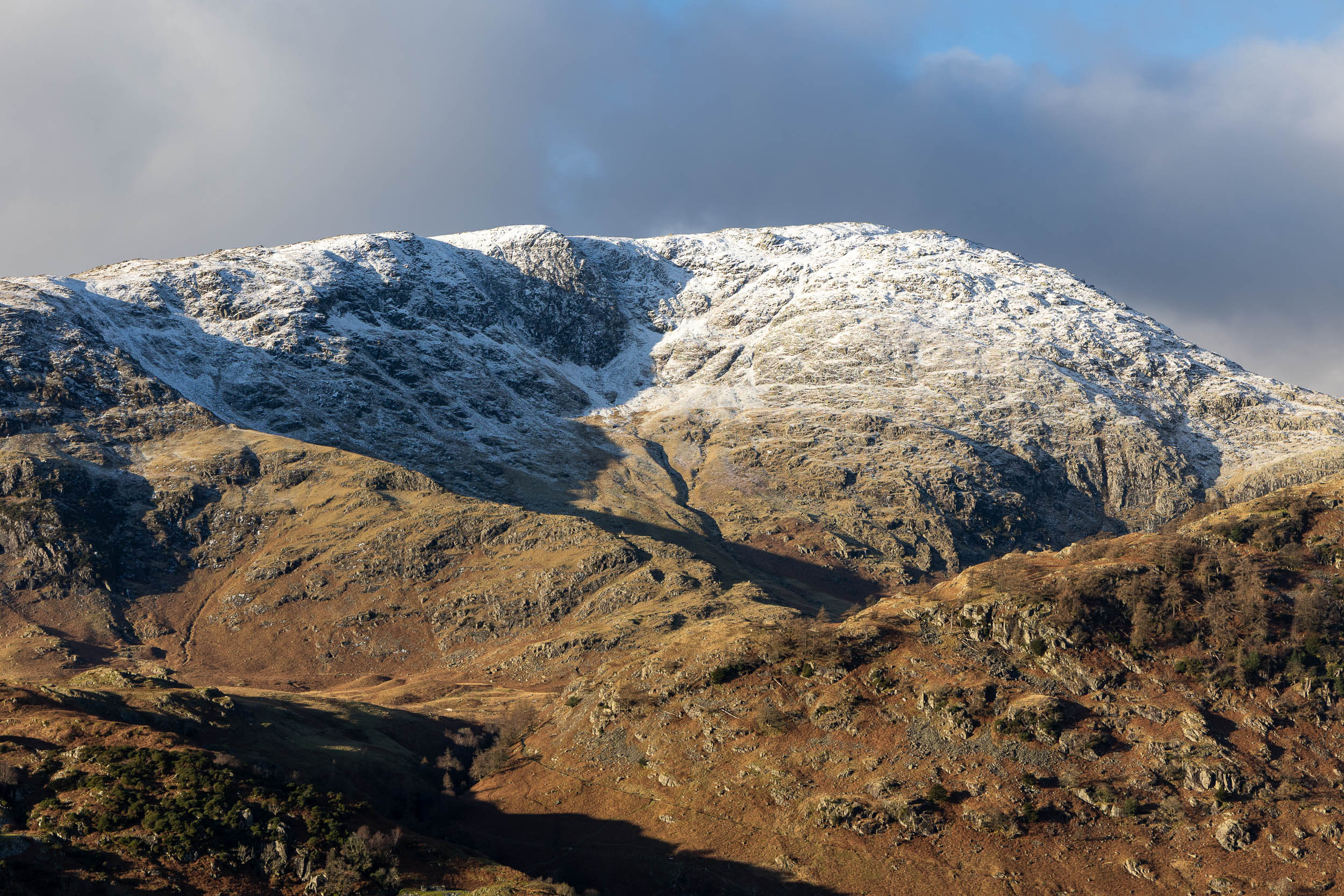
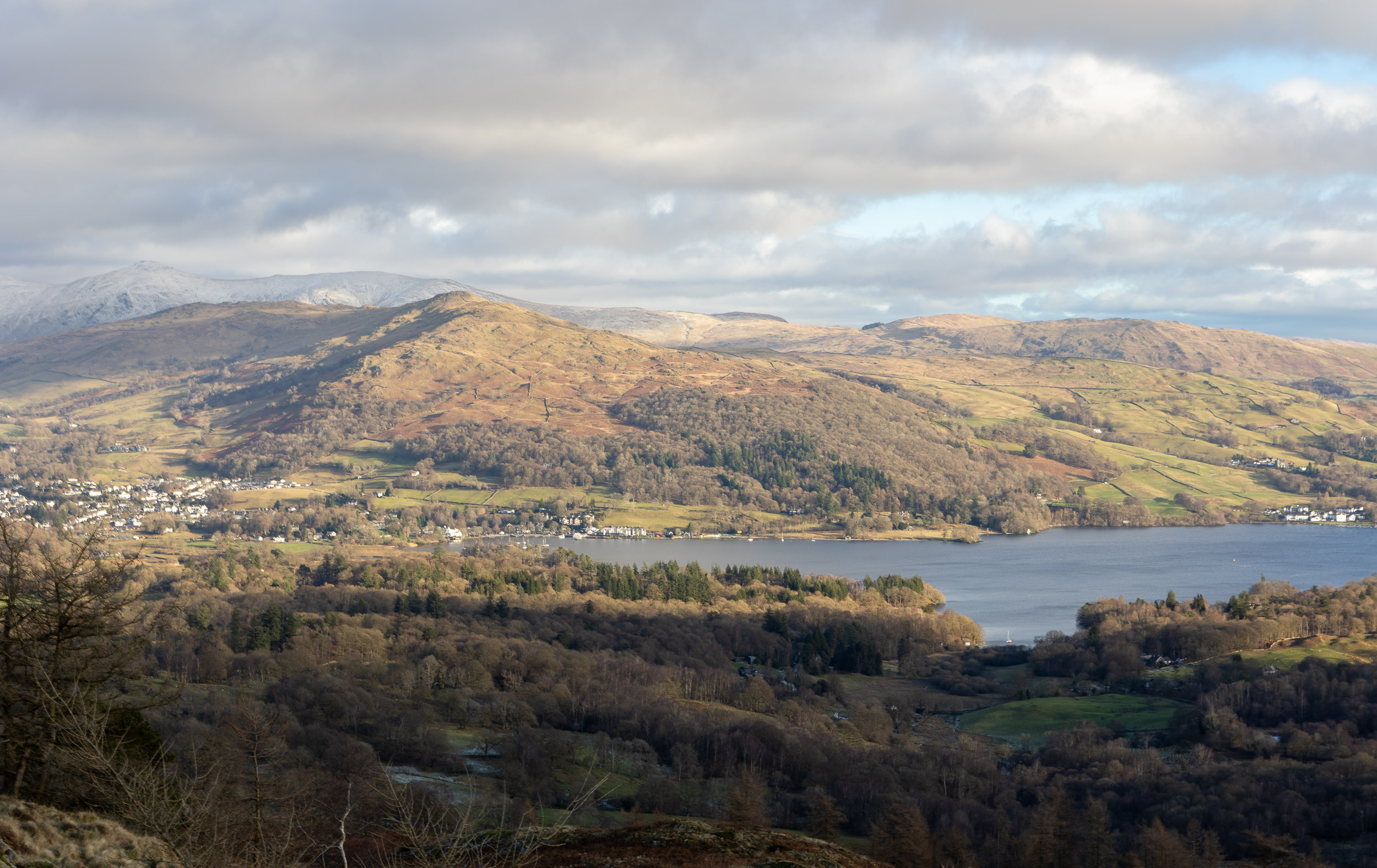
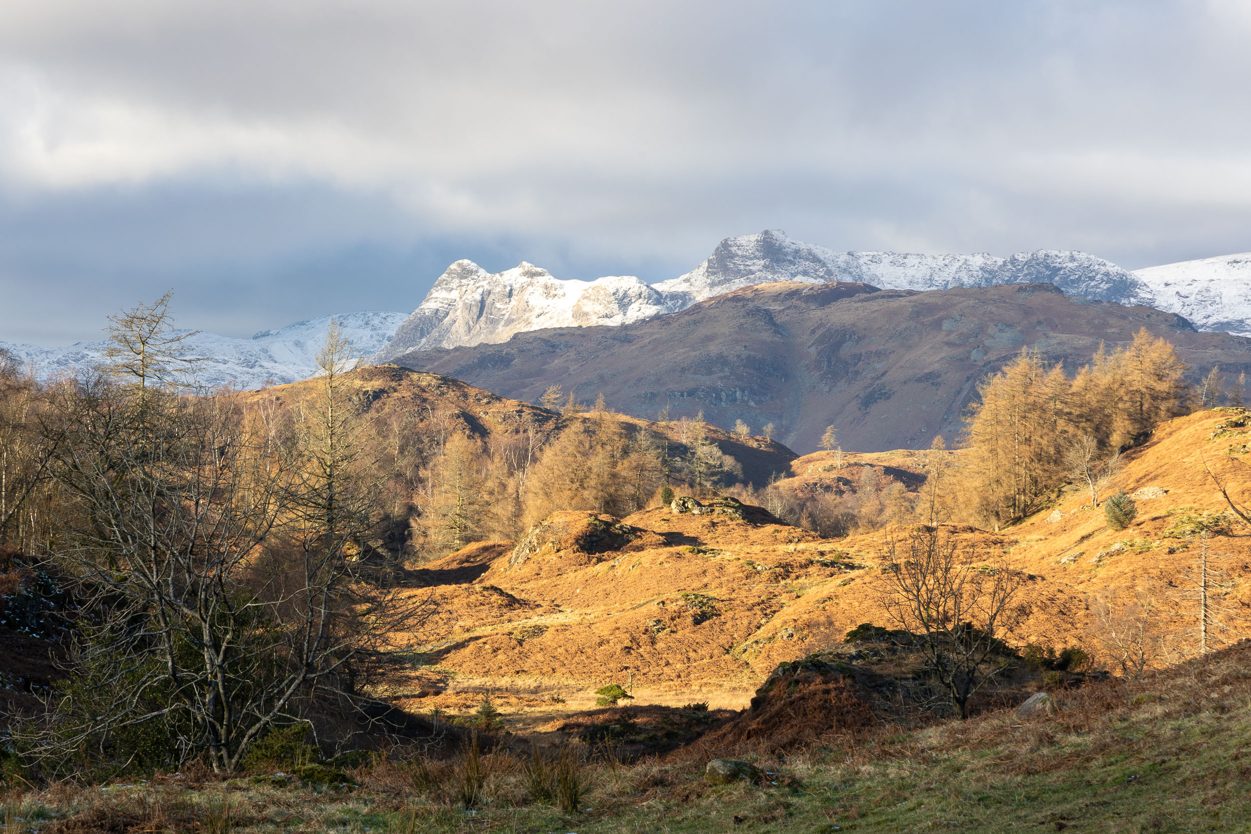
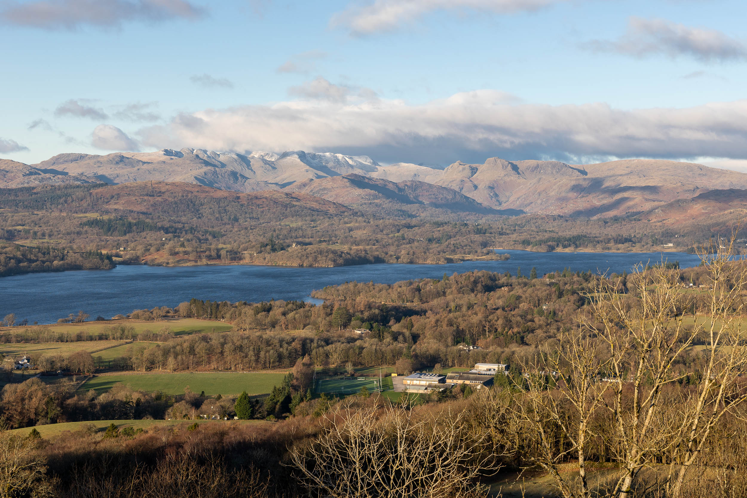
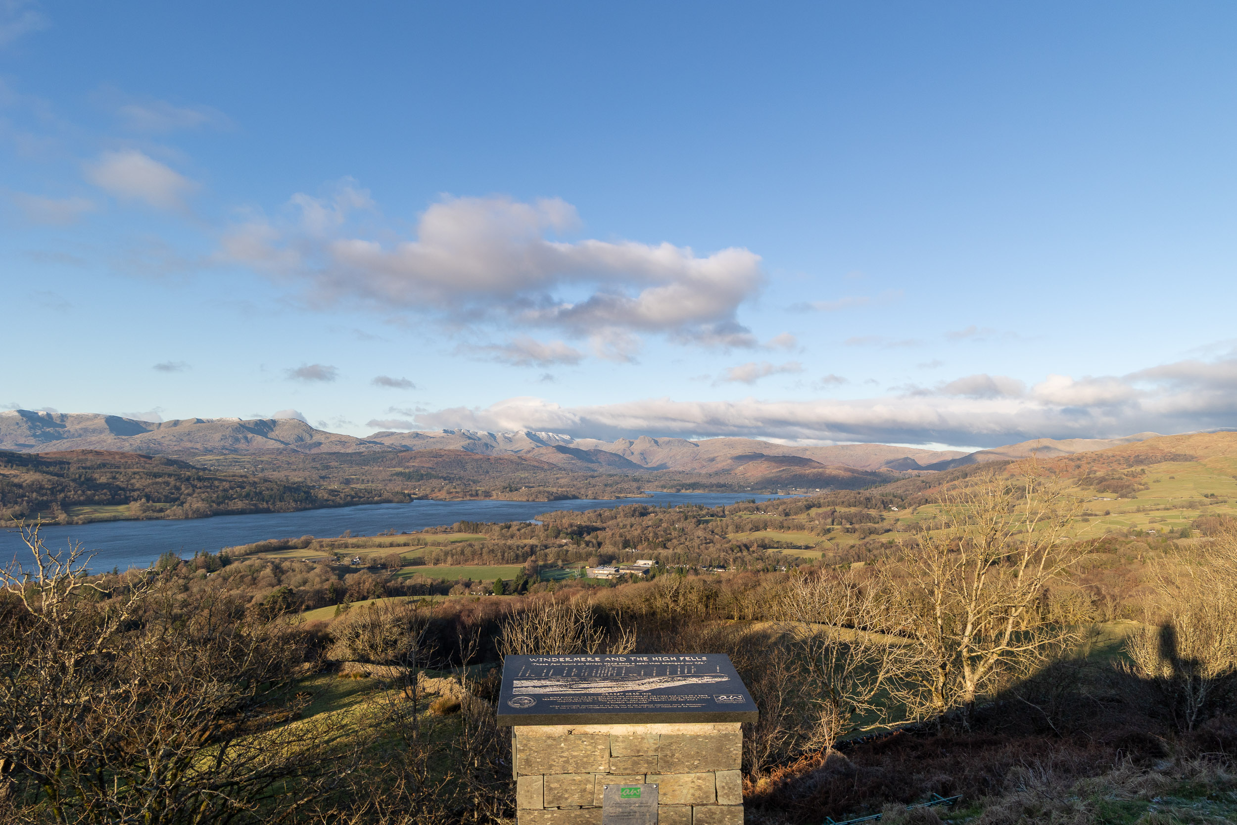
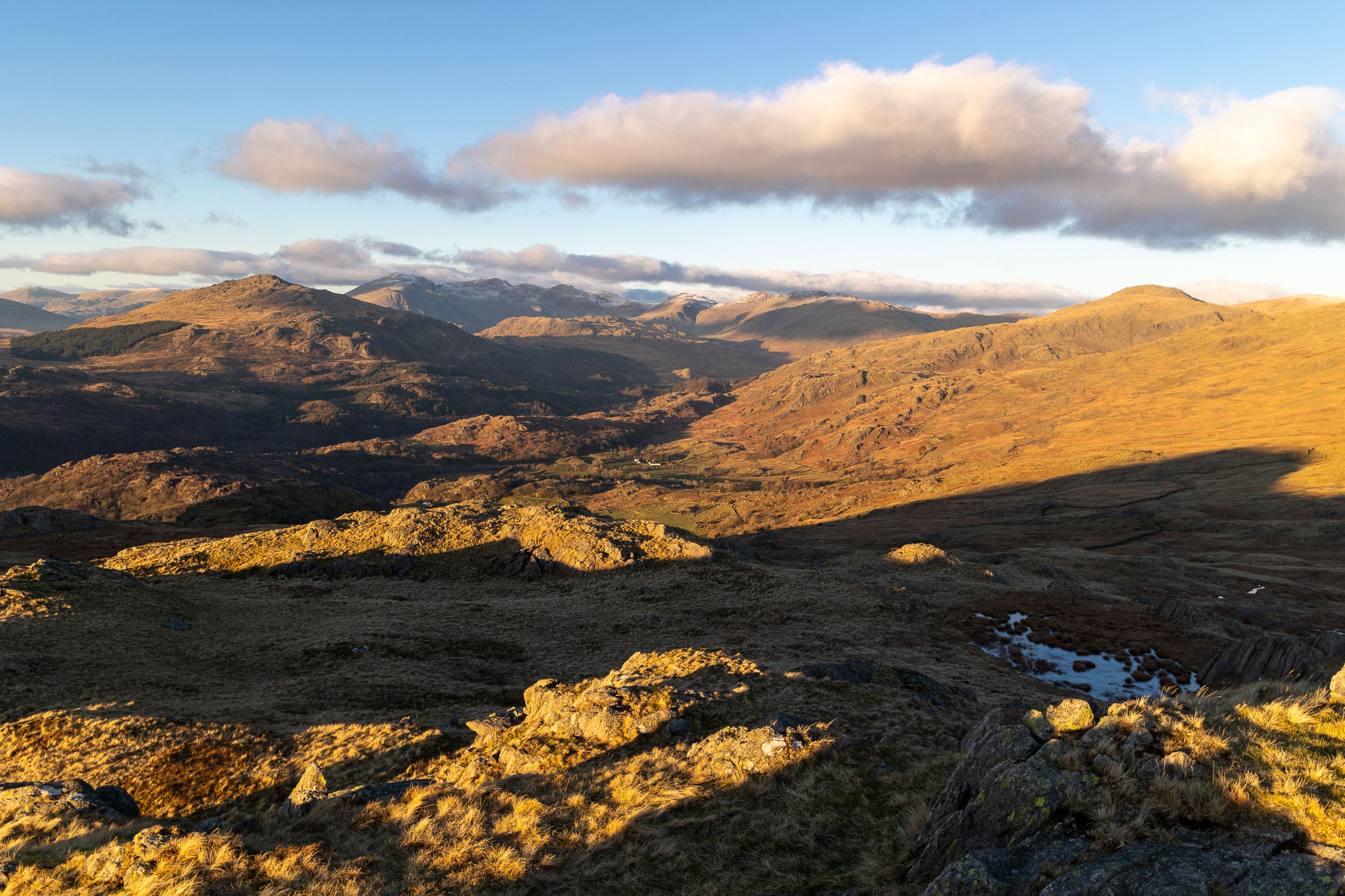
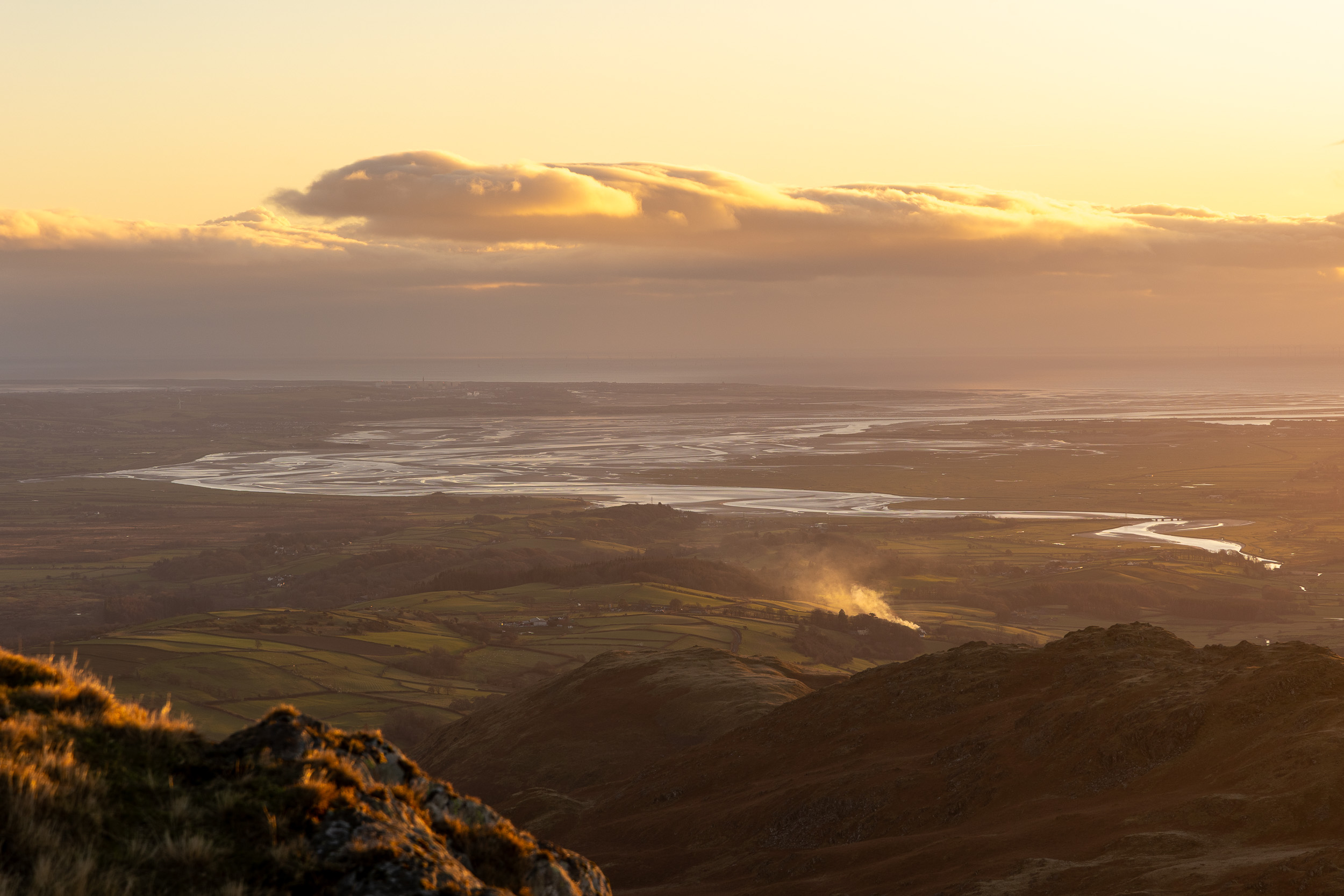
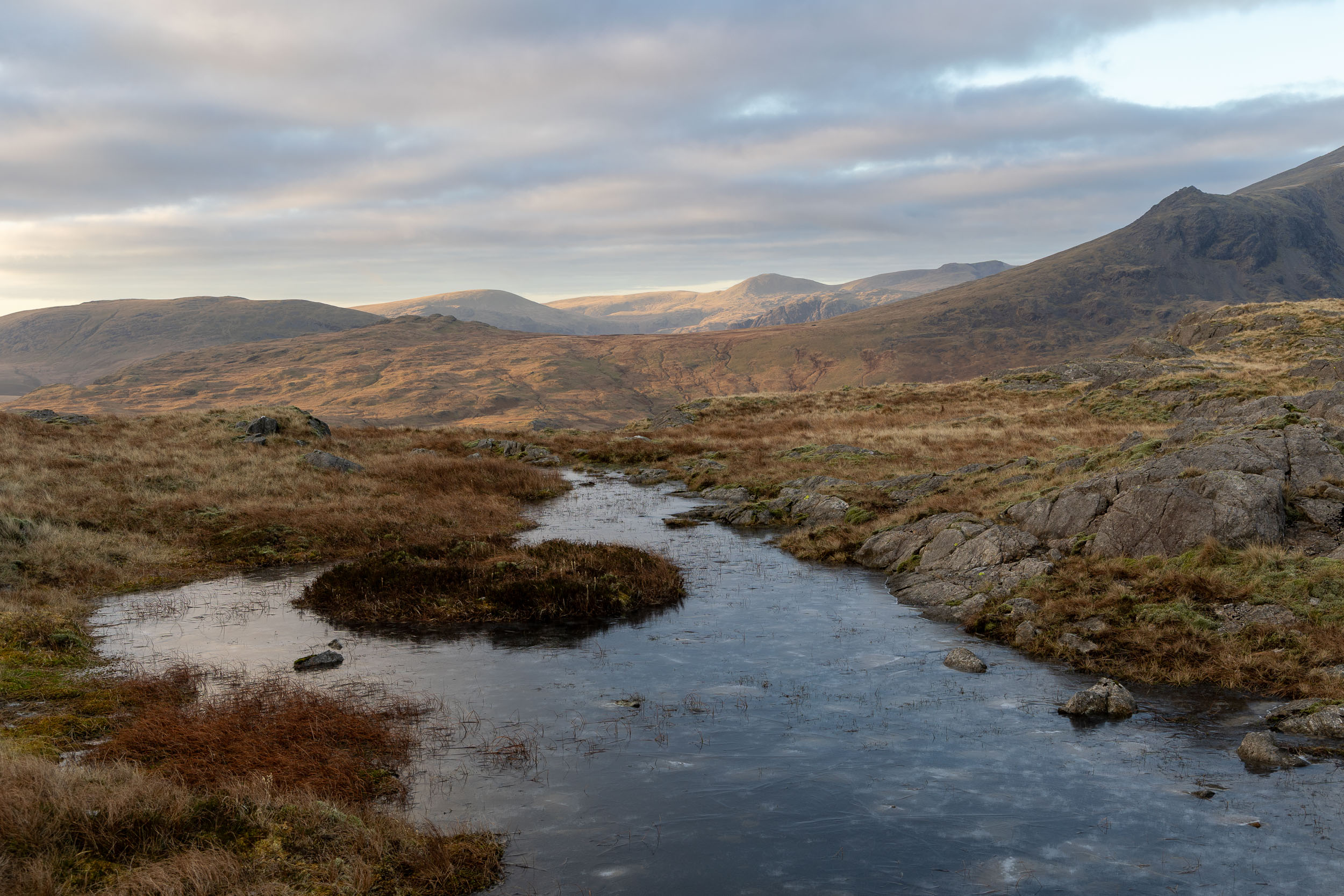
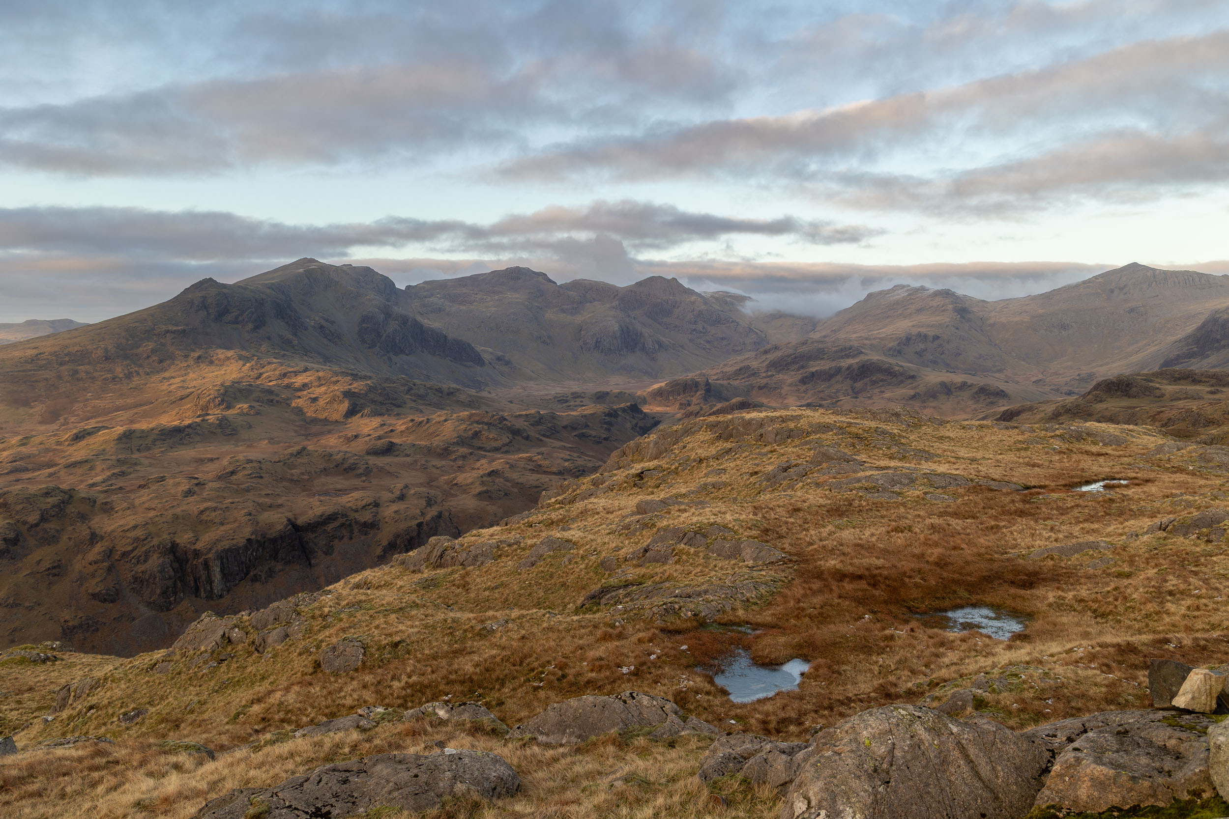
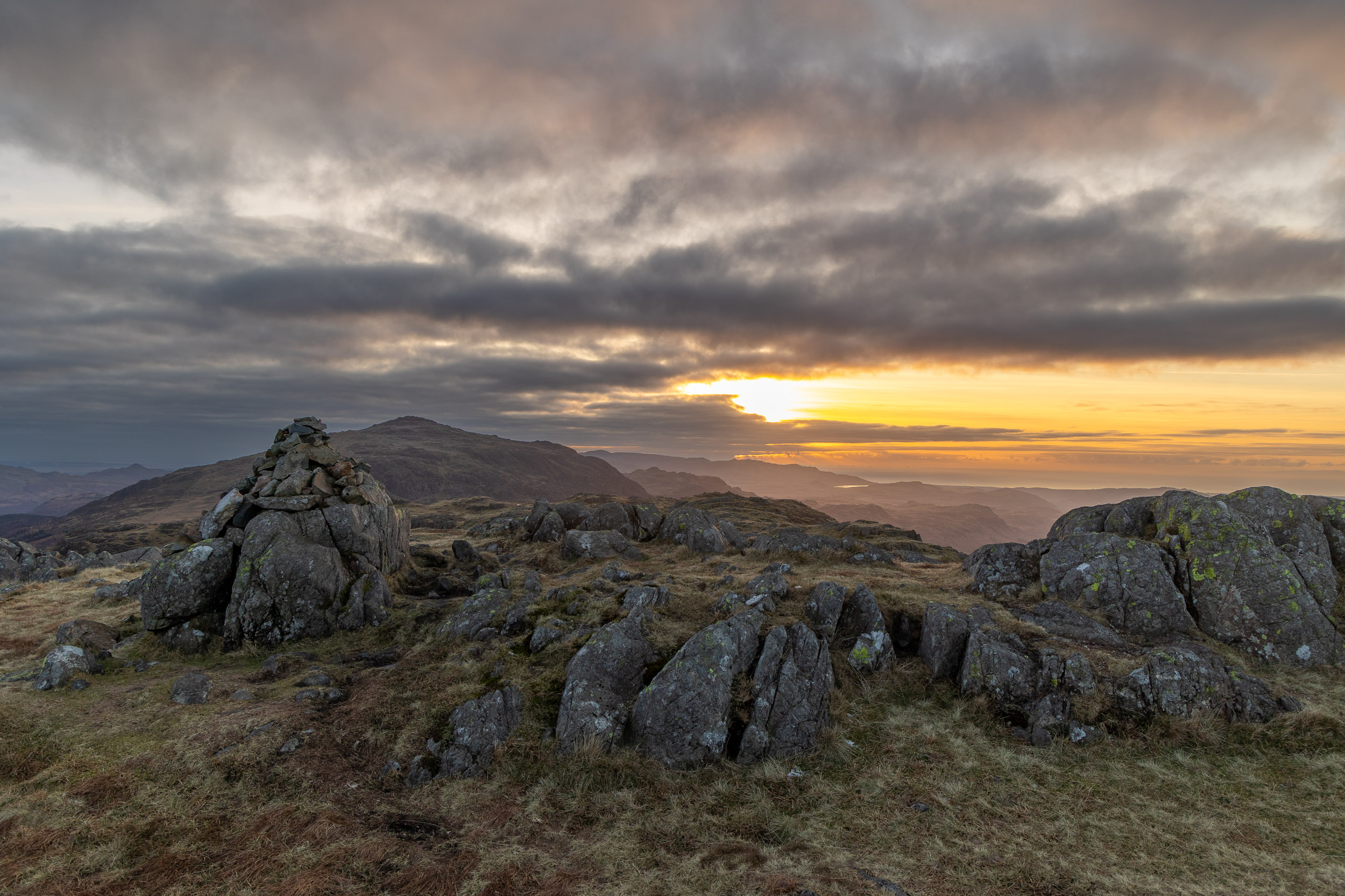
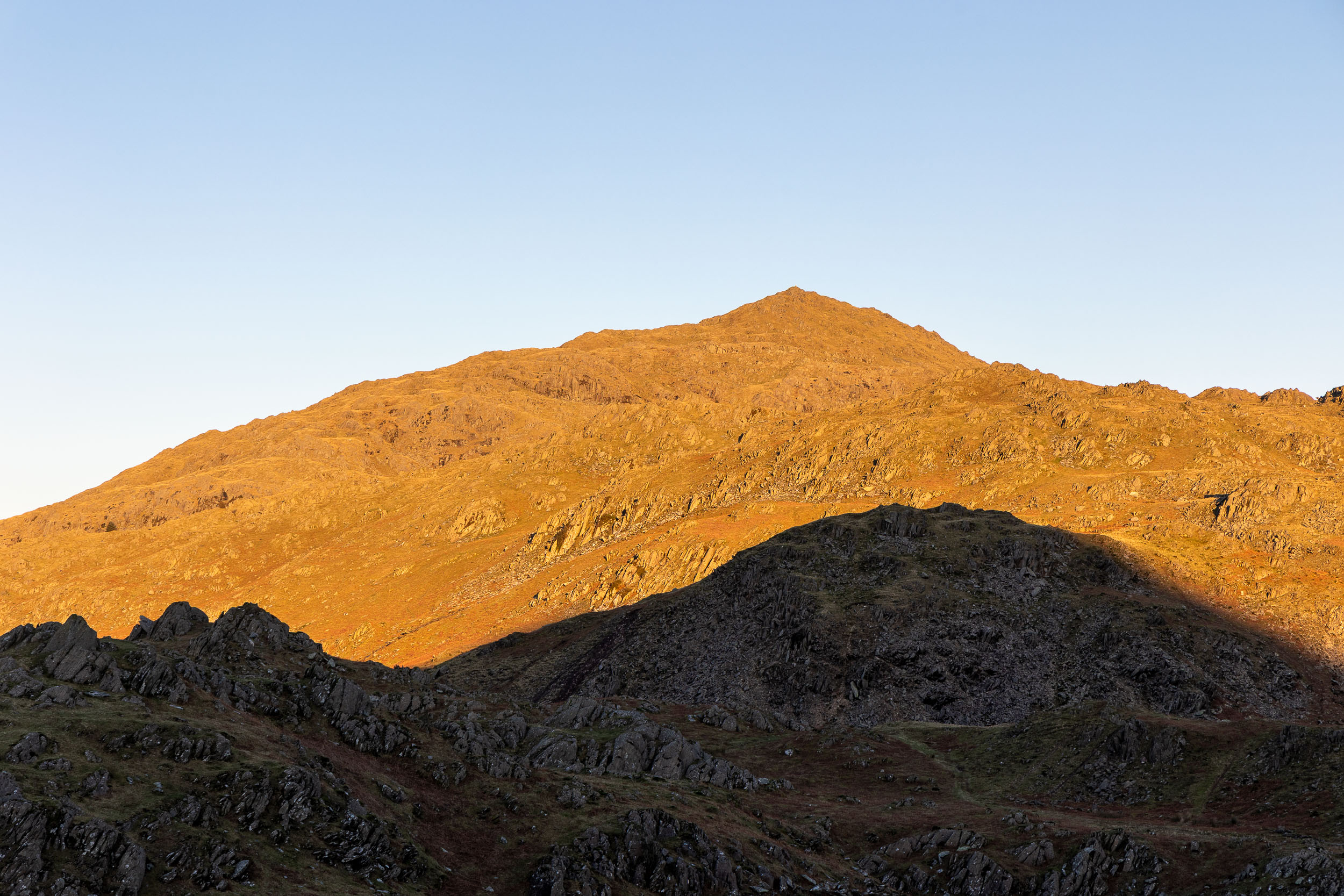
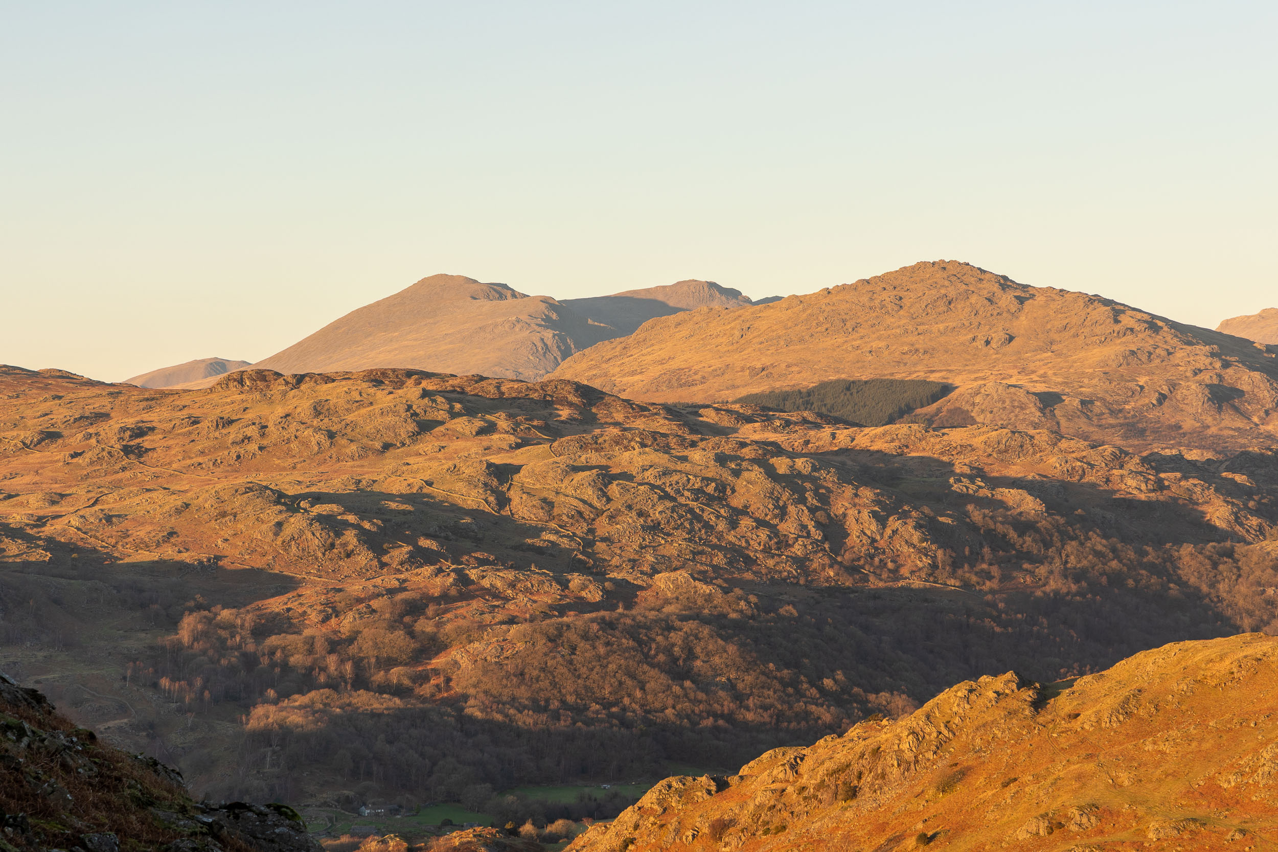
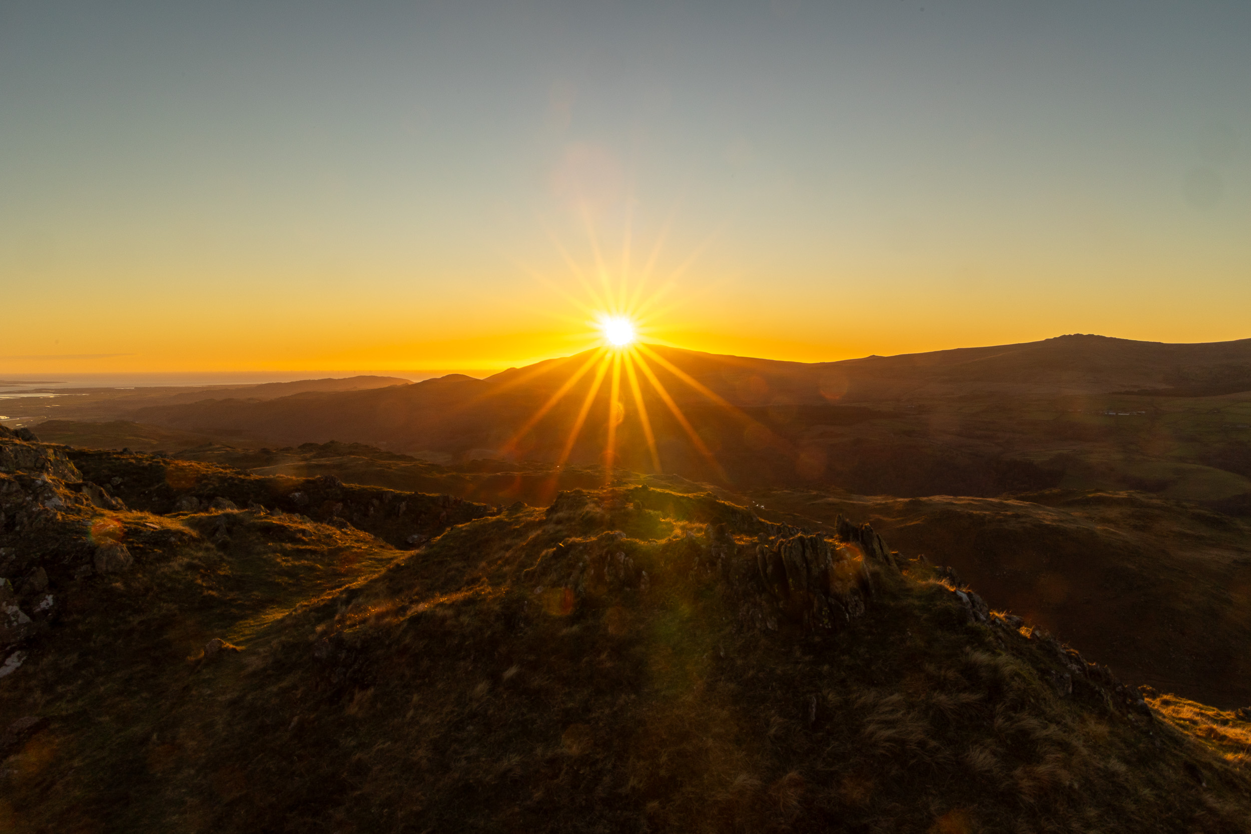
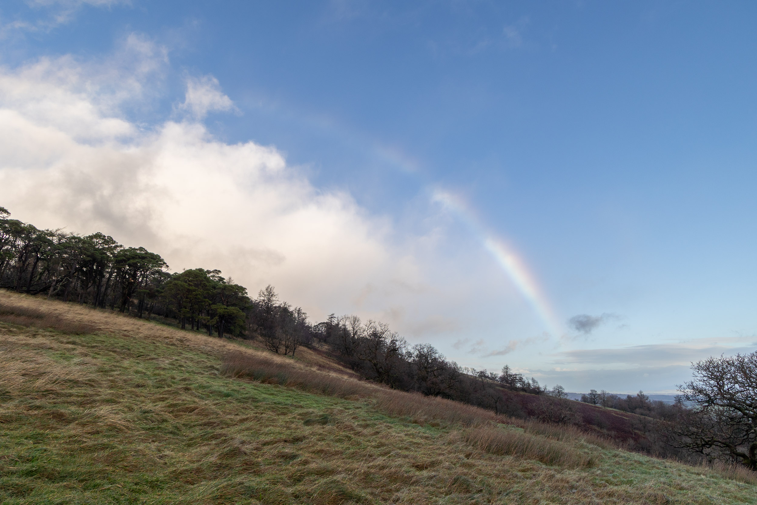
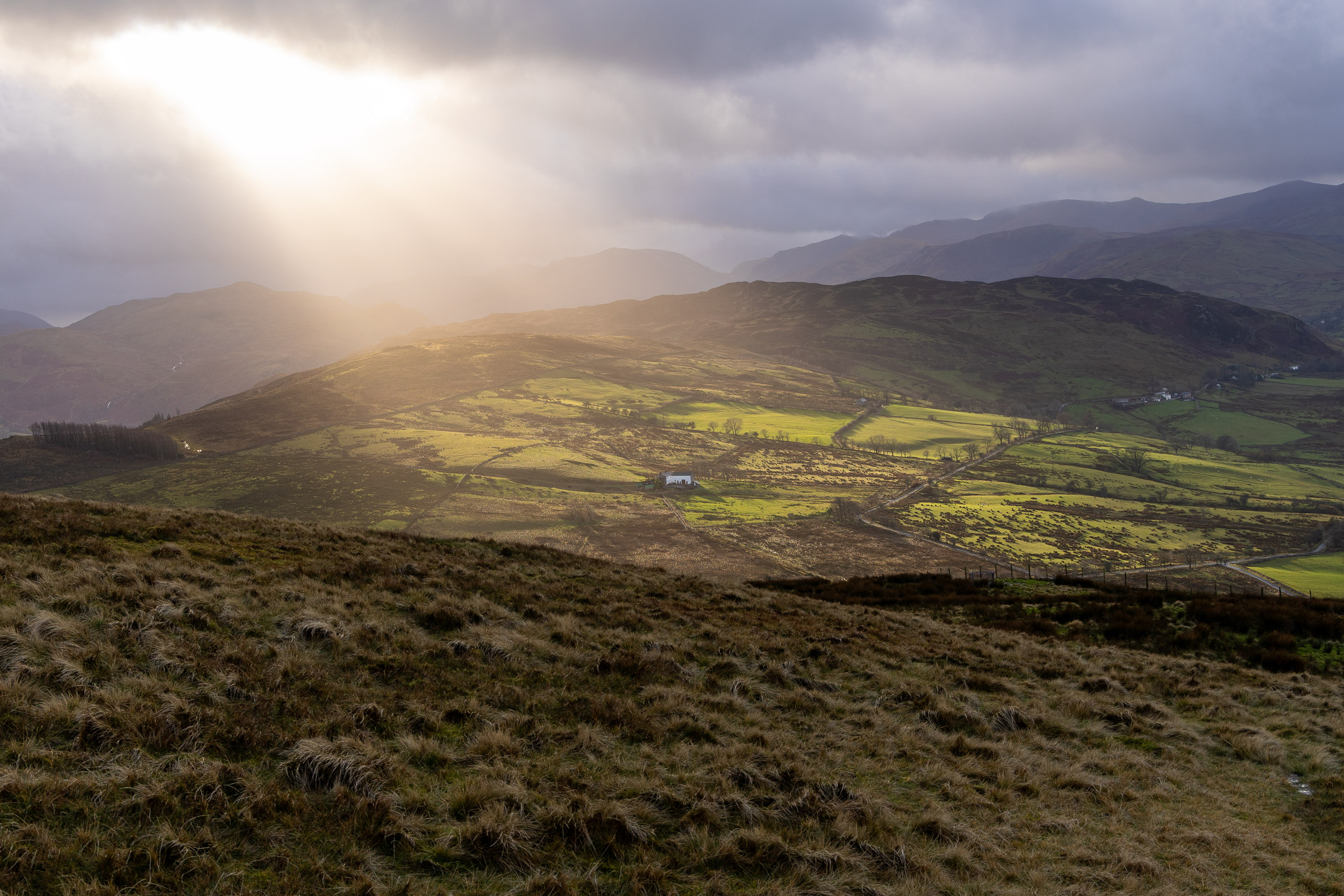
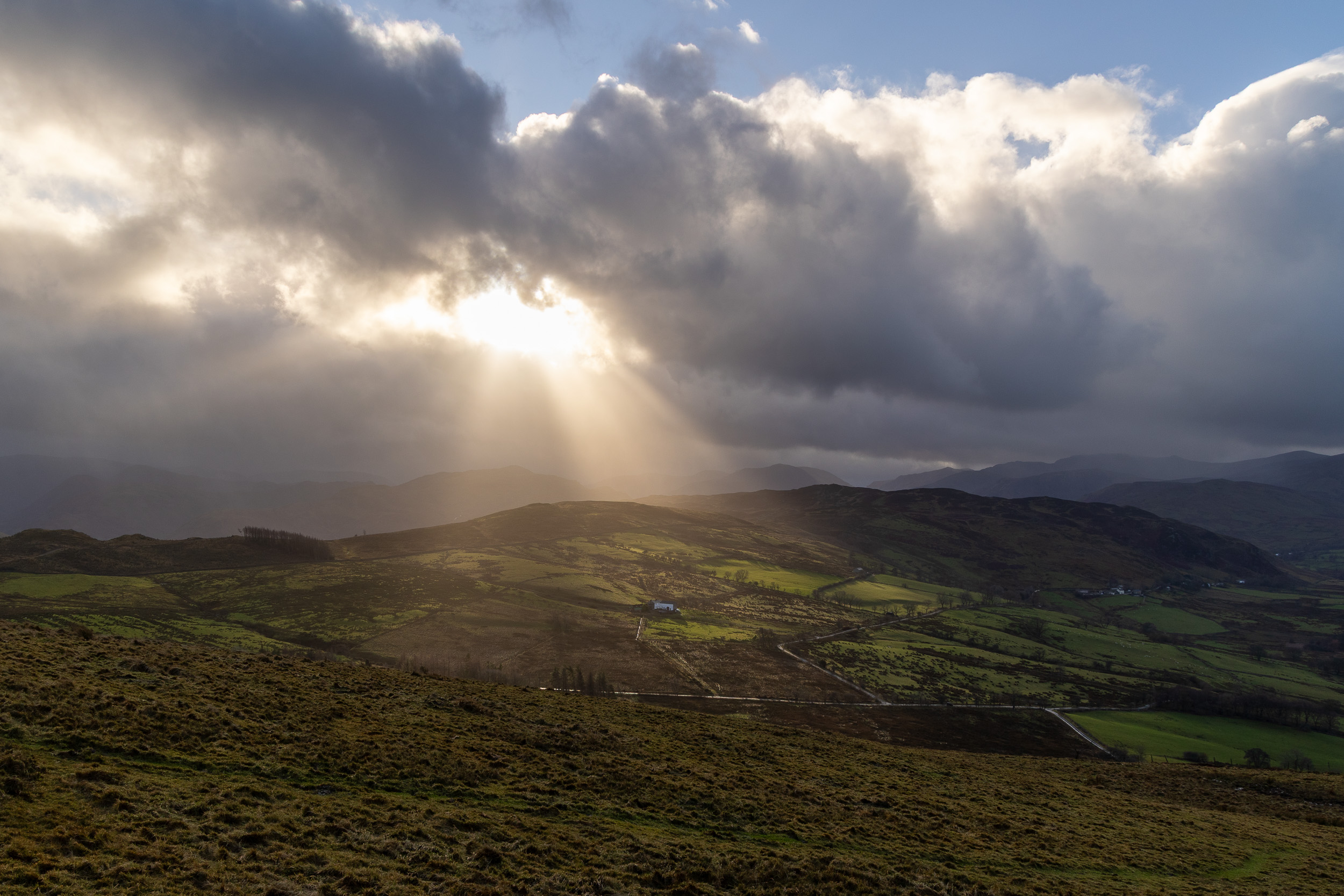
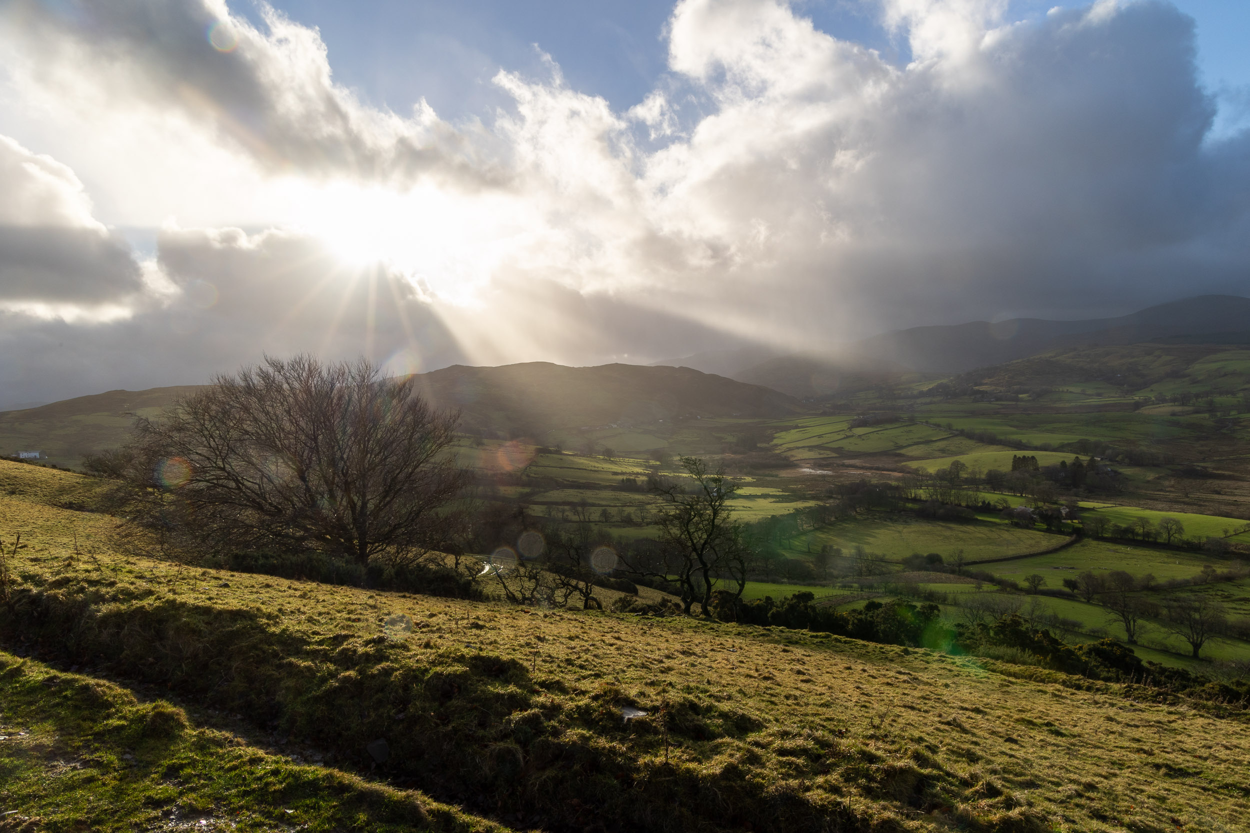
The view from the top of the climb looking across the misty trees and, as so often, it always seems to be brighter ‘over there’!

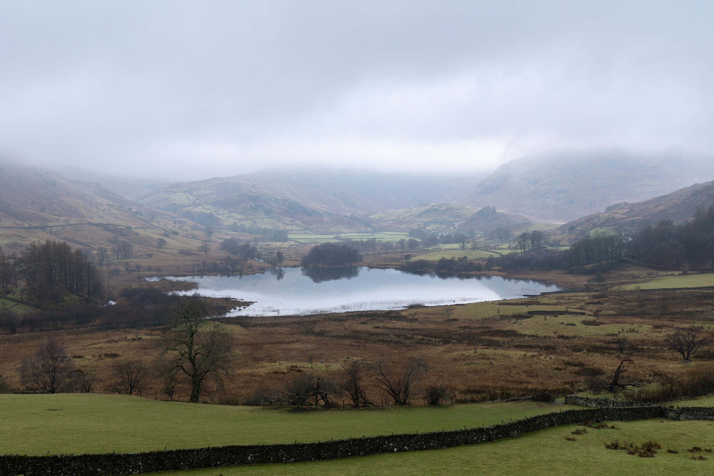
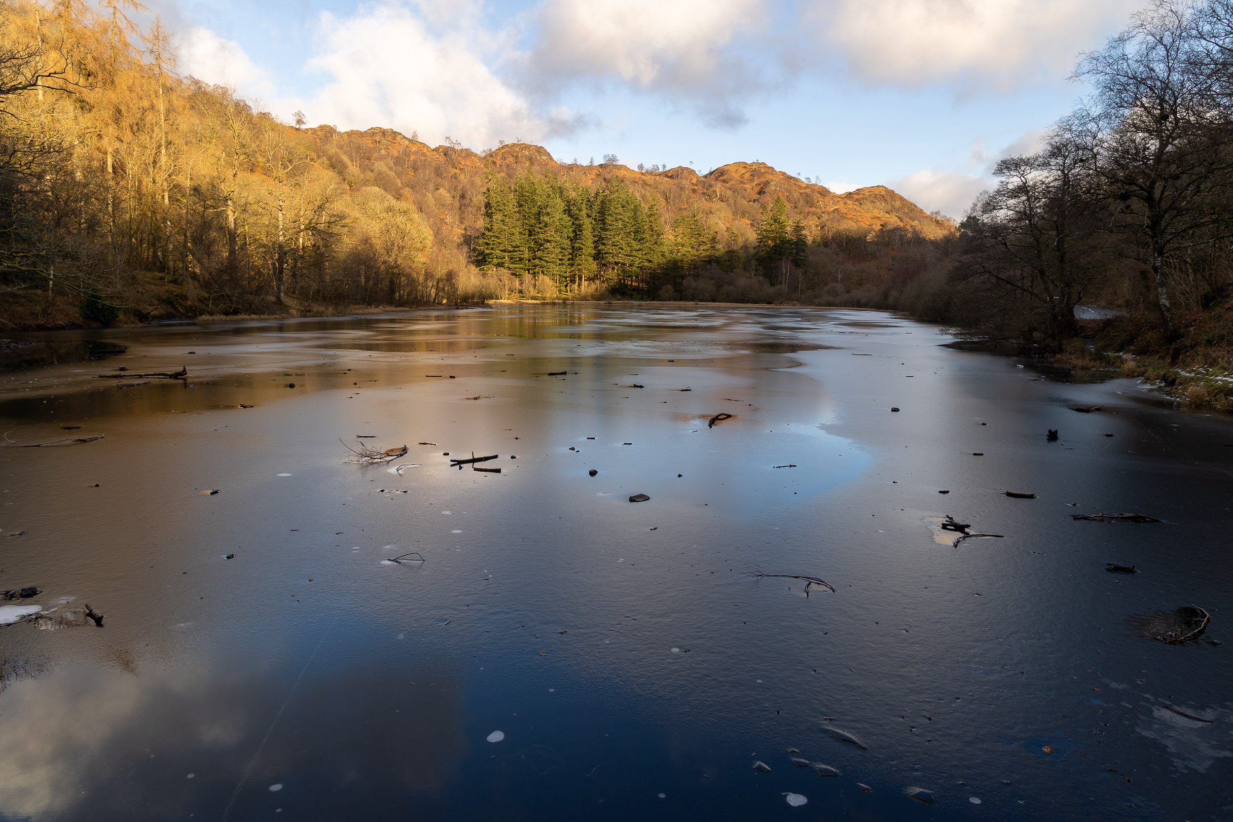
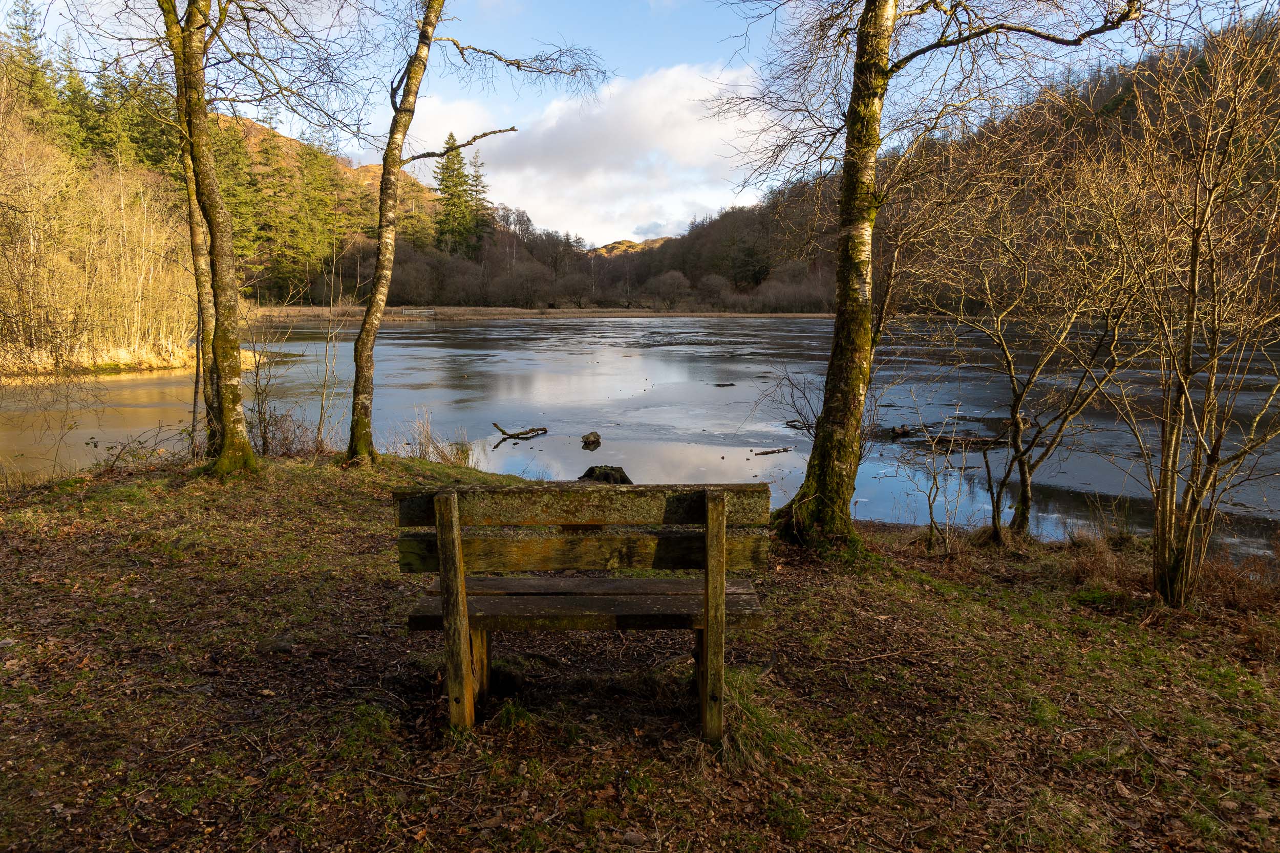
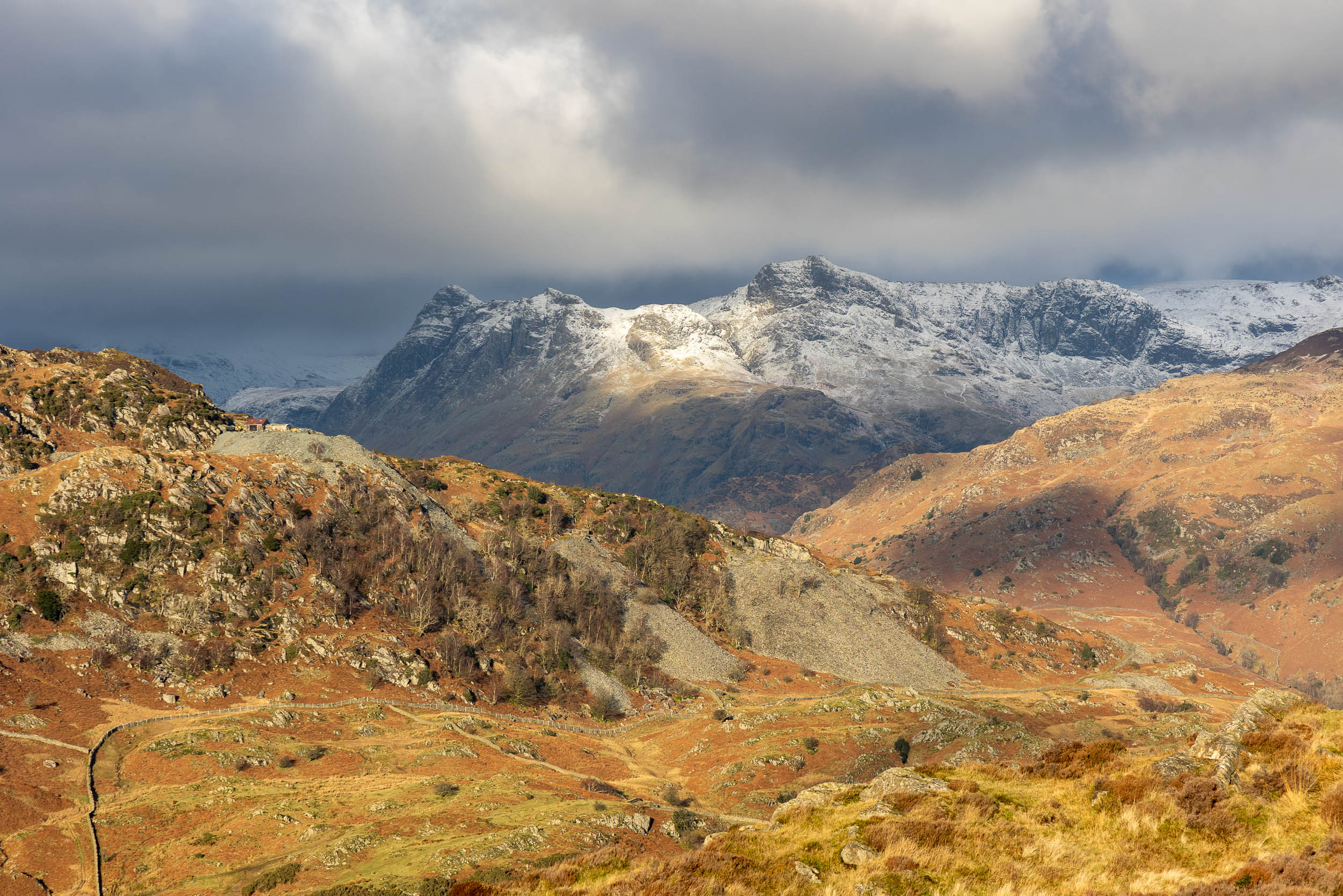
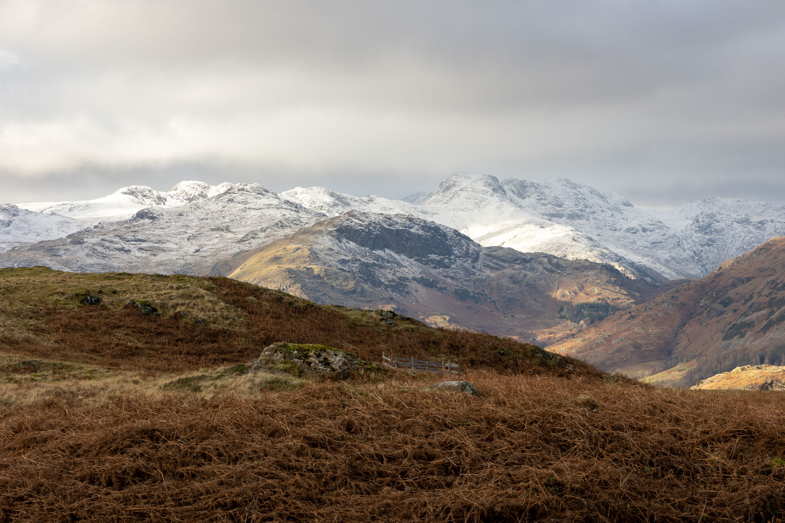
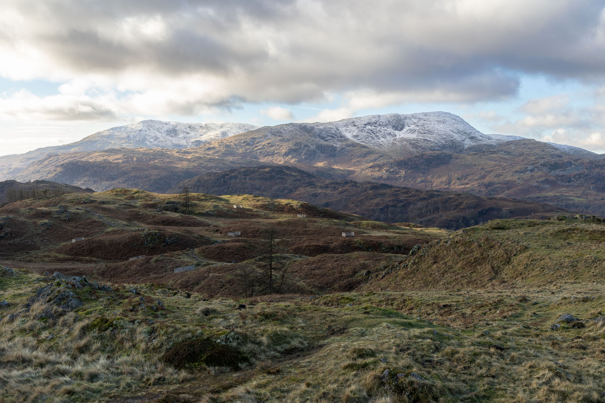
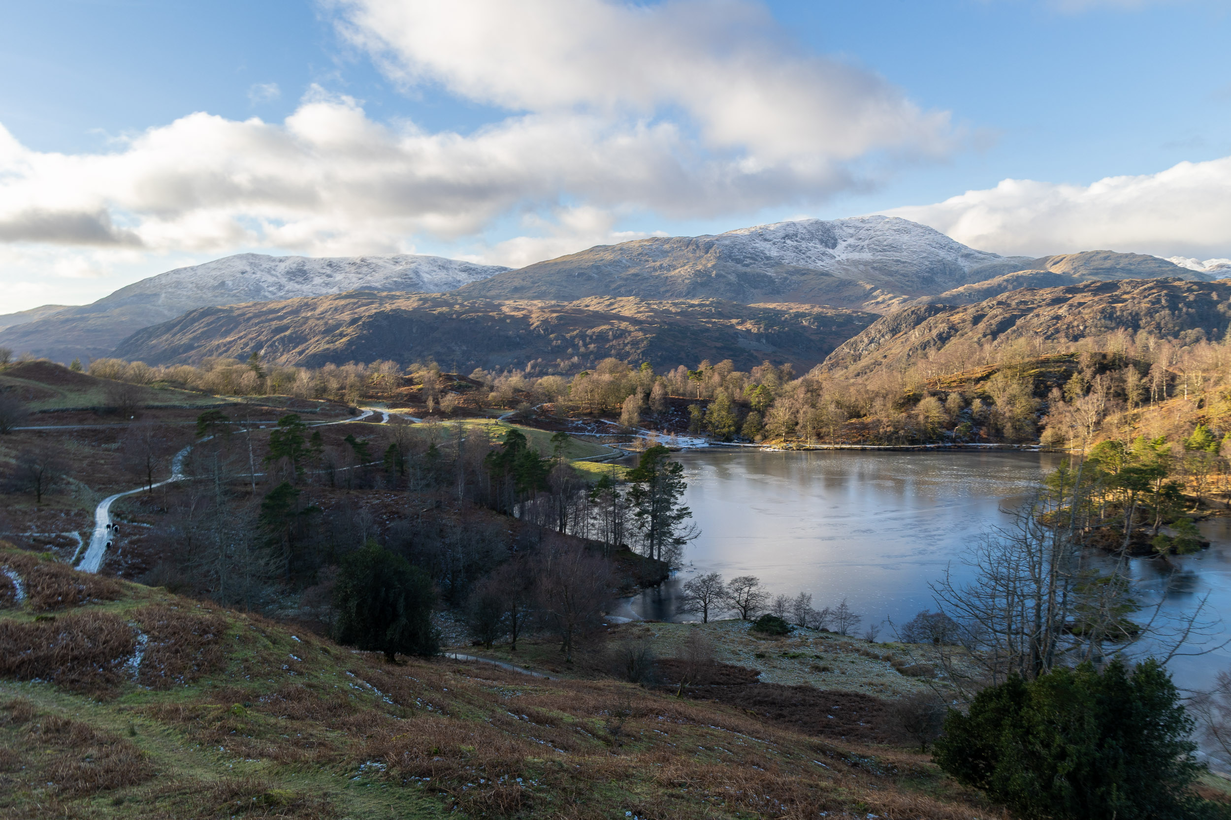
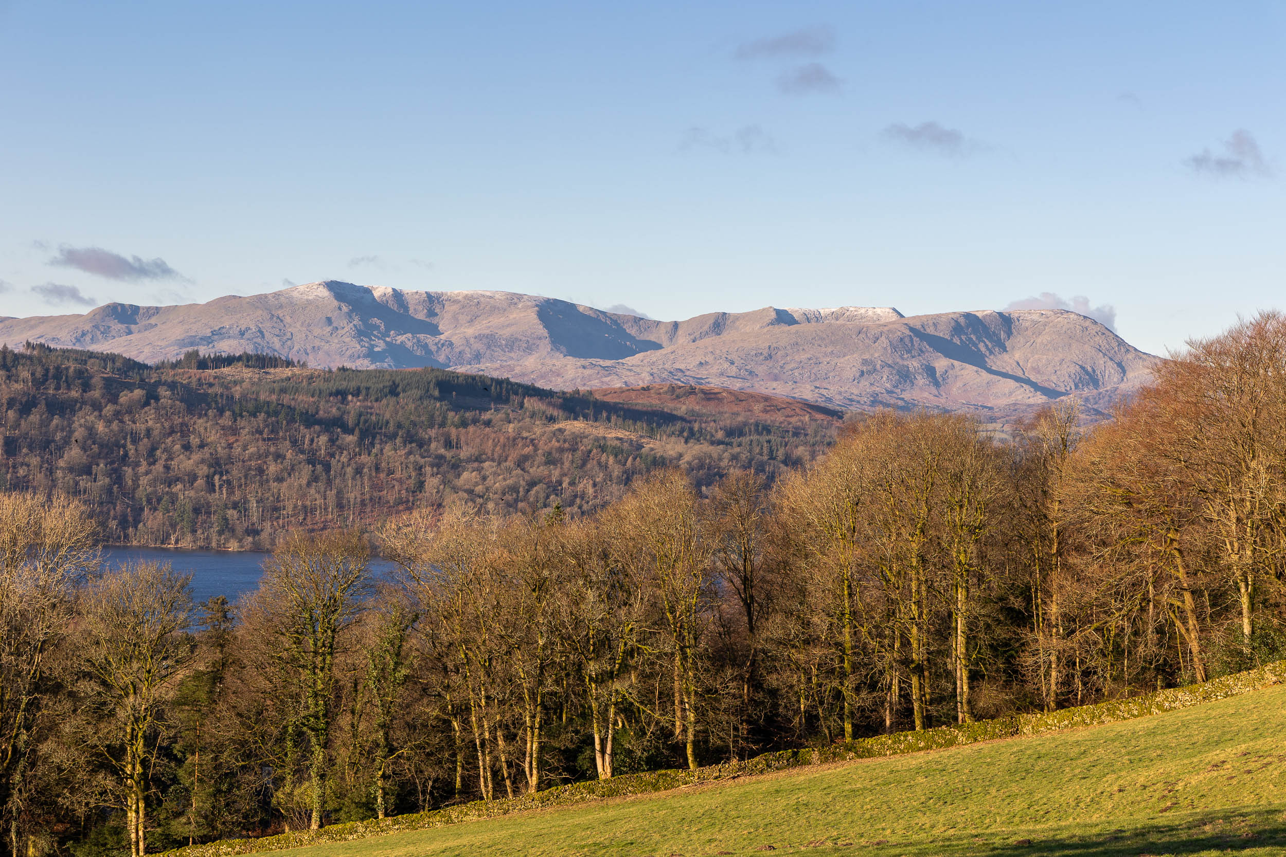
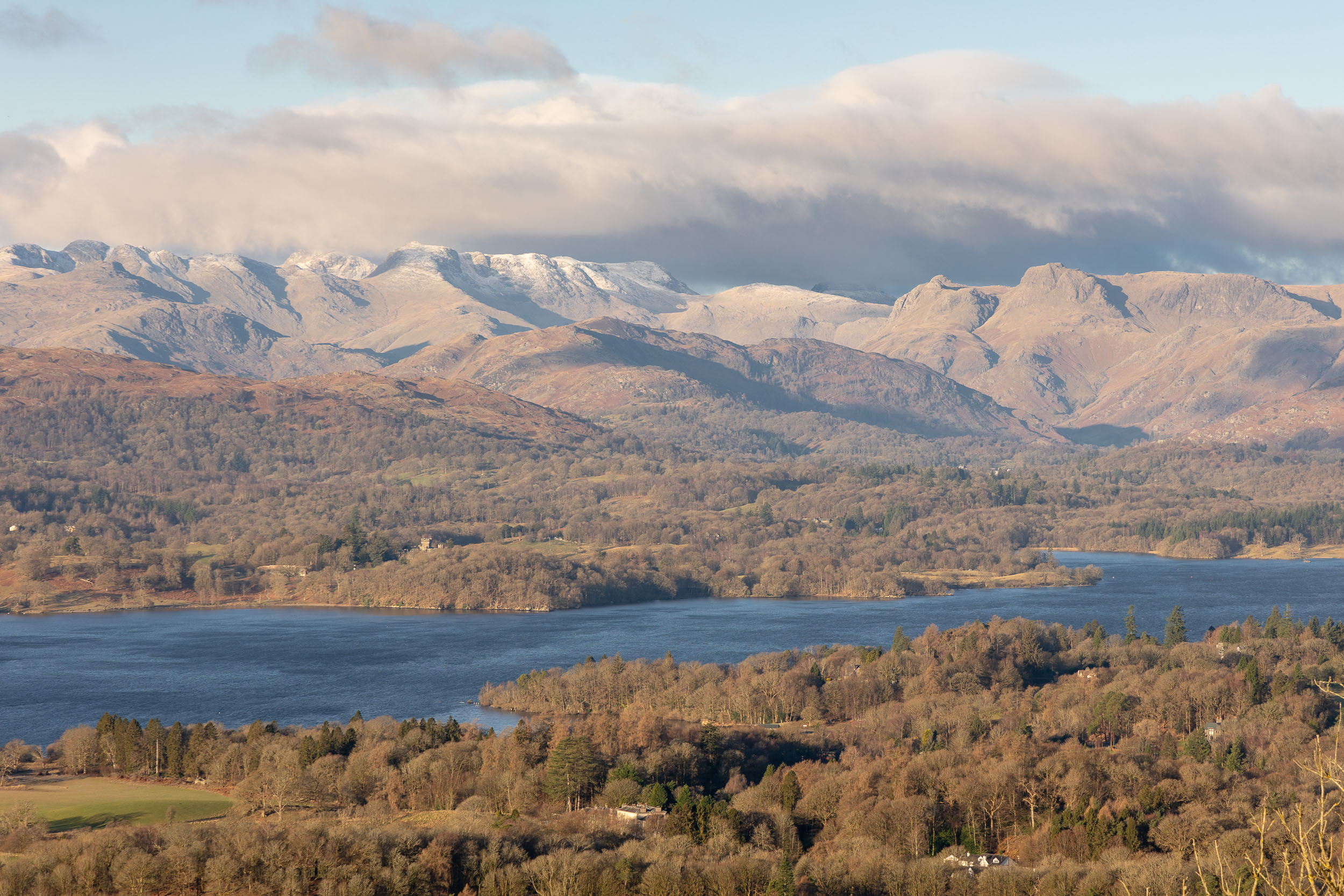
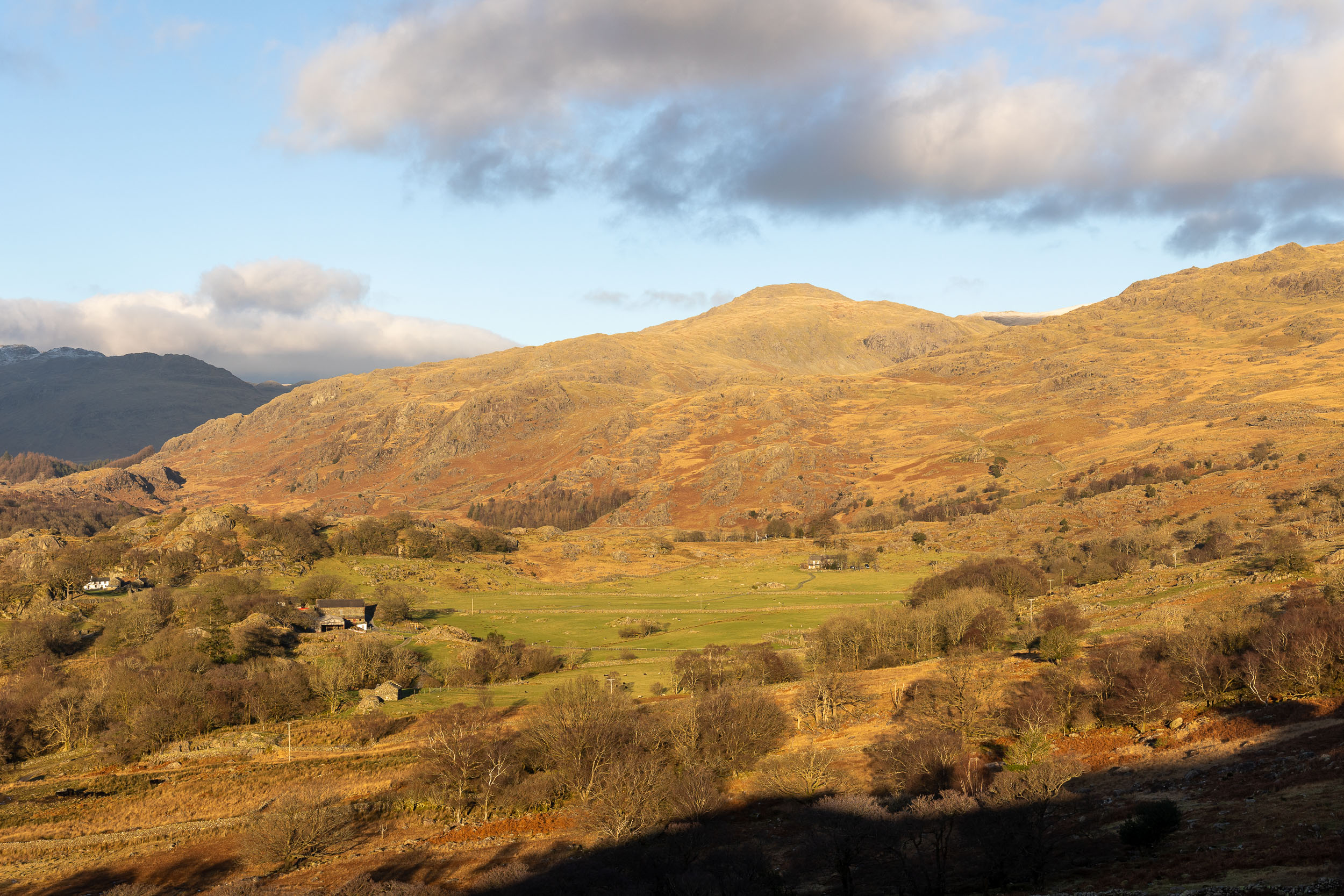
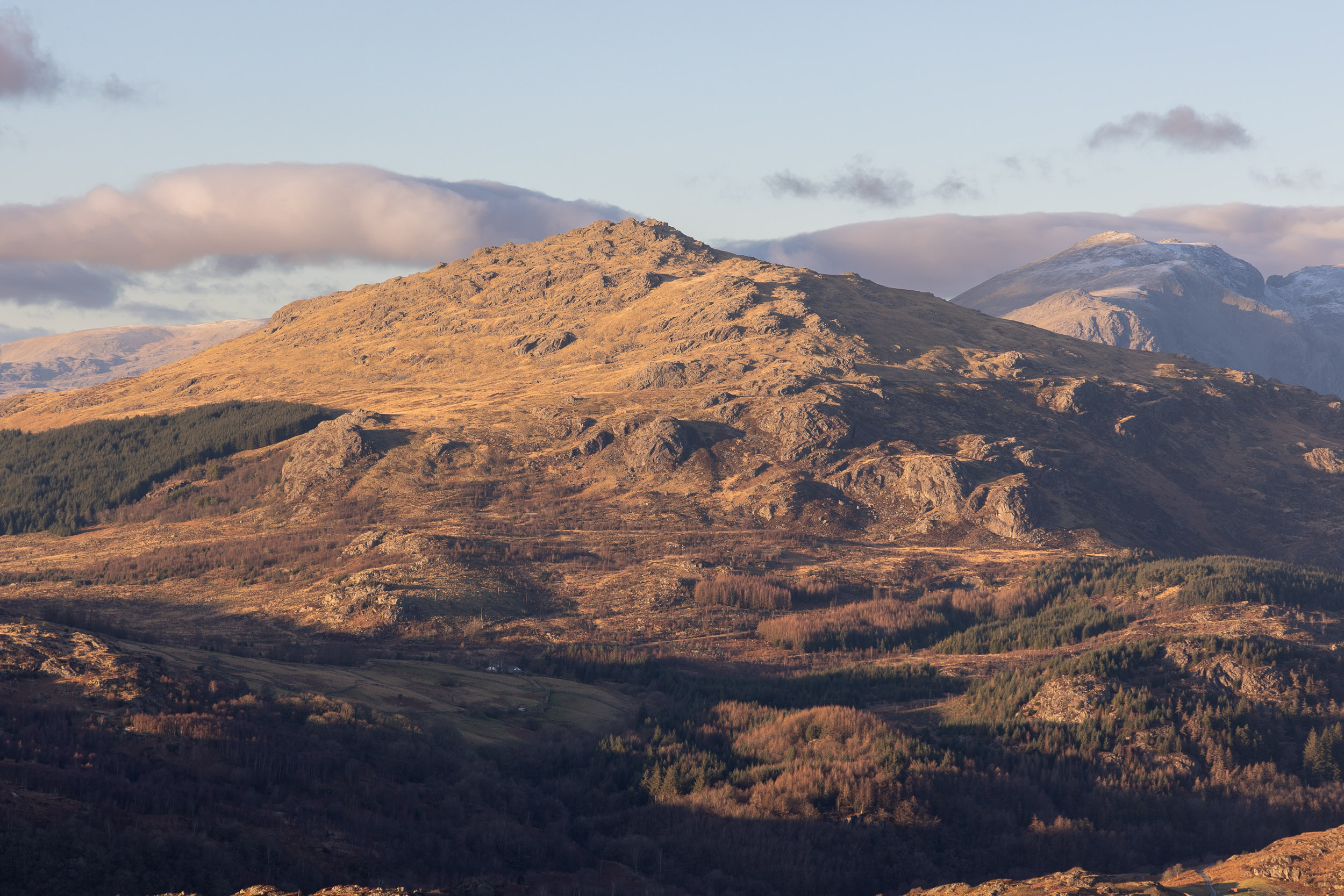
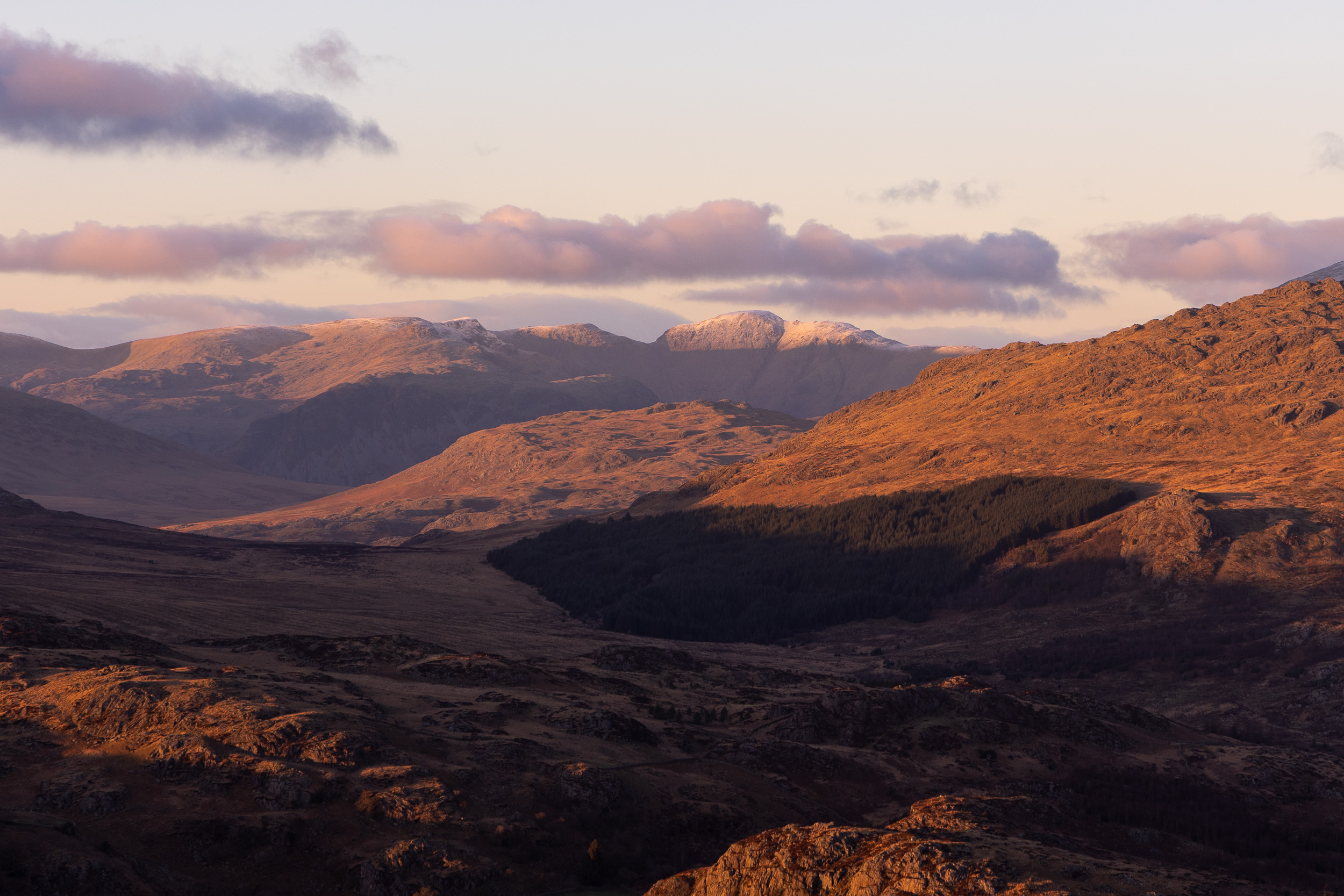
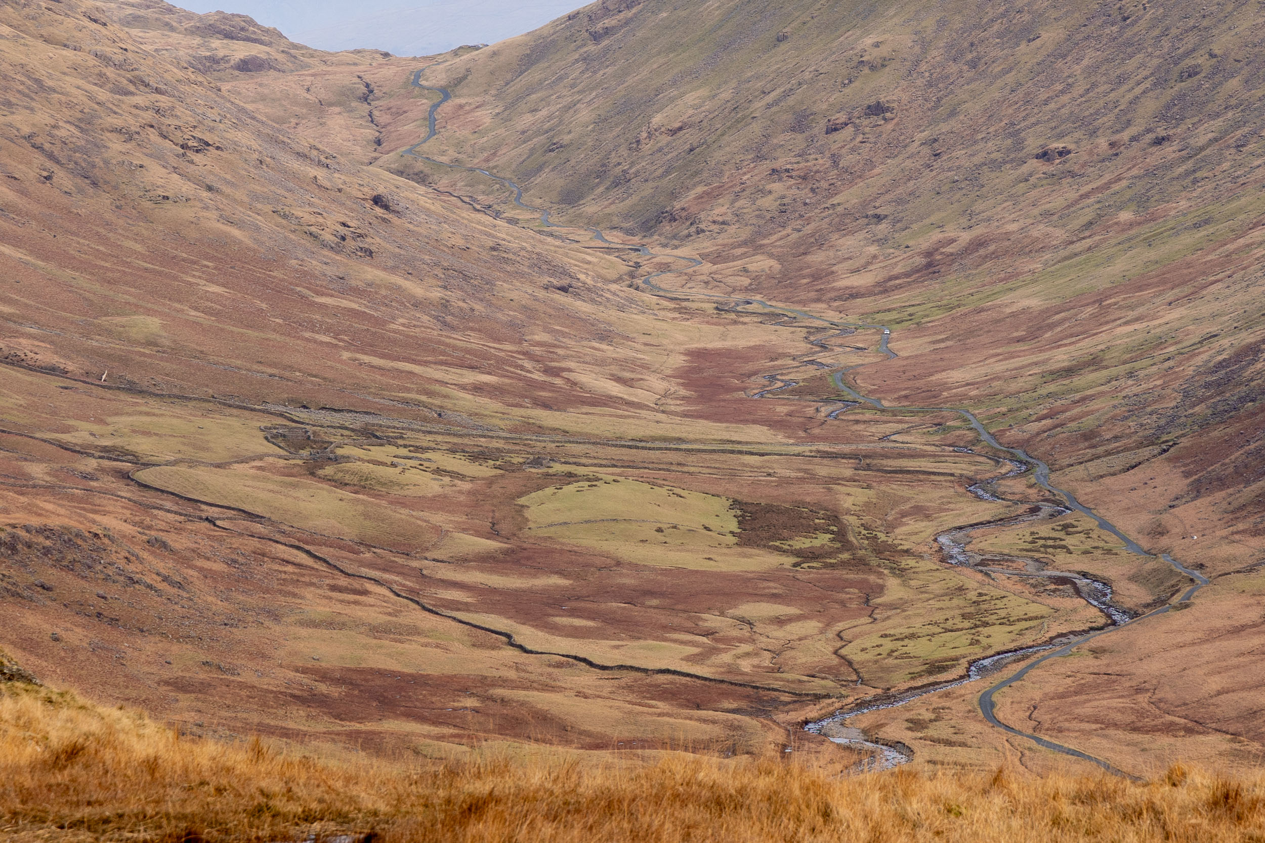
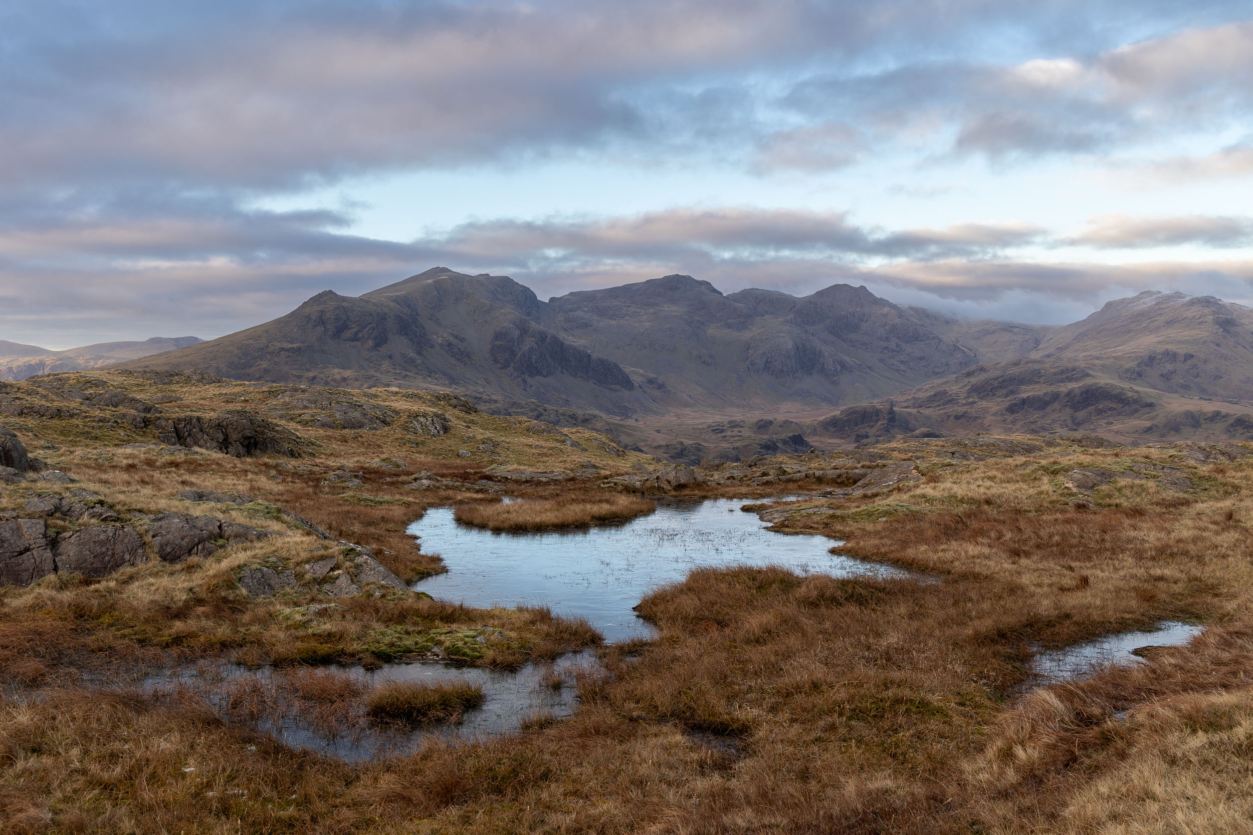
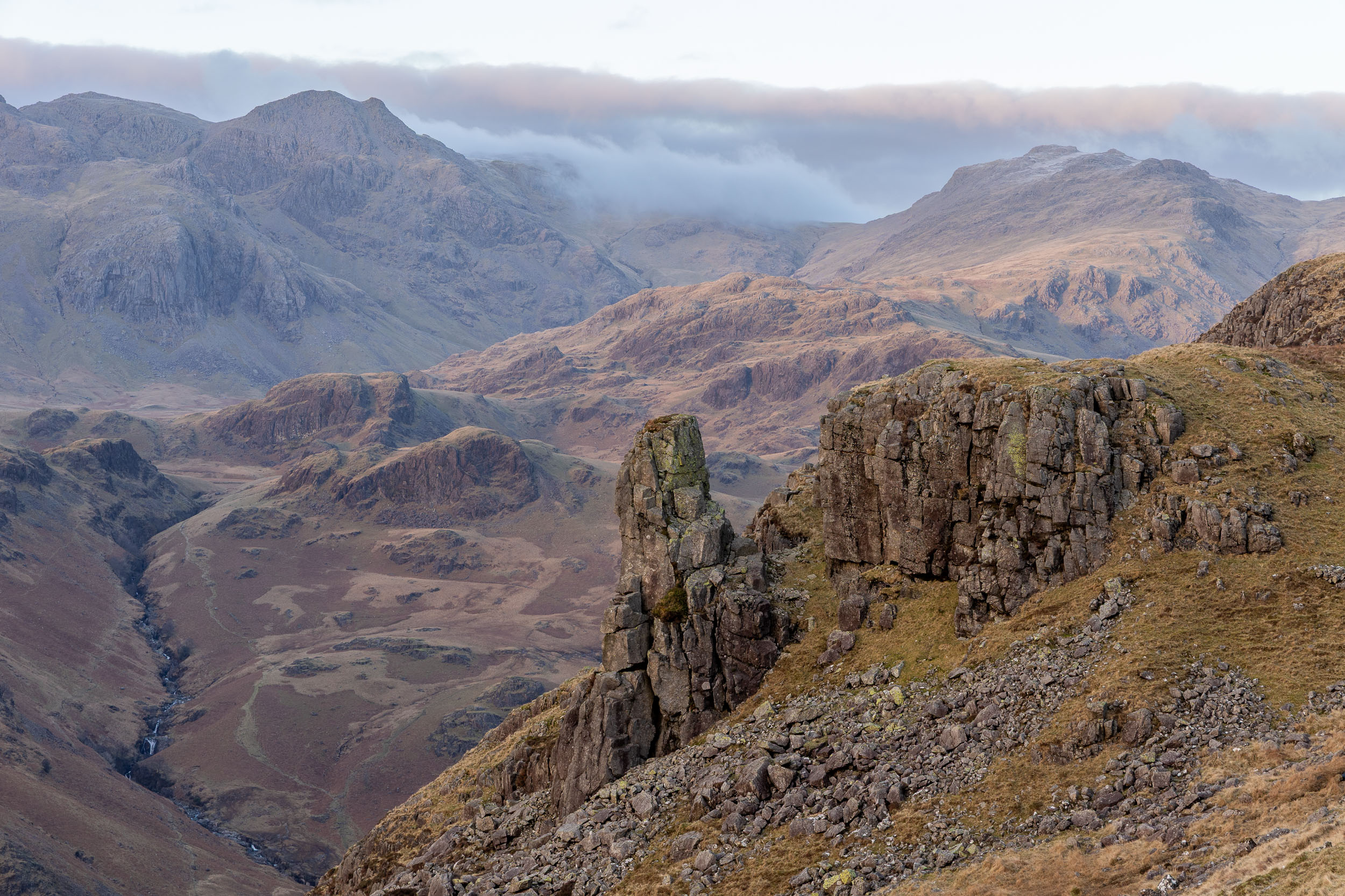
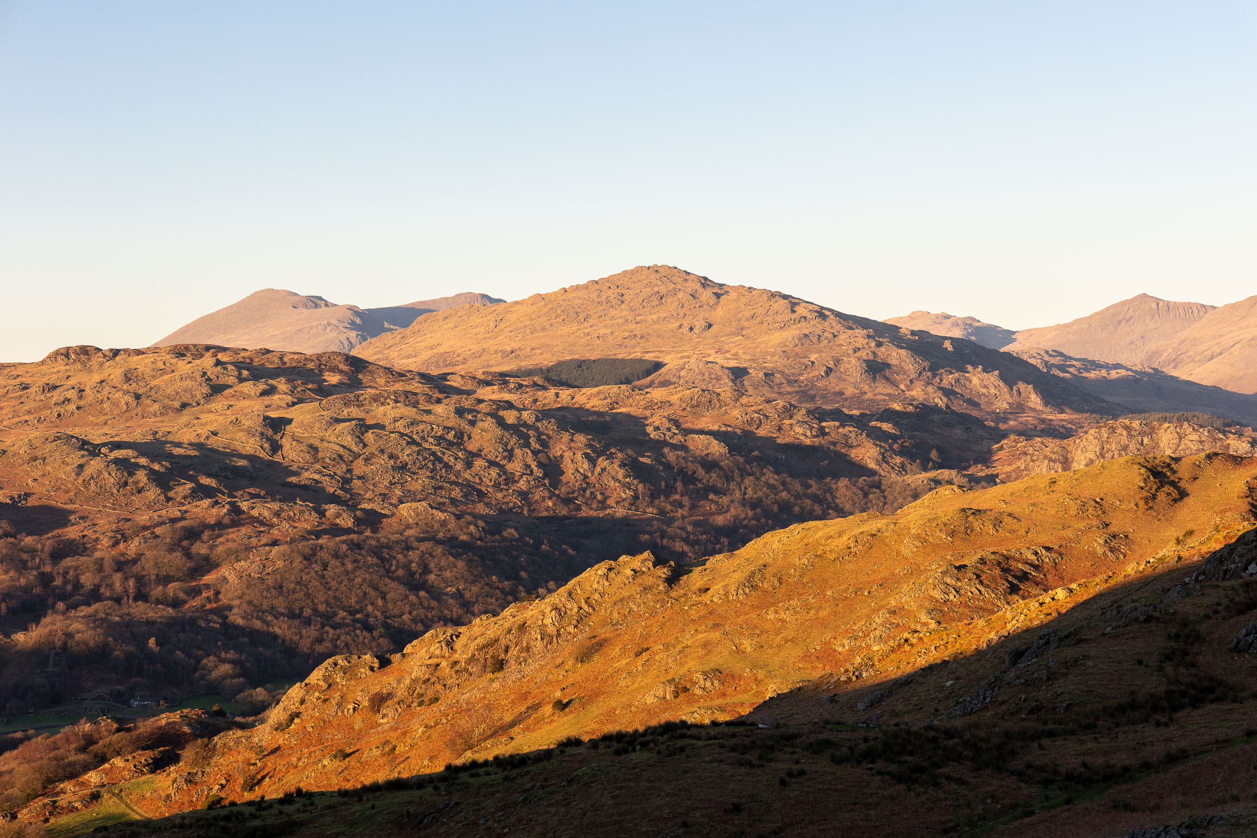
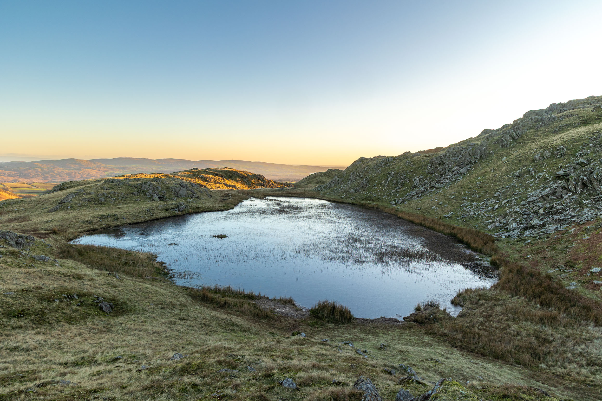
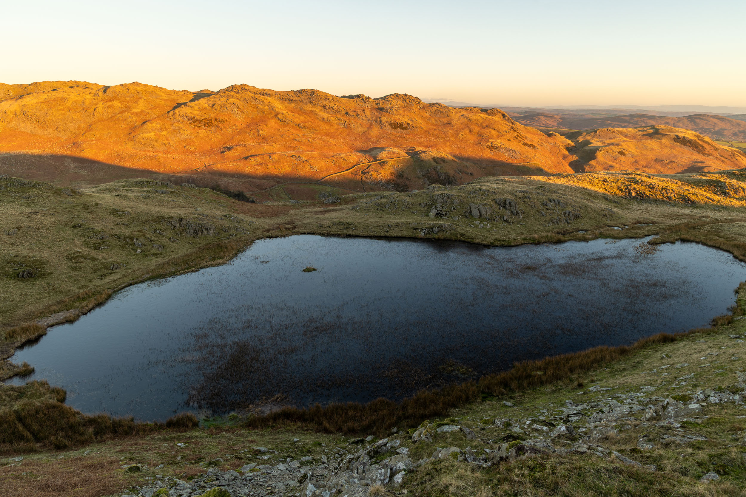
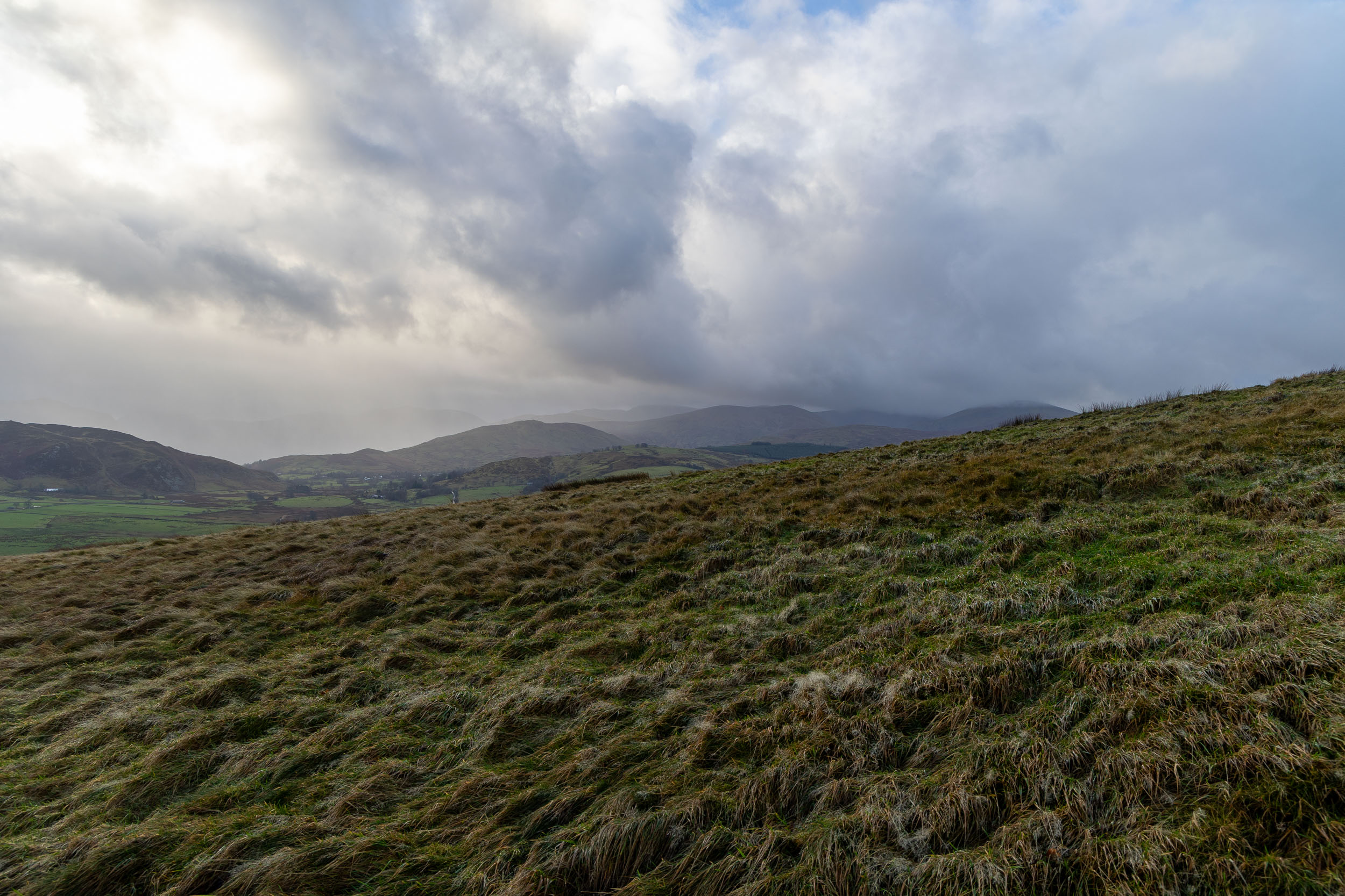
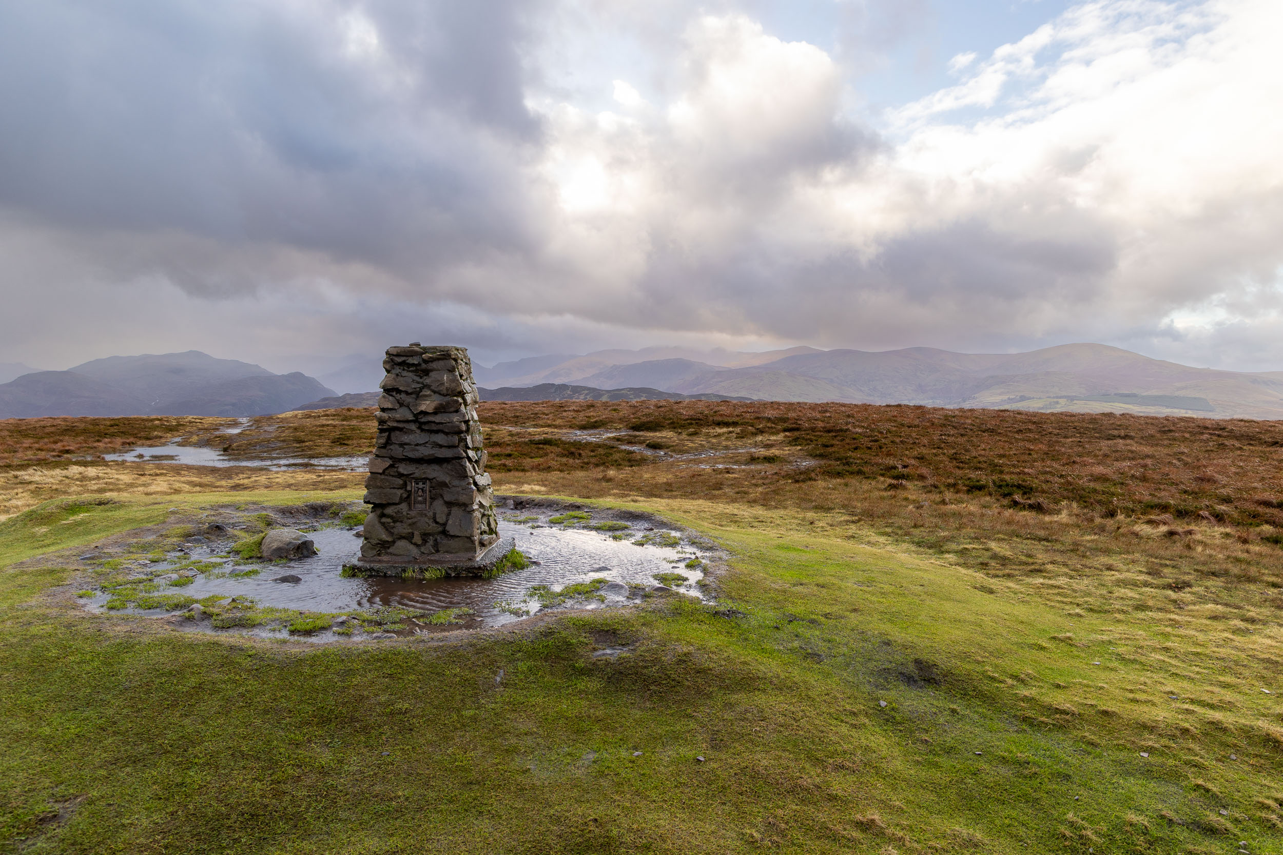
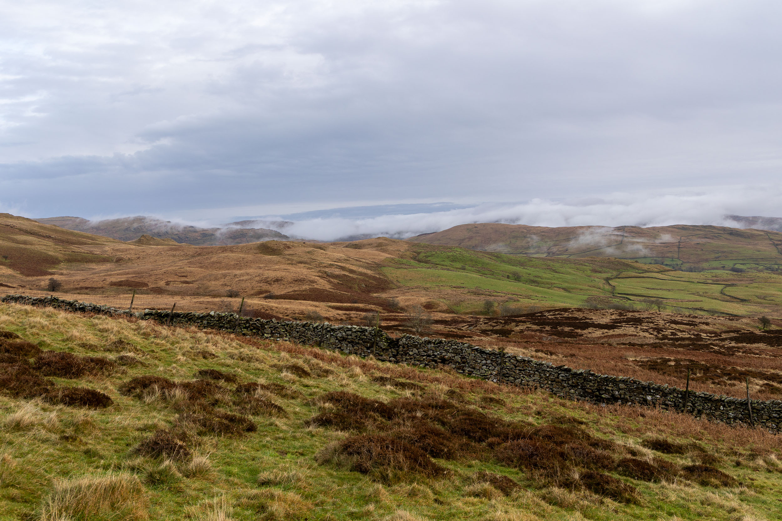
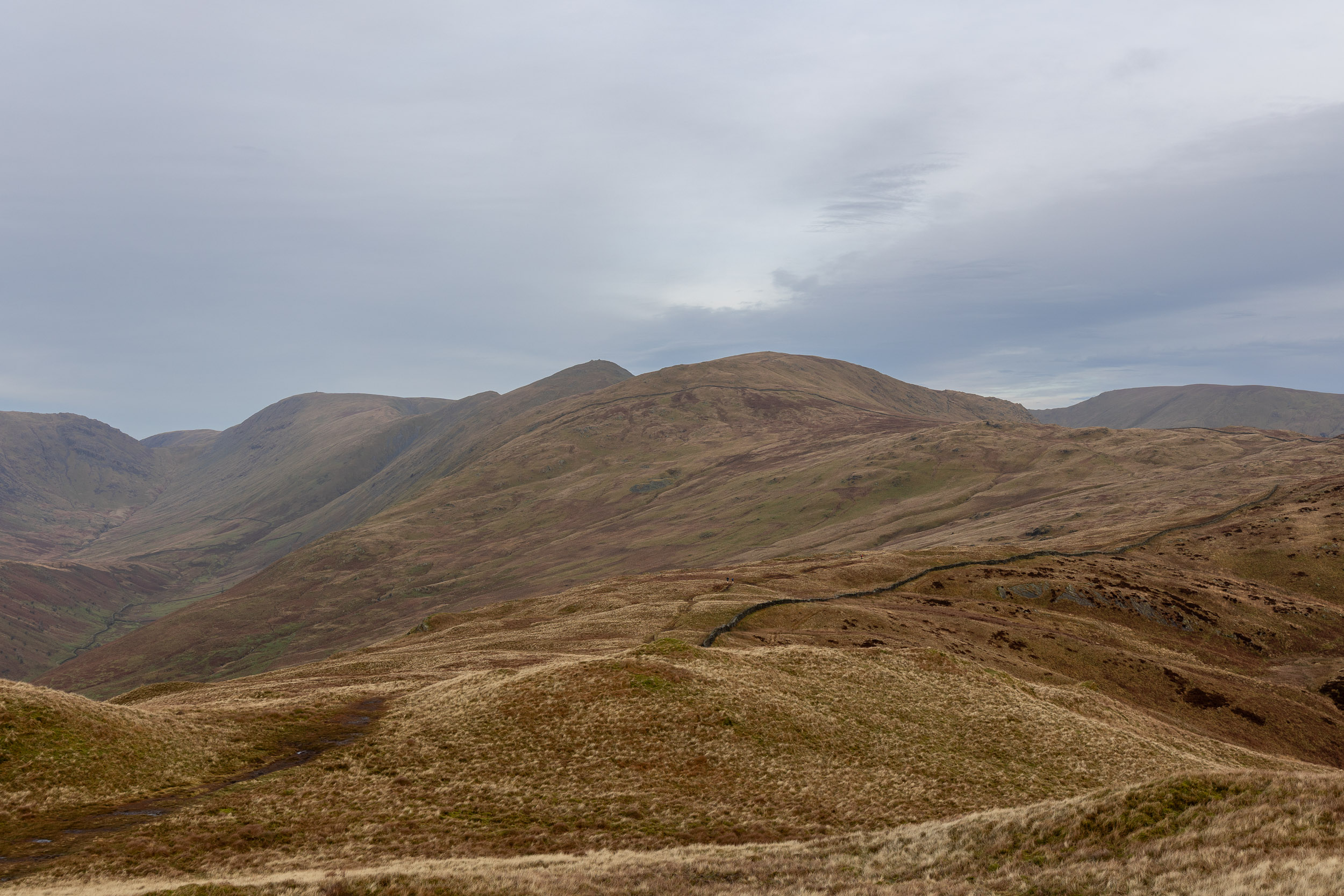
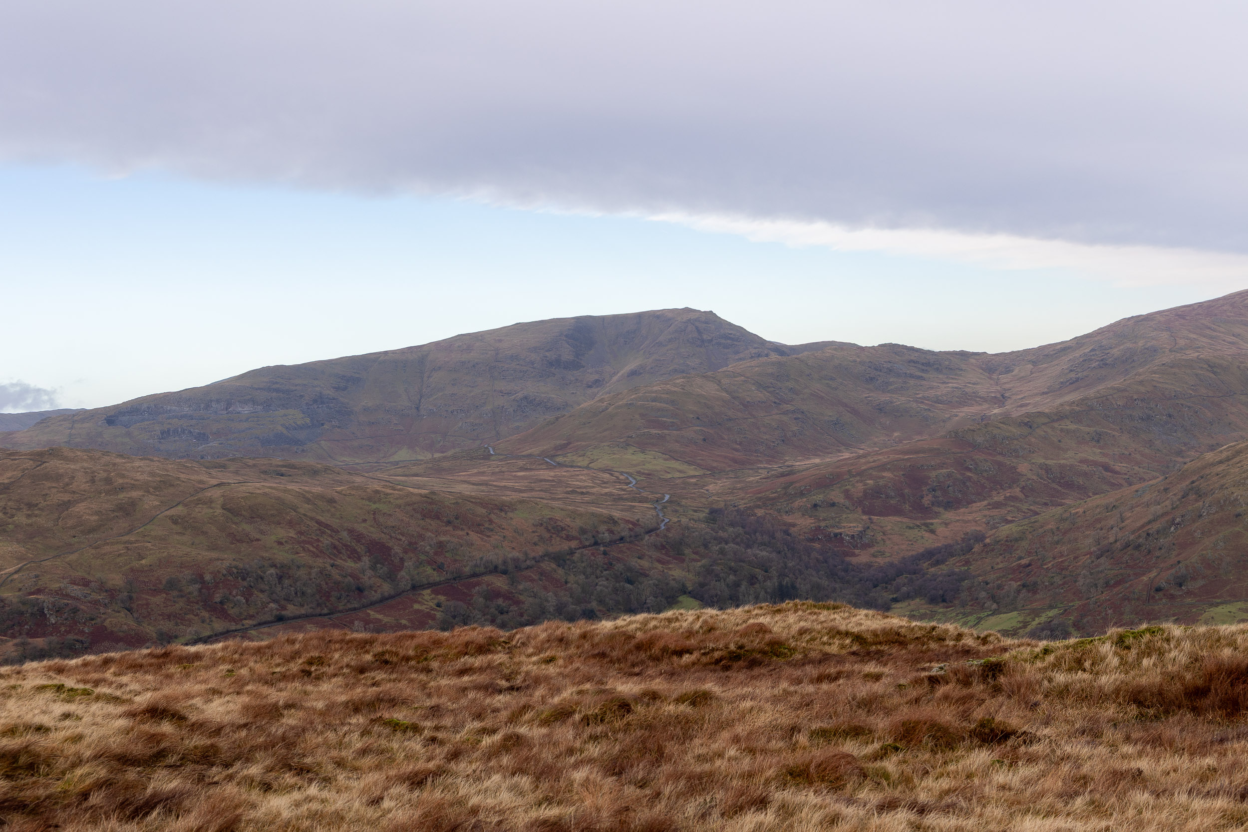
Little Langdale Tarn with very low cloud down on the Coniston fells.

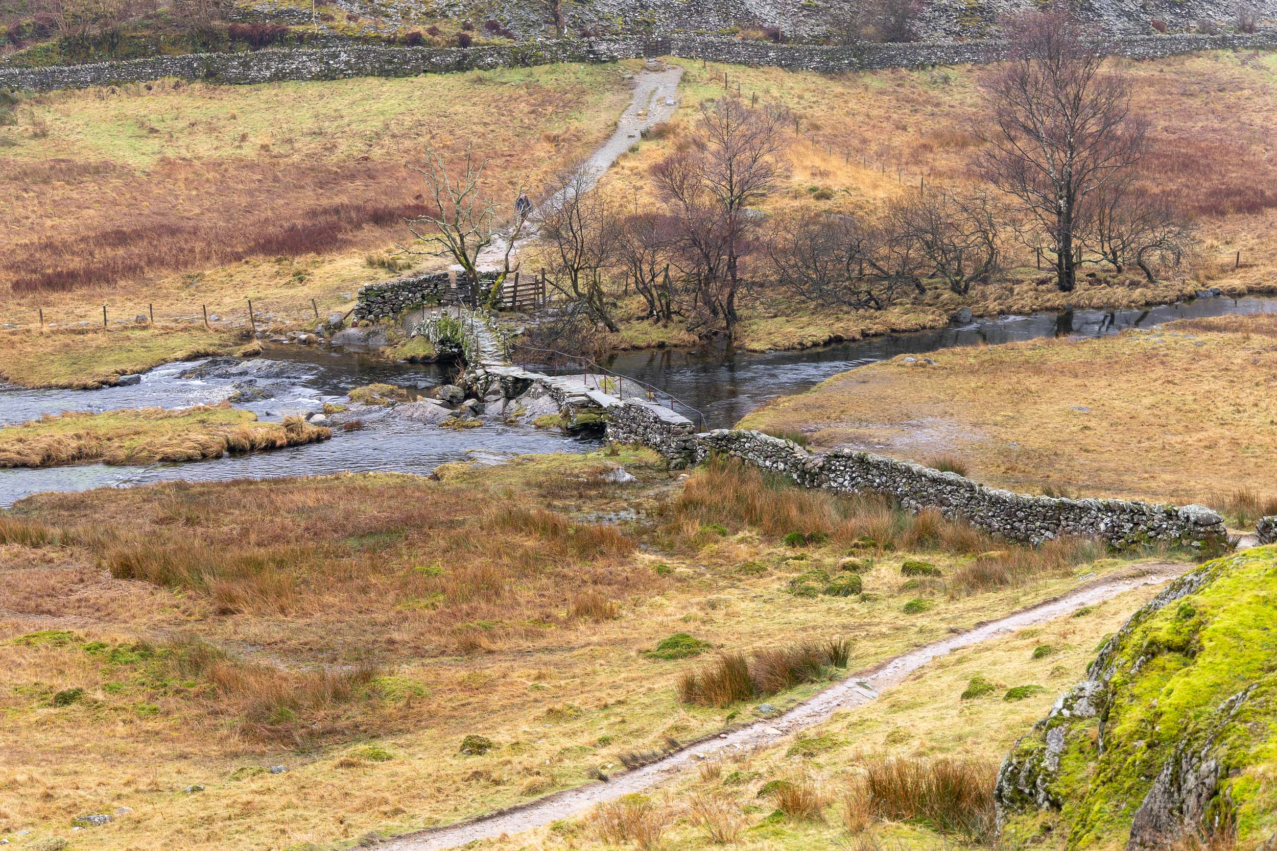
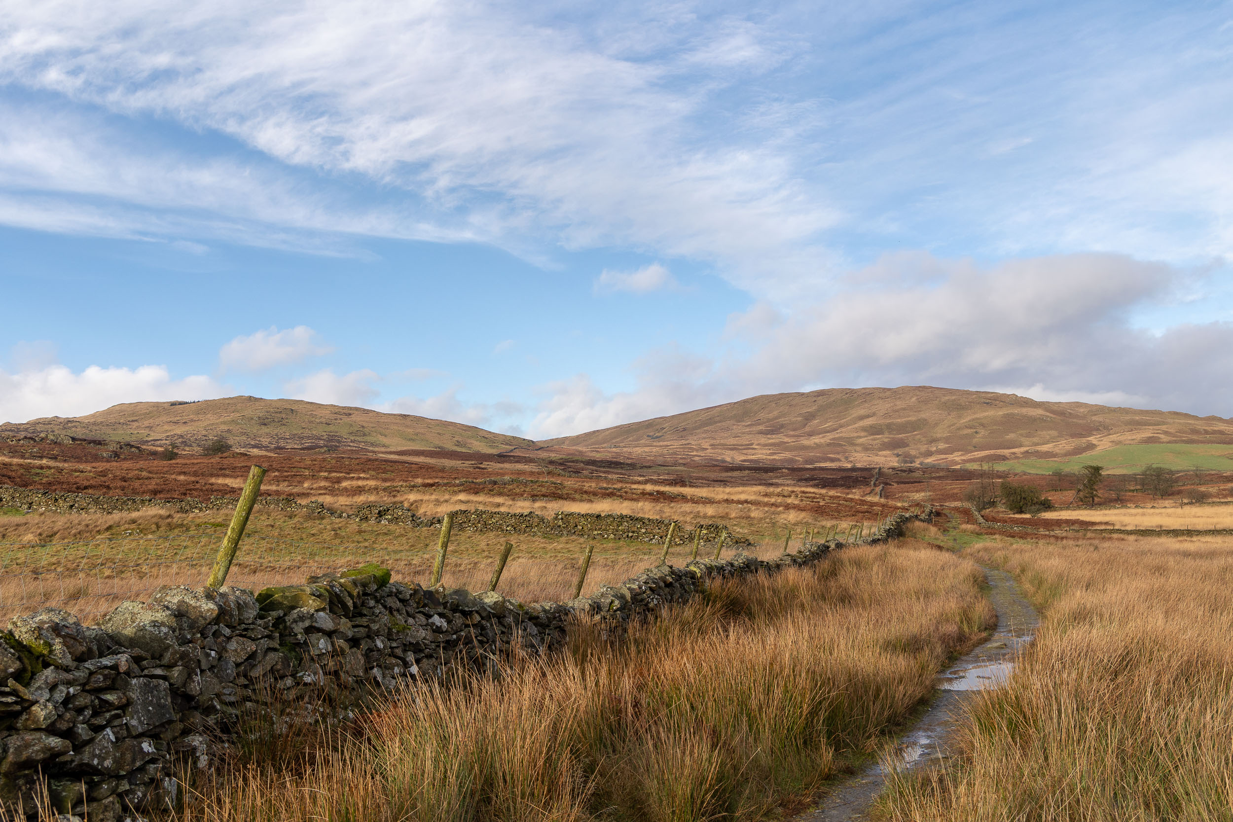
The path down to Slater (or Slater’s) Bridge.

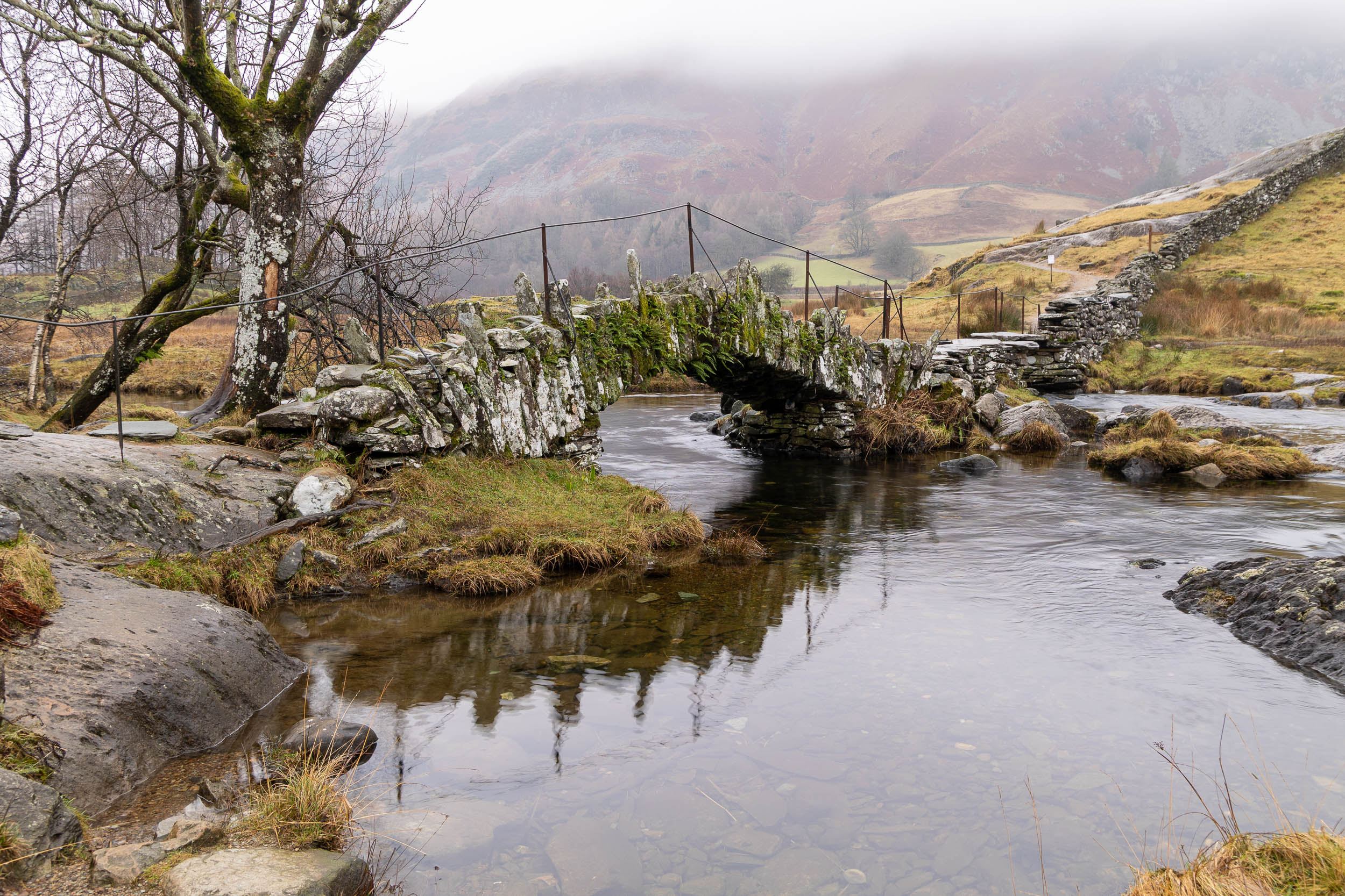
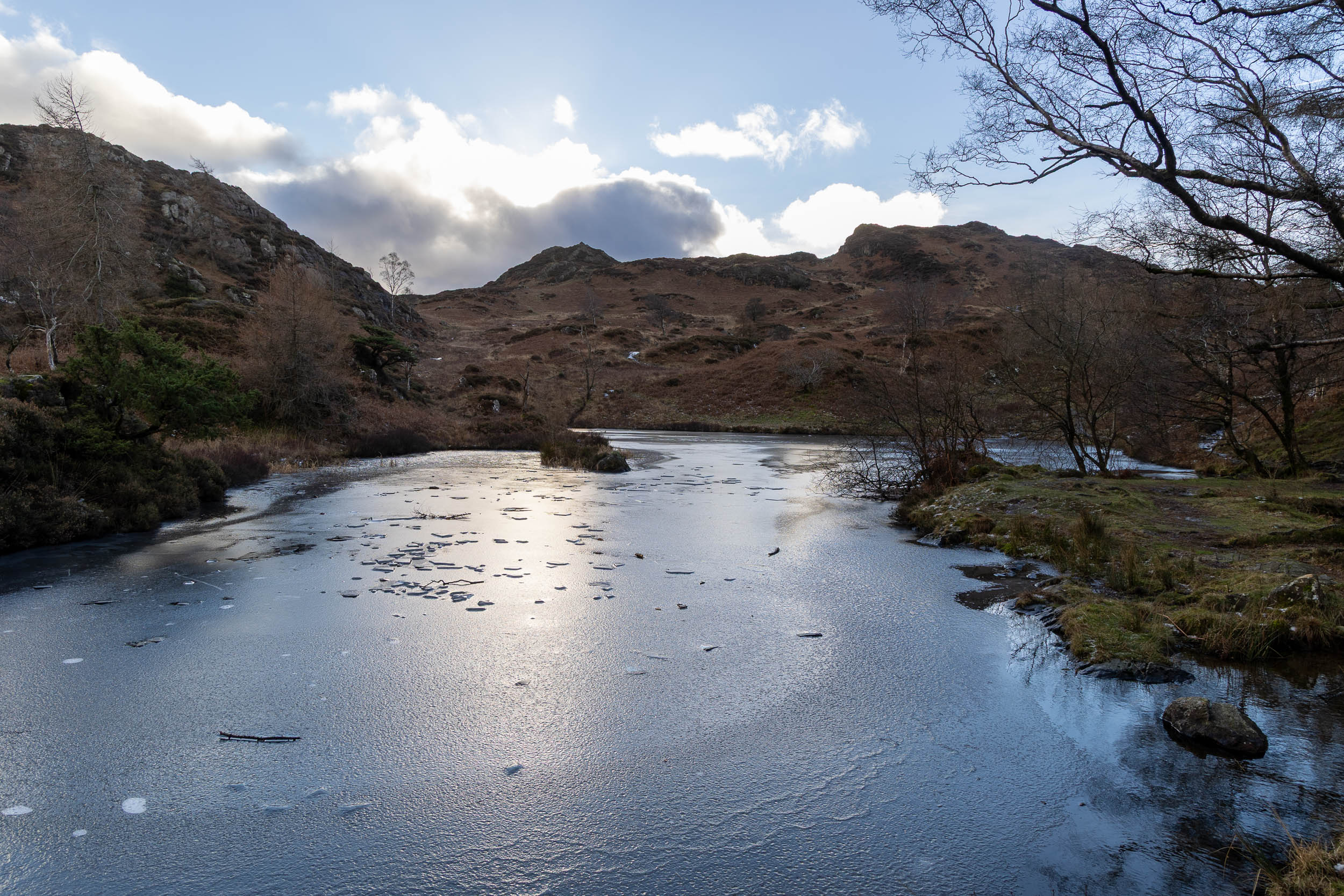
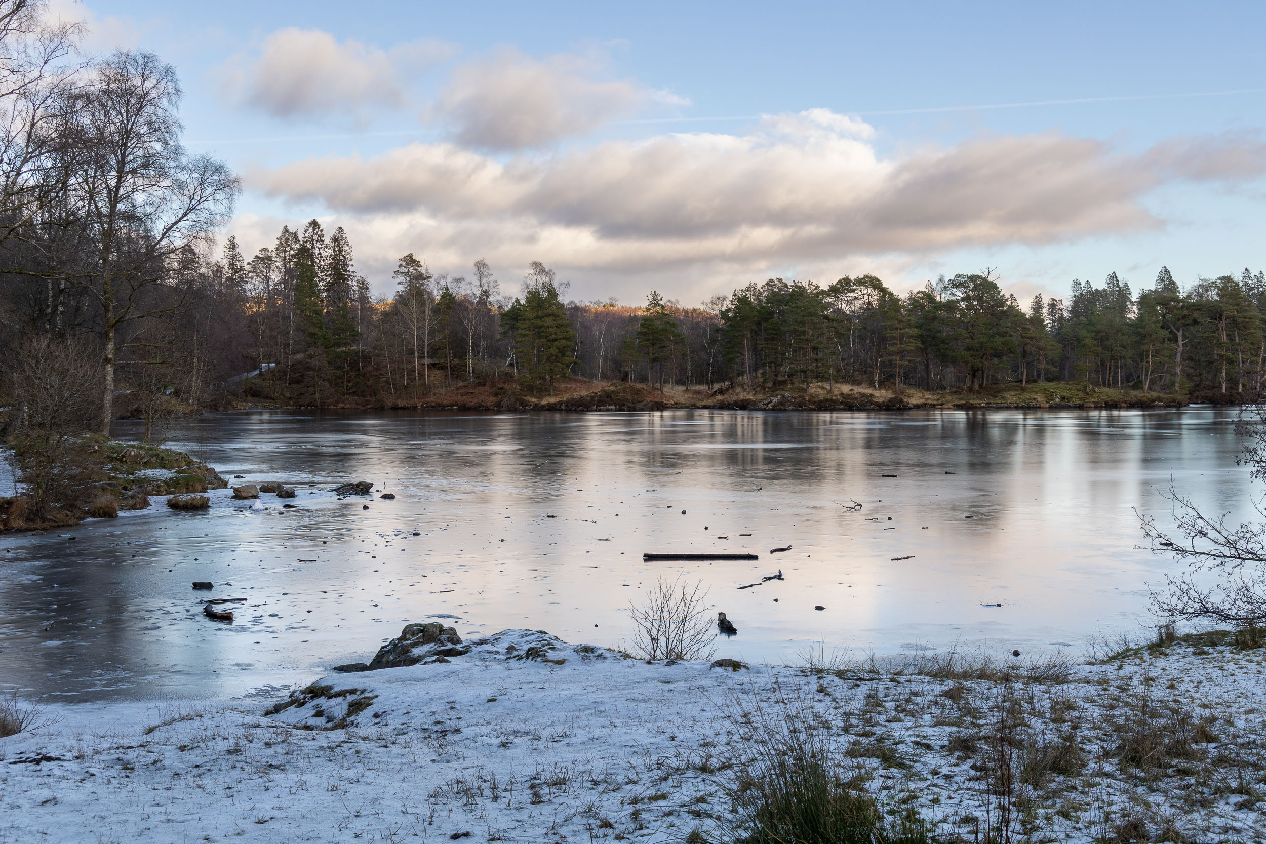
Down at Slater Bridge – again, all was very quiet in this area. Not too far now to Cathedral Quarry.

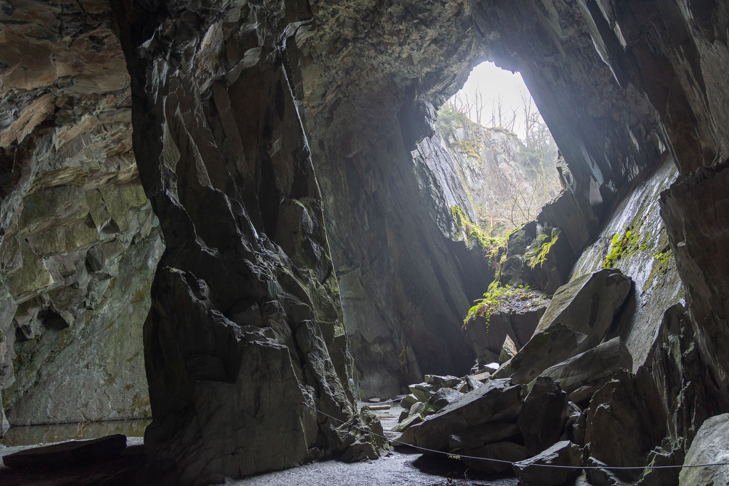
Inside Cathedral Cave.

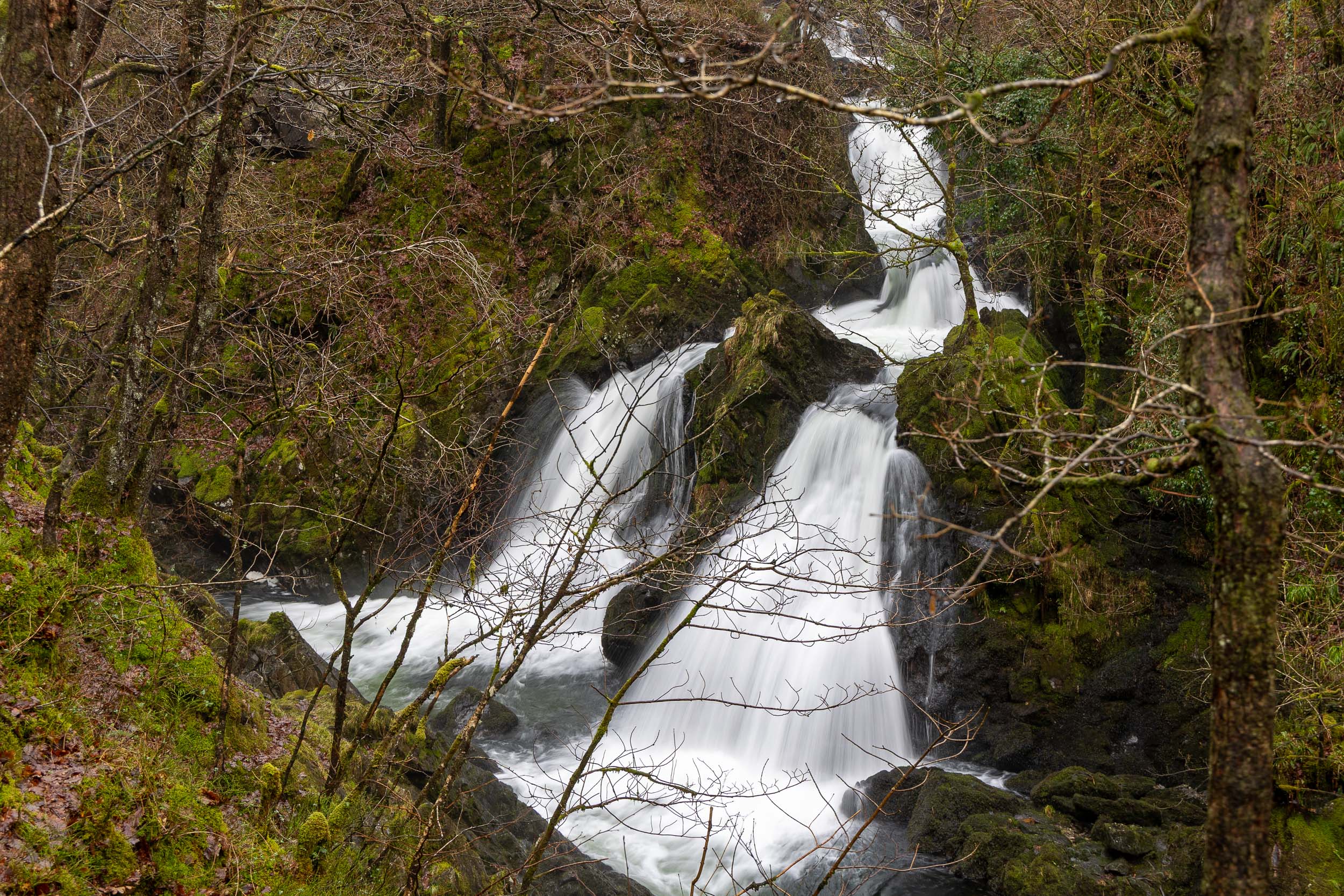
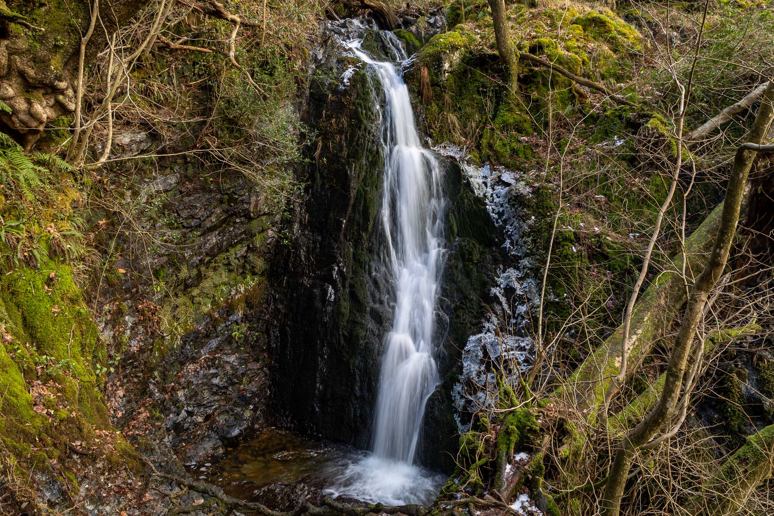
Colwith Force, again the falls were in good flow. Not far from here back to Skelwith Bridge – a great finishing point with a coffee and cake from Chester’s. On the way back from Colwith Falls I passed 3 people who were walking along playing loud music, oblivious to their surroundings. I cannot understand some people, but then again I am old!

Holme Fell, Black Fell & Tarn Hows

Walked on 07/01/2026

Start Point: Yew Tree Tarn (NY 322 003)

Yew Tree Tarn – Uskdale Gap – Ivy Crag – Holme Fell – Hodge Close – Oxen Fell – Iron Keld plantation – Black Fell (Black Crag) – Tarn Hows – Tom Ghyll – Yew Tree Tarn

Distance: 12.7 km
Total Ascent: 386 metres     
Time Taken: 4 hours   
Start Time: 10:10
Weather: Sunny spells, cold wind. 3ºC
Finlay’s Wainwright count: 18/214 (1 new this walk)

Route Map. GPX download available.

There has been lots of snow around this week but the main concern today was ice and there was plenty of that on this walk even though it was comparatively low level. I was quite tempted by Wetherlam but opted for a lower walk today, thinking of Finlay’s experience. It also gave plenty of opt out options depending on conditions so I ended up doing a fairly long walk taking in Black fell again and around Tarn Hows. It was a lovely walk, of course I need to be well wrapped up against the freezing wind and Finlay fared well once more and strengthened his fell walking abilities.

Frozen Yew Tree Tarn at the start of the walk.

A seat with a view a little further around Yew Tree Tarn.

The view to the Langdale Pikes from the top of Uskdale Gap. As soon as I came out of the shelter of the Uskdale Gap which is nestled between crags, there was a really icy north-westerly wind blowing – time to layer up!

Looking towards a cloud capped Helvellyn from Ivy Crag, those clouds look snow laden.

The Old Man and Wetherlam from Ivy Crag, the summit ridge of Holme Fell is the central rib.

A grand view of the full length of Coniston Water, taken from Ivy Crag.

Holme Fell is Wainwright #18 for Finlay.

The summit of Holme Fell, Wetherlam beyond.

The Old Man above the Yewdale fells – I must say the Coniston area seems to have the best of the weather today.

The Langdale Pikes looking broody from the northern end of Holme Fell summit rib.

Wetherlam appears up close and personal from here and what a great view of Steel Edge.

Back down at the (frozen) disused reservoir. From here I took the track above Hodge Close quarry and across Oxen Fell.

The view across the fields from High Oxen Fell to Pike o’ Blisco and Bowfell, Lingmoor Fell central. From High Oxen Fell I crossed the A593 and flooded the track southwards to Iron Keld plantation before diverting across to Black Fell.

This is a more distant but similar view to the one above and shows the grandeur of the relatively close scenery, Bowfell looks magnificent from here with Rossett Gill picked out in the snow to the right.

Black Crag, the summit of Black Fell.

The view to Wansfell across Windermere, Ambleside below.

Windermere from Black Fell.

The south-east cairn on Black Fell.

The Coniston fells from Arnside Plantation heading for Iron Keld.

A sunny spell on the Langdale Pikes.

On the high level path at (frozen) Tarn Hows.

Tarn Hows.

On the way around Tarn Hows, I had a forlorn hope that the coffee shop would be open in the car park – alas the lack of people anywhere around Tarn Hows and the state of the icy road stopping anyone driving up that way told me it would be a negative. The most dangerous part of the walk were the paths around the Tarns which were solid ice – I did have more than one embarrassing ‘fall on backside’ moments around there!

Tom Ghyll falls.

Does anyone still read these? I know I have been off line for a good while but have picked up the fell walking cudgel recently with renewed vigour, especially now with Finlay in tow. Should I continue with the site or let it lapse into a comatose state once more?

Orrest Head

Walked on 03/01/2026

Start Point: Lay-by on the A591 (SD 414 987)

A591 – Common Wood – Orrest Head (Outlying Fell) – A591

Distance: 2.5 km
Total Ascent: 114 metres     
Time Taken: < 1 hour
Start Time: 09:50
Weather: Sunny. -1ºC with a cold wind chill on the top.
Finlay’s Wainwright count: 17/214 (0 new this walk)

Route Map – GPX download available.

I had a chance of a quick walk today so I chose Orrest Head where there are great views for relatively small effort – a good choice I think!

You don’t have to climb too far from the main Windermere – Kendal road (A591) to get a great view along the length of Windermere…

…and a great view of the length of the Coniston fells, from The Old Man to Wetherlam.

It doesn’t take long to reach the top and wow, what a great view. No wonder A.Wainwright’s life was changed by his walk up here in 1930. What a lovely clear view today but once again there was a cold, biting wind.

A similar view as the on the climb but clearer looking to the Coniston fells across Windermere.

Looking to the east to Caudale Moor and Thornthwaite Crag, the sky looks leaden and perhaps snow-laden.

Close up on Crinkle Crags, Bowfell and The Langdale Pikes.

Things have changed a bit up here since last time I visited with this new circular seating area.

A wider view of the view from the top of Orrest Head.

The Wainwright viewpoint indicator.

Finlay looking a bit windswept.

The sign at the bottom is still the same.

2005 version with Connie!

Caw

Walked on 02/01/2026

Start Point: Seathwaite car park next to church (SD 229 961)

Seathwaite – Green Pikes (Outlying Fell) –  Pikes (Outlying Fell) – Caw (Outlying Fell) – Seathwaite

Distance: 5.8 km
Total Ascent: 469 metres     
Time Taken: 2 hours 10 minutes
Start Time: 14:15
Weather: Mainly sunny. 2ºC with a cold wind chill on the top.
Finlay’s Wainwright count: 17/214 (0 new this walk)

It was another sunny and cold day in the Lake District, perfect weather for a walk really. It’s a while since I’ve been to Green Pikes and Pikes, generally I tend to climb Caw from Broughton Mills side as it’s quicker to get to and to climb from there. None of this walk disappointed though with glorious views along the Duddon Valley to the Scafells and the rest of the high fells beyond – all covered with a sprinkling of snow today. I didn’t see anyone else at all today.

Grey Friar from the Dobby Shaw climb, heading for Green Pikes.

Harter Fell.

A great, wintry view along the Duddon Valley from the steep climb to Green Pikes. Harter Fell is on the left and the Scafells beyond with a sprinkling of snow on them.

White Pike glowing in the already setting winter sun.

The top of Green Pikes is marked with a small cairn containing only a few stones and the large shadow of Caw is looming over us.

Green Pikes can seem a strange choice for a named top as it is not too far from our next one, Pikes. The view though is outstanding and almost like being on the edge of a cliff looking out over the Duddon Valley.

Harter Fell looking like a giant, Scafell beyond.

Next stop is Pikes ahead (not quite as bad to reach as it appears in this photo!).

The moon rising over the Coniston fells, taken from Pikes.

The view of the Duddon Valley from Pikes.

On leaving Pikes there is a bit of a disheartening dip before a seemingly long and steep climb to the summit of Caw. I wasn’t sure whether I would make it before the sun dipped behind Black Combe which is probably 10-15 minutes before actual sunset. As it turned out the climb wasn’t too bad after all!

Phew, made it! The wind really picked up once on top of the Caw summit ridge and of course it was a real icy blast!

Finlay in the sunny glow.

The moon is noticeably higher over The Old Man now and the shadows ever lengthening. Pikes is still catching the sunlight, centre right.

Caw summit trig. point.

Some of the Wasdale fells in the distance – Red Pike, Scoat Fell and Pillar.

Looking out to the west Cumbrian coast, Devoke Water nestling on Birker Fell with Sellafield works visible beyond.

The Duddon Estuary.

The sun setting behind Black Combe, Stickle Pike directly below it. it was a lovely walk with complete solitude and nice to be wrapped up well against the cold chill.

Hard Knott

Walked on 30/12/2025

Start Point: Hardknott Pass summit (NY 230 014)

Hardknott Pass – Border End – Eskdale Needle – Hard Knott – Hardknott Pass

Distance: 3.2 km
Total Ascent: 237 metres     
Time Taken: 1 hour
Start Time: 14:45
Weather: Partly cloudy. 3ºC
Finlay’s Wainwright count: 17/214 (1 new this walk)

I did think it would be clearer this afternoon after a cloudy start but that never quite materialised. I can’t complain as the views from Hard Knott are always good, some of the best views of the Scafells and Upper Eskdale that can be had in my view. I love these frozen winter days when it really does give the feeling of peace and solitude.

The long and winding road – Wrynose Pass.

A breathtaking sight of the Scafells comes into view as the top of the small col between Border End and Hard Knott is reached.

Ask Pike has a sprinkling of snow on the top. Everything above the 500m level was frozen up here and the silence was deafening.

Eskdale with Hardknott Roman Fort visible below.

Once on top of Border End, the view really opens up and the full Scafell range comes into view and look superb across this frozen pool.

Seatallan and Haycock catch the last of the sun with a little bit of Yewbarrow visible beyond the Slight Side ridge.

The view from the summit cairn on Border End. I had a five minute conversation with someone that had climbed up from the fort and first time visiting the area – not a bad time to do it!

Fading light and the last of the sunshine on the slopes of Slight Side and Scafell.

I dropped off piste a little to find Eskdale Needle – always a treat to see this rugged rock tower with its even more rugged surroundings! This gave young Finlay a little taste of the rough stuff as we traversed towards it and a bit of ‘follow me closely’ training (plus of course ‘leave the sheep alone’ training – OFF!)

The light was fading fast now so it was on with the climb up to Hard Knott and just made it for the final part of the sunset, here looking towards the West Cumbrian coast.

Well done Finlay, Hard Knott is Wainwright #17.

The summit of Hard Knott.

A final shot of the sunset from the descent, the point towards the right is the cairn on Border End. On the descent I was thinking how good it was to have the frozen ground to walk across rather than finding a way across the bog – of course I thought too soon when I broke through an icy section and got a good boot full of freezing water. It was like quicksand. -I thought I was going to be dragged down to the icy depths and never be seen again 9thankfully I made it out alive!).

Stickle Pike sunset

Walked on 26/12/2025

Start Point: Kiln Bank Cross (SD 215 933)

Kiln Bank Cross – Stickle Tarn – Stickle Pike – Kiln Bank Cross

Distance: 1.6 km
Total Ascent: 115 metres     
Time Taken: 45 minutes or so.
Start Time: 15:10
Weather: Beautiful and clear. 3ºC
Finlay’s Wainwright count: 16/214 (0 new this walk)

Well, what another beautiful day this Boxing Day was. I had no walk planned but on such a day a short walk up to Stickle Pike is always a treat for a great sunset and it certainly did not disappoint today. It was a good way to try and work off a surplus of calories and a beautiful end to the day.

A fabulous view almost at the beginning of the climb looking to Harter Fell, Scafells to the left and Esk Pike and Bowfell to the right.

Caw and our own Stickle Pike shadow.

Climbing higher the views just get better.

Stickle Tarn.

A wider view along the Duddon Valley, the shadows lengthening already.

This final part of the climb to Stickle Pike.

Up at the tarn.

Looking down on the tarn from further up.

The sun is quickly dropping behind Black Combe.

Stickle Pike.

A wider view, and what a magnificent one it is in this light. I was all alone and it was so peaceful up here.

Finlay sunset.

The Duddon Estuary.

I couldn’t resist one final shot of this view, the sun had gone now on the descent but the final dying embers were making the high fells glow red.

The Mell Fells

Walked on 19/12/2025

Start Point: Lane End at the foot of Great Mell Fell (NY 407 247)

Lane End – Great Mell Fell – Brownrigg Farm – Greenrow – Lowthwaite – Little Mell Fell – Greenrow – Brownrigg Farm – Lane End

Distance: 10 km
Total Ascent: 569 metres     
Time Taken: 3 hours 30 minutes
Start Time: 10:10
Weather: Everything – very windy, rain, hail, sun! 7ºC
Finlay’s Wainwright count: 16/214 (2 new this walk)

Route Map – GPX download available

I’ve had this walk planned for a little while, it seemed a good one for Finlay to tick off another couple of Wainwrights as he is still only a youngster. The slopes are quite gentle and no ‘rough stuff’ to speak of but the recent heavy rain coupled with strong winds and awkward stiles and gates made the walk a little more adventurous than I thought it would be!

Looking along the lane at the start of the walk, the surrounding fields and roads were very wet and it was raining once more so today’s walk was completed throughout in waterproofs.

Heading onto the fell – interesting to note that it is monikered ‘Mell Fell’ rather than ‘Great Mell Fell’.

The wind really picked up as I climbed and the showers were quickly blowing through. This is looking back to Little Mell Fell (at this point I was thinking I ‘might’ go there but there is a bail out option as we return to the car on the figure of eight planned walk).

I wasn’t really expecting to see blue skies today but the wind was so fierce it was blowing the clouds through quickly.

It was a real boggy squelch up to the top and the wind made it feel harder than it should have been to get here.

Finlay neatly sums up the weather at the top of Great Mell Fell, Wainwright #15 for him.

Great Mell Fell looking towards Blencathra.

Looking across Troutbeck to Blencathra and Souther Fell. The straight line of the disused rifle range can be spotted between the trees below.

There was a steep descent from here to pick up the lower level path that circumnavigates the fell where we arrived at the car…should I, shouldn’t I? Of course I carried on, I was here now! For anyone who is going to follow a similar route to mine, the paths between Brownrigg Farm and Greenrow are not the best to say the least. At this time of year and after so much rain, the field paths were a real bog fest. Coupled with this was the crossing of two stiles one after the other immediately followed by a footbridge crossing with a further two stiles on it – none of these were dog friendly. Further stiles at Greenrow were also not conducive to a dog getting through easily! I wasn’t particularly looking forward to coming back this way.

It was mostly rain on the way to Little Mell Fell, we walked a quiet tarmac lane to Lowthwaite and then the lower fell path to The Hause. From there it is the short, steep climb to the top of Little Mell Fell, Wainwright #16 for Finlay. He is one mucky pup now, that’s for sure and the wind was once more fierce up here.

Little Mell Fell.

A brief interlude of sunshine on Greenhead from the boggier than boggy descent.

The first (5 bar) gate on the descent was locked so Finlay had to learn the art of limbo dancing beneath it whilst I had to do the high jump.

Sunshine on the descent – amazing!

The sunshine spells were brief but welcome. The second 5 bar gate leading onto the lane above Foxhill Farm was also locked and this one proved trickier to get under for Finlay. From there we had to get back across to Brownrigg Farm but now I knew the lie of the land it allowed me to take a couple of small detours to make the return journey a little easier.

Mossy old wall at Brownrigg Farm.

Sour Howes & Sallows

Walked on 12/12/2025

Start Point: Browfoot Lane, Kentmere (NY 448 004) – Not recommended!

Browfoot Lane – Capple Howe – Sour Howes – Sallows – Kentmere Park – Browfoot Lane

Distance: 12 km
Total Ascent: 331 metres     
Time Taken: 3 hours
Start Time: 09:40
Weather: Ever improving. 7ºC
Finlay’s Wainwright count: 14/214 (2 new this walk)

Route Map as an indication of the route taken. A better starting point to tackle these fells from Kentmere side would have been Kentmere or perhaps High Borrans.

Setting off along the (very) wet bridleway towards Sour Howes. I parked at the top of Browfoot Lane which is certainly not to be recommended. The lane was covered with quite large potholes and at the top of it, where the road meets the bridleway, there was barely room to park a single car.

This was quite a big day in Finlay’s fell walking career – after doing a lot of recall training it was time to give him a chance off lead and this seemed like the perfect opportunity to do it. The bridleway was walled for long sections with numerous gates so there was no chance of him running off too far! As it happened he was fine and came back every time so the off lead training was extended to the open countryside – he did very well!

There was plenty of low cloud hugging the fell tops, especialy to the east of Kentmere.

Well that was a boggy old trudge but I guess there has ben plenty of rain lately. I ended up going too far and crossing Park Beck before climbing through a gate, which was a mistake as there was no way on to the open fellside that I could see (although I did end up coming from Sallows that way later on) so I retraced my steps and climbed to the right of the wall to the south of the beck. This is looking to Morecambe Bay from one of the Grouse butts on the steep climb.

A fantastic view of Windermere opened up as we climbed, this is taken from the top of Capple Howe.

It is a short walk to Sour Howes from Capple Howe and the view to Threshthwaite Mouth and the head of Troutbeck are tremendous. Wainwright #13 for Finlay!

Sour Howes.

Troutbeck from Sour Howes.

Heading for Sallows, another squelchy affair.

A fine view along some of the Far Eastern fells – Yoke, Ill Bell, Froswick, Thornthwaite Crag.

Red Screes and the Kirskstone Pass road in view.

Finlay on the summit mound of Sallows, #14/214.

There was a lovely, dramatic winter sky looking southwards.

Looking down on Kentmere from the descent from Sallows. On the face of it this should have been a straightforward descent, however someone had placed a herd of cows in the way of us and the path below so special avoidance techniques were required to circumnavigate them!

We successfully negotiated a way down and the skies were ever clearing with even a bit of sunshine now. We walked this path in both directions – Sour Howes is on the left and Sallows on the right.

Williamson’s Monument on Hugill Fell.

Almost back at the car and it was the best part of the day now looking across to Green quarter.

Harter Fell from Eskdale

Walked on 03/12/2025

Start Point: Jubilee Bridge, Eskdale (NY 213 011)

Jubilee Bridge – Harter Fell (Eskdale) – Hardknott Pass – Mediobogdum (Roman Fort) – Jubilee Bridge

Distance: 8.6 km
Total Ascent: 539 metres     
Time Taken: 3 hours 15 minutes   
Start Time: 10:00
Weather: Wet. 4ºC
Finlay’s Wainwright count: 12/214 (1 new this walk)

Route Map – GPX download available (this is the cleaned up version where I should have walked, my navigational issues are not included!)

I had picked out Harter Fell as a possibility today and the intention was to do it from the Duddon valley side…but…the Duddon Valley road was closed beyond the Birker Fell turning. That meant initiating plan B and walk from Jubilee bridge at the foot of Hardknott Pass. Eskdale was deserted as I drove along the valley and apart from a couple of walkers at the start ion the walk I saw no one all day (but neither did I see much else given the weather!). All more experiences in Finlay’s fell walking journey though, he’s coming along well.

694A6148

A view into Upper Eskdale looking back along the path from Jubilee Bridge.

694A6149

The view in the opposite direction along the length of Eskdale. The weather was changing quickly with some bright spells appearing, albeit fleetingly. Looking up to higher ground it didn't look so great with the tops shrouded in mist.

694A6150

Sometimes it looked as though it might clear...but then any views were soon gone again as quickly as they appeared. You have to be optimistic if you are a fell walker!

694A6151

Once we rounded the corner to climb steeply to the summit, the weather really did take a turn for the worse with quite strong winds and constant drizzle. Here's a 'quick on the draw' type shot of the trig. column and the true summit beyond. As I descended from here I slipped on a sloping section of rock, banging my left arm and hip quite badly - ooh yah!!

694A6165-2

There were some navigational issues leaving the confusing summit of Harter Fell - initially I set off down the wrong way heading for the Duddon valley side then had to double back, climbing to the summit again to get my bearings before heading off down to Hardknott Pass. Even that wasn't straightforwardd in the mist and boggy mess as I seemed to be veering off the path. On the map it shows a lot more forest than there actually is these days and that threw me off a bit as well. It wasn't too bad in the end though, one final navigation mistake was around the un-named tarn below Peathill Crag. I found the right way after a little bit of wandering around and there was a stile with barbed wire which was not dog friendly. I followed it back until I came to a gate I had spotted earlier. From then on it was an easy descent to the pass.

694A6168

Then out of nowhere the mist finally parted, this is looking across the road to Border End.

694A6169

Hardknott Pass looking down into Eskdale.

694A6174

I walked through the Roman parade ground to the fort (Mediobogdum) and had a little look around, what a place!

694A6176

Hardknott - Fort and Pass.

694A6179

Finlay - the centurion!

694A6182

It was very atmospheric with the cloud swirling over the fells and not a soul around. I tried to imagine what it was like here 2000 years ago, I wonder what those stationed here thought of it?

694A6187

Ready for action - sir!

694A6192

Heading back to the car at Jubilee Bridge - let's go and get dried off Finlay my lad!

Lingmoor Fell

Walked on 25/11/2025

Start Point: Blea Tarn Car Park (NY 296 043)

Blea Tarn Car Park – Lingmoor Fell – The Squeeze – Side Pike – Blea Tarn – Blea Tarn Car Park

Distance: 5.4 km
Total Ascent: 341 metres     
Time Taken: 2 hours   
Start Time: 09:30
Weather: Sunny and lovely. 2ºC
Finlay’s Wainwright count: 11/214 (1 new this walk)

Route Map – GPX download available

Today turned out to be another blue, clear sky day in between a few less favourable ones weather-wise. Lingmoor Fell is a relatively easy walk but one which offers fine views and gets up close and personal with some of the bigger fells such as the Langdale Pikes and Bowfell – another great training ground for young Finlay then! He is looking more grown up by the day, they don’t stay pups for long.

694A6063

Straight from the car park close to Blea Tarn there is a fantastic view from the road already with the early light on the Langdale Pikes and Side Pike.

694A6065

Crinkle Crags and Bowfell on the steep climb from Bleatarn House ('Solitary').

694A6069

Close up on magnificent Bowfell and The Band; there are fine retrospective views all the way up this ascent.

694A6070

The Coniston fells across Little Langdale - Wetherlam, Swirl How and Great Carrs.

694A6071

Pike o' Blisco, Crinkle Crags and Bowfell - wow, what fabulous views in every direction today.

694A6075

Once we reached the top of Lingmoor Fell there was a cold and icy wind blowing. It was a bit odd as it was only blowing on the very top and we didn't have to walk very far to get out of it again. Well done Finlay, you are doing so well, this is Wainwright #11.

694A6085

The view from Lingmoor Fell and the way ahead, following the fence.

694A6089

Helvellyn and Fairfield have a bit of cloud on the tops now.

694A6093

A fine view into Mickleden and our next target is in view, Side Pike (centre right, with the wall at its foot).

694A6096

Following the wall to Side Pike.

694A6099

Descending towards Side Pike - is there even a way up?

694A6106

Yes there is, and this is the key to climbing it through this thin gap in the rock (known as The Squeeze or slightly less flattering as 'Fat Man's Agony'). Thankfully I was still able to make it through (!) and Finlay was back and forth through it a few times!

694A6113

A fine view into Oxendale with Crinkle Crags at its head.

694A6119

The Langdale Pikes from Side Pike - what a stunning view (and probably the finest view there is of them).

694A6127

The view into Mickleden from near to the road crossing before the path around Blea Tarn.

694A6129

Another well known view of the Langdale Pikes across Blea Tarn. It was really quiet around here today and a perfect ending to this lovely walk.

Brock Barrow

Walked on 21/11/2025

High Nibthwaite – Brock Barrow (OF) – Low Light Haw (OF) – High Light Haw (OF) – High Nibthwaite

Distance: 4.2 km
Total Ascent: 221 metres     
Time Taken: 1 hours 30 minutes   
Start Time: 09:50
Weather: Sunny and lovely. 2ºC
Finlay’s Wainwright count: 10/214 (no new ones this walk; OF = Wainwright Outlying Fell)

Route Map – GPX download available

Since my last walk in Wasdale on that beautiful afternoon, there has been some cold and dull weather and a fair bit of rain but today (Friday) it turned out to be a stunning morning once more. I have walked all these fells a fair few times but some of them not for a few years now so am rekindling my acquaintance with them and of course there is the ongoing training for Finlay. He takes it all in his stride, still nothing too strenuous at the moment but he has taken to it well. Great views today, I loved it!

694A6005

Looking over a frosted wall to Coniston Water at High Nibthwaite.

694A6006

What a beautiful morning.

694A6007

Cold and crisp, just how I like it.

694A6009

A layer of mist on the lake with Beacon Fell reflected.

694A6011

Looking along the length of Coniston water to the high Coniston fells.

694A6012

...and a zoomed in version.

694A6016

The scene was constantly changing as the sun rose and gave a little heat into the day, the mist swirling and rising.

694A6018

The Anthony Gormley statue keeping watch over High Nibthwaite.

694A6023

A misty Crake Valley with the windmills over on Kirkby Moor from the climb to Brock Barrow alongside Caws Beck. As we climbed into the sunshine towards the top of Brock Barrow, there was evidence of cows. I thought I was lucky as the cows must be on lower ground at this time of year - wrong! As we crossed through the wall that encircles Brock Barrow there was indeed a large herd of cows looking at us. We then had to backtrack a bit and approach the summit from the north to avoid unnecessary confrontation. I looked down on Coniston Water and the mist was creeping northwards quite rapidly, it would have been a great view and a sight to see from the top. As it turned out, it had completely disappeared during the enforced detour.

694A6026

The Crake Valley from the fine cairn on Brock Barrow.

694A6028

Looking northwards to the Coniston fells. Yesterday they had been covered in a fresh blanket of snow but it had all but disappeared from the southern facing slopes now.

694A6029

The dog enemy! Normally the short walk to the top would have Benn straight through the centre of this photo but we had to take a big arc to the left.

694A6032

What a fabulous view of the Coniston fells.

694A6033

Looking down on High Nibthwaite towards Black Combe.

694A6039

A magnificent obelisk on Brock Barrow plus the cairn that marks the top!

694A6041

Lots of geese flyovers today.

694A6044

Heading for the secondary summit, the cairn can be seen in the middle ground ahead.

694A6045

The secondary summit on Brock Barrow. There is a new gate to the right of the cairn to head through (part of the cow management I presume!).

694A6047

Low Light Haw.

694A6050

Distant snow covered Howgills.

694A6054

On High Light Haw looking towards Black Combe, Brock Barrow is the mid ridge on the left.

694A6057

Me and my shadow - a wide angle view from High Light Haw.

694A6059

Close up on Dow Crag and The Old Man.

694A6062

Finlay taking in the view on the descent back to the Parkamoor track.

Nether Wasdale circuit

Walked on 17/11/2025

Greendale – Joss Naylor Cairn – Buckbarrow – Glade How – Cat Bields – Seatallan – Middle Fell – Greendale

Distance: 9.8 km
Total Ascent: 734 metres     
Time Taken: 2 hours 40 minutes   
Start Time: 13:35
Weather: Sunny and lovely. 5ºC
Finlay’s Wainwright count: 10/214 (3 new this walk)

Route Map – GPX download available

What a fantastic day in between the rainy ones! I didn’t have a walk particularly planned for today but when I saw the weather…well, needs must! Pack your bags Finlay my lad, we’re off out! I knew Wasdale would be a good bet on a day such as this as the views are always outstanding and it didn’t;’t disappoint today with the added bonus of it being very quiet. We walked a lovely circuit of Nether Wasdale taking in Buckbarrow, Seatallan and Middle Fell which takes the Finlay count to 10!

694A5917

Britain's favourite view? So the TV programme said anyway - it is certainly fantastic on a day such as this.

694A5918

Buckbarrow (which will be our first summit of the day) from the same place as the previous photo.

694A5919

...and Middle Fell (which will be our final summit of the day) again from the same place. There is magnificent scenery in every direction when you are in Wasdale.

694A5920

Closer up on Buckbarrow from Joss Naylor's garden. I thought about Joss a fair bit on this walk with it being his stomping ground - I think you could say all these fells on today;'s walk were his back garden. I met him a number of times and even walked these fells with him once. He was certainly a dog lover, he had a soft spot for our old Beardie Casper back in the day and of course Dougal who walked with us. I know he would have loved Finlay too.

694A5922

The Scafells from the climb alongside Greendale Gill, there's not a cloud in the sky today.

694A5924

The plaque at the foot of the Joss Naylor cairn, rebuilt by him to celebrate the life of Queen Elizabeth The Queen Mother. I have been at this cairn twice with Joss himself and I know he enjoyed building it.

694A5927

The Joss Naylor Cairn looking towards Middle Fell.

694A5933

Buckbarriow summit. It was a real boggy trudge getting from Joss's cairn to Buckbarrow and I was conscious of the time it was taking. I wanted to see the sunset from up on high aiming to get to Middle Fell for around 15.45 (sunset 16.10) with a bit of breathing room to get down before it was dark.

694A5938

Buckbarrow, Wainwright #8 for Finlay.

694A5941

There was further bogginess on the next section climbing to Glade How, although a lot of the puddles were now iced over. As we climbed I could already 'feel' the sun starting to set and this is noticeable in the colour changes in the photos and of course the lengthening shadows. This is the cairn on Glade How looking at the next section of the climb to Cat Bields.

694A5942

Middle Fell from Glade How.

694A5944

Looking back to Glade How and Buckbarrow from Cat Bields.

694A5945

The view across to the Scafells was constantly fabulous!

694A5946

Looking out to the Irish Sea from Cat Bields.

694A5949

The cairn on Cat Bields. Now for the climb to Seatallan across the boggy and icy ground.

694A5952

Which view are you taking in Finlay?

694A5953

694A5955

Haycock from Seatallan.

694A5957

Seatallan is Wainwright #9 for Finlay. He is getting into this fell walking malarkey now.

694A5964

There is a superb view from the easternmost edge of Seatallan before the steep and dramatic plunge down into Greendale - from Great Gable to the Scafells with Yewbarrow central in this shot.

694A5967

Scoat Tarn and Scoat Fell.

694A5971

On the descent of Seatallan looking to Middle Fell with Greendale Tarn looking like a mirror.

694A5978

Middle Fell - made it right on cue at 15.43 to catch the best of the sunset as 10 minutes later it was all but gone in this valley.

694A5983

Middle fell - Wainwright #10 for Finlay and you can tell he has been enjoying himself today!

694A5985

Haycock, Scoat Fell and Red pike from Middle fell.

694A5987

Seatallan and the ridge just walked from left to right.

694A5988

Sunset on Middle Fell.

694A5990

What a fabulous sunset over the Scafells. We sat there for a few minutes, a oatie bar for me and a Bonio for Finlay. What a life Finlay, how blessed we are to witness scenes such as this. It was so peaceful today, not a breath of wind, the ever lowering sun and not a single person seen all afternoon...perfect.

694A5993

The Screes.

694A5994

I managed to take a shot with a wide angle lens whilst we were sat here (what I mean is I actually thought about doing it and remembered that the lens was in my bag!).

694A5999

One last shot - I can't resist - and now it's time to be off. I saw two people climbing as I was going down, I think they missed the sunset if that's what they were after. What a fantastic afternoon on the fells.

High Rigg

Walked on 13/11/2025

Start Point: Lay-by opposite Thirlmere Dam road (NY 315 194)

Lay-by (opposite Thirlmere Dam road) – Wren Crag – High Rigg (Birkett) – High Rigg (Wainwright)/Naddle Fell (Birkett) – St. John’s Church – Low Bridge End Farm – Lay-by

Distance: 8.3 km
Total Ascent: 247 metres     
Time Taken: 2 hours 10 minutes   
Start Time: 10:25
Weather: Wet. 10ºC
Finlay’s Wainwright count: 7/214 (1 new this walk)

Route Map – GPX download available

It was a wet walk today – as any fell walker knows, we live with hope that the rain will clear and that the sun will shine through with beautiful blue skies. Any fell walker knows that this doesn’t always happen – oh well! Once you’re out, you’re out! One thing was for sure, there weren’t many others out today but good to get out for Finlay’s 7th Wainwright. He is coming along well, today’s lessons were traversing boggy and sodden paths, jumping stiles over walls (actually he jumped a wall when I was on the stile, an amazing 6 foot leap) and sheep (the avoidance thereof).

694A5863

Climbing up towards Wren Crag with the main A591 below looking to Great How. I was hopeful at this point that the rain would pass over.

694A5867

Castle Rock above Legburthwaite.

694A5870

Scots Pine on Wren Crag neatly framing the main road along the valley.

694A5872

There are still some lovely autumn colours around and beyond...even more rain.

694A5874

On Wren Crag and if anything the rain was getting heavier and the wind was starting to pick up a little.

694A5878

A brief shelter by the wall on Mart Crag.

694A5880

Any pool in a storm for Finlay!

694A5882

The view looking back to Thirlmere.

694A5889

Now it starts to get confusing with the profusion of rocky knolls and tops. This is High Rigg (Birkett) top or High Rigg SE top depending on what and where you look. The view is towards High Rigg (Wainwright) summit...named Naddle Fell by Birkett. I told you it was confusing! The worst of the weather came in now for the walk between the two tops - lots of rain and a strong wind.

694A5892

The cairn without a view of anything at all on High Rigg.

694A5894

Wet Wainwright #7 for Finlay.

694A5898

Skiddaw briefly making an appearance over St John's Youth Centre, Church and Low Rigg.

694A5902

Rainbow over St John's in the Vale. The rain finally stopped on the return leg on the lower path. I say path, actually it was more like a river and it took a fair bit of wading to get through at times.

694A5905

The best view of the day along St John's in the Vale.

Black Fell from Tarn Hows

Walked on 06/11/2025

Start Point: NT Car Park (SD 327 995)

NT Car Park (Tarn Hows) – The Tarns – Iron Keld – Black Fell (Black Crag) – South East Cairn – Iron Keld – Tarn Hows – NT Car Park (Tarn Hows)

Distance: 7.6 km
Total Ascent: 153 metres     
Time Taken: 2 hours   
Start Time: 09:50
Weather: Grey and overcast but warm for the time of year. 12ºC
Finlay’s Wainwright count: 6/214 (1 new this walk)

Route Map

It was nice and sunny this morning at home but by the time I made it to Coniston, the skies were grey and overcast. I was set to walk from Tarn Hows around Black fell then Holme Fell but decided to leave Holme Fell for another day when there are some clearer skies. It was unseasonably warm today and this walk was completed in shirt sleeves which is remarkable for November. It was also very still with barely a breath of wind, all of which combined to make this a really lovely walk. Once I was a quarter of the way along the outward path along Tarn Hows there was no one around until I was back to the main path. Of course the car park was full when I got back but there was the special treat of coffee and cake at Joey’s Cafe waiting for me!

694A5787

All is calm down at The Tarns with only a few people about. Up on the top are the belted Galloway cows that inhabit the area. They must be used to people and dogs as they seemed very docile when we passed and never even gave us a second glance when we passed some of their brethren later on in the walk.

694A5788

Iron Keld Plantation between Tarn Hows and Black Fell.

694A5791

It made me feel old walking through Iron Keld Plantation - when I first walked this way 25 odd years ago, it was a thick pine forest. Over the years I have seen that felled and a new woodland landscape emerge - there are still some pines but mainly Birch trees now and they seem to be coming on well.

694A5799

We made a small detour to spot height 297m (on the O.S map) for no reason really - there were no views today as the clag was down low. This made for a walk in silence apart from some distant chainsaw action and there wasn't a breath of wind.

694A5801

Blag Crag, the summit of Black Fell looking over High Arnside.

694A5809

Where is this Black Crag you speak of? Wainwright #6 for Finlay.

694A5814

Windermere just about visible.

694A5816

The south east cairn below with Esthwaite water beyond.

694A5827

Down at the magnificent cairn.

694A5829

Esthwaite Water from the cairn. As we walked back towards Iron Keld I could see a bird in the treetops and it was making a strange 'bop bop' noise. I couldn't for the life of me think what it was - a Rook perhaps? Answers on a postcard please if anyone knows...

694A5841

At the Scott Memorial above Tarn Hows. We had to tippy toe past some of those Belted galloway's to get here. As I mentioned earlier, they never even looked at us even though we had to walk through the middle of their small herd.

694A5843

Holme Fell beyond The Tarns - if the weather had been a bit better I may have taken that in as a round trip but maybe next time.

694A5850

Finlay at the memorial.

694A5856

Reflections back at Tarn Hows, the ripples caused by Finlay having a dunk, at least it cleaned all the mud off him. The good thing about finishing here is that there is a coffee wagon at the car park with a good selection of cakeys to go with it.

Gowbarrow Fell

Walked on 30/10/2025

Start Point: NT Car Park (NY 400 216)

NT Car Park (High Cascades) – High Cascades – Gowbarrow Fell – Shooting Lodge – Green Hill – (Aira Force) – High Force – NT Car Park (High Cascades)

Distance: 6.4 km
Total Ascent: 395 metres     
Time Taken: 2 hours  
Start Time: 10:00
Weather: Sunny spells. 6ºC
Finlay’s Wainwright count: 5/214 (1 new this walk)

Route Map
(this was the intended route although I went off piste to get up to Green Hill and descended the path from there towards Aira Force. With hindsight it may have been better to stick to the top and head for Green Hill directly, however there were some great – and dramatic – views from the circular path.)

We are on the Wainwright bagging trail once more for Finlay and doing some of the easier walks to build him up. Gowbarriow Fell was an excellent choice today as it turned out with the weather being a lot better to the east than it had been further west. As I came over Kirkstone Pass, there was thick layer of mist over Ullswater so I hoped that we could get above it for our walk today.

694A5675

When I parked up and prep'd for the walk, I was still under the mist but as I left the car park it miraculously cleared and I was just above it and could see sunny blue skies. Brilliant!

694A5676

This is right at the start of the walk with the sun starting to shine though as I went through the gate.

694A5681

Crossing the bridge over the upper cascades.

694A5684

Mono mist lifting.

694A5687

Lovely colours and fluidic mist looking over Dockray to Great Dodd. This path as changed a bit since I was last here (2011! has it really been that long?) with some new zig-zags installed to try and stop erosion and some wooden fences to try and force you to stick to the path.

694A5695

Ullswater covered in mist.

694A5696

A fabulous view now climbing alongside the wall into clear air. I spotted a pink and cream stripy child's hat...should I take it to see if I could find the owner or leave it there as they may return to where they had walked? Decisions, decisions...

694A5698

Blencathra looking magnificent but the top of it didn't stay clear for long today.

694A5700

The mist over the water is breaking and lifting with the heat of the day. I left the wooly hat towards the bottom but caught up with the owners. Sorry dad (or papa - they were a French family) you will have to go back down and retrieve it - at least it was found!

694A5704

Gowbarrow Fell, Great Mell Fell beyond. There was a lady with a young lad and also an even younger member of the family in a baby carrier. I congratulated the lad (I think he was 5 years old) on his second Wainwright - that's no mean feat. Well done!

694A5709

...and a big well done to (muddy!) Finlay, that's #5 in the bag!

694A5712

Ullswater from the summit with breaking mist.

694A5714

Rounding the corner by the old Shooting Lodge there were some dramatic clouds over the High Street fell.

694A5721

This path is fabulous, especially at this time of year.

694A5723

All the good weather is to the east today and the colours over here are truly stunning.

694A5725

A solitary boat on Ullswater and a great view of the Beda Fell ridge.

694A5730-2

Finlay - looking good Finster! Lake District fell walking training is going well - we are sticking to the easier fells for now to build him up.

694A5735

Hallin Fell.

694A5741

I went off piste from the main path to climb up to Green Hill, a great vantage point for Ullsawter with Lyulph's Tower below.

694A5751

Tongue's out for Finlay on Green Hill.

694A5757

The cairn on Green Hill.

694A5762-3

More autumn colours on the descent towards Aira Force. I gave Aira Force a miss today as there were so many people around with it being half term and the path back to the car past High Force was really busy. This was a really enjoyable walk, I may not leave it so long next time!

Tarn Hows & The Scott Memorial

Walked on 23/10/2025

Start Point: Tarn Hows NT Car Park (NY 326 995)

Clockwise circular following the main paths.

Distance: 3.6 km
Total Ascent: 60 metres     
Time Taken: 1 hour  
Start Time: 13:00
Weather: Sunny spells. 9ºC

The weather was pleasant enough for a short walk after lunch today for me, Louise and Finlay. When we arrived at Tarn Hows it was actually raining lightly and the first half of the walk was under ominous clouds. As we rounded the top end of The Tarns, the clouds blew over and sunny blue skies miraculously appeared! This is always a fantastic little walk and it gave Finlay a chance of some swimming lessons to boot.

Route Map and GPX Download

694A5616

As we rounded the eastern side of The Tarns the sun came out and showed the autumn colours off to good effect.

694A5620

Coniston Old Man and Wetherlam.

694A5622

Crinkle Crags, Pike o' Blisco and Bowfell beyond Tarn Hows.

694A5623

Still cloudy looking across to Dunmail Raise.

694A5626

...but slowly clearing away.

694A5631

The Scott Memorial, Tarn Hows.

694A5632

Finlay at the memorial.

694A5636

Looking the other way to The Old Man and Wetherlam.

694A5641

The Langdale Pikes.

https://www.facebook.com/reel/9196705557120402

Wansfell & Wansfell Pike

Walked on 22/10/2025

Start Point: Troutbeck (NY 409 032))

Troutbeck – Nanny Lane – The Hundreds – Wansfell – Baystones (487m) – Wansfell Pike – Nanny Lane – Troutbeck

Distance: 7.5 km     Total Ascent: 322 metres     Time Taken: 2 hours. Start Time: 10:00

Weather: Showers with sunny spells. 9ºC

Finlay’s Wainwright count: 4/214 (1 new this walk)

It was pouring with rain when I set off from trout beck this morning but it did look as though it would be showery and that’s how it turned out in the end thankfully – at least there were some sunny spells!almost as soon as I set off I spotted a familiar figure in his unmistakable ‘uniform’ of beige Duffle Coat, none other than Chris Jesty (of Wainwright book update fame). I had a chat to him and his family, great to see he is still getting out on the fells into his 80’s.

This was another nice little walk to introduce Finlay to fell walking life – I had him off the lead for a while plus there were (new to him) stiles and walls to negotiate. He’s coming along well and Wainwright #4 is in the bag!

Route Map with downloadable GPX

694A5566

Me and Chris Jesty.

694A5567

It was raining heavily as I climbed Nanny Lane from Troutbeck. To the south was sunshine so I was fairly confident that the weather would be showery with some (hopefully) decent spells of sunshine.

694A5570

A glimmer of blue sky as the rain blows through Troutbeck Park.

694A5571

Continuing on Nanny Lane, Wansfell on the horizon.

694A5574

I managed to give Finlay a bit of off lead training up here, confident that he couldn't run off anywhere and that he wouldn't be spooked by surprises such as sheep and people!

694A5575

Blue sky incoming.

694A5580-2

It has just about stopped raining as we hit the summit of Wansfell - wet and muddy, this was Wainwright #4 for Finlay.

694A5583

As if by magic the sky cleared - Wansfell looking to Wansfell Pike, Windermere to the left.

694A5585

Just over the wall to the north is Baystones and a spot height of 487m marked on the O.S map. I'm sure I had to climb the wall last time I came here but that is now down so even easier to get to although it doesn't really add anything that the Wansfell actual summit has. This is the view towards Kirkstone Pass to the north.

694A5586

Wansfell and Wansfell Pike from Baystones.

694A5587

694A5588

Heading for Wansfell Pike following the wall along the ridge.

694A5592

Ambleside is getting a sunny spell below but there is rain incoming again!

694A5593

Wansfell Pike ahead and it looks like there are one or two people up there - up top now I had been alone.

694A5594

looking back to Wansfell from the ridge.

694A5597

The Great Wall of Wansfell continues.

694A5599

There is a lovely view of Windermere from here.

694A5600

Finlay is enjoying the view too.

694A5602

Clearing a little to the north and the Kentmere fells are visible again. You will have to take my word for it that we visited Wansfell Pike as shortly after this photo was taken the heaven's opened - and remained open - until we got back down to Nanny Lane! On the descent from Wansfell Pike there was a familiar figure approaching again - yes it was Chris Jesty for the second time. As I said to him you wait 20 years for a Jesty then 2 come along at once! I wonder how the Duffle Coat fared in the pouring rain?

694A5610

There were some lovely autumn colours in Troutbeck when the sun came out.

694A5612

Troutbeck.

Red Screes Inversion

Walked on 14/10/2025

Kirkstone Pass – Red Screes – Smallthwaite Band – Middle Dodd – Smallthwaite Band – Kirkstone Pass

Start Point: Kirkstone Pass (NY 401 080)

Distance: 4.5 km     Total Ascent: 455 metres     Time Taken: 2 hours 30 minutes     Start Time: 10:25

Weather: Murky and grim below the cloud, blue skies and sunshine above! 10C

Finlay’s Wainwright count: 3/214

The weather appeared to be favourable for a temperature inversion today given a high pressure had been sitting over the whole country for the week. As always, you never can be 100% sure until you get there and even then it is a question of where and which fell will be high enough. Bearing in mind I had young Finlay with me, I chose Red Screes starting from the top of Kirkstone Pass – good choice it turned out in the end and it was a fabulous walk soaring above the clouds.

Route Map

694A5492

Made it! I talked to a couple who were descending as I climbed and they confirmed I would get up above the cloud today - and this is the first breakthrough to stunning blue sky and clarity.

694A5494

The views were just fabulous as I came through the cloud, whetting my appetite for the rest of the walk.

694A5495

Caudale Moor and High Street across Kirkstone Pass. The prominent rock in the foreground is known as The Horn.

694A5496

A wider view as I climbed.

694A5497

The Kentmere fells..

694A5502

Finally I was up on to the summit and there was a magnificent view across the sea of cloud to Crinkle Crags, the Scafells and Great Gable.

694A5503

The Coniston fells across the summit tarn.

694A5507

Red Screes.

694A5509

Red Screes Tarn.

694A5513

What a day!

694A5519

Wainwright #2 for Finlay. He's a good lad climbing with aplomb - every walk is a learning experience for him at the moment and we are taking gentle steps.

694A5526

Wall to wall sunshine and in shirt sleeves for the descent to Middle Dodd along Smallthwaite Band. As I descended I could see the summit of Middle Dodd was back down in the cloud but not worry, it was too close to miss out whilst we were up here.

694A5527

Lovely!

694A5533

Middle Dodd, Wainwright #3 for Finlay.

694A5537

When I was on the summit of Red Screes, I talked to a couple of young ladies and discussed Brocken Spectres and the fact there would be a great chance of them on the way to Middle Dodd with the sun behind and the cloud below. I left them and descended and there were Brocken Spectres everywhere I looked and fogbows of varying quality. As I climbed again I asked them if they had spotted them but no, they were sure there were none to be seen. I looked back as I climbed above the cloud again and sure enough there were great fogbows...

694A5539

...and Brocken Spectres.

694A5540

The view across to Helvellyn from Smallthwaite Band.

694A5544

Close up on the Scafells, Harrison Stickle in front of them.

694A5545

The cloud seems to be rising now as the heat of the day warms up the clouds.

694A5547

Froswick and Ill Bell looking just great.

694A5559

As I looked back, Middle Dodd finally appeared from the cloud! Oh well, I can't really grumble on a day like this.

Loughrigg Fell

Walked on 24/09/2025

Start Point: Tarn Foot, Skelwith Bridge (NY 345 039)

Tarn Foot – Ivy Crag – Loughrigg Fell – The How – Loughrigg Tarn – Tarn Foot

Distance: 4.7 km     Total Ascent: 259 metres     Time Taken: 1 hour 50 minutes     Start Time: 09:50

Weather: Dull but clearing. 12°C

Finlay’s Wainwright count: 1/214

Finlay is 6 months old now (but looks a lot older!) and he has grown quickly. Time for us to get out on a longer walk and his first actual Wainwright summit with the relatively easy climb from Tarn Foot up to Loughrigg Fell. The day cleared out nicely with a fair few people up on the summit enjoying the lovely views.

Route Map

694A5464

Wetherlam from the start of the climb towards Ivy Crag.

694A5465

Looking into Great Langdale.

694A5467

There is a great view of Windermere from here.

694A5470

Higher up now looking across Loughrigg Tarn to Wetherlam.

694A5471

Elter Water is in view in this photo.

694A5472

Windermere from the summit.

694A5475

A truncated (and dare I say it ugly) repair to the trig column, it's a shame it couldn't have been rebuilt properly.

694A5480

Blue skies looking to Dunmail Raise.

694A5483

Well done Finlay, that's Wainwright #1 in the bag!

694A5491

Back down at Loughrigg Tarn.

Beacon Fell

Walked on 21/09/2025

Start Point: At the end of the minor road from Brown Howe (SD 281 916)

Beacon Fell (OF) from Tottle Bank

Distance: 3.9 km     Total Ascent: 155 metres     Time Taken: 1 hour 20   Start Time: 10:05

Weather: Bright and sunny. 10°C

What a beautiful sunny morning, too good to miss for a walk up to Beacon Fell and give Finlay another chance to experience the great outdoors with a swim in Beacon tarn for him and later in Coniston Water. The perfect morning turned a little sour at the end, read on for details…

Route Map

694A5378

It's a lovely, clear morning climbing towards Beacon Fell.

694A5383

Not a cloud in the sky looking down on Coniston Water, the bracken is starting to turn now.

694A5384

The climb ahead along Fletcher Gully.

694A5394

Finlay in the bracken and heather.

694A5397

Coniston Water.

694A5407

Beacon Fell summit looking towards Black Combe.

694A5410

The Coniston fells also from the summit. I couldn't see the tin when I looked but I have indeed heard reports it is still there!

694A5419

The fell dog.

694A5422

Beacon Tarn down below.

694A5427

Down at the tarn.

694A5432

He seems to like the water, young Finlay.

694A5436

Leaving the tarn to head back toward the start, following the Cumbria Way.

694A5438

A final view of the Coniston Fells on a beautiful sunny Sunday morning. Later things got a lot worse - whoever thought that not putting spare wheels in modern cars was a good idea needs to think again! I punctured not far from the start and what would have been a 10 minute wheel change turned into an annoying 5 hour wait for recovery with lunch at the Wilson's with Louise whilst we waited!

  • 1
  • 2
  • 3
  • …
  • 54
  • Next Page »