The weather was little disappointing early on as the sky was overcast and generally grey. It started to brighten as we climbed and cleared out to blue sky when we hit the top of Steel Edge. It was also a cool day, even when the sun came out there was a cold breeze on the top so I was glad of long sleeves and long trousers. Once again there was virtually no-one around and Finlay got to check out some of the rough stuff again. This is a great little circular – not too taxing but still a scramble – with fabulous views in every direction.
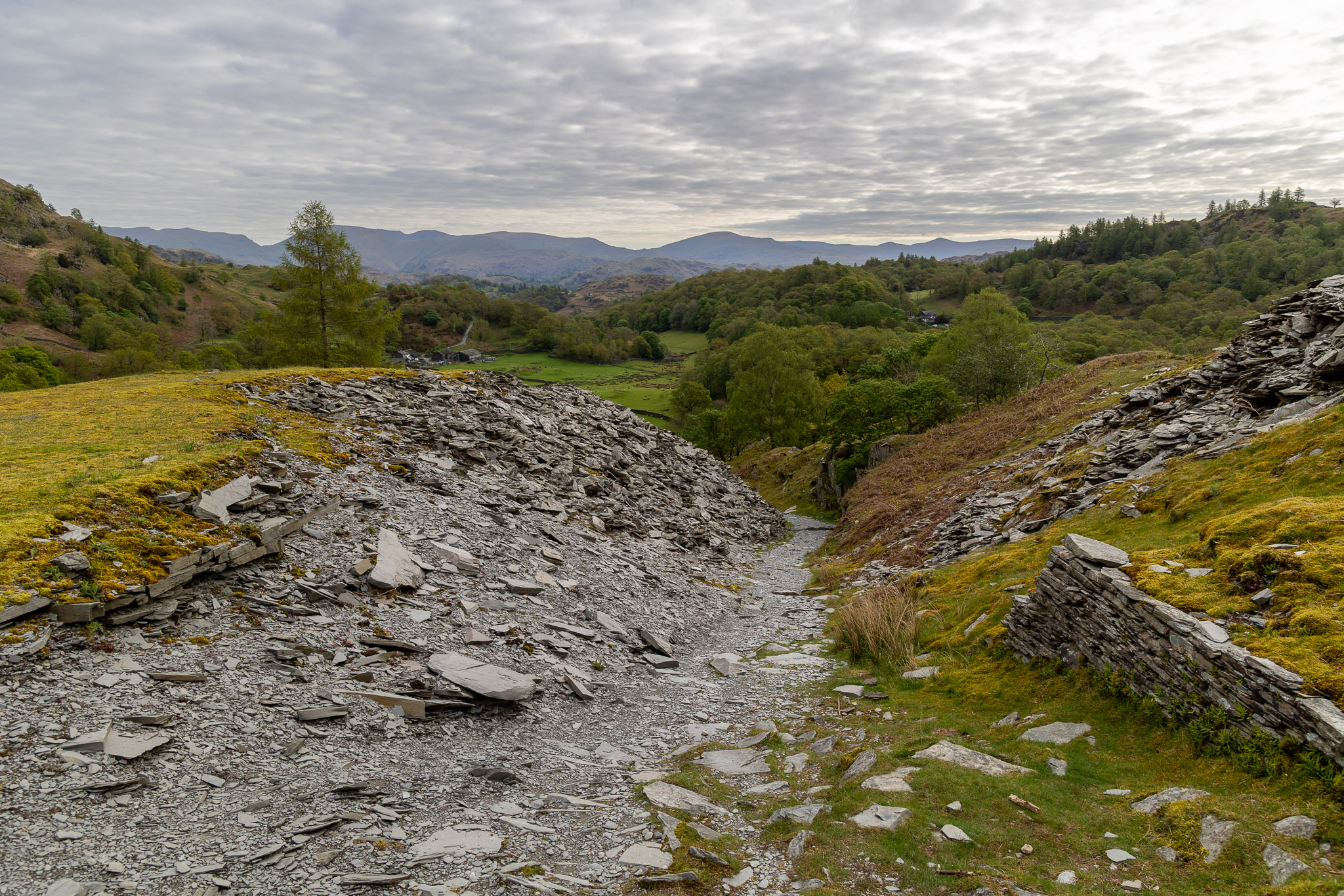
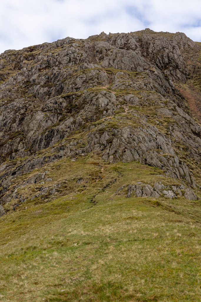
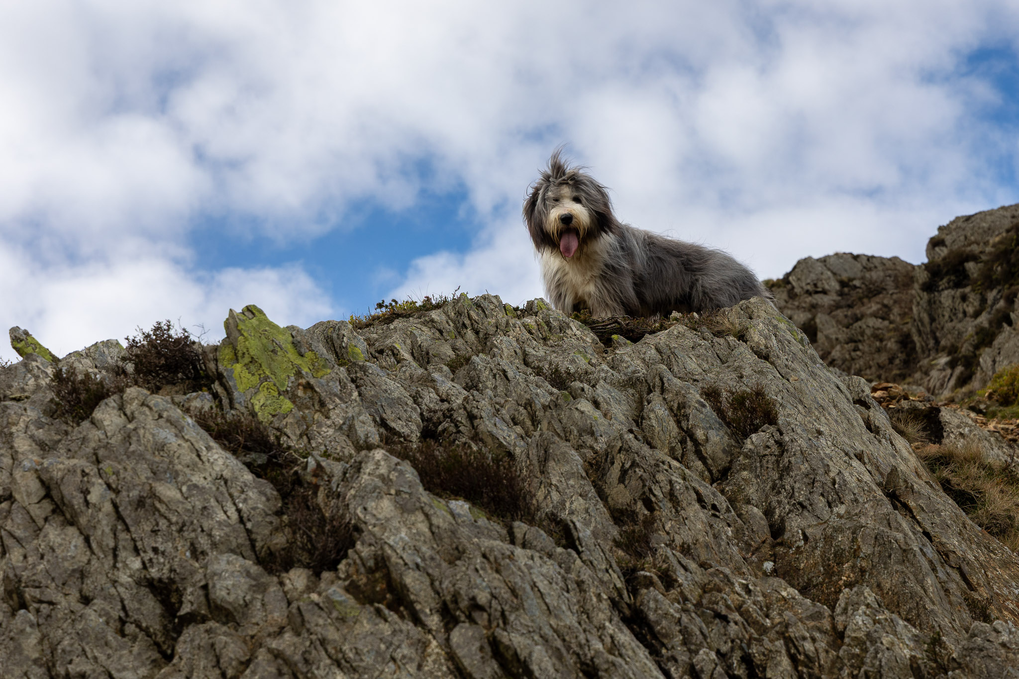
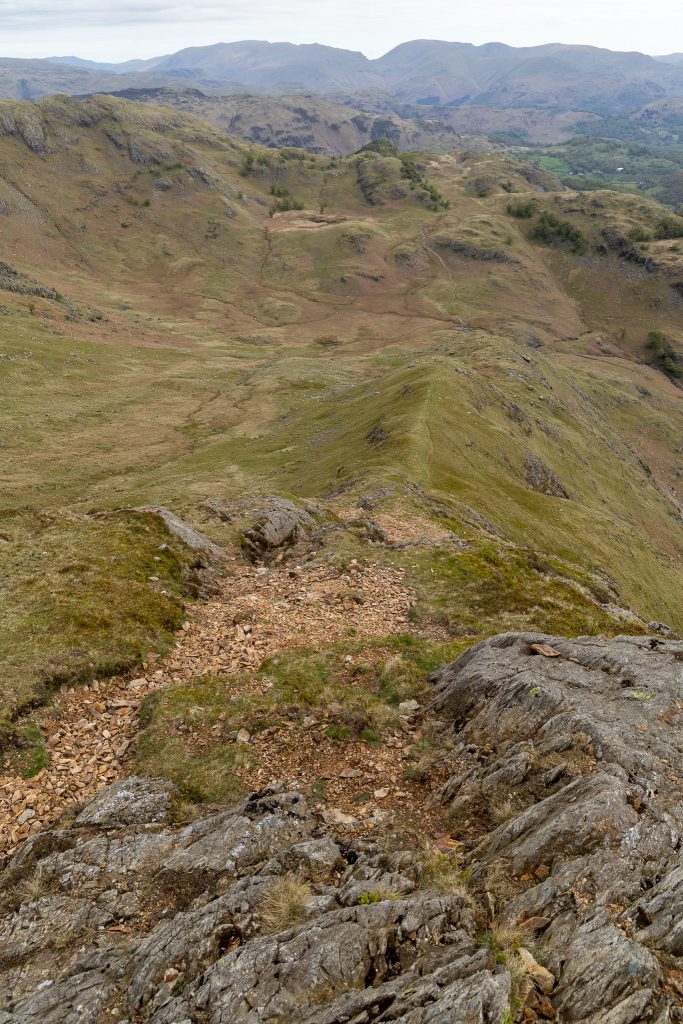
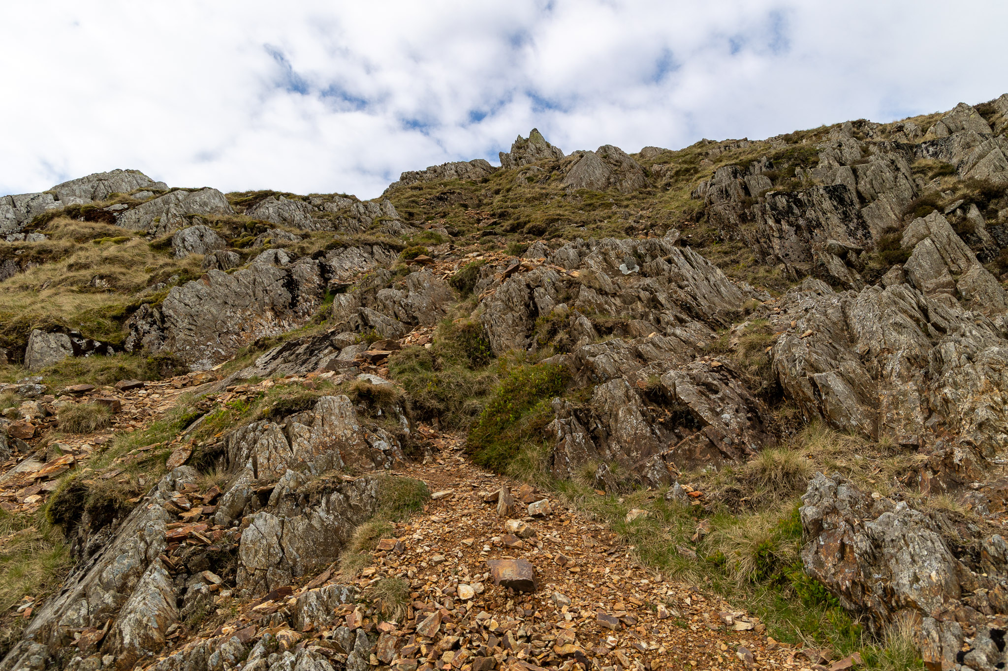
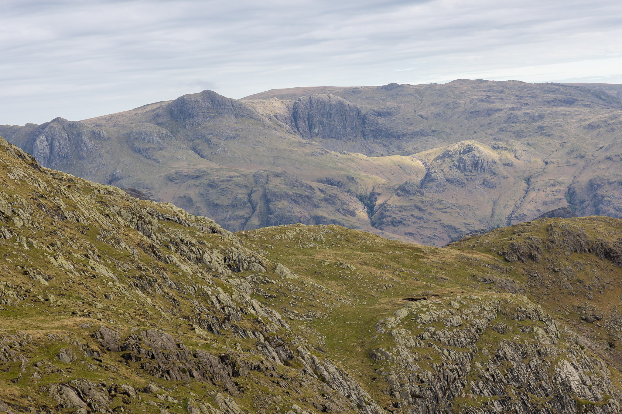
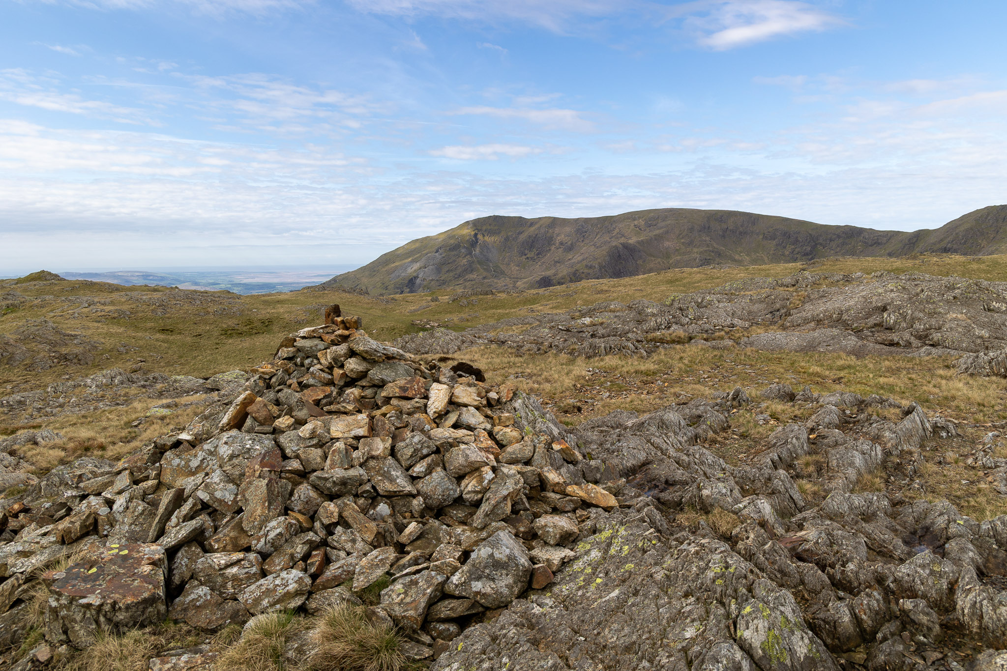
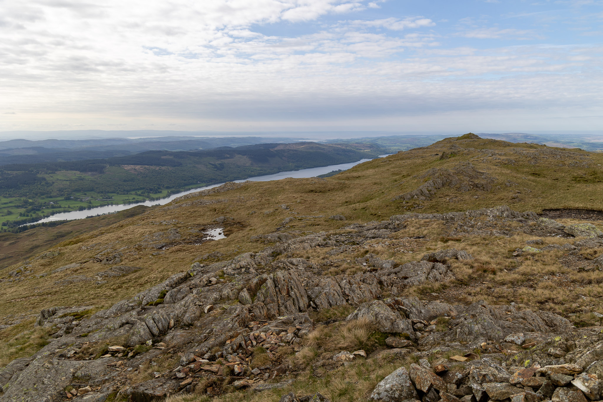
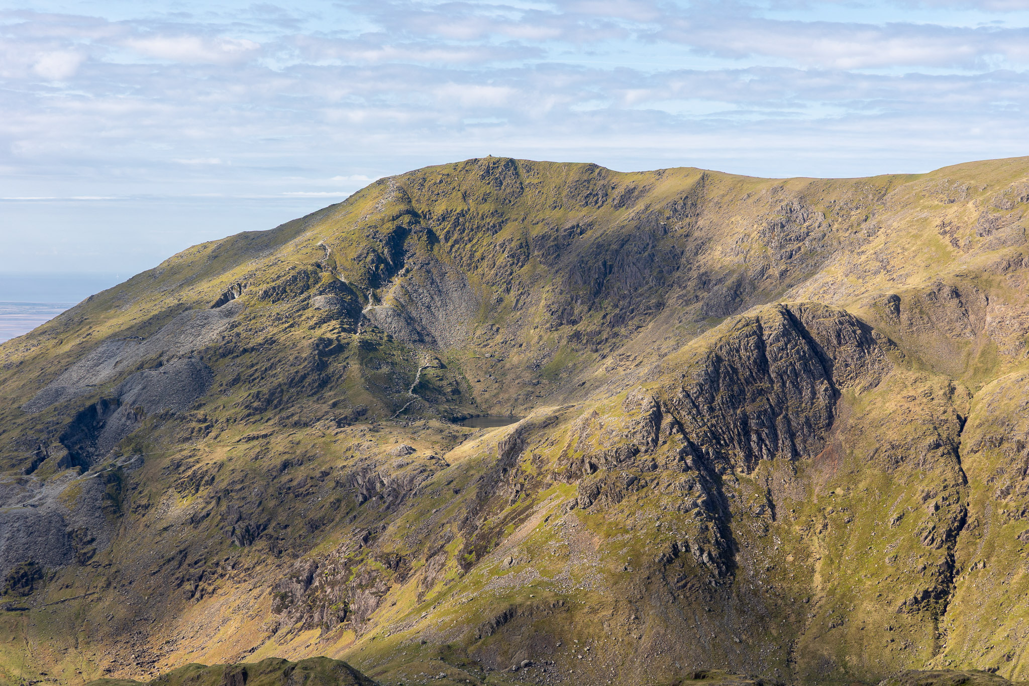
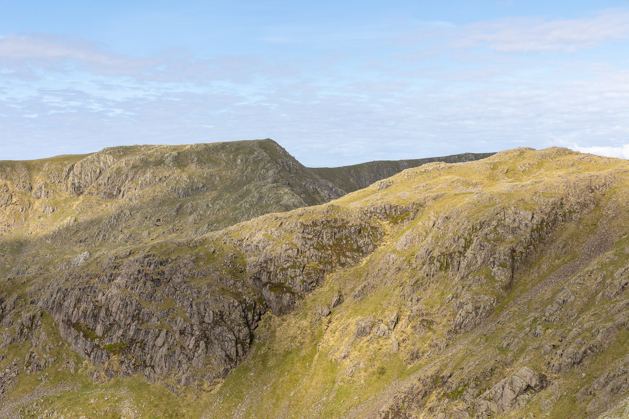
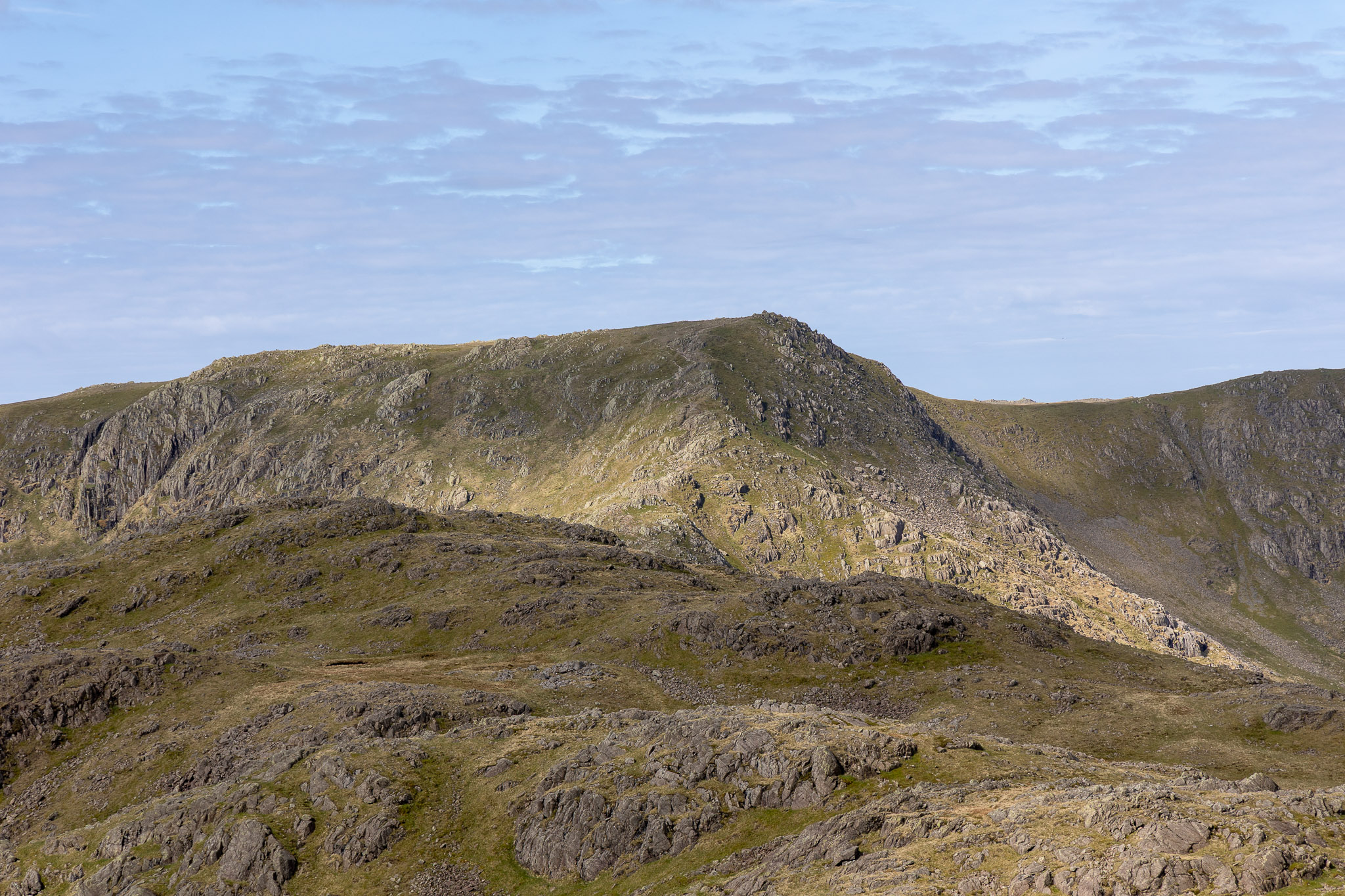
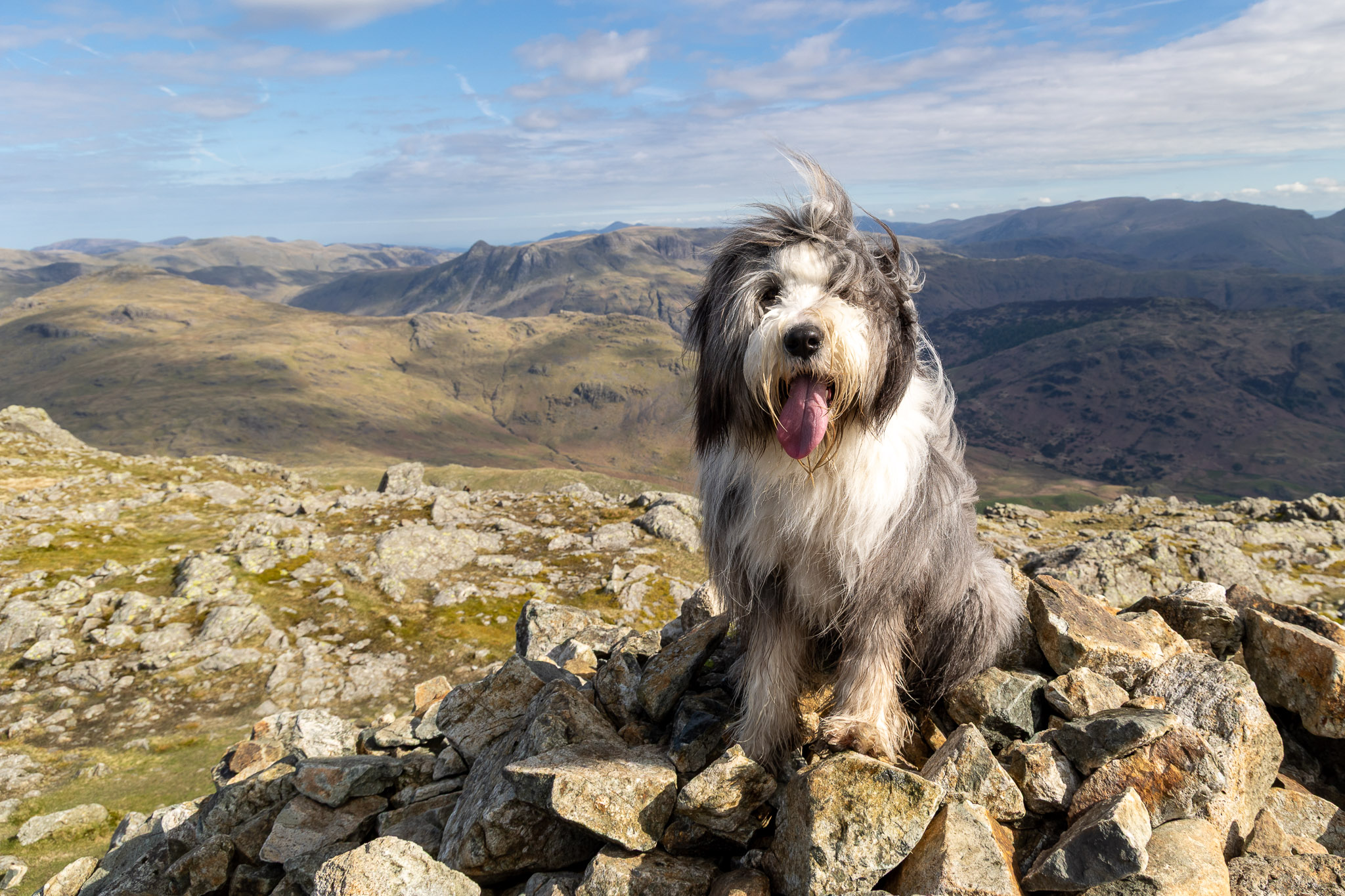
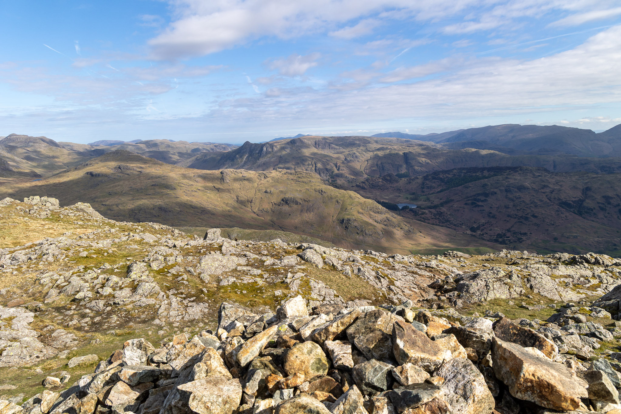
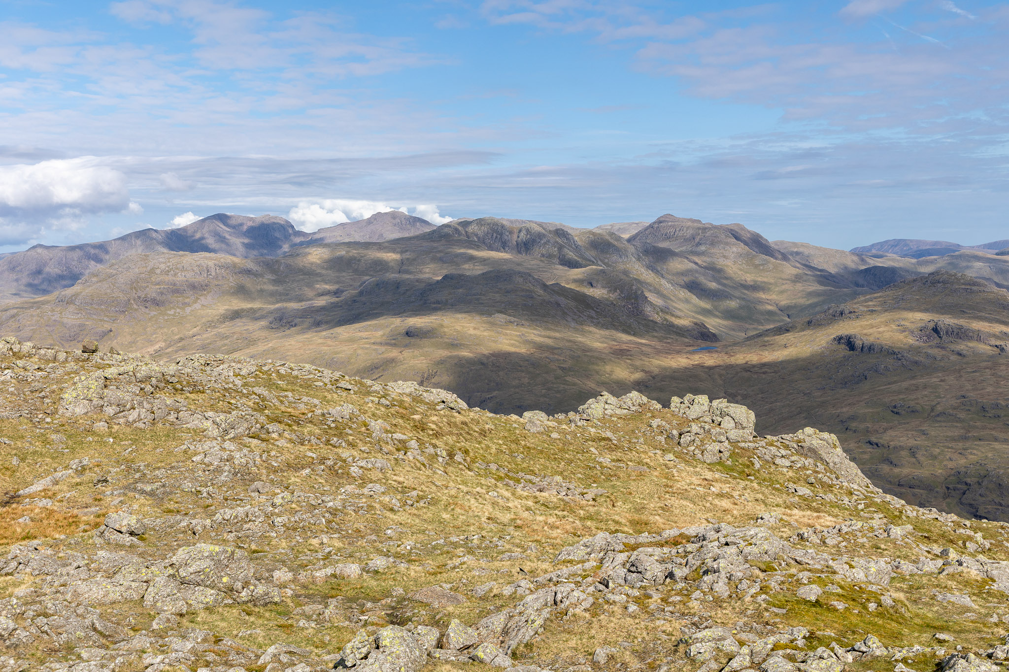
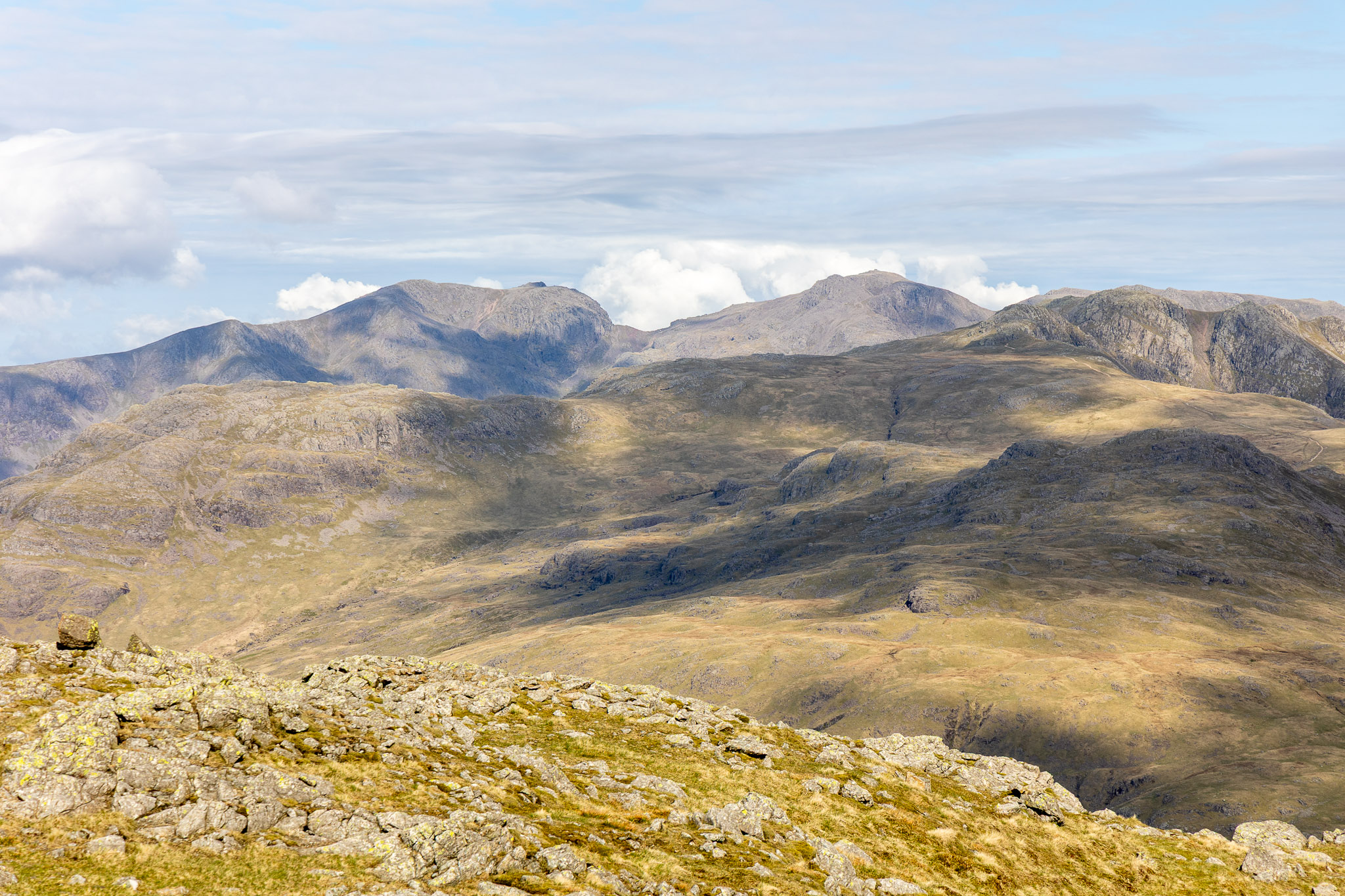
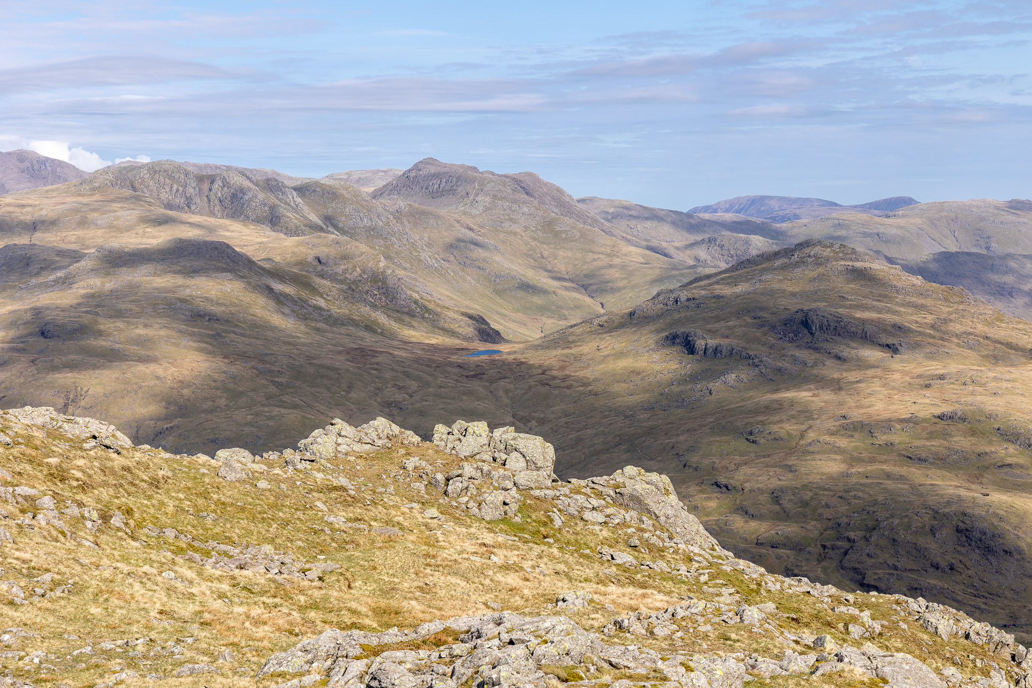
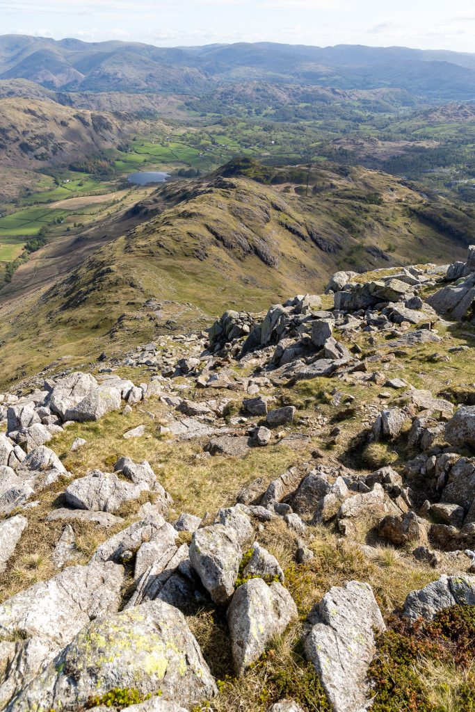
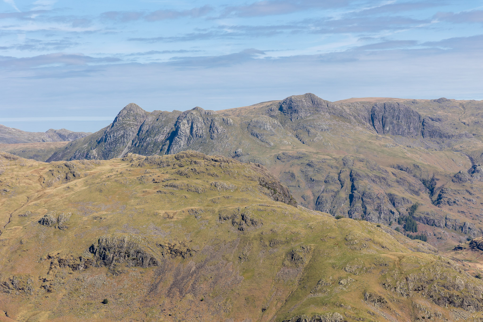
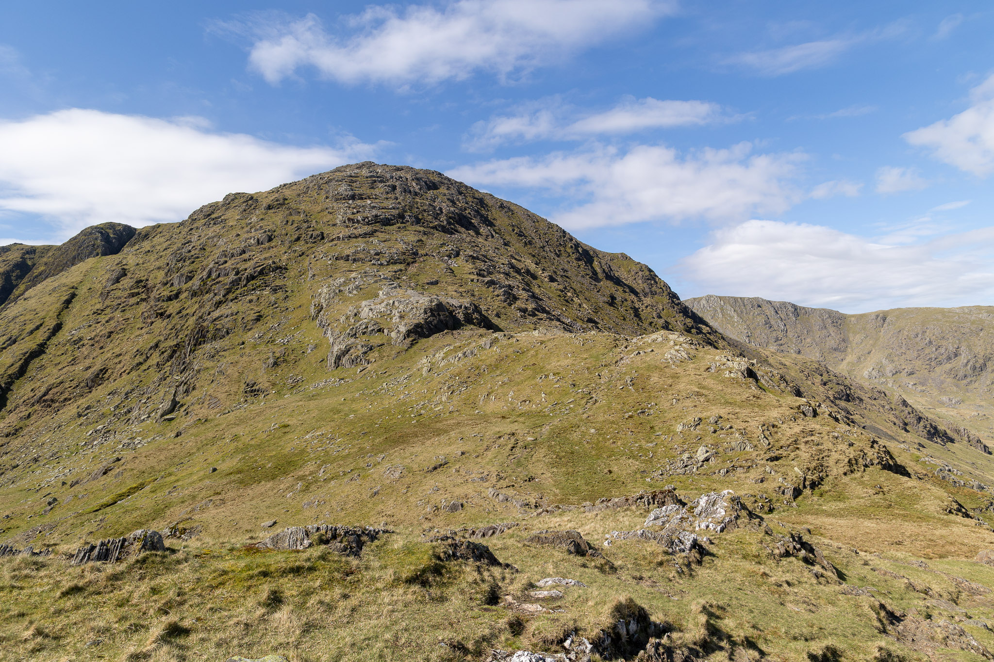
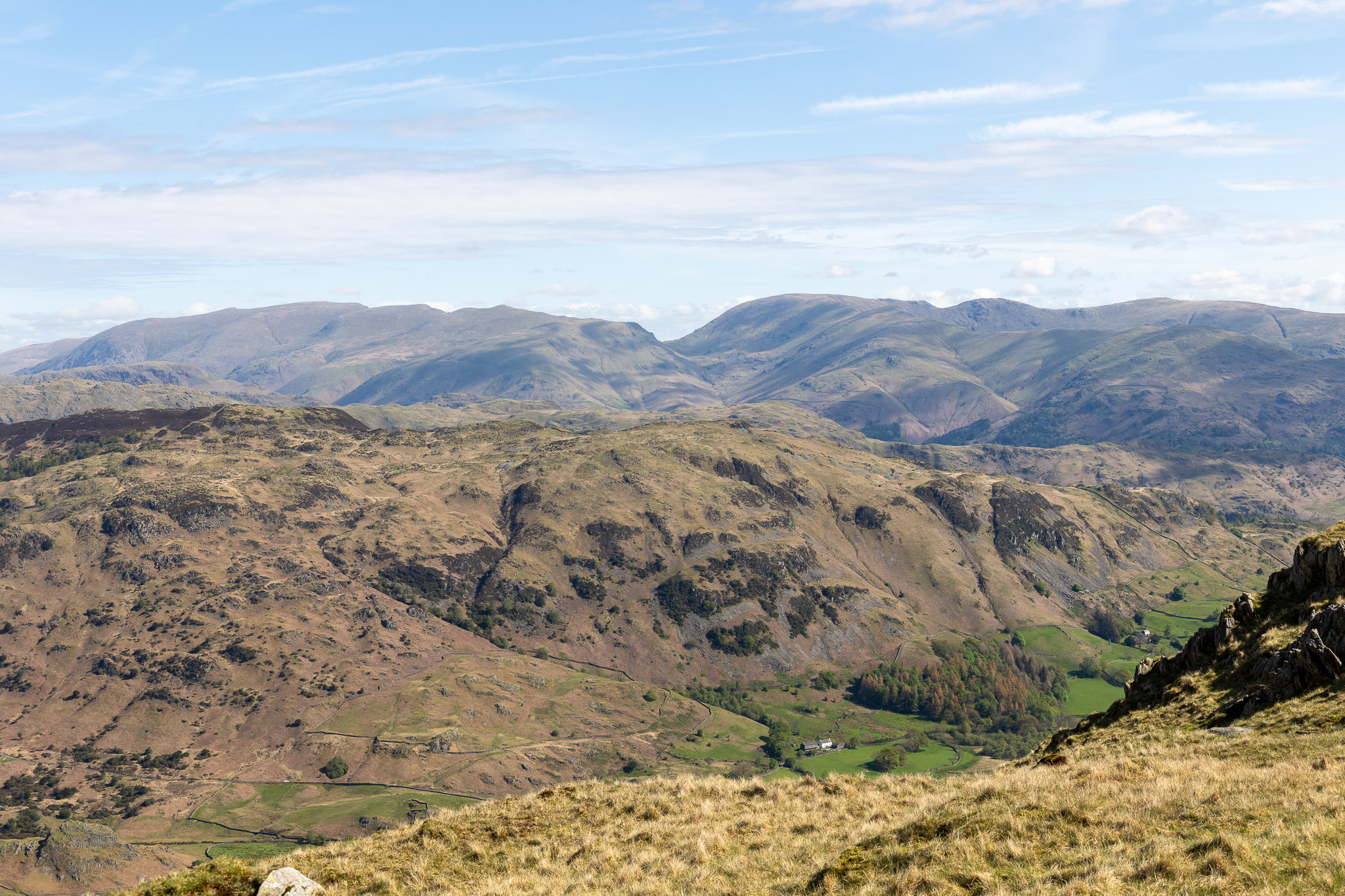
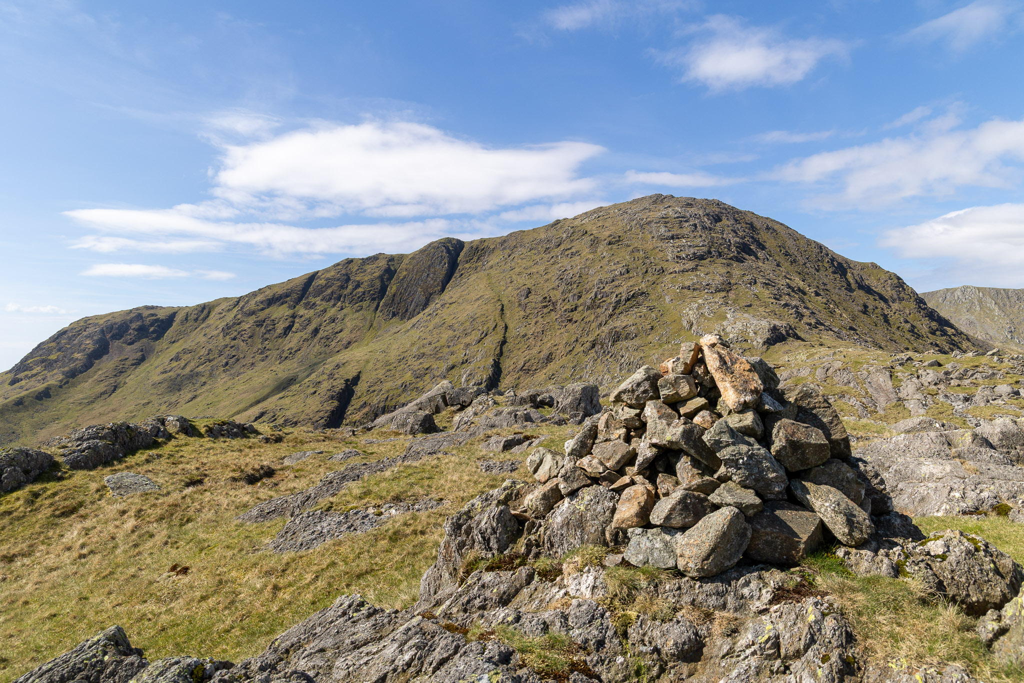
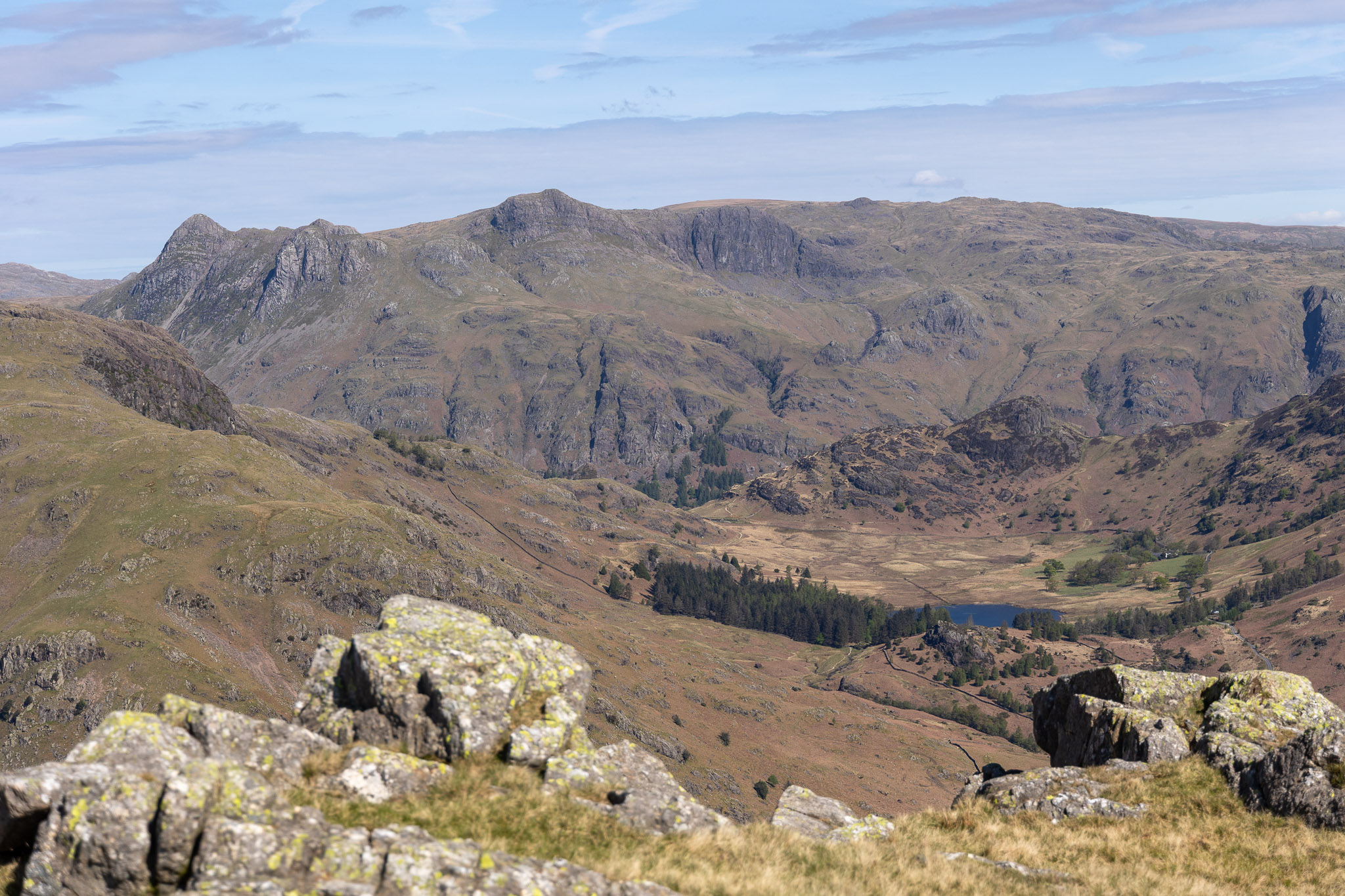
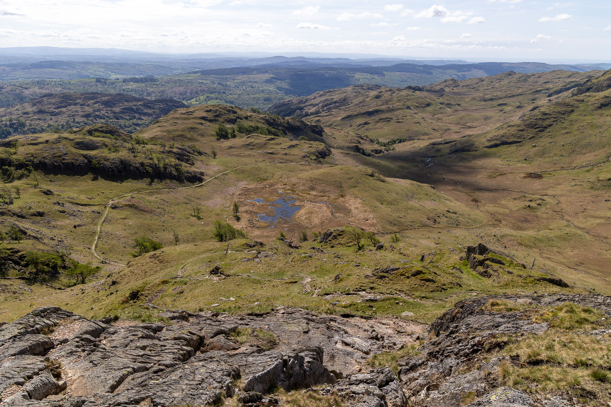
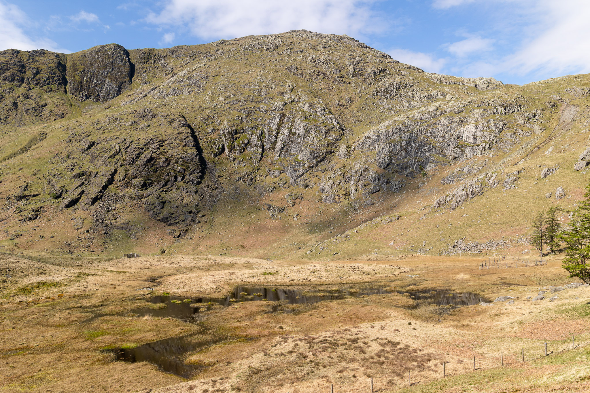
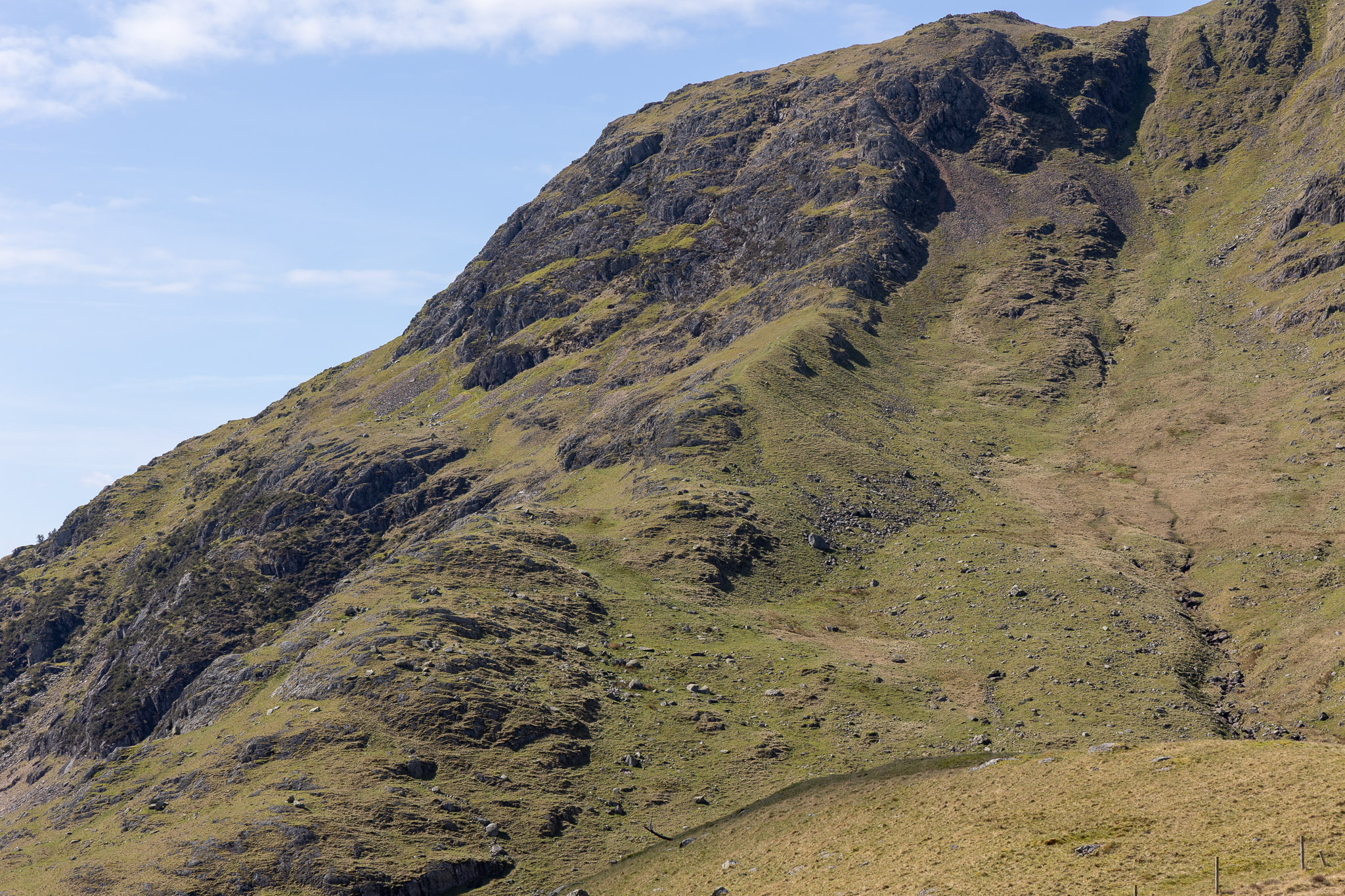
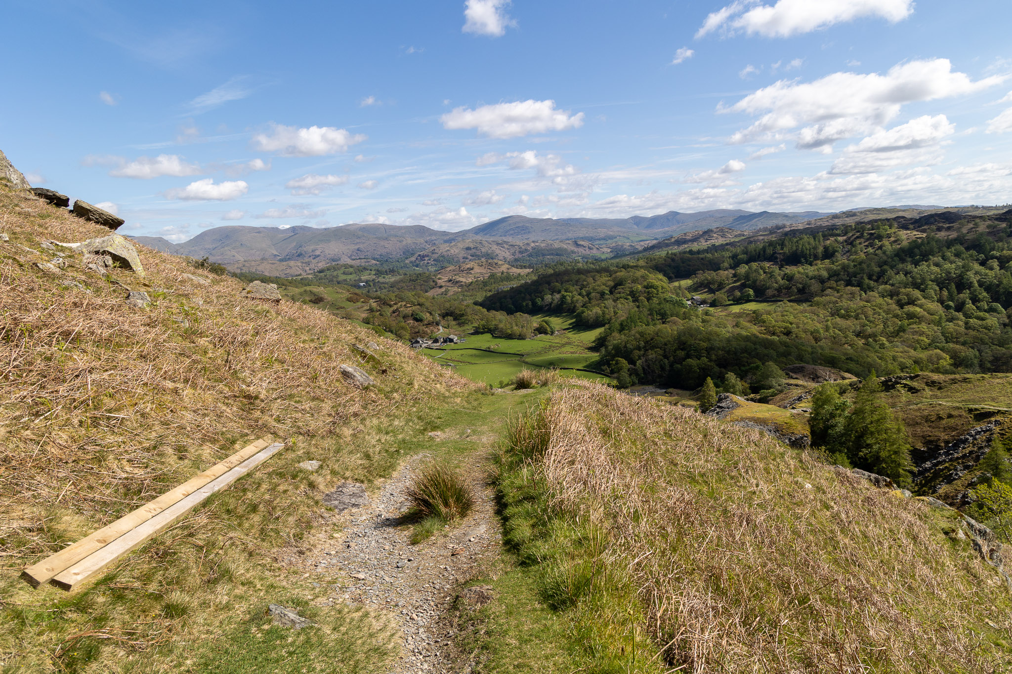
This area has a few new fences since the last time I walked this way. I must say the first hurdle from the car park (before the steep stone staircase) is not dog friendly at all with a high stile and fence to cross immediately – not even a chance for a warm up! This is looking back that way from the climb between the spoil heaps, the sky is grey and leaden but I am hopeful of the wether turning better.At the foot of Steel Edge after crossing Crook Beck, the route of ascent can be seen running centrally.Young Finlay is certainly a faster climber than me! Hurry up Dad!Looking back down the first section of Steel Edge.Almost at the top now, not far to go and the sky seems to be clearing.The scene of our last walk – Harrison Stickle and Pavey Ark with High Raise and Sergeant Man beyond.Well look at that! Blue skies above Coniston Old Man from the cairn on the top of Lad Stones, directly at the top of Steel Edge.Coniston Water from Lad Stones with Morecambe Bay beyond.Beautiful light on Coniston Old Man with Low Water nestled below.Swirl How and Prison Band beyond Black Sails.Close up on Prison Band, the way of descent (or ascent) from Swirl How.Wainwright #39 for Finlay is Wetherlam. Well done and straight onto the top of the cairn for a pose – that’s the way lad!What a view from Wetherlam today, this is looking north to the Langdale Pikes with Skiddaw and Blencathra visible in the distance.The Scafells, Crinkle Crags and Bowfell.Scafell, Mickledore and Scafell Pike beyond Little Stand and Cold Pike with ever changing dappled light.Red Tarn sits between Cold Pike and Pike o’Blisco (we did these relatively recently you may remember), beyond are the Crinkle Crags and Bowfell.The descent of Wetherlam Edge – it looks fearsome but it is not too bad if you are careful. Both edges climbed today are scrambles, albeit relatively easy ones. As I descended here and when I was slightly off piste, I heard a strange noise getting closer. Directly below me was a young lad wearing earphones and ‘singing’ happily along and completely oblivious to us even being there.Close up on the Langdale Pikes, everywhere was getting the sun now.Wetherlam Edge from below – it’s steeper than it looks from here.Looking across to the Helvellyn range, left and Fairfield, right.Wetherlam from Birk Fell.Blea Tarn and Side Pike down below, the Langdales beyond.Dry Cove Bottom and Tilberthwaite from the steep path descending from Birk Fell.Wetherlam across the boggy and not aptly named Dry Cove Moss.There is a good view of Steel Edge from this side.What a beautiful morning it has turned into.
2 thoughts on “Wetherlam”
Rod Hepplewhite
Now Then Sean, great photos of your walk but you had to go and show a photo of The Scafells, Crinkle Crags and Bowfell well clear of any cloud, they weren’t on BH Monday – HARRUMPH!!
I set off with a pal from the ODG just gone 8:15am with the intention of walking The Band, The Climbers’ Traverse, The Great Slab, Bowfell, Esk Pike, Esk Hause, Angle Tarn, Rossett Pike, Mickleden and back to the ODG …. except it didn’t quite turn out like that. We were in cloud by the time we passed White Stones on The Band, visibility c.10 metres. We missed the path to The Climbers’ Traverse and were too far up the main path before realising our mistake to turn back and try to find the path. On reaching the approach to Bowfell’s summit visibility was down to 7-8 metres. Executive decision, rather than carrying on to Esk Pike, seeing nothing, and possibly making another navigational error, we decided to cut our losses and descend The Great Slab, enjoy the jaunt along The Climbers’ Traverse and return to the ODG taking a lunch stop at White Stones. The cloud had clearly started to lift as we were out of the clag as we left The Climbers’ Traverse and dropped down to The Band and, of course, by the time we returned to Stool End Farm there was blue sky and white fluffy clouds above Crinkle Crags and Bowfell. Never mind, the fells will still be there for another (sunny) day.
Sound like a bit of bad luck and timing there Rod! Isn’t that always the way, the same as the weather always looks better ‘over there’ and you are often in cloud whilst everywhere else is clear? Such is life, hopefully that sunny day will be there next time! Sean