Height: 663 metres / 2175 feet Grid reference: NY 33074 21130
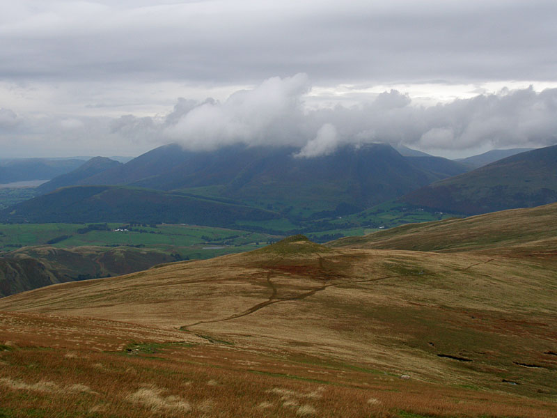
Skiddaw from Little Dodd, Calfhow Pike below.
Calfhow Pike with Skiddaw in the background
Height: 663 metres / 2175 feet Grid reference: NY 33074 21130
Skiddaw from Little Dodd, Calfhow Pike below.
Calfhow Pike with Skiddaw in the background
Start point: Stanah (NY 318 189)
Stanah – Sticks Pass – Stybarrow Dodd – Watson’s Dodd – Great Dodd – Calfhow Pike – Fornside – Stanah
Distance: 6.8 miles Total Ascent: 795 metres Time Taken: 3 hours
Weather: Mainly in mist, cold wind. 3°C
I think me and Casper were both chomping at the bit to get back on the fells today even though the weather seemed a bit murky. The climb to Sticks Pass gave a fleeting hope of a temperature inversion but the wind higher up ended that notion and the higher tops were walked coldly in the freezing fog.

The Dodds

Climbing to Sticks Pass from Stanah.

Falls on Stanah Gill.

The A591 below with High Rigg to the right.

Climbing higher.

A beam of sunlight on High Rigg as the mist descends into St John's in the Vale with Dodd in the distance.

Suddenly, blue skies approaching Sticks Pass.

Looking over into Glencoyne and the last of the clear weather. The wind was picking up now ruining any chance of an inversion and it was back into the freezing fog for the rest of the walk.

Winter sun on the climb to Stybarrow Dodd.

Casper gives the eye with a frozen beard and face fur.

The summit of Stybarrow Dodd.

Watson's Dodd.

The wind shelter on Great Dodd.

A brief clearing in the mist heading for Calfhow Pike.

Iced up Casper.

From Calfhow Pike I took the steep descent into St John's in the Vale via Fornside, below.
Start point: Dockray, adjacent to the bridge. (NY 393 215)
Dockray – Bracken How (492) – Round How (493) – Common Fell – Watermillock Common –Swineside Knott – Brown Hills – Birkett Fell – Hart Side – White Stones on Green Side – Stybarrow Dodd – Watson’s Dodd – Great Dodd – Little Dodd (St John’s Common) (494) – Calfhow Pike (495) –Clough Head (496) – Dockray
Distance: 13.4 miles Total Ascent: 1156 metres Time Taken: 4 hours 45 minutes
Weather: Overcast, rain later. 14oC.
Another grey day today with just the odd glimmer of sunshine and heavy rain at the end. This is quite a long circuit but relatively easy going across boggy grass. I visited a couple of small tops at the beginning of the walk that I had never been to before which offered great views over Ullswater with little effort. It was very quiet up there though, and we never saw a single soul all day.


About the only blue sky of the day over Great Mell Fell, from Bracken How.

Common Fell from Round How. The bracken is turning brown now.

Sunrays over Ullswater looking to Place Fell.

Great Dodd from Common Fell.

Casper having a rest on Swineside Knott.

Looking to the head of Ullswater.

Brown Hills from Watermillock Common.

Ullswater.

Angus and Casper above Ullswater.

Looking over to Place Fell.

Sheffield Pike.

Catstycam appears from the mist.

You can't miss Birkett Fell with its name plaque set in the cairn. Named after Baron Birkett, KC MP, an early advocate of National Parks and a fierce opposer to Manchester Corporation's attempts to take water from Ullswater. He also went to the same school as me (though he wasn't in my class, I hasten to add!).

Angus on Hart Side, Stybarrow Dodd behind.

Looking down Stanah Gill on Stybarrow Dodd to Thirlmere.

Great Dodd from Stybarrow Dodd.

High Rigg and St John's in the Vale from Watson's Dodd. Beyond is Keswick, Bassenthwaite Lake, Dodd and Skiddaw (in mist).

Thirlmere from Watson's Dodd.

The wind was howling across Watson's Dodd.

A retrospective view from Great Dodd - in the distance is the pointed Catstycam with Helvellyn in cloud. Centre left is Stybarrow Dodd with Watson's Dodd to the right.

Skiddaw from Little Dodd. Below is the next objective, the spur of Calfhow Pike.

Angus has spotted the rain coming on our final summit, Clough Head - the end of the Helvellyn massif.

Blencathra from Clough Head. Now it was time to put on the jacket and put the camera away for a very damp descent to the Old Coach Road and a wet trudge back to Dockray.
Wanthwaite – Threlkeld Knotts – Clough Head (113) – Calfhow Pike – Little Dodd (St John’s Common) – Great Dodd (114) – Watson’s Dodd (115) – Great Dodd – Randerside – Mariel Bridge – Old Coach Road – Wanthwaite

Skiddaw from Wanthwaite, the start of the walk.

High Rigg from the climb to Threlkeld Knotts. The colours have just started to turn autumnal.

Skiddaw from Threlkeld Knotts summit.

Blencathra from the summit of Clough Head.

Great Dodd from the summit of Clough Head.

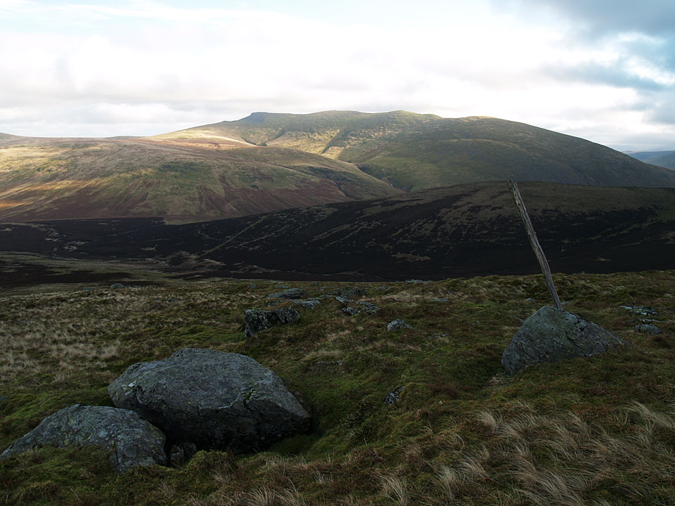
Calfhow Pike from the descent of Clough Head.

Thirlmere from Calfhow Pike, High Seat in the far distance.

Great Dodd summit.

Watson's Dodd from Great Dodd.

Skiddaw and Blencathra from Watson's Dodd summit.

The summit of Randerside on the descent of Great Dodd, Catstycam and Helvellyn are in the distance.

The old coach road crossing the Mosedale Beck, Blencathra is in the distance.