Height: 290 metres / 951 feet Grid reference: NY 24934 15937 Category: The North Western Fells
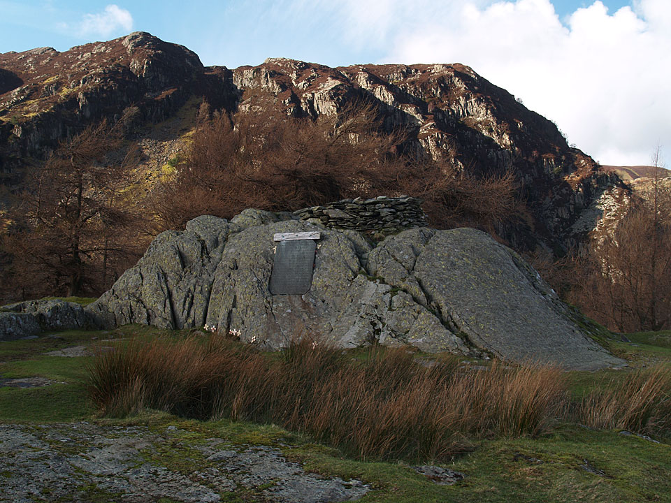
The summit of Castle Crag
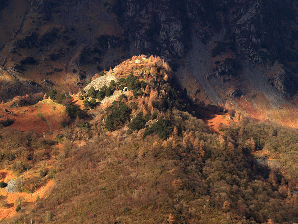
Castle Crag across Borrowdale
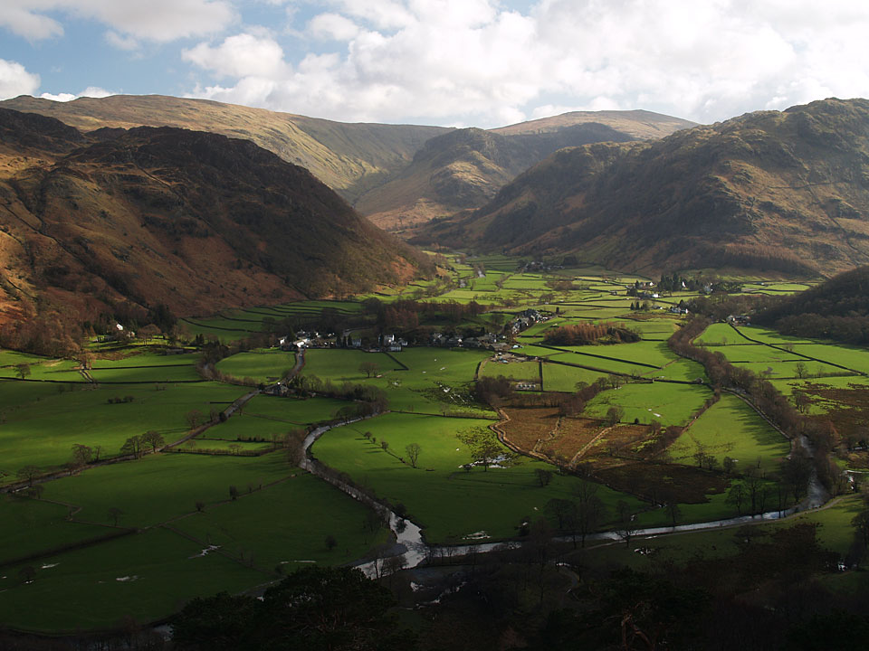
Borrowdale from Castle Crag
Height: 290 metres / 951 feet Grid reference: NY 24934 15937 Category: The North Western Fells
The summit of Castle Crag
Castle Crag across Borrowdale
Borrowdale from Castle Crag
Start point: Grange (NY 252 175)
Grange – Allerdale Ramble – Castle Crag – High Hows Wood – Low Hows Wood – Grange
Distance: 3.1 miles Total Ascent: 270 metres Time Taken: 1 hour 10 minutes Start Time: 11:00
Weather: Light rain. 10C
The extreme wet weather made an unwelcome return again yesterday and many roads in the area were flooded with flood warnings also being given for many areas in Cumbria. I visited both Love the Lakes shops this morning and was good to see that all the roads were open and largely clear of water. There was some localised flooding and I took some photos of these areas on my journey. Eventually I ended up in Borrowdale for a short walk up to the lowest Wainwright of them all, Castle Crag.
A few photos taken on the way to Love the Lakes, Bowness…

Castle Crag route map.

The River Leven at Backbarrow, a raging torrent with spray everywhere.

The Swan Hotel at Newby Bridge and the water is lapping at the terrace.

Looking the other ay from the same place. The water has risen above the bank on the grassed area to the left and that boat on the right has broken its mooring.

The almost inevitable flooding at Fell Foot cafe. The water isn't as deep as it has been the last couple of years but I think the tea room is flooded.

This building certainly is.

So is the barbeque area.

Fell Foot path.

Shrubs and trees partially submerged.

Ticket offices under water in Bowness.


Windermere lapping at the promenade.

A swan looks for the jetty. - - - At least the roads to Keswick were clear enough with most of yesterday's standing water now gone.

The River Derwent looking towards Grange.

Beck crossing.

King's How across the river.

Crossing Gowder Dub.

Following the Allerdale Ramble adjacent to Broadslack Gill.

Looking back along the path from the start of the climb to Castle Crag.

Castle Crag ahead through the larches and spoil heaps.

Dougal (in camouflage!) finds the zig zags through the slate spoil.

Looking across the colourful trees towards Dale Head.

Looking into Borrowdale across Wainwrights Scots Pines.

Here comes the rain! Derwent Water from the top of Castle Crag.

King's How.

Big Casper and tiny Dougal.

The standing slate stones below the summit.

The Borrowdale Fells from Castle Crag.

Dougal and a spiral masterpiece.

High Hows Wood.

Back to the River Derwent.

Down at the southern end of Derwent Water, there is no way to get to the footbridge today.

Derwent Water flood.
Start point: Rosthwaite village hall (NY 258 149)
Rosthwaite – Dock Tarn – Great Crag – Grange Fell (Brund Fell) – King’s How – Grange – Castle Crag – Rosthwaite
Distance: 7.5 miles Total Ascent: 780 metres Time Taken: 4 hours
Weather: Drizzle turning to sunshine. 10oC.
Today was certainly a day of two halves for this walk around Wainwright’s ‘loveliest square mile in Lakeland’ – dull and drizzling when we set off eventually ending up as sunshine and blue skies for a lovely Spring day ending.


Setting off in the drizzle alongside Stonethwaite Beck.

Following the Cumbria Way past Stonethwaite with Eagle Crag and Rosthwaite Fell ahead.

Eagle Crag and Sergeants Crag from the steep climb to Great Crag through the woods.

Cascades on Willygrass Gill.

Dock Tarn.

Borrowdale from Great Crag.

Castle Crag across Borrowdale.

A close-up version.

Heading for Grange Fell - Brund Fell, the summit, is to the right and King's How is to the left.

Watendlath and Watendlath Tarn, High Tove beyond.

High Seat beyond Joppelty How from Brund Fell.

Borrowdale from Brund Fell.

Heading for King's How.

Rosthwaite Fell, Glaramara and Thornythwaite Fell - the Borrowdale Fells. Pike o' Stickle is visible on the distant left.

Derwent Water from King's How with Skiddaw covered in cloud - not for long though as there was a big change in the weather for the final part of the walk.

Angus on King's How. This is his birthday treat, he is 11 on the 9th March - Happy Birthday Angus!

Looks like Casper has been rolling around in the grass.

Looking across to the crags on the eastern face of High Spy.

Heading into Grange with the sun shining now.

The River Derwent.

It's all sparkly sunshine on the way to Castle Crag.

Castle Crag from the south.

The spoil heap on the way to Castle Crag summit; Angus has found the path.

Skiddaw and Derwent Water from Castle Crag.

The summit of Castle Crag.

Looking across to King's How.

Blencathra.

Helvellyn Lower Man and Helvellyn - looks like there are a couple of people on the top of Helvellyn!

The Jaws of Borrowdale - it's a different day now.

Again, with more sky.

...and even more sky!

Looking back to Castle Crag.
Start point: Rosthwaite (NY 258 149)
Rosthwaite – Dock Tarn – Great Crag (371) – Grange Fell (Brund Fell) (372) – King’s How (373) – Bowder Stone – Grange – Castle Crag – Rosthwaite
Distance: 9.3 miles Total Ascent: 990 metres Time Taken: 3 hours 20 minutes
Weather: A lovely summer’s day, 21°C.
Today’s walk takes place in ‘the loveliest square mile in Lakeland’ according to Wainwright, in Borrowdale up to Grange Fell and across the valley to Castle Crag (incidentally the lowest Wainwright and the only one less than 1000′). It certainly was lovely today as the sun shone and it was very warm with the merest breeze; a real English summer’s day.

Grange Fell route map.

Borrowdale from the path between Rosthwaite and Watendlath.

Watendlath and Watendlath Tarn, High Seat behind.

Great Gable, left, out of the clouds now with High Crag to the right from Great Crag.

Grange Fell from Great Crag.

Angus atop Brund Fell.

Looking across Borrowdale to Castle Crag - the lower prominence with trees on in the foreground. Behind are Dale Head and High Spy.

The Skiddaw fells and Derwent Water from King's How.

The Bowder Stone.

King's How from Castle Crag across Borrowdale.

Rosthwaite and the Jaws of Borrowdale from Castle Crag.

Okay, here's the colour version of the Derwent Water photo...
Start point: Rosthwaite (NY 258 149)
Rosthwaite – Great Crag (211) – Grange Fell (212) (Brund Fell) – King’s How – Grange – Castle Crag (213) – Rosthwaite
Weather: Generally dull with some rain and sunshine.


Grange Fell from Rosthwaite.

Approaching Great Crag.

Low Saddle, High Saddle and Ullscarf from Great Crag summit. Dock Tarn is visible in the centre.

Watendlath Tarn and High Seat from Great Crags Northern cairn.

Brund Fell.

Derwent Water and Skiddaw from Brund Fell, the summit of Grange Fell.

Maiden Moor behind King's How.

Derwent Water and Skiddaw from King's How summit.

Castle Crag and Dale Head from the descent of Grange Fell.

NT sign and Grange Bridge.


The Holy Trinity church, Grange and Broadslack Gill.


Glaramara, Seathwaite Fell and Green Gable from Castle Crag. The Scots Pines are mentioned by AW.

Borrowdale from Castle Crag summit.

Looking along the River Derwent to Derwent Water from Castle Crag.

Borrowdale, Ullscarf and Greenup Edge.

New Bridge near Rosthwaite; Castle Crag, Skiddaw and King's How.
