Striding Edge

A photo diary of Lake District fell walks

  • Walks
  • Fells
    • Wainwrights
      • Eastern Fells
      • Far Eastern Fells
      • Central Fells
      • Southern Fells
      • Northern Fells
      • North Western Fells
      • Western Fells
      • Outlying Fells
    • Birketts
  • Dogs
  • Love The Lakes
  • Contact

Clough Head

Height: 726 metres / 2382 feet Grid reference: NY 33393 22541 Category: The Eastern Fells
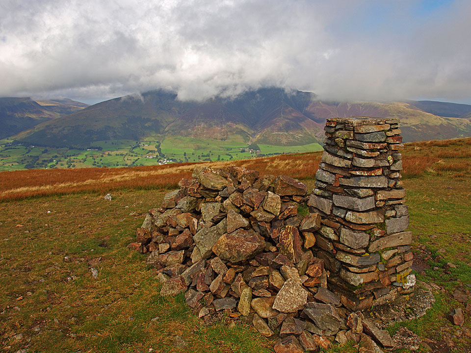
Blencathra from Clough Head

Blencathra from Clough Head

The Business Meeting, Clough Head

Walked on 26/09/2012

Start point: Wanthwaite (NY 316 232)

1Wanthwaite – Wanthwaite Bank – Buck Castle – Jim’s Fold – Clough Head – Old Coach Road – Wanthwaite 

Distance: 4.4 miles     Total Ascent: 595 metres     Time Taken: 2 hours 30 minutes     Start Time: 09:50

Weather: Changeable but dry. 12°C

The Business Meeting? Well today was a bit of that, taking a walk with Clive Hutchby to discuss various things up to Clough Head. There were some good sunny spells but it was really quite cold on the top with a strong breeze blowing.
Clough Head.JPG

P9265868.jpg

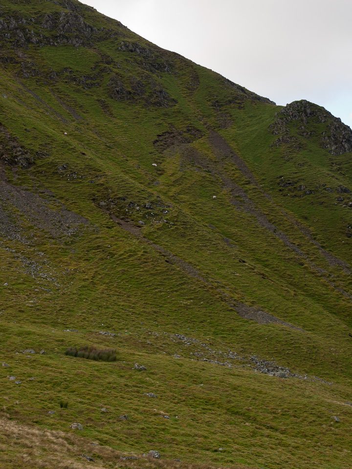
Clough Head from Wanthwaite, the route of ascent is from left to right.

P9265871.jpg

Looks promising over Skiddaw.

P9265873.jpg

Leaving the Old Coach Road to climb through the old quarries.

P9265880.jpg

Through the quarries looking to Clough Head.

P9265889.jpg

Wanthwaite Bank.

P9265892_stitch.jpg

Skiddaw and Blencathra.

P9265893.jpg

Getting into the groove.

P9265895.jpg

Looking back down.

P9265900.jpg

Bright and sunny towards Skiddaw.

P9265902.jpg

St John's in the Vale and High Rigg.

P9265904.jpg

The light makes it look like a painting.

P9265909.jpg

Climbing higher.

P9265911.jpg

I took Wainwright's intermediate 'sporting' route (Buck Castle on the OS map), the line of the path can be seen in this photo. Clive took the easier and more usual grass slope route to the top.

P9265920.jpg

Looking beyond Threlkeld Knotts from the climb to Gategill Fell, Hall's Fell and Doddick Fell on Blencathra.

P9265921.jpg

On Buck Castle looking to Wainwright's amphitheatre.

P9265922.jpg

A long way down from the top of the rock tower of Buck Castle.

P9265924.jpg

The sheep show the path across Wanthwaite Crags.

P9265929.jpg

The view towards Keswick from high above Wanthwaite.

P9265931.jpg

High Rigg summit in the sunshine, layers of fells beyond.

P9265934.jpg

Looking down from Wanthwaite Crags.

P9265941.jpg

Across Derwent Water to the Coledale fells.

P9265946.jpg

Sunshine and a cold wind on the climb to Clough Head summit.

P9265950_stitch.jpg

A Blencathra panoramic...and Dougal.

P9265957.jpg

The Vale of Keswick from Clough Head.

P9265959.jpg

Clive, propping up the trig column.

P9265966.jpg

The Coiled Springs.

P9265967.jpg

Looking for a way down.

P9265976_stitch.jpg

Threlkeld Knotts and beyond from the descent.

P9265981.jpg

Looking back to Clough Head from the Old Coach Road.

Clough Head via Fisher’s Wife Rake

Walked on 17/08/2011

Start point: Wanthwaite (NY 316 232)

Wanthwaite – Fisher’s Wife’s Rake – Jim’s Fold – Clough Head – Red Screes – Threlkeld Knotts – Wanthwaite 

Distance: 3.5 miles     Total Ascent: 601 metres     Time Taken: 2 hours 30 minutes     Start Time: 12:25

Weather: Sunny and warm. 15ºC

It was a dogless walk today as I took the opportunity to get up to Clough Head in sunny weather with Robin. We ascended by the steep Fisher’s Wife’s Rake and descended by the even steeper Red Screes north face of Clough Head. Looking around, there were a few fells that were in and out of cloud and I think we caught best part of the day as well.

Clough Head

Clough Head route map.

17.08.11-003

First view of Skiddaw and Lonscale Fell from the Old Coach Road.

17.08.11-005

There were some big clouds to the south, here looking into St. John's in the Vale.

17.08.11-007

High Rigg.

17.08.11-009

Following the wall to Fisher's Wife's Rake beneath Wanthwaite Crags.

17.08.11-013

Skiddaw and Blencathra from the foot of Fisher's Wife's Rake.

17.08.11-018

Climbing the rake.

17.08.11-024

The key to finding the rake is the single Rowan tree at the bottom of these crags.

17.08.11-032

The view down Fisher's Wife's Rake - it's a steep climb but not as bad as it looks on this photo as the path crosses from right to left across this scree run.

17.08.11-034

A panoramic view from the rake.

17.08.11-043

The view from the top of the rake.

17.08.11-046

Skiddaw and Blencathra.

17.08.11-049

High Rigg and layers of fells beyond.

17.08.11-051

Standing on the edge.

17.08.11-057

That's one way to get down quick!

17.08.11-063

Thirlmere across Sandbed Gill with the distant Scafells in cloud.

17.08.11-065

Jim's Fold.

17.08.11-070

Sky.

17.08.11-073

Fells.

17.08.11-086

Skiddaw from Clough Head, back in sunshine now.

17.08.11-087

A mono view of the Vale of Keswick.

17.08.11-093

Robin does a Wainwright (Clough Head 7).

17.08.11-095

The Skiddaw massif.

17.08.11-096

Great Mell Fell.

17.08.11-098

Blencathra.

17.08.11-100

A glimpse of Derwent Water and Bassenthwaite Lake, Tewet Tarn in the centre.

17.08.11-104

At the top of the steep descent.

17.08.11-118

Looking back, it seems almost impossible to descend the north face of Clough Head but we came straight down the centre in this photo.

17.08.11-121

Threlkeld Knotts summit.

17.08.11-128

Hall's Fell Ridge.

17.08.11-132

The more substantial cairn further north of Threlkeld Knotts. Much later, on the way home...

17.08.11-143

...a beautiful sunset over Windermere.

Clough Head

Walked on 07/09/2009

Start point: Wanthwaite (NY 316 232)

Wanthwaite – Fisher’s Wife’s Rake – Jim’s Fold – Clough Head – Red Screes – Wanthwaite

Distance: 3.7 miles     Total Ascent: 592 metres     Time Taken: 2 hours

Weather: Showers and sunny spells. 17C.

Fisher’s Wife’s Rake is one of those walks I have had on the agenda for a while and it certainly is the direct route to Clough Head, although it wasn’t as severe as I was expecting. There were showers at the start of the climb up the rake but the clouds miraculously cleared towards the end of the walk, reminding me that it is still late summer yet.


Clough Head

Clough Head route map.

07.09.09-013

Skiddaw and Lonscale Fell from the Old Coach Road.

07.09.09-017

Wanthwaite Crags across the disused quarries. Fisher's Wife's Rake is the grassy gully to the right of the crags.

07.09.09-022

Crossing the wall at the ladder stile.

07.09.09-026

The Skiddaw massif from the path following the wall beneath Wanthwaite Crags.

07.09.09-029

High Rigg and the central fells from the foot of Fisher's Wife's Rake.

07.09.09-032

Climbing the rake in the rain.

07.09.09-039

Casper does a double take - yes, up there!

07.09.09-042

Blencathra through the Rowan Tree.

07.09.09-048

Looking down Fisher's Wife's Rake.

07.09.09-053

A sunny interlude on High Rigg.

07.09.09-056

Looking down Fisher's Wife's Rake from the top.

07.09.09-060

The north-western fells.

07.09.09-065

A rainbow over St John's in the Vale.

07.09.09-068

A glimpse of Thirlmere from Sandbed Gill.

07.09.09-075

Jim's Fold.

07.09.09-078

Great How and Thirlmere, Ullscarf beyond.

07.09.09-080

Blencathra from Clough Head.

07.09.09-091

Striking a familiar pose...

img015

07.09.09-108

The Vale of Keswick.

07.09.09-109

Cloud lifting from Skiddaw.

07.09.09-112

The start of the shelf path on Red Screes.

07.09.09-123

Suddenly it is summer again!

07.09.09-127

Sunshine over Keswick.

07.09.09-145

Blencathra from the wall crossing.

07.09.09-154

Casper has a dip in a small beck on the Old Coach Road.

The Dodds

Walked on 29/09/2006

Start point: Dockray, adjacent to the bridge. (NY 393 215)

Dockray – Bracken How (492) – Round How (493) – Common Fell – Watermillock Common –Swineside Knott – Brown Hills – Birkett Fell – Hart Side – White Stones on Green Side – Stybarrow Dodd – Watson’s Dodd – Great Dodd – Little Dodd (St John’s Common) (494) – Calfhow Pike (495) –Clough Head (496) – Dockray

Distance: 13.4 miles     Total Ascent: 1156 metres     Time Taken: 4 hours 45 minutes

Weather: Overcast, rain later. 14oC.

Another grey day today with just the odd glimmer of sunshine and heavy rain at the end. This is quite a long circuit but relatively easy going across boggy grass. I visited a couple of small tops at the beginning of the walk that I had never been to before which offered great views over Ullswater with little effort. It was very quiet up there though, and we never saw a single soul all day.
01 The-Dodds

29.09.06-003

About the only blue sky of the day over Great Mell Fell, from Bracken How.

29.09.06-006

Common Fell from Round How. The bracken is turning brown now.

29.09.06-011

Sunrays over Ullswater looking to Place Fell.

29.09.06-020

Great Dodd from Common Fell.

29.09.06-023

Casper having a rest on Swineside Knott.

29.09.06-025

Looking to the head of Ullswater.

29.09.06-027

Brown Hills from Watermillock Common.

29.09.06-028

Ullswater.

29.09.06-036

Angus and Casper above Ullswater.

29.09.06-042

Looking over to Place Fell.

29.09.06-043

Sheffield Pike.

29.09.06-044

Catstycam appears from the mist.

29.09.06-048

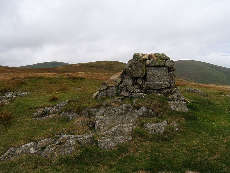
You can't miss Birkett Fell with its name plaque set in the cairn. Named after Baron Birkett, KC MP, an early advocate of National Parks and a fierce opposer to Manchester Corporation's attempts to take water from Ullswater. He also went to the same school as me (though he wasn't in my class, I hasten to add!).
29.09.06-053

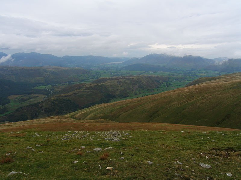
Angus on Hart Side, Stybarrow Dodd behind.

29.09.06-063

Looking down Stanah Gill on Stybarrow Dodd to Thirlmere.

29.09.06-066

Great Dodd from Stybarrow Dodd.

29.09.06-067

High Rigg and St John's in the Vale from Watson's Dodd. Beyond is Keswick, Bassenthwaite Lake, Dodd and Skiddaw (in mist).
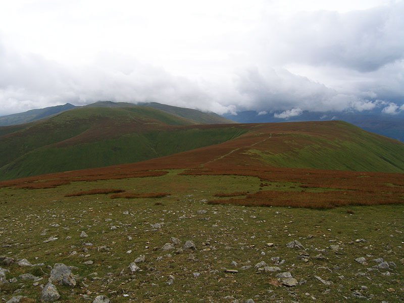
29.09.06-069

Thirlmere from Watson's Dodd.

29.09.06-072

The wind was howling across Watson's Dodd.

29.09.06-077

A retrospective view from Great Dodd - in the distance is the pointed Catstycam with Helvellyn in cloud. Centre left is Stybarrow Dodd with Watson's Dodd to the right.

29.09.06-083

Skiddaw from Little Dodd. Below is the next objective, the spur of Calfhow Pike.

29.09.06-092

Angus has spotted the rain coming on our final summit, Clough Head - the end of the Helvellyn massif.

29.09.06-094

Blencathra from Clough Head. Now it was time to put on the jacket and put the camera away for a very damp descent to the Old Coach Road and a wet trudge back to Dockray.

The Dodds

Walked on 13/10/2003

Wanthwaite – Threlkeld Knotts – Clough Head (113) – Calfhow Pike – Little Dodd (St John’s Common) – Great Dodd (114) – Watson’s Dodd (115) – Great Dodd – Randerside – Mariel Bridge – Old Coach Road – Wanthwaite

013.JPG

Skiddaw from Wanthwaite, the start of the walk.

014.JPG

High Rigg from the climb to Threlkeld Knotts. The colours have just started to turn autumnal.

015.JPG

Skiddaw from Threlkeld Knotts summit.

016.JPG

Blencathra from the summit of Clough Head.

017.JPG

Great Dodd from the summit of Clough Head.

018.JPG

Calfhow Pike from the descent of Clough Head.

019.JPG

Thirlmere from Calfhow Pike, High Seat in the far distance.

020.jpg

Great Dodd summit.

021.JPG

Watson's Dodd from Great Dodd.

022.JPG

Skiddaw and Blencathra from Watson's Dodd summit.

023.JPG

The summit of Randerside on the descent of Great Dodd, Catstycam and Helvellyn are in the distance.

024.JPG

The old coach road crossing the Mosedale Beck, Blencathra is in the distance.

Walking Diary

  • The Mosedale Horseshoe 01/03/2022
  • Caw 18/01/2022
  • Coniston sunset 17/01/2022
  • Blencathra 15/01/2022
  • Scafell Pike 14/01/2022

Social

  • Facebook
  • Twitter

Information

  • Striding Edge
  • T&C’s
  • Privacy
  • Links