Striding Edge

A photo diary of Lake District fell walks

  • Walks
  • Fells
    • Wainwrights
      • Eastern Fells
      • Far Eastern Fells
      • Central Fells
      • Southern Fells
      • Northern Fells
      • North Western Fells
      • Western Fells
      • Outlying Fells
    • Birketts
  • Dogs
  • Love The Lakes
  • Contact

Dodd

Height: 502 metres / 1647 feet Grid reference: NY 24420 27353 Category: The Northern Fells
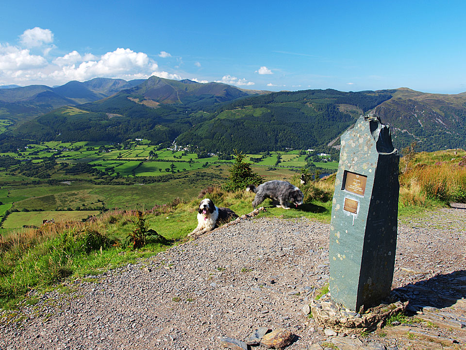
Dodd summit
Dodd summit

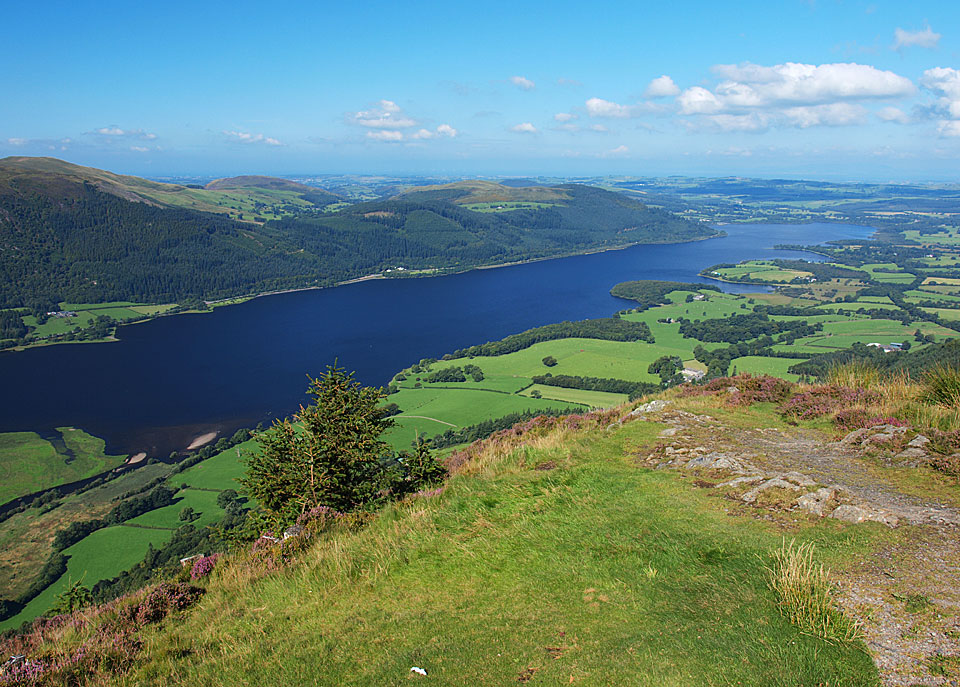
Bassenthwaite Lake from Dodd

Bassenthwaite Lake from Dodd

Carl Side

Walked on 26/08/2010

Start point: Millbeck (NY 255 262)

Millbeck – Doups – White Stones – Carl Side – Long Side – Ullock Pike – Longside Wood – Long Doors – Dodd – Lyzzick Wood – Millbeck

Distance: 5.5 miles     Total Ascent: 842 metres     Time Taken: 3 hours    Start Time: 08:15

Weather: Sunny. 18C

I didn’t really know where I was going to end up when I set off this morning and this was very much a dynamic walk. I intended going up to Skiddaw but I ended up going in the opposite direction and just making my mind up as I walked. The unusual descent is not really recommended unless you are in a rush and I could not resist squeezing Dodd in at the end of the walk. How I found my way through the woods below Dodd I’ll never know but as it turned out the navigation was spot on!
 

Carl Side

Carl Side route map.

26.08.10-001

An early start from Millbeck.

26.08.10-003

Not a bad morning but it was cool.

26.08.10-005

Derwent Water from Doups.

26.08.10-006

The north western fells.

26.08.10-016_stitch

A panoramic view from the climb.

26.08.10-020

A heathery climb to Carl Side, Skiddaw in cloud.

26.08.10-023

Dodd seems temptingly close from here.

26.08.10-024

White Stones.

26.08.10-029

Looking back along the ridge.

26.08.10-032

Carsleddam - I was thinking about descending back over there.

26.08.10-038

Carl Side summit - the wind was so cold now I needed my jacket on.

26.08.10-040

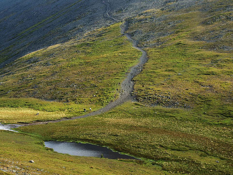
Carlside Tarn - I was going to climb Skiddaw on the path beyond but changed my mind and decided to head west instead.
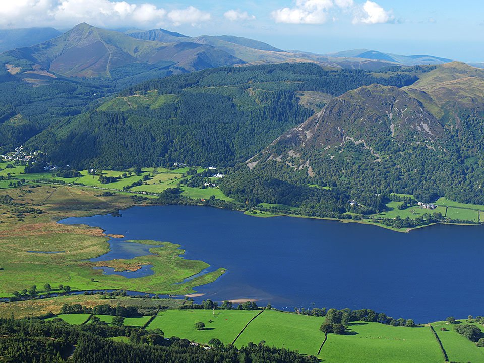
26.08.10-045

Long Side from Carl Side.

26.08.10-063

Hair raising for Dougal on Long Side.

26.08.10-064

Ullock Pike from Long Side.

26.08.10-067

Longside Edge.

26.08.10-071

The view from Ullock Pike.

26.08.10-083

Looking across Bassenthwaite Lake to Barf, Grisedale Pike up to the left. From here I took the direct route back down into Longside Wood - the quick way down!

26.08.10-088

Long Side from the forest road.

26.08.10-089

Looking for Dodd.

26.08.10-094

Dodd summit.

26.08.10-096

The early morning mist is clearing nicely now.

26.08.10-099

Bassenthwaite Lake from Dodd. I descended back to Long Doors and then along the forest track. Miraculously, I managed to find the faint and hidden path that descended all the way through Lyzzick Wood back towards Millbeck.

26.08.10-104

Phew, made it out of the trees!

26.08.10-107

Catbells and Maiden Moor.

26.08.10-109

Millbeck.

Dodd

Walked on 11/09/2009

Start point: The Old Sawmill tearooms. (NY 234 281)

Dodd from The Old Sawmill tearooms

Distance: 2.4 miles     Total Ascent: 382 metres     Time Taken: 1 hour 15 minutes

Weather: Hazy sunrise. 9C.

I was out and about early this morning for a quick climb to Dodd from The Old Sawmill tearooms. Prior to climbing the fell, I had a look down at Derwent Water for a calm lake shot (2011 calendar?!) and managed to elbow my way in with all the other photographers down there! It was a lovely morning but I was a bit too early for those blue skies today.
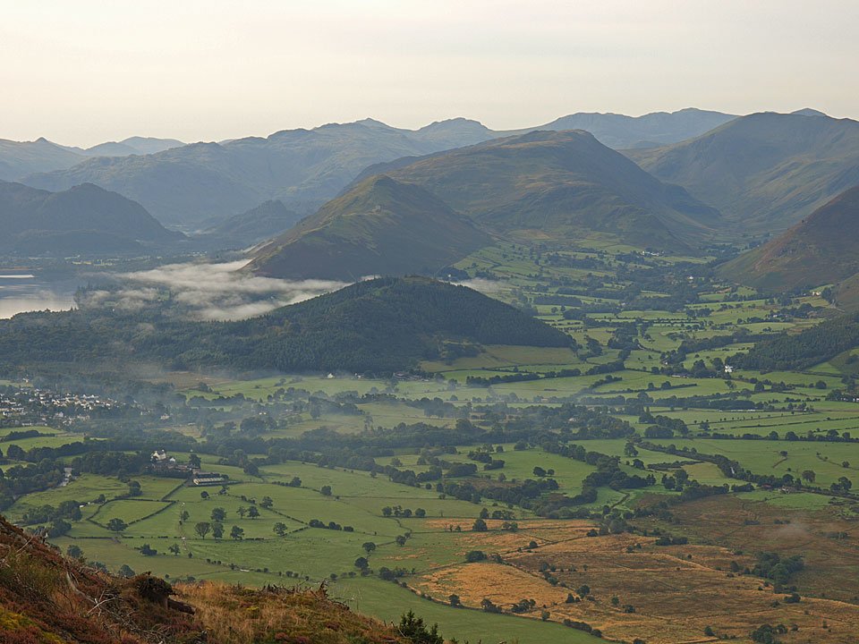
Dodd

Dodd route map.

11.09.09-022

Early morning, Derwent Isle.

11.09.09-027

Looking along Derwent Water.

11.09.09-038

Crossing Skill Beck.

11.09.09-050

A small pool on the way to Dodd.

11.09.09-064

A view of Bassenthwaite Lake from the climb.

11.09.09-070

Hmm, which way do you think Casper?

11.09.09-081

Catbells with mist over Derwent Water.

11.09.09-087

Barrow and Causey Pike, Dale Head and Hindscarth beyond.

11.09.09-101

Casper on Dodd.

11.09.09-115

Catbells and Maiden Moor beyond Swinside, little Castle Crag is to the left of them - the jaws of Borrowdale.
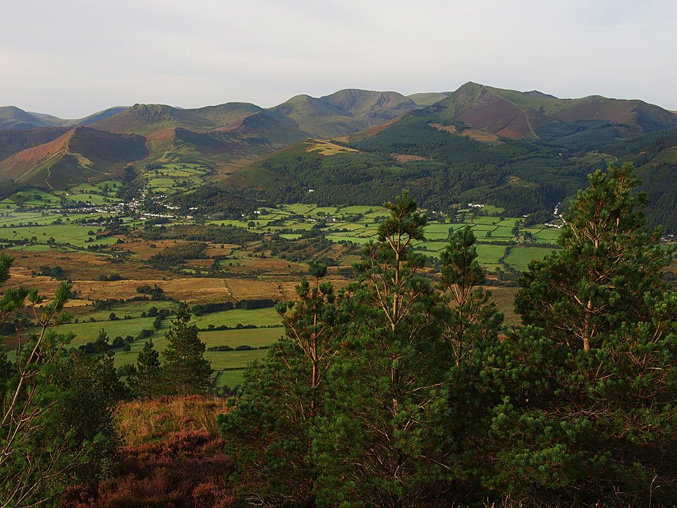
11.09.09-126

Crag Hill and Grisedale Pike amongst others.

11.09.09-131

Bassenthwaite Lake.

11.09.09-146

Zooming in, Criffel can be seen across the Solway Firth.

11.09.09-154

Looking the other way - daybreak on Dodd.

11.09.09-159

There is a wonderful view over the Vale of Keswick from here.

11.09.09-173

The golden glow of sunrise over the Coledale Fells from the descent. It was such a nice morning and the paths had such an easy gradient and surface that I ran all the way down. I had some time to kill before some business in Keswick, so it was back to Derwent Water to se if I could nail a decent shot of the calm lake.

11.09.09-183

11.09.09-188

11.09.09-192

Dodd is the fell to the left of the Skiddaw massif. Later...

11.09.09-200

Ashness Bridge.

11.09.09-211

Catbells from Surprise View.

11.09.09-215

Derwent Water and Skiddaw from Surprise View.

Hopegill Head

Walked on 09/01/2008

Start point: Hopebeck (NY 169 241)

Hopebeck – Dodd (Lorton) (523)– Gasgale Crag  – East Top of Whiteside – Hopegill Head – Ladyside Pike (524) – Swinside (525) – High Swinside Farm – Hopebeck

Distance: 4.6 miles     Total Ascent: 677 metres    Time Taken: 2 hours 30 minutes

Weather: Gale force winds and snow. 3°C

It was really rough weather today with a strong, freezing wind making the going tough for much of the route. The calmest part was surprisingly the high level ridge to Hopegill Head between the outward leg of Dodd and the homeward leg of Ladyside Pike. Coupled with the really strong wind was treacherous ice covered which had a thin veneer of snow on top – that meant we certainly had to watch our step today.
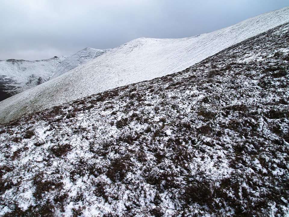
Hopegill Head

09.01.08-006

Heading for Dodd - the Lorton one.

09.01.08-009

Hope Gill and Hopegill Head.

09.01.08-013

Crossing Hope Beck.

09.01.08-018

The Hopegill Head - Whiteside ridge at the head of the valley

09.01.08-041

On the summit of Dodd the wind started to get stronger.

09.01.08-061

As we climbed above the snowline it became much stronger making walking quite difficult. Two steps forward, one step back.
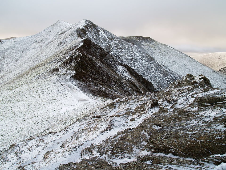
09.01.08-072

Looking back down the route just ascended to Dodd.

09.01.08-075

Ladyside Pike and Hopegill Head with Grisedale Pike beyond.

09.01.08-077

Whiteside from Gasgale Crags with Crummock Water and Mellbreak visible.

09.01.08-083

Casper on Gasgale Crags, Grasmoor beyond.

09.01.08-093

Grisedale Pike beyond Hopegill Head with the magnificent arête yet to climb.

09.01.08-097

Sail and Crag Hill over Coledale Hause.

09.01.08-100

Looking back to Whiteside.

09.01.08-104

It almost looks like a drawing this photo, climbing to Hopegill Head.

09.01.08-112

Again from further along the ridge. It was a toss up as to whether I would get blown off by the gale force wind or slip and fall on the ice along here.
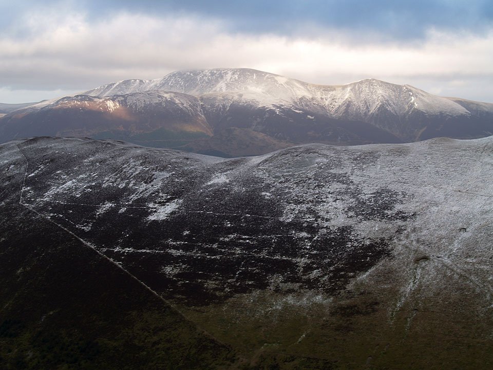
09.01.08-115

Climbing the icy ridge.

09.01.08-117

Looking back to Whiteside.

09.01.08-121

Nearly there Casper! (He is not superimposed on there either!).

09.01.08-128

Dark and brooding Grasmoor from Hopegill Head.

09.01.08-130

Grisedale Pike across Hobcarton.

09.01.08-148

Skiddaw from Hopegill Head. The descent from here to the Ladyside Pike ridge was unbelievably treacherous as it was all ice for the initial section, meaning there was lots of zig-zagging and shuffling around.
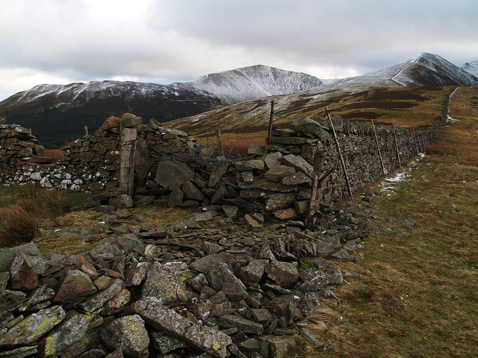
09.01.08-151

Looking back to the descent from Hopegill Head. Phew! Finally made it.

09.01.08-154

Ladyside Pike ahead.

09.01.08-157

Hopegill Head from the summit of Ladyside Pike.

09.01.08-169

If anything the wind picked up even more during the descent as Casper ably demonstrates here.

09.01.08-187

The top of Swinside was a vague one, somewhere around here. The route of descent from Ladyside Pike to here was along the line of the wall.

09.01.08-190

Lorton Vale and Loweswater get some sunshine with Blake Fell directly ahead and Loweswater Fell to the right.

09.01.08-191

Looking north to Cockermouth from the steep descent.

Dodd

Walked on 16/08/2006

Start point: The Old Sawmill tearooms. (NY 234 281)

Dodd (483) from The Old Sawmill tearooms

Distance: 2.5 miles     Total Ascent: 400 metres     Time Taken: 3 hours

Weather: Generally dull with the odd sunny spell and a heavy shower. 19oC

Today’s mission was to see the Osprey’s from the viewpoint in Dodd Wood, make it to the top of Dodd and have some nice cake in the tearoom at the end – all accomplished! There was a brief spell of sunshine on the way up to the summit, but later we could see the rain quickly advancing across the Derwent Valley and we got a good soaking during lunch – not to worry, we didn’t let it dampen our enthusiasm much!

01 Dodd

16.08.06-012

Barf across Bassenthwaite Lake from the Osprey viewpoint. We saw one Osprey on the nest and one in flight today.

16.08.06-017

A close-up of Barf.

16.08.06-018

Scar Crags, Sail, Crag Hill and Grisedale Pike across the southern end of Bassenthwaite Lake.

16.08.06-024

Someone wants us to hurry up!

16.08.06-033

Looking south west across the Derwent Valley.

16.08.06-035

Grisedale Pike looking a bit broody. To the left is Crag Hill and peeping out to the right is Hopegill Head.

16.08.06-036

Looking along the River Derwent to Bassenthwaite Lake.

16.08.06-038

Derwent Water.

16.08.06-039 Annotated_small

Looking across the Derwent Valley.

16.08.06-049

The rain is heading our way from the Newlands Valley.

16.08.06-064

Made it! Connie and Casper at the summit of Dodd.

16.08.06-065

As we start lunch, the rain comes ever closer. Get your coat on Connie!

16.08.06-067

Bassenthwaite Lake from Dodd.

16.08.06-071

Angus.

Dodd

Walked on 08/04/2004

Start point: The Old Sawmill tearooms. (NY 234 281)

Dodd (207) from The Old Sawmill tearooms.

Weather: Dull and cool.

Dodd

Sale Fell - 8th April 035

Stream near The Old Sawmill Tearoom.

Sale Fell - 8th April 036

Forest stream.

Sale Fell - 8th April 038

Derwent Water from the ascent of Dodd.

Sale Fell - 8th April 039

The Coledale and Newlands Fells from Dodd.

Sale Fell - 8th April 041

Dodd summit.

Sale Fell - 8th April 045

Latrigg with the Helvellyn ridge in the distance from Dodd.

Walking Diary

  • The Mosedale Horseshoe 01/03/2022
  • Caw 18/01/2022
  • Coniston sunset 17/01/2022
  • Blencathra 15/01/2022
  • Scafell Pike 14/01/2022

Social

  • Facebook
  • Twitter

Information

  • Striding Edge
  • T&C’s
  • Privacy
  • Links