Height: 230 metres / 755 feet Grid reference: SD 36208 87996 Category: The Outlying Fells
Finsthwaite Heights
High Dam
Height: 230 metres / 755 feet Grid reference: SD 36208 87996 Category: The Outlying Fells
Finsthwaite Heights
High Dam
Start point: High Dam car park (SD 369 882)
Finsthwaite Heights (OF) and High Dam
Distance: 2 miles Total Ascent: 150 metres Time Taken: 1 hour
Weather: Overcast with showers. 11oC.
We had a short, low level walk today up to the lovely High Dam and to Finsthwaite Heights. The trees are resplendent in golden glory at the moment making this walk in an already attractive area even more so.


Autumnal beck.

Thought I'd better get a shot of these two...

...newly scrubbed and cleaned. How long will it last?

Low Dam.

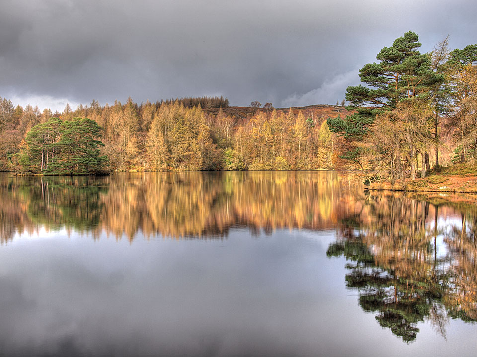
High Dam.


All is golden from Finsthwaite Heights, looking through the gap in the trees to Red Screes.

Angus has seen something - a deer perhaps?

Gummer's How across Windermere.

Autumn on Staveley Fell looking across Lakeside.

Moving water.
Start point: High Dam car park (SD 369 882)
Finsthwaite Heights (OF) and High Dam
Distance: 2 miles Total Ascent: 150 metres Time Taken: 1 hour
Weather: Dull and raining. 7°C
Another low level walk today due to the inclement weather up to Finsthwaite Heights and High Dam from Finsthwaite. Although man made to provide water power for the nearby bobbin mills (1835), the dams still manage to look beautiful and were described by Wainwright as ‘a much nicer place than the over populated Tarn Hows’.
Oddly, in the Wainwright Outlying fell chapter ‘Finsthwaite Heights’, he makes no mention of reaching the actual highest point and the chapter is just a walk around the area, so today I made the small detour to reach the top.


Following the outflow of the dams.

Upward and onward.

In a whirl through the woods.

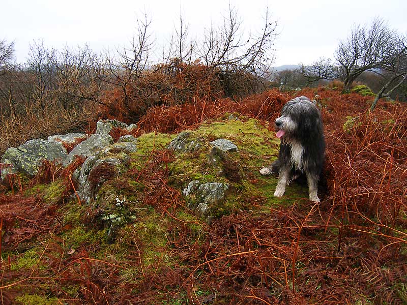
Angus on the raised mound which marks the 'summit' of Finsthwaite Heights.

Finsthwaite Heights.

High Dam from Finsthwaite Heights.

...and a glimpse of Windermere, looking north to Belle Isle.

Looking across to Gummer's How.

Low Dam outlet.

Low Dam.

Swimming in the rain.

Dog on a mission - on the wall of High Dam.

High Dam.

Finsthwaite Church.
Start point: Newby Bridge (SD 367 864)
Finsthwaite Heights (OF Walk – no definite summit) from Newby Bridge
Weather: Rain.
A short walk on this wet morning to Finsthwaite and High Dam from Newby Bridge. This walk follows Wainwright’s Finsthwaite Heights chapter in his book ‘The Outlying Fells of Lakeland’, page 74.
‘Everywhere the surroundings are delightful. But this is not fellwalking’ – AW
There are spaces for parking on the Rusland road adjacent to the River Leven and The Lakeside and Haverthwaite (L&H) Railway line.


Newby Bridge.

Weir on the River Leven. I tried to follow the Wainwright description as closely as possible but things have changed over the last 30 years. I crossed over the L&H bridge and then immediately left down a narrow lane which leads top private houses. The path is signposted to the right from this lane and climbs steeply upwards with stone steps along the way to help. I followed the path to a branch to the right which led to the only high viewpoint of the walk on Summer House Knott - no views today though. Then it was back to the main path and up to the right to Finsthwaite Tower almost hidden by dense foliage. This is a lovely woodland walk, whatever the weather.

Finsthwaite Tower - 'Erected to honour the officers, seamen and marines of the Royal Navy whose matchless conduct and irresistible valour decisively defeated the fleets of France, Spain and Holland and preserved and protected liberty and commerce 1799'. It's a pity it has now fallen into disrepair. From the tower, I followed the obvious path which deviates from the Wainwright route and in fact ended up coming into Finsthwaite the way he describes for the return leg. Not to worry, only a field full of bulls to contend with once free from the woods!

Finsthwaite from the path to Great Knott Wood.

Finsthwaite Church. The off-license in Finsthwaite mentioned by Wainwright has long gone but the signposted path is still there and indeed it seems to go through the gardens of private dwellings. There is no danger of getting lost on this route - just follow the painted white arrows!

Where am I? Once through the gate and over the bridge, the path from the new-ish car park to High Dam is unmissable. As Wainwright said of High Dam 'it is a much nicer place than the over-populated Tarn Hows'.


Low Dam.

High Dam. I then crossed the High Dam Wall for a circuit of Low Dam before another deviation from Wainwright's route - rather than retuning by the same path I came up, it was down to the car park and back along the road to Finsthwaite.

High Dam outflow and the 3D map of the area on the right explains that High Dam was constructed to turn the water wheels at Stott Park Bobbin Mill, the bobbins being used in the cotton mills in Lancashire. The map itself is on top of a large wooden bobbin. From Finsthwaite Church again, it was back across the two open fields (past the bulls again) and then a climb to below Finsthwaite tower and then a sharp descent to the road near Lakeside and an easy walk along the path back to Newby Bridge.


Lakeside from Landing How, Gummer's How is lost in the mist behind.