Height: 254 metres / 834 feet Grid reference: SD 46000 98777 Category: The Outlying Fells
Reston Scar
Kemp Tarn
Height: 254 metres / 834 feet Grid reference: SD 46000 98777 Category: The Outlying Fells
Reston Scar
Kemp Tarn
Start point: Barley Bridge, Staveley (SD 470 987)
Hugill Fell (OF) and Reston Scar (OF) from Staveley
Distance: 2.2 miles Total Ascent: 192 metres Time Taken: 1 hour Start Time: 09:30
Weather: Dull but warm. 20ºC
Today I chased the weather really and headed east as a great sheet of grey cloud was working its way from the west over the Lake District. At least I managed to set off in the sunshine but that was soon obliterated as general dullness set in. It was warm work today though and the views from these fells are a little too distant at the best of times, so that wasn’t helped by the conditions.

Hugill Fell route map.

Brunt Knott across The Bungalow.

Casper hiding in the meadow.

The cloud rolling in from the west to obliterate the blue sky.

Nearly at the top looking to Brunt Knott and Potter Fell.

Casper checks out what is happening down in Kentmere.

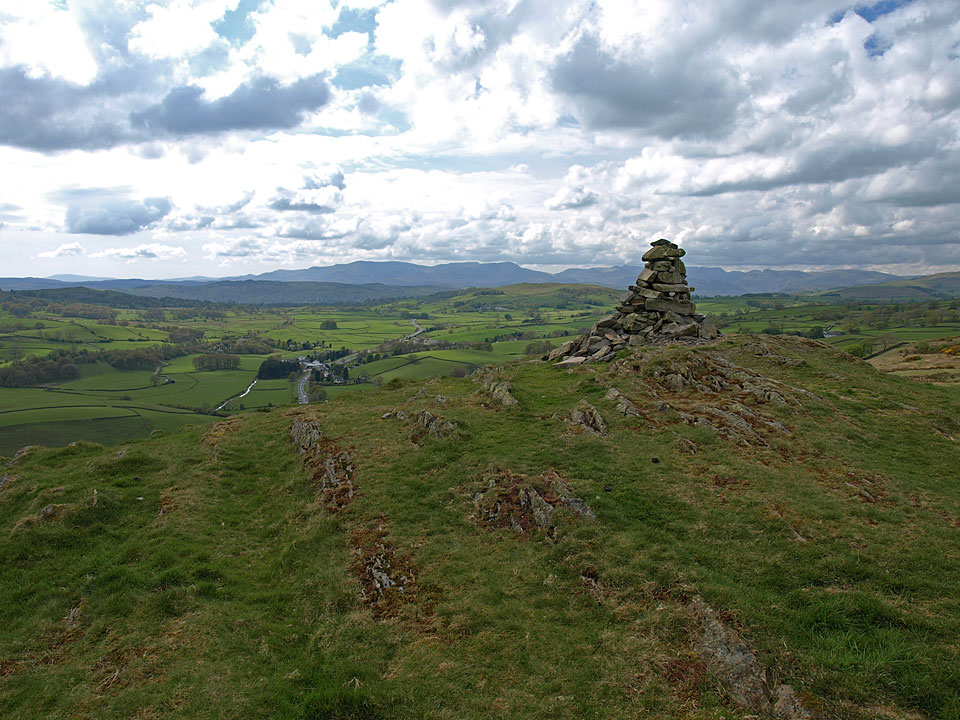
The cairn that formerly stood at the Wainwright top has now disappeared - Casper and Dougal hunt in vain for it.

The Kentmere Valley. The good news is that you can now walk across to Reston Scar whereas before access was forbidden. On the way we found the remains of the cairn on the path - it is now a line of stones crossing the boggy ground.

Crinkle Crags and Bowfell catch some rain, the Langdale Pikes to the right from the highest central point.

Heading for Reston Scar, Dougal does a Casper!

The Coniston fells from Reston Scar, the main A591 through Ings below.

The length of Casper and Dougal's tongues tell how warm it is up here today.

Hugill Fell from Reston Scar.

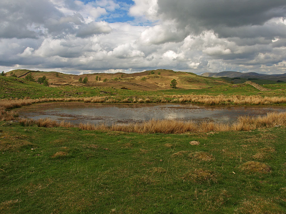
Kemp Tarn.

Staveley from Reston Scar.

The weir at Barley Bridge in mono.

The colour version.

Tranquil River Kent apart from those two dogs having a dip.
Start point: Staveley (SD 469 985)
Reston Scar (OF) from Staveley
Distance: 1.6 miles Total Ascent: 150 metres Time Taken: 1 hour
Weather: Warm with sunny spells. 15°C.
Today we had a short walk from Staveley up to Reston Scar, the one that is clearly visible from the main road heading towards Windermere. It was really quite pleasant when the sun was shining and the views were fairly extensive.

Reston Scar route map.

Climbing the path from Brow Lane to Reston Scar.

Casper and Brunt Knott.

Kemp Tarn, a tarn that made Casper dirtier rather than cleaner when he had a dip.

Looking along the wall to Hugill Fell.

The silhouette of the Coniston fells from the top of Reston Scar.

Connie and Casper at the top. It was warm until we reached the top where we managed to find the breeze.

Kentmere Pike beyond Hugill Fell summit.

Kentmere from Reston Scar.

Back at Barley Bridge in Staveley and a chance for Casper to clean up.
Hugill Fell (OF) and Reston Scar (OF) from Staveley
Today’s two short walks follow Wainwright’s Hugill Fell and Reston Scar chapters in his book ‘The Outlying Fells of Lakeland’, pages 22 and 24. They both start from different places in Staveley and it was almost like two different days with the Hugill Fell walk done in the rain and the Reston Scar walk done under blue skies and sunshine.
Walk 1 – Hugill Fell from Staveley
Start point: Staveley – Barley Bridge (SD 470 987)
Weather: Rain, overcast.


Brunt Knott from the steep path to Hugill Fell.

Hugill Fell summit cairn looking to a the clouded in Crinkle Crags and Langdale Pikes. The high point of Hugill Fell is on the other side of a wall, 320 metres SW.

he Kentmere Valley from Hugill Fell.

Walk 2 – Reston Scar from Staveley
Start point: Staveley – Brow Lane (SD 468 984)
Weather: Sunny.

Looking back to Staveley from the track at the start of the walk.

Kemp Tarn with Brunt Knott behind.

The Coniston Fells to the left, the Sca Fells and Langdale Pikes to the right from the summit of Reston Scar.

The Sca Fells and the Langdale Pikes from Reston Scar. See below for an annotated version of this photo.


The Kent Estuary from the descent of Reston Scar.