Striding Edge

A photo diary of Lake District fell walks

  • Walks
  • Fells
    • Wainwrights
      • Eastern Fells
      • Far Eastern Fells
      • Central Fells
      • Southern Fells
      • Northern Fells
      • North Western Fells
      • Western Fells
      • Outlying Fells
    • Birketts
  • Dogs
  • Love The Lakes
  • Contact

Rough Crag (Riggindale)

Height: 628 metres / 2060 feet Grid reference: NY 45428 11244
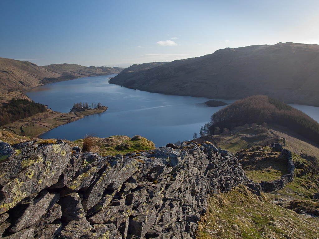
Haweswater from the Rough Crag ridge
Haweswater from the Rough Crag ridge

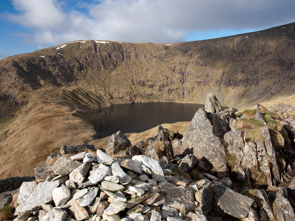
Blea Water from Rough Crag

Blea Water from Rough Crag

Riggindale Round

Walked on 30/04/2013

Start point: Mardale Head (NY 469 107)

Mardale Head – Rough Crag (Riggindale) – Caspel Gate – Long Stile – High Street – Straits of Riggindale – The Knott – Rampsgill Head – Kidsty Pike –High Raise – Low Raise – Castle Crag (Mardale) – The Rigg – Mardale Head

Distance: 8.5 miles     Total Ascent: 888m metres     Time Taken: 4 hours 30 minutes     Start Time: 07:00

Weather: Sunny spells. 11oC.

It was beautiful this morning, very still and sunny and it was pleasantly warm climbing Rough Crag but as soon as I got to the High Street plateau it was covered with cloud which made it feel a lot cooler. It was a great day for it though and we were in total solitude throughout with just deer and sheep for company.

01 Riggindale Round

P4303212

Calm reflections on Haweswater.

P4303219

Harter Fell.

P4303225

Haweswater from the Rough Crag ridge.

P4303230

Harter Fell from higher up.

P4303244

Small Water is nestling somewhere in the combe to the left and Mardale Ill Bell.

P4303246

Fabulous views today.

P4303247

A glimpse of Small Water.

P4303255

Blea Water from Rough Crag.

P4303261

One mucky pup!

P4303268

Long Stile, the climb to High Street.

P4303269-Edit

Blea Water.

P4303275

Long Stile over Caspel Gate.

P4303277

Caspel Gate Tarn.

P4303290

There were some lovely sunny spells and it was quite warm when the sun was out.

P4303295

Looking down Long Stile.

P4303296

On High Street though it was suddenly cloud covered and felt a lot cooler.

P4303300

High Street summit looking to Helvellyn.

P4303302

Hayeswater.

P4303309_10_11

Looking back to High Street.

P4303313

The Knott.

P4303315

The Knott summit cairn.

P4303316

Rest Dodd and The Nab with Ullswater catching the sun in the distance.

P4303319

High Street and Thornthwaite Crag from Rampsgill Head.

P4303322

Ramps Gill from Ramspgill Head.

P4303327

High Street from Kidsty Pike.

P4303340

High Raise.

P4303345

Low Raise...back in the sunshine!

P4303355

Haweswater from the south-east ridge.

P4303357

Descending the south-east ridge. If you find a lens cap along here it could well be mine!

P4303364

The British Fort on the south-east ridge with Haweswater beyond.

P4303365

The view from The British Fort.

P4303375

Riggindale.

P4303395

On the way home, the head of Haweswater. Select on the image to see a larger version. This photo will be available as a premium canvas print, e-mail me if you are interested for sizes etc.

Mardale Round

Walked on 12/11/2008

Start point: Mardale Head (NY 469 127)

Mardale Head – Hollow Stone – Branstree north ridge – Artlecrag Pike – Branstree – Gatescarth Pass – Little Harter Fell – Harter Fell (Mardale) – Nan Bield Pass – Mardale Ill Bell – High Street – Rough Crag (Riggindale) – Mardale Head

Distance: 8.2 miles     Total Ascent: 960 metres     Time Taken: 4 hours

Weather: Sunny and bright, becoming cloudy. 10oC.

It was sunny and bright first thing this morning with hardly a cloud in the sky – fantastic conditions for a walk around Mardale Head. Once up to High Street, the clouds came in and made it all a bit flat and I felt in hindsight it might have been better walking anti-clockwise…but then again, who knows? You never can tell what the weather will do.
Mardale Round.jpg

12.11.08-009.jpg

It's a lovely morning with sun shining at the head of Mardale.

12.11.08-026.jpg

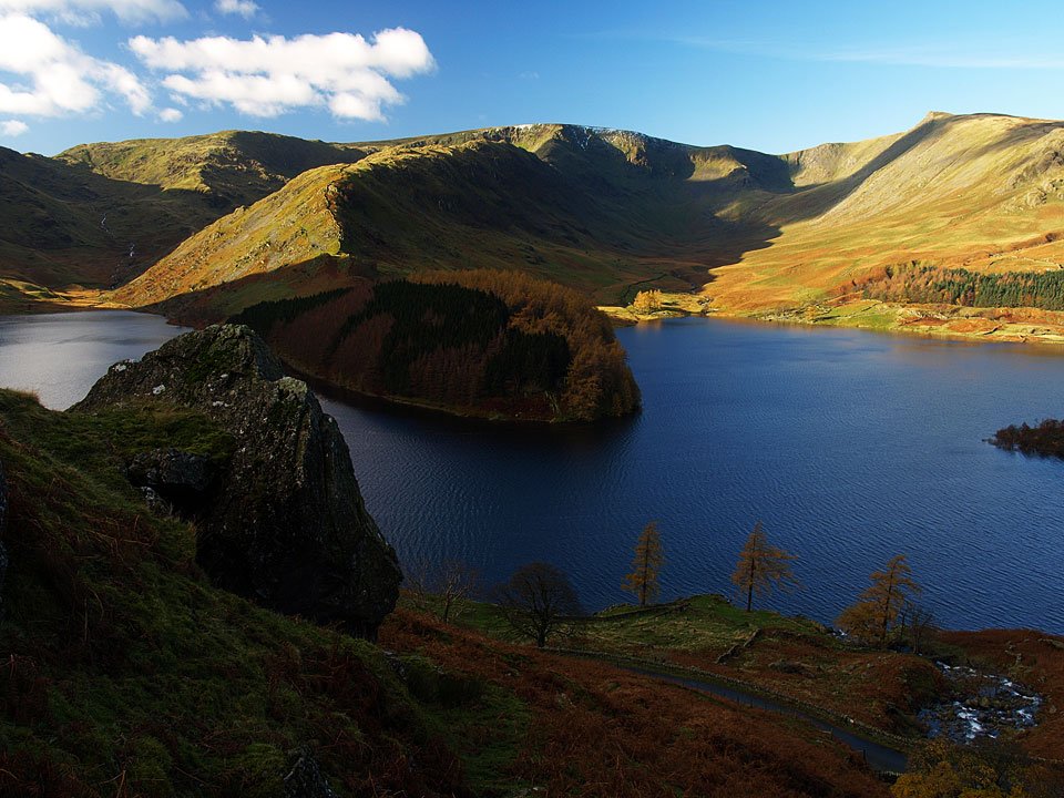
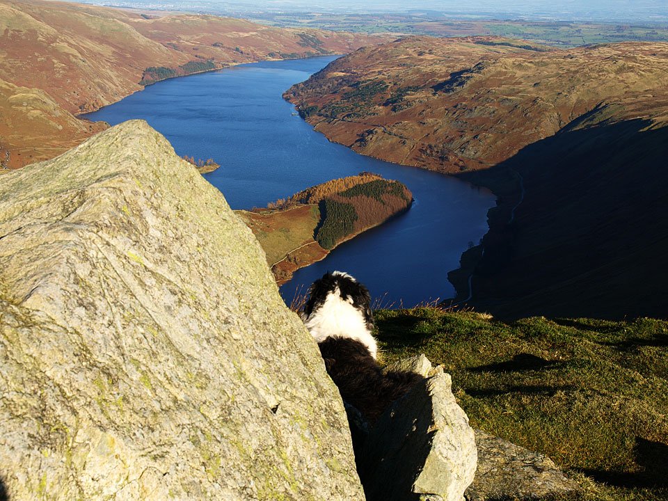
The route from the road up to the north ridge of Branstree is certainly initially steep and direct. There is a great view over Haweswater into Riggindale, the rock in the foreground being the Hollow Stone.
12.11.08-027.jpg

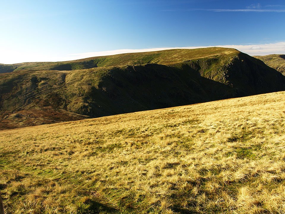
Kidsty Pike above Riggindale.

12.11.08-036.jpg

The head of Riggindale.

12.11.08-037.jpg

Kidsty Pike and Kidsty Howes.

12.11.08-039.jpg

High Street with a touch of snow on top from the old sheepfold.

12.11.08-048.jpg

Selside Pike from the north ridge.

12.11.08-052.jpg

Looking north east from Artlecrag Pike.

12.11.08-060.jpg

The view to the west from the same place.

12.11.08-064.jpg

The summit of Branstree with a hot air balloon over Harter Fell.

12.11.08-073.jpg

Harter Fell from the descent of Branstree. The path used in ascent across Gatescarth Pass can be seen starting from the mid-left.
12.11.08-076.jpg

Looking back to Branstree.

12.11.08-080.jpg

The path to Harter Fell.

12.11.08-083.jpg

Casper Wainwright (see Harter Fell 10, The Far Eastern Fells below). The benchmark in the Wainwright self-portrait can be seen on the rock in the photo. All you need now is a pipe Casper!
img009.jpg

12.11.08-093.jpg

High Street and Small Water from Harter Fell.

12.11.08-095.jpg

The summit of Harter Fell.

12.11.08-100.jpg

Mardale Ill Bell and High Street.

12.11.08-105.jpg

Descending to Nan Bield Pass.

12.11.08-107.jpg

Yoke, Ill Bell and Froswick above Kentmere Reservoir.

12.11.08-112.jpg

Harter Fell from Nan Bield pass.

12.11.08-117.jpg

Looking back to Harter fell from the climb to Mardale Ill Bell.

12.11.08-121.jpg

Small Water and Haweswater.

12.11.08-124.jpg

High Street from Mardale Ill Bell.

12.11.08-130.jpg

Casper on Mardale Ill Bell.

12.11.08-141.jpg

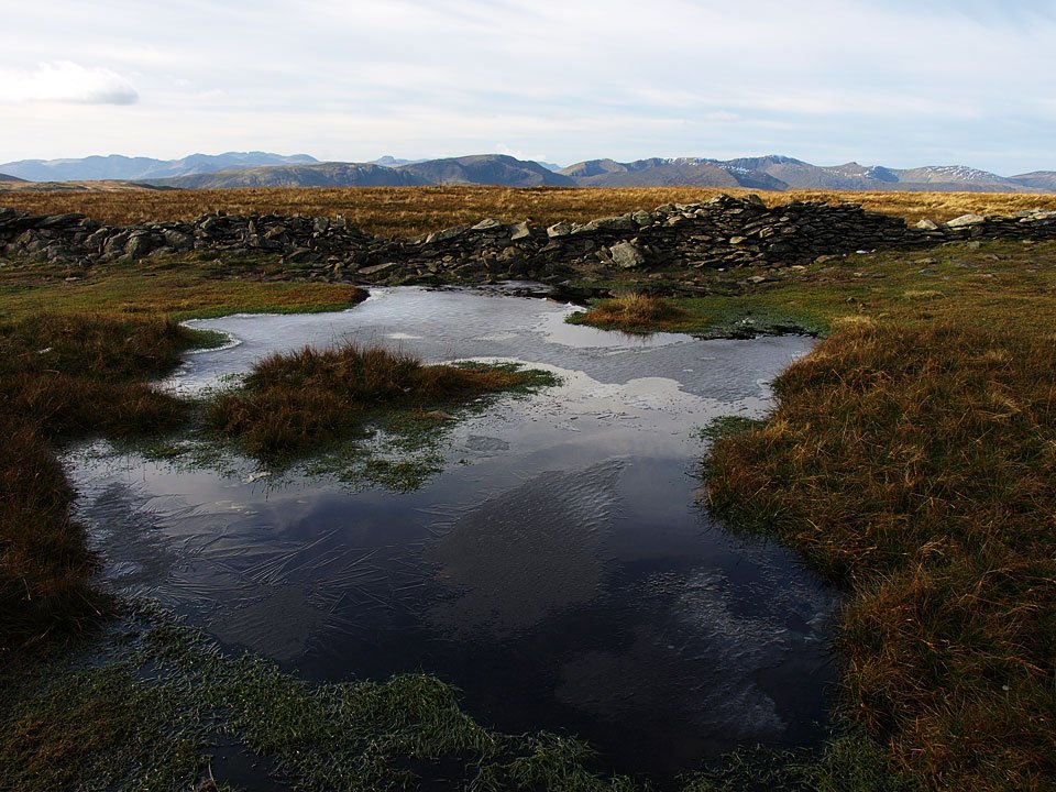
Once on High Street, it started to cloud over. This view is to the western fells with the Scafells and Great Gable in the distance and Helvellyn mid distance on the right. That's an icy looking puddle!

12.11.08-151.jpg

Helvellyn from High Street.

12.11.08-154.jpg

The wall on High Street.

12.11.08-160.jpg

The flat top of Harter Fell from High Street.

12.11.08-167.jpg

Long Stile and Rough Crag, the route of descent.

12.11.08-173.jpg

Blea Water from the snowy eastern edge of High Street.

12.11.08-184.jpg

Long Stile.

12.11.08-191.jpg

It has completely clouded over now looking back to High Street and Long Stile over Caspel Gate Tarn from Caspel Gate.

12.11.08-201.jpg

High Street from Rough Crag.

12.11.08-215.jpg

Colourful trees on The Rigg looking along Haweswater.

12.11.08-221.jpg

Haweswater.

12.11.08-227.jpg

Autumn on The Rigg.

12.11.08-236.jpg

Orange grass crossing Mardale Beck.

Riggindale Round

Walked on 09/10/2006

Start point: Mardale Head (NY 469 107)

Mardale Head – The Rigg – Rough Crag (Riggindale) – Caspel Gate – Long Stile – High Street – Straits of Riggindale – Rampsgill Head – Kidsty Pike – High Raise (497) – Low Raise (498) – Castle Crag (Mardale) (499) – The Rigg – Mardale Head

Distance: 10.2 miles     Total Ascent: 1085 metres     Time Taken: 4 hours 15 minutes

Weather: Sunny, a glorious Autumn day. 16oC.

I nearly never bothered today, it was wet and miserable first thing this morning but a chance hearing of the weather report on the radio made me get out as it was supposedly brightening during the day. I could hardly believe my luck as I reached Mardale, for the sun was shining and the skies were blue. This was a really enjoyable round (helped by the weather of course!) taking the direct route to High Street via Rough Crag, walking along the Roman Road, trying and failing to spot the Riggindale Golden Eagles and finishing off on the ancient British Fort on Castle Crag above Haweswater.
01 Riggindale Round

09.10.06-002

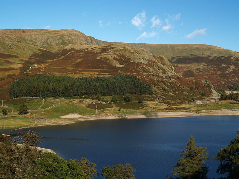
The ridge route for today's walk over Rough Crag and up to High Street, here seen over Haweswater.

09.10.06-007

Harter Fell at the head of Mardale.

09.10.06-009

Mardale Ill Bell.

09.10.06-014

Mardale Beck in spate, as were all the watercourses in the area due to recent heavy rain.

09.10.06-020

Harter Fell from The Rigg.

09.10.06-025

Looking across Haweswater to Lady's Seat and Castle Crag, the route used in descent from Low Raise later.
09.10.06-026

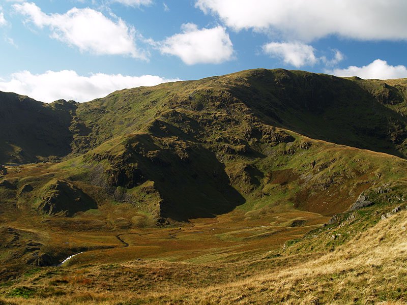
Riggindale and the Mardale skyline.

09.10.06-037

Haweswater from the steep climb to Rough Crag.

09.10.06-041

Mardale Waters from the Rough Crag ridge - Small Water is in the cirque to the left, Blea Water in the one to the right.
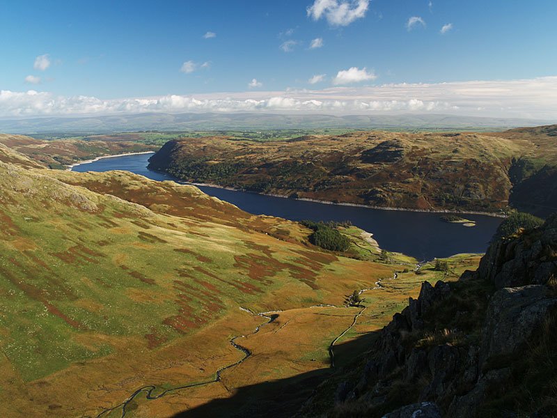
09.10.06-053

Some warm Autumn sunshine on Rough Crag for Casper and Angus.

09.10.06-056

Blea Water, High Street above.

09.10.06-062

Looking across Riggindale to Kidsty Pike.

09.10.06-063

Haweswater Reservoir and Mardale from Rough Crag - Golden Eagles nest on the crags here, the only pair in England. The valley was flooded in the 1930's to create a reservoir for Manchester and the village of Mardale was lost under the water forever.
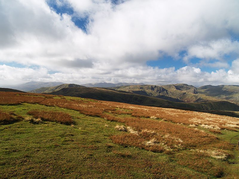
09.10.06-073

Long Stile leading to High Street over Caspel Gate.

09.10.06-085

Looking back to Rough Crag, Branstree in view over the tarn.

09.10.06-088

Rough Crag from Long Stile.

09.10.06-089

A sparkling Blea Water, Harter Fell beyond.

09.10.06-094

Looking along Riggindale to Mardale.

09.10.06-098

The summit of High Street, deserted today.

09.10.06-108

Looking south-west to the Coniston fells in the distance, Red Screes and the Fairfield group in the middle distance.
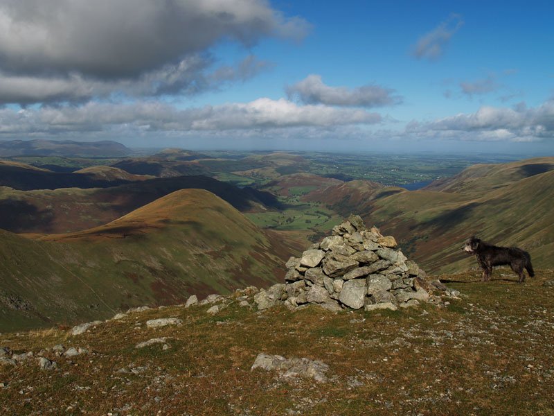
09.10.06-112

A closer shot of Fairfield. Great Gable and the Scafell range are in the left distance.

09.10.06-114

The shadows of the three amigos looking to Hayeswater.

09.10.06-116

...and the uncluttered version.

09.10.06-121

Walking along the Roman Road to the Straits of Riggindale.

09.10.06-124

Kidsty Pike from Twopenny Crag.

09.10.06-129

Ramps Gill from Rampsgill Head, The Nab to the left.

09.10.06-130

The eastern fells from Rampsgill Head.

09.10.06-132

We could hear the bellowing of the stags in Martindale Deer Forest below - they certainly caught the attention of Angus.
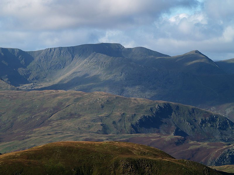
09.10.06-138

Where Eagles Dare - Angus on Kidsty Pike, well known perch of the Golden Eagles.

09.10.06-145

Looking across to the Helvellyn massif from the path to High Raise.

09.10.06-148

Fairfield from High Raise, Great Gable on the distant right.

09.10.06-149

Helvellyn from High Raise. Striding Edge is the ridge in the centre with Swirral Edge and Catstycam to the right.

09.10.06-158

The rock littered summit of High Raise.

09.10.06-162

The tumulus and cairn on Low Raise.

09.10.06-165

Haweswater from Lady's Seat and the magnificently situated ancient British fort atop Castle Crag in the foreground.

09.10.06-166

Whelter Bottom from Castle Crag.

09.10.06-167

Haweswater from the ruins of the fort.

09.10.06-174

Still lots of sunshine for the boys to soak up.

09.10.06-176

Crossing Randale Beck.

Mardale Skyline

Walked on 04/05/2004

Start point: Mardale Head (NY 469 127)

Mardale Head – Gatescarth Pass – Adam Seat (1) – Little Harter Fell (2) – Harter Fell (Mardale) (3) – Nan Bield Pass – Mardale Ill Bell (4) – High Street (5) – Rough Crag (Riggindale) (6) – Rampsgill Head (7) – Kidsty Pike (8) – Mardale Head

Weather: Sunny with snow and hail showers.

This is the start of my quest to climb the 541 Birkett Fells!

Mardale Northern

Mardale southern

4th May - Mardale Skyline 001

Haweswater from Mardale Head...

4th May - Mardale Skyline 002

and Gatescarth Beck.

4th May - Mardale Skyline 010

The Boundary Stone at the summit of Adam Seat, 'L' on one side

4th May - Mardale Skyline 011

'H' on the other (Longsleddale and Haweswater).

4th May - Mardale Skyline 014

Haweswater from the summit of Little Harter Fell. (Compare AW The Far Eastern Fells - Harter Fell 10).

4th May - Mardale Skyline 017

Harter Fell summit in a snow shower.

4th May - Mardale Skyline 019

Kentmere

4th May - Mardale Skyline 021

A rainbow over Small Water ('the finest of Lakeland's tarns), from the descent to Nan Bield Pass.

4th May - Mardale Skyline 025

Mardale Ill Bell summit with Yoke, Froswick and Ill bell in the background.

4th May - Mardale Skyline 030

Two views of High Street summit.

4th May - Mardale Skyline 032

4th May - Mardale Skyline 034

Rough Crag and Haweswater from High Street. The area around the small tarn is called Caspel Gate.

4th May - Mardale Skyline 036

Harter Fell and the Nan Bield Pass from Rough Crag summit, Small Water is just visible.

4th May - Mardale Skyline 042

Hayeswater and the distant Patterdale Fells from the Roman Road.

4th May - Mardale Skyline 044

The mist swirls across High Street on the walk to Rampsgill Head.

4th May - Mardale Skyline 045

Looking North from Rampsgill Head's summit. The Nab is to the left with Hallin Fell in the centre adjoining Steel Knotts. Ullswater is just visible right of centre.

4th May - Mardale Skyline 050

High Street from Kidsty Pike summit.

4th May - Mardale Skyline 055

The sun shines on Riggindale and Rough Crag.

4th May - Mardale Skyline 058

A long meander of Riggindale Beck...

4th May - Mardale Skyline 059

and the ruins of Riggindale Farm.

4th May - Mardale Skyline 061

The Mardale Skyline.

Walking Diary

  • The Mosedale Horseshoe 01/03/2022
  • Caw 18/01/2022
  • Coniston sunset 17/01/2022
  • Blencathra 15/01/2022
  • Scafell Pike 14/01/2022

Social

  • Facebook
  • Twitter

Information

  • Striding Edge
  • T&C’s
  • Privacy
  • Links