Striding Edge

A photo diary of Lake District fell walks

  • Walks
  • Fells
    • Wainwrights
      • Eastern Fells
      • Far Eastern Fells
      • Central Fells
      • Southern Fells
      • Northern Fells
      • North Western Fells
      • Western Fells
      • Outlying Fells
    • Birketts
  • Dogs
  • Love The Lakes
  • Contact

Scar Lathing

Height: 439 metres / 1440 feet Grid reference: NY 22611 04944

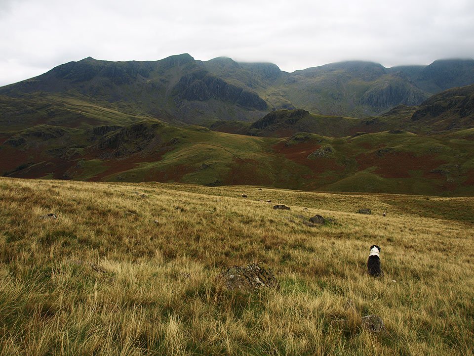
The view across Great Moss from Scar Lathing.

Scafell Pike

Walked on 25/09/2008

Start point: Hardknott Pass (NY 231 014)

Hardknott Pass – Hard Knott – Lingcove Beck – Scar Lathing – Great Moss – Pen – Scafell Pike – Broadcrag Tarn – Cam Spout – Great Moss – Lingcove Beck – Hard Knott – Hardknott Pass

Distance: 9.3 miles     Total Ascent: 1240 metres     Time Taken: 5 hours 45 minutes

Weather: Overcast. 17ºC.

The weather certainly didn’t turn out as I expected with it being rather grey and I didn’t really know which route I would take until I did it. I must say it took longer than I thought and it was pretty arduous going at times over boggy ground coupled with a steep ascent and descent. It was still enjoyable though – this is my favourite area of all.
Scafell-Pike.jpg

25.09.08-005.jpg

Dawn at an un-named tarn on Hard Knott.

25.09.08-013.jpg

Sunrise over Wrynose Pass.

25.09.08-016.jpg

Esk Pike, Bowfell and Crinkle Crags from Hard Knott summit.

25.09.08-030.jpg

Heading into Upper Eskdale it all looks a bit gloomy and the cloud is starting to form on the tops.

25.09.08-042.jpg

The Scafells ahead.

25.09.08-047.jpg

Bowfell and Crinkle Crags.

25.09.08-048.jpg

Slight Side and Scafell, hidden by cloud.

25.09.08-054.jpg

Bowfell.

25.09.08-062.jpg

Casper plans the route - there is a steep descent to cross Lingcove Beck then a steep climb again over the knolls in the middle distance.
25.09.08-076.jpg

Casper hides in the bracken shortly after the crossing of Lingcove Beck.

25.09.08-078.jpg

Lingcove Beck.

25.09.08-090.jpg

Slight Side and Scafell from Scar Lathing, Sampson's Stones on the mound beneath Cam Spout Crag.

25.09.08-094.jpg

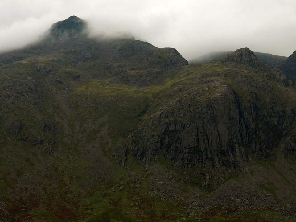
Scafell Pike hidden by cloud with Ill Crag to the right.

25.09.08-100.jpg

Casper above Great Moss.

25.09.08-110.jpg

The cloud is clearing from Scafell Pike now. The peak to the right of Esk Buttress is Pen. Now, should I climb Pen or climb Little Narrowcove? In the end I decided on Pen and climbed following the gill to the left of Esk Buttress - which was steep to say the least!
25.09.08-125.jpg

The Scafells reflected in a tarn on Great Moss.

25.09.08-128.jpg

Scafell.

25.09.08-132.jpg

Esk Pike at the head of Great Moss.

25.09.08-142.jpg

Great Moss from the climb to Pen, Hard Knott and Harter Fell in view.

25.09.08-159.jpg

Volcanic sedimentary layers on the summit of Pen.

25.09.08-161.jpg

25.09.08-164.jpg

The formidable East Buttress on Scafell.

25.09.08-168.jpg

The way to Scafell Pike from Pen.

25.09.08-195.jpg

Scafell, Broad Stand and Mickledore from the Eskdale Cairn on Scafell Pike.

25.09.08-201.jpg

Pillar, Kirk Fell, Great Gable and beyond from the summit Scafell Pike.

25.09.08-204.jpg

Looking over Styhead Tarn to Derwent Water, Skiddaw and the northern fells.

25.09.08-208.jpg

The eastern fells beyond the Scafell ridge.

25.09.08-219.jpg

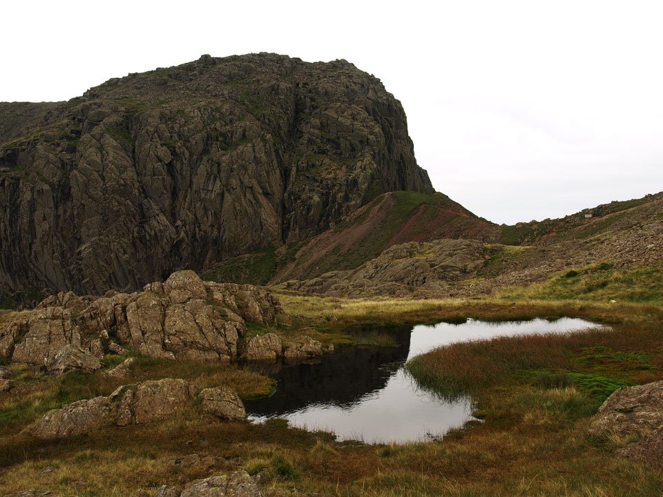
Broad Stand from Broadcrag Tarn - the highest tarn in the Lake District at 827m according to Wainwright and Birkett...but my mapping software shows Foxes tarn at 837m and Crinkle Crags Tarn (near the summit of Long Top, un-named on the OS map) at 854m. Now, should I climb Lord's Rake and climb Scafell or descend Cam Spout? Oops, look at the time - lets go!

25.09.08-235.jpg

Descending the Cam Spout path.

25.09.08-256.jpg

Upper Eskdale from the descent by Cam Spout, which was a mere trickle today.

25.09.08-258.jpg

Looking back to Cam Spout and Scafell.

25.09.08-271.jpg

The aforementioned Long Top.

25.09.08-274.jpg

I don't believe it! (to coin a phrase) - sunshine on Great Moss.

Upper Eskdale Round

Walked on 15/04/2005

Start point: Hardknott Pass summit (NY 230 014)

Hardknott Pass – Border End (326) – Hard Knott (327) – Eskdale Needle – Yew Bank (328) – Throstlehow Crag (329) –Scar Lathing (330) – High Scarth (331) – Silverybield (332) – Scale Bridge – Taw House – Brotherilkeld – Hardknott Castle Roman Fort – Hardknott Pass

Distance: 9.7 miles     Total Ascent: 1940 metres     Time Taken: 4 hours 35 minutes

Weather: Snow, rain, sleet, wind! 5oC.

Today’s walk is a round of Upper Eskdale, one of the wildest and best valleys in the Lake District. At the head of Eskdale lie the ‘heads of state’ of English mountains, namely Scafell Pike, Sca Fell, Esk Pike and Bow Fell and this area offers some of the finest views anywhere.

Once again, it seems winter has returned with snow showers present throughout the walk and fresh snow on top of the high fells.
Upper Eskdale

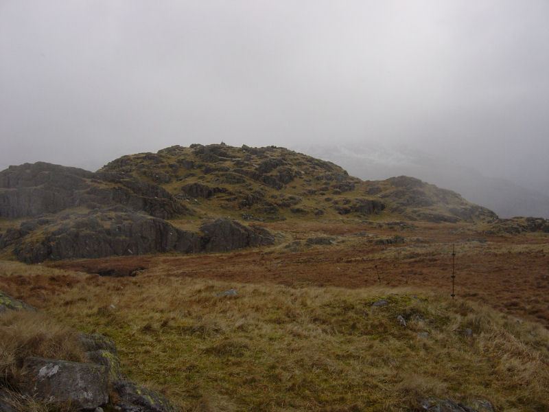
Upper Eskdale route map.

Upper Eskdale- 15th April 007

Approaching Hard Knott. The many electric fences in this area (one can be seen to the right) certainly made Angus squeak when he 'got it wrong'.

Upper Eskdale- 15th April 009

Harter Fell through a snow storm from the summit of Hard Knott.

Upper Eskdale- 15th April 014

The Eskdale Needle from the south.

Upper Eskdale- 15th April 017

The Eskdale Needle.

Upper Eskdale- 15th April 021

It was very windy on the summit of Yew Bank!

Upper Eskdale- 15th April 028

Across Lingcove Beck - the wall runs up to Throstlehow Crag, the next port of call with Scar Lathing the crag to the right. In the background are the Sca Fells complete with fresh snow.

Upper Eskdale- 15th April 029

Esk Pike and Bow Fell in cloud.

Upper Eskdale- 15th April 035

Looking along Eskdale to Harter Fell from Throstlehow Crag. Can you spot the Eskdale Needle?

Upper Eskdale - Panorama3_annotated_small

The view across Great Moss from Scar Lathing.

Upper Eskdale- 15th April 051

Crossing the River Esk.

Upper Eskdale- 15th April 052

Great Moss.

Upper Eskdale- 15th April 054

Slight Side from High Scarth.

Upper Eskdale- 15th April 056

Slight Side and High Scarth from Silverybield.

Upper Eskdale- 15th April 058

The impressive Yew Crags on the east face of Border End.

Upper Eskdale - Panorama4

Scale Gill waterfall.

Upper Eskdale- 15th April 067

Brotherilkeld Farm.

Upper Eskdale - Panorama5

Mediobogdum - Hardknott Roman Fort. The fort walls are to the left and to the right is the parade ground.

Walking Diary

  • The Mosedale Horseshoe 01/03/2022
  • Caw 18/01/2022
  • Coniston sunset 17/01/2022
  • Blencathra 15/01/2022
  • Scafell Pike 14/01/2022

Social

  • Facebook
  • Twitter

Information

  • Striding Edge
  • T&C’s
  • Privacy
  • Links