Height: 587 metres / 1926 feet Grid reference: NY 47241 06212 Category: The Far Eastern Fells
Kentmere from Shipman Knotts
Height: 587 metres / 1926 feet Grid reference: NY 47241 06212 Category: The Far Eastern Fells
Kentmere from Shipman Knotts
Start point: Kentmere (NY 456 041)
Kentmere – Garburn Pass – Yoke – Ill Bell – Froswick – Thornthwaite Beacon – High Street – Mardale Ill Bell – Nan Bield Pass – Harter Fell –Kentmere Pike – Shipman Knotts – Kentmere
Distance: 13 miles Total Ascent: 1161 metres Time Taken: 5 hours Start Time: 07:00
Weather: Overcast, 10C
The good weather certainly deserted me this morning and the walk from Kentmere to the top of the Garburn Pass was completed in pouring rain. The weather improved by drying up but the tops were shrouded in mist throughout the walk, although the sun did have a good attempt at trying to burn through but never quite made it. There were no views and no other people around today.

Kentmere Horseshoe route map.

Badger Rock in the rain.

Looking back to Kentmere.

A bit brighter now but still raining climbing the Garburn Road.

Heading for Yoke - what's that over there boys?

A glimpse of Windermere from the 'motorway'.

Yoke.

Ill Bell - there are only two cairns standing now...

...although there are three 'monuments' in this photo. Cheer up Dougal, it might never happen.

Casper checks out Kentmere Reservoir below.

Froswick.

Lingmell End on Mardale Ill Bell across Upper Kentmere.

Thornthwaite Beacon.

The summit of High Street.

Looks a bit clearer over on The Knott and Rest Dodd from the Roman Road.

Hayeswater.

In the absence of any views whatsoever, here is another dog/summit photo of Dougal on Mardale Ill Bell!

This is how to grade a path so that packhorses can get up them - the ancient track across Nan Bield Pass from Kentmere.

Kentmere Pike.

Shipman Knotts across the stile.

Kentmere Pike from Shipman Knotts.

Longsleddale from Shipman Knotts.

It looks a bit brighter now looking towards the Ill Bell ridge from Stile End.

Kentmere Pike and Shipman Knotts from Low Lane.

Crossing a sunny River Kent.

Sunshine over Green Quarter.

Kentmere Church.

Start point: Kentmere (NY 456 041)
Kentmere – Garburn Pass – Yoke – Ill Bell – Froswick – Thornthwaite Beacon – Mardale Ill Bell – Nan Bield Pass – Harter Fell – Kentmere Pike –Shipman Knotts – Kentmere
Distance: 12 miles Total Ascent: 1100 metres Time Taken: 4 hours 30 minutes
Weather: Sunny and clear with high cloud. 3°C.
Another fine and sunny day! It was even colder than ever in the valley this morning as temperatures struggled to get above zero – once up onto the fells however, it was really quite warm again in the sun. Only Casper for company today; Angus had a day off for a good sleep after the previous few days excursions!


Blue sky climbing the Garburn Road.

Heading across to Yoke.

Looking back to Windermere, the early morning mist still hanging on the lake.

The Coniston fells from the southern end of Yoke.

Looking west to the Scafells.

The route ahead is Yoke, Ill Bell, Froswick and Thornthwaite Crag.

Ill Bell from Yoke.

A lovely panorama from Yoke with Black Combe on the distant left, the Coniston fells over to Crinkle Crags and the Scafells with Great Gable and Pillar distant right.

Harter Fell from the frozen summit tarn on Yoke.

The route of the return leg - Mardale Ill Bell, the Nan Bield Pass and Harter Fell over Kentmere Reservoir.

The view from Ill Bell.

Climbing to Froswick, Thornthwaite Crag beyond.

Red Screes over Caudale Moor with Lingmoor Fell, Crinkle Crags and Bow Fell beyond.

Mardale Ill Bell and Kentmere Common across Kentmere.

Harter Fell from Froswick.

Heading along the frozen Thornthwaite Crag summit plateau.

Looking south-west from Thornthwaite Crag with Bow Fell distant centre.

Fairfield and Helvellyn.

Striding Edge and Helvellyn.

Bow Fell with the Langdale Pikes in front and the Scafells.

Fairfield and Dollywaggon Pike.

High Street.

Rest Dodd and The Knott across Hayeswater.

Casper on the summit of Mardale Ill Bell, Haweswater and The Pennines beyond.

Haweswater and the easterly view from Mardale Ill Bell.

Looking back to Thornthwaite Crag.

The flat top of Harter Fell ahead.

Small Water in shadow.

The climb to Harter Fell across Nan Bield Pass.

Looking back to Mardale Ill Bell and High Street.

High Street and Rough Crag with a glimpse of Blea Water from Harter Fell, Rampsgill Head and Kidsty Pike to the right.

The westerly view from the summit of Harter Fell.

Heading to Kentmere Pike.

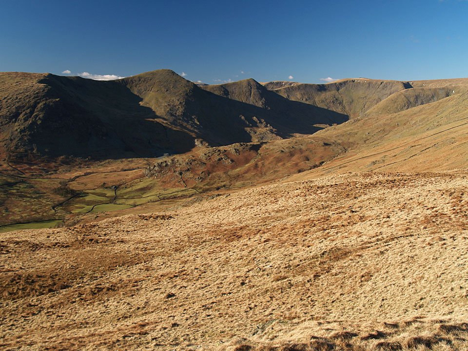
Kentmere from Shipman Knotts.

Longsleddale from the descent of Shipman Knotts.

Kentmere from Stile End.

Fell ponies in Kentmere.

Kentmere Horseshoe.

Hollow Moor, Green Quarter and Low Bridge from Kentmere.
Start point: Kentmere (NY 176 011)
Kentmere – Garburn Pass – Yoke (313) – Ill Bell (314) – Froswick (315) – Thornthwaite Beacon – Mardale Ill Bell – Nan Bield Pass – Harter Fell – Kentmere Pike (316) – Goat Scar (317) – Shipman Knotts (318) – Kentmere
Distance: 13.7 miles Total Ascent: 1436 metres Time Taken: 5 hours
The day started off brightly for today’s long Kentmere Horseshoe walk with the grey clouds gathering by lunchtime and taking the edge off the fine views. There is still plenty of snow on the tops although it was warmer than of late. This is a fine round with great views in all directions.

The Kentmere Horseshoe route map.

Elevation profile of the route.

3D image of the walk route.

Yoke ahead, with Ill Bell and Froswick appearing to the left.

The Coniston Fells from Yoke.

The view along Windermere from the summit of Yoke.

Panorama of the way ahead from Yoke.

The three summit cairns on Ill Bell.

The sun shines on Yoke from Ill Bell.

One man and his dog on Ill Bell.

Ill Bell from the approach to Froswick.

The head of Kentmere from Froswick.

Looking north-west towards Helvellyn from Thornthwaite Crag.

The view north on the way to Mardale Ill Bell.

A glittering Kentmere Reservoir with Yoke - Ill Bell - Froswick to the right.

Small Water and Haweswater from the descent to the Nan Bield Pass.

Yoke - Ill Bell - Froswick from Harter Fell.

No need to use the stile with all the snow drifting against the wall on Kentmere Pike.

Longsleddale from Goat Scar.

The wild ponies have come down to the valley for winter.

The Kentmere Horseshoe. Select on the image for a full size version.
Kentmere – Garburn Pass – Yoke (53) – Ill Bell (54) – Froswick (55) – Mardale Ill Bell (56) – Harter Fell (Mardale) (57) – Kentmere Pike (58) – Shipman Knotts (59) – Kentmere

Thornthwaite, Ill Bell and Yoke from the Garburn road.

Cairn on Yoke.

Ill Bell from Yoke.

Windermere from Ill Bell, Troutbeck Tongue in the centre, Wansfell to the right.

Thornthwaite Crag from Froswick summit.

Kentmere Reservoir.

Windermere from Froswick.

Wild ponies on Thornthwaite.

Mardale Ill Bell summit, Haweswater Reservoir behind.

Small Water and the southern end of Haweswater Reservoir from Mardale Ill Bell.

The Nan Bield Pass - Mardale or Kentmere?

Harter Fell summit.

Kentmere Pike summit.

Shipman Knotts summit looking over to Yoke and Ill Bell.