Striding Edge

A photo diary of Lake District fell walks

  • Walks
  • Fells
    • Wainwrights
      • Eastern Fells
      • Far Eastern Fells
      • Central Fells
      • Southern Fells
      • Northern Fells
      • North Western Fells
      • Western Fells
      • Outlying Fells
    • Birketts
  • Dogs
  • Love The Lakes
  • Contact

South Top of Black Combe

Height: 587 metres / 1926 feet Grid reference: SD 13572 85147
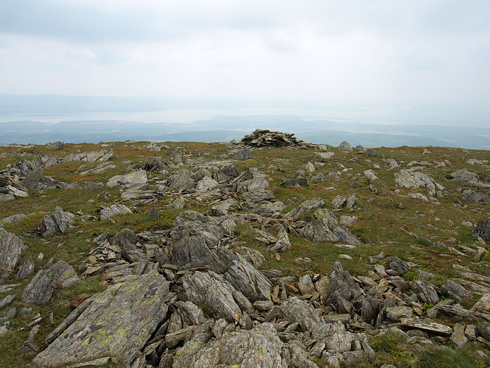
The South Top of Black Combe
The South Top of Black Combe

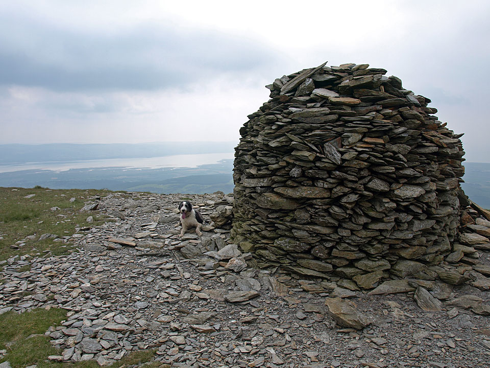
The large cairn on the South Top

The large cairn on the South Top

Black Combe

Walked on 05/06/2009

Start point: Whicham Church (SD 135 827)

Whicham Church – Black Combe (OF) – South Top of Black Combe – Seaness – Whicham

Distance: 4.7 miles     Total Ascent: 574 metres     Time Taken: 1 hours 45 minutes

Weather: Hazy with the odd sunny spell. 14C.

It feels like ages since I have been to Black Combe and even longer since I ascended from Whicham Church, the quickest and easiest way to get to the top. The weather wasn’t good for distant views as it was very hazy and the predicted rain came as I set off home in the car.
Black Combe

Black Combe route map.

05.06.09-005

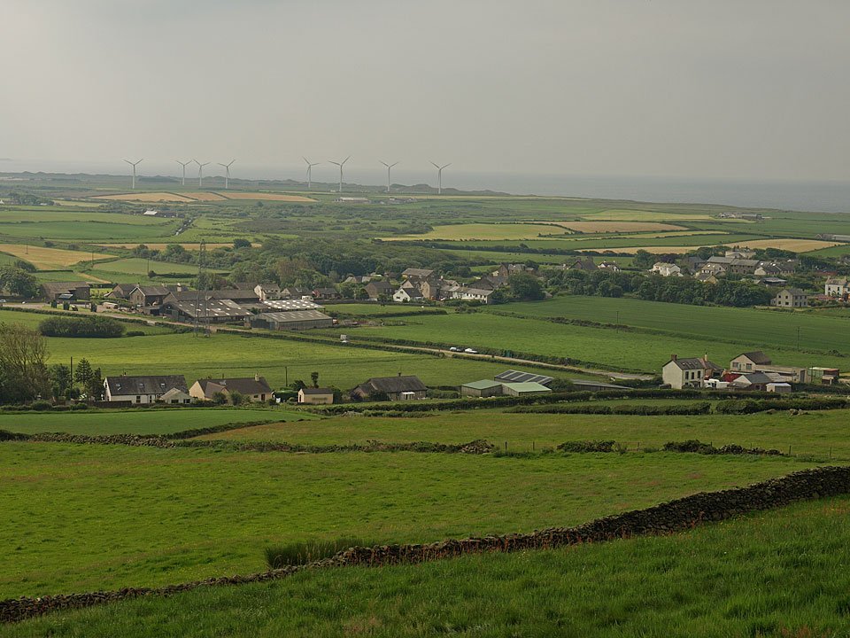
Looking across to Kirksanton and Silecroft Wind Farm. Some people complain about windmills spoiling the view but at Kirksanton there is an application to build a new nuclear power station right by that wind farm. I know which I would prefer.
05.06.09-013

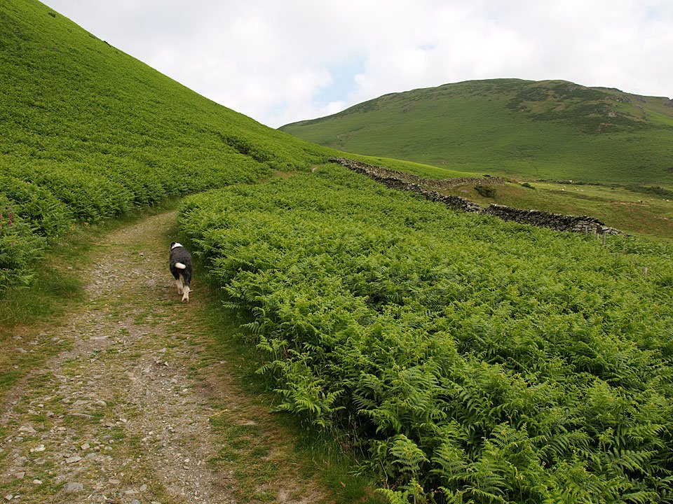
Foxgloves at the foot of Black Combe.

05.06.09-014

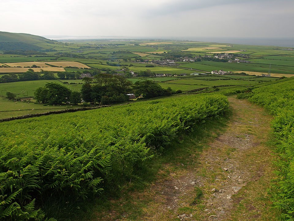
'Which other fell can be ascended in carpet slippers?' said Wainwright about the climb to Black Combe along this path from Whicham.
05.06.09-017

Looking back from further up the path. There are virtually no distant views today as it is so hazy but the Furness Peninsular can be made out on the horizon.

05.06.09-038

Black Combe summit ahead. What's Casper up to?

05.06.09-025

Having a roll in the grass of course!

05.06.09-049

The summit of Black Combe.

05.06.09-051

Casper in the shelter.

05.06.09-060

My, what a long tongue you have little Beardie boy.

05.06.09-062

Black Combe summit tarn.

05.06.09-071

The South Top of Black Combe.

05.06.09-073

Looking back over the tarn to the summit from the South Top of Black Combe.

05.06.09-075

The large cairn on the South Top with the Duddon Estuary beyond.

05.06.09-085

Descending to the Whicham Valley. The main path drops down in the middle of these two rises but I detoured off to the right which is Seaness. Is that Sea as in the water beyond the coast or does it have the same name as me?!

05.06.09-087

The Cumbrian coast from Seaness, Walney Island beyond.

05.06.09-090

Black Combe from Seaness.

05.06.09-096

Whicham Church.

Black Combe

Walked on 11/07/2007

Start point: Beckside (SD 153 847)

Beckside – Whicham Mill – Whitecombe Head – Black Combe (OF) – South Top of Black Combe – Eller Peatpot – Beckside

Distance: 5.5 miles     Total Ascent: 560 metres     Time Taken: 2 hours

Weather: Overcast. 15oC.

More cloud but no rain at least for our walk this morning up to Black Combe, that great hulk of fell at the south-western tip of the Lake District. It is a relatively easy ascent following Whitecombe Beck all the way to Whitecombe Head, the sting in the tail being the very steep descent to get back to the valley.

Black Combe

11.07.07-002

Whicham Mill.

11.07.07-003

Heading along Whitecombe Valley.

11.07.07-007

Whitecombe Beck.

11.07.07-013

Casper seems to like it in there!

11.07.07-016

Whitecombe Valley.

11.07.07-023

Looking across to Black Combe from the climb across the lower slopes of White Combe.

11.07.07-026

The same view from higher up, the clouds are down on the summit of Black Combe up to the right.

11.07.07-032

Looking along the valley to Barrow-in-Furness and Walney Island across the Duddon Estuary beyond Millom.

11.07.07-034

Heading for Black Combe.

11.07.07-040

Angus and Casper on the misty summit of Black Combe.

11.07.07-055

A close-up of Barrow and Walney Island with Haverigg in the foreground.

11.07.07-057

White Combe from Black Combe. The path used in ascent can be seen zig-zagging to the left.

11.07.07-059

Blackcombe Screes from Eller Peatpot.

11.07.07-066

Angus.

11.07.07-076

White Hall Knott from the descent.

11.07.07-081

Blackcombe Beck.

Black Combe

Walked on 19/06/2006

Start point: Beckside (SD 153 847)

Beckside – Whicham Mill – South Top of Black Combe – Black Combe (OF) – Whitecombe Moss – White Combe (OF) – White Hall Knott – Beckside

Distance: 6.25 miles     Total Ascent: 657 metres     Time Taken: 2 hours 30 minutes

Weather: Overcast. 16oC.

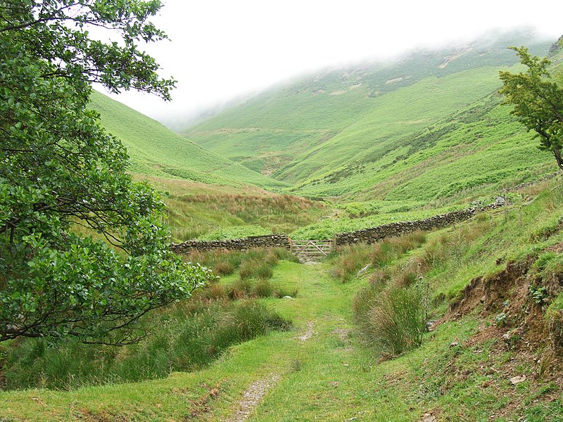
Another day with non-existent views; the whole of the Lake District seemed to be enveloped in low lying cloud today with the promise of further (summer!) weather like this for a few days yet. I had a walk up to Black Combe, a relatively easy walk, and a nice one whatever the weather – at least the rain held off!
01 Black Combe

19.06.06-002

Whicham Mill.

19.06.06-006

The way ahead following Whitecombe Beck. It is interesting to compare the predominately green colour of today's photos with those from last time here on 20th January
19.06.06-007

Whitecombe Beck.

19.06.06-012

Yes Casper, all the way up there.

19.06.06-022

Blackcombe Beck.

19.06.06-029

White Hall Knott from the climb to Black Combe alongside Blackcombe Beck.

19.06.06-032

Heading into the cloud.

19.06.06-036

Still need a drink though...

19.06.06-037

...from this boggy tarn!

19.06.06-039

Let's go!

19.06.06-043

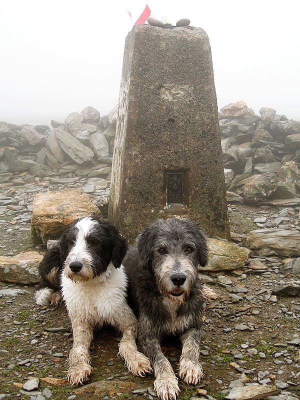
A misty Black Combe summit - I found an England flag on the way up, so it now resides on the top of the trig. column!

19.06.06-054

Angus.

19.06.06-055

Casper.

19.06.06-057

Out of the mist briefly, approaching White Hall Knott.

19.06.06-065

Looking along the Whicham Valley from White Hall Knott.

19.06.06-066

The path used to ascend Black Combe is the main track from the left up to the groove of Blackcombe Beck and then the faint path through the bracken to the right of the beck.

19.06.06-070

Whicham Valley.

19.06.06-074

Black Combe from the bottom, the top half still in cloud.

19.06.06-075

The ends of the horseshoe, Black Combe left and White Hall Knott, right.

Black Combe

Walked on 20/01/2006

Start point: Beckside (SD 153 847)

Beckside – White Hall Knott – White Combe (OF) – Whitecombe Moss – Black Combe (OF) – South Top of Black Combe – Whicham Mill – Beckside

Distance: 6.25 miles     Total Ascent: 657 metres     Time Taken: 2hours 20 minutes

Weather: Generally dull with the odd sunny spell. 7°C

Black Combe stands isolated at the south-western tip of the Lake District and today it stood isolated as the only cloud-free fell I could see! Well, it did at first, anyway – the mist soon rolled in to cover the very top of Black Combe by the time I arrived. The descent of Black Combe following this route is particularly attractive, following the beck all the way back to the start point.

01 Black Combe

20.01.06-002

White Hall Knott, White Combe and the White Combe ridge running to the left.

20.01.06-015

Catching a brief moment of sunshine on the steep ascent to White Hall Knott.

20.01.06-022

The Whicham Valley.

20.01.06-025

Black Combe from White Hall Knott, Blackcombe Beck running down the centre. The path to the right of the beck is the path used in descent.

20.01.06-025a panorama1

The Duddon Estuary and the Furness peninsula.

20.01.06-043

Looking into Black Combe.

20.01.06-043a panorama2

Panoramic Black Combe - two Angus' (Angi?!) in this one!

20.01.06-052

Looking along the valley from Whitecombe Head.

20.01.06-085

The Irish Sea and the West Cumbrian coastline through the mist from the summit of Black Combe.

20.01.06-089

Black Combe summit tarn.

20.01.06-094

Cold and windy by the tarn, it's blowing straight off the sea.

20.01.06-098

Misty Blackcombe Screes.

20.01.06-108

The wind is still blowing across this tarn further down. Behind is Whitecombe Head and beyond is Buck Barrow and Whitfell.

20.01.06-108a

White Hall Knott on the descent.

20.01.06-121

The accompaniment all the way down was the delightful Blackcombe Beck...

20.01.06-130

...tumbling down...

20.01.06-136

...and down...

20.01.06-139

...now it has turned into Whitecombe Beck, used to power Whicham Mill. See and hear Blackcombe Beck

Black Combe

Walked on 17/02/2005

Start point: Beckside (SD 153 847)

Beckside – White Hall Knott – White Combe (OF) – Whitecombe Moss – Stoupdale Head (OF) – Black Combe (OF) –South Top of Black Combe – Whicham Mill – Beckside

Distance: 6.25 miles     Total Ascent: 657 metres     Time Taken: 2hours 20 minutes

Weather: Sunny and bright.

Black Combe lies in the extreme south-west of the Lake District and its remoteness from other fells means that it is rarely visited and its detachment from the main fells means that it is easily identifiable from a distance.

The sun shone more than could have been expected this morning with the thick covering of cloud over the top of Black Combe lifting by the time I reached the summit. Black Combe is described in Wainwright’s Black Combe chapter in his book ‘The Outlying Fells of Lakeland’, page 176.

Black Combe

Elevation

Elevation profile of the route. Key: WHK=White Hall Knott, WC=White Combe, SH=Stoupdale Head, BC=Black Combe

Black Combe 3D

3D image of the walk route.

Black Combe - 17.02.05 001

White Hall Knott with the White Combe ridge running to the left.

Black Combe - 17.02.05 003

The Whicham Valley from the ascent of White Hall Knott.

Black Combe - 17.02.05 004

The cloud hangs on the very top of Black Combe, from White Hall Knott. The route used in descent is the shoulder running from the top left down through the centre.

Black Combe - 17.02.05 007

The Coniston Fells from White Combe. See below for an annotated version of this photo.

Black Combe annotated

Black Combe - 17.02.05 008

Sunrays over the Duddon Estuary.

Black Combe - 17.02.05 011

Black Combe from White Combe, the clouds clearing now.

Black Combe - 17.02.05 012

Looking north to the Scafell range in heavy cloud from Stoupdale Head.

Black Combe - 17.02.05 021

Looking back to Stoupdale Head from the ascent of Black Combe.

Black Combe - 17.02.05 033

View from a sunny South Top of Black Combe, annotation below.

Black Combe - 17.02.05 033 annotated

Black Combe - 17.02.05 036

Looking over White Combe to the Coniston Fells.

Black Combe - 17.02.05 044

Whitecombe Beck.

Black Combe - 17.02.05 046

Whicham Mill.

Black Combe

Walked on 05/07/2004

Start point: Beckside (SD 153 847)

Beckside – White Hall Knott (83) – White Combe (84) (OF) – Whitecombe Moss – Stoupdale Head (85) (OF) – Black Combe (86) (OF) – South Top of Black Combe (87) – Whicham Mill – Beckside

Weather: Sunny and bright, misty on Black Combe summit.

A walk in the sunshine today around the Cirque of Black Combe, a remote fell in the extreme south west of the Lake District. Its detachment from other fells makes it unique and its unobstructed view allows great views of the high fells and to the Irish Sea.

“the amplest range of unobstructed prospect may be seen that British ground commands” – said William Wordsworth about Black Combe.

As well as taking in the Birkett tops, parts of this walk are described in Wainwright’s Black Combe chapter in his book ‘The Outlying Fells of Lakeland’, page 162.

The walk started at Beckside on the A595 where there are parking spaces by the side of the road. I followed the tarmac for a short way until just before the Fox and Goose cottages, and then a track almost hidden by dense trees and signposted for White Combe lead to the heavily brackened fell side. The track went up the side of the fell, I followed it to the col and then cut back left to the grassy, flat summit of White Hall Knott
Black Combe

Dsc01180

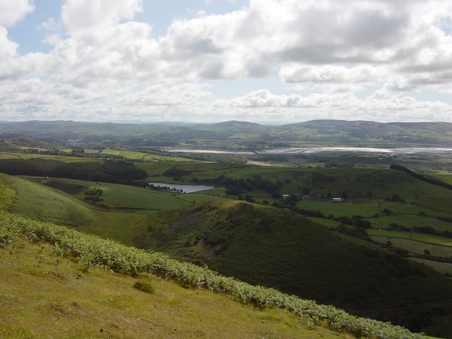
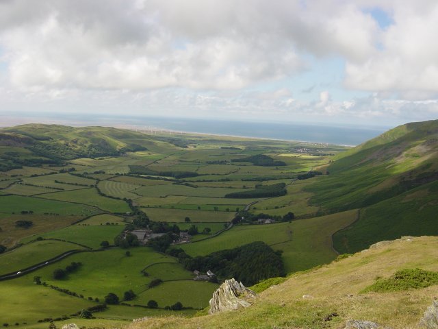
Kirkby Moor over the Duddon Estuary from the ascent of White Hall Knott. The water in the foreground is Baystone Bank Reservoir.
Dsc01183

Black Combe from White Hall Knott.

Dsc01184

Bowfell, The Crinkle Crags and the Coniston Fells from the summit of White Hall Knott.

Dsc01186

Looking down the Whicham Valley from White Hall Knott. From White Hall Knott, it was back along the shoulder and an easy ascent to the summit of White Combe, topped with a large stone cairn and wind shelter.
Dsc01188

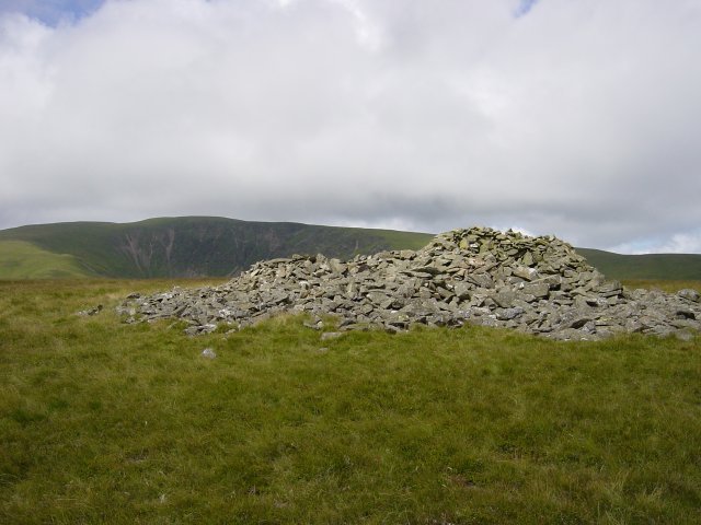
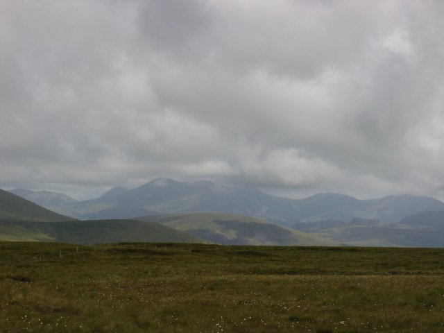
Black Combe from the summit of White Combe. From White Combe, it was an easy, pathless ascent over lush grassy moor to the summit of Stoupdale Head marked by a small pile of white quartz. The views to the Scafell range from here were stunning.
Dsc01198

The Scafell Pikes from Stoupdale Head summit.

Dsc01202

Zooming in on the Scafells. The Buttermere fells and Great Gable are to the left. From Stoupdale Head, it was back along the path following the rim of firstly Whitecombe and then Blackcombe Screes, up into the cloud at 550 metres and onto the summit of Black Combe.
Dsc01206

Black Combe summit

Dsc01207

and the summit tarn. From the summit, it was across the dip which holds the summit tarn and onto the South Top which has a large, round cairn which can be seen from the valley below.
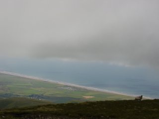
Dsc01209

The South Top of Black Combe summit

Dsc01212

and a view through the mist to the Irish Sea and West Cumbrian coastline. Then it was along the shoulder and head for the Whitecombe Beck valley below. Once below the cloud, the views to the south were fantastic.

Dsc01220

Barrow-in-Furness and Walney Island across the Duddon Estuary from the descent of Black Combe. From the steep descent to Whitecombe Beck, it was past Whicham Mill and through Rallis Farm and back to the start point of the walk at Beckside.

Dsc01222

The lovely Whicham Mill.

Dsc01224

Black Combe across the Duddon Estuary.

Walking Diary

  • The Mosedale Horseshoe 01/03/2022
  • Caw 18/01/2022
  • Coniston sunset 17/01/2022
  • Blencathra 15/01/2022
  • Scafell Pike 14/01/2022

Social

  • Facebook
  • Twitter

Information

  • Striding Edge
  • T&C’s
  • Privacy
  • Links