Height: 472 metres / 1548 feet Grid reference: SD 15147 87374 Category: The Outlying Fells
Stoupdale Head
Height: 472 metres / 1548 feet Grid reference: SD 15147 87374 Category: The Outlying Fells
Stoupdale Head
Start point: Corney Fell road (SD 150 896)Corney Fell road – Stoneside Hill – Charity Chair – Stoupdale Head (OF) – Black Crag – Raven Crag – Corney Fell road
Distance: 4.5 miles Total Ascent: 300 metres Time Taken: 2 hours
Weather: Grey, overcast and windy. 13oC.
It was a grey start to the day again today with plenty of rain and fast moving clouds around. I decided to stay relatively low and visit a pretty much unfrequented area to the south of the Corney Fell road, Swinside Fell. This was a really boggy route and quite hard going with only occasional, fleeting views of anything – and it felt so cold, almost (dare I say it?) Autumnal…


We couldn't see a thing in the mist on Stoneside Hill.

The mist suddenly clears for a while looking over to Hentoe Hill and Black Combe.

Charity Chair.

Looking back to Stoneside Hill, now out of the mist.

Plenty of bogs to roll in around here Casper!

The mist rolled back in again all the way to Stoupdale Head but suddenly cleared again at Derry, looking along Whicham Beck.

It's a bit windy up here!

Yep!

Knott Hill and the Duddon Estuary from Black Crag.

A panoramic view from Raven Crag - Swinside Farm below with Swinside Stone Circle, centre, and Knott Hill.

Something's going on in the Circle.

A storm brewing on the Coniston fells.

Couldn't see this at the start of the walk - the route to Stoneside Hill.
Start point: Beckside (SD 153 847)
Beckside – White Hall Knott – White Combe (OF) – Whitecombe Moss – Stoupdale Head (OF) – Black Combe (OF) –South Top of Black Combe – Whicham Mill – Beckside
Distance: 6.25 miles Total Ascent: 657 metres Time Taken: 2hours 20 minutes
Weather: Sunny and bright.
Black Combe lies in the extreme south-west of the Lake District and its remoteness from other fells means that it is rarely visited and its detachment from the main fells means that it is easily identifiable from a distance.
The sun shone more than could have been expected this morning with the thick covering of cloud over the top of Black Combe lifting by the time I reached the summit. Black Combe is described in Wainwright’s Black Combe chapter in his book ‘The Outlying Fells of Lakeland’, page 176.


Elevation profile of the route. Key: WHK=White Hall Knott, WC=White Combe, SH=Stoupdale Head, BC=Black Combe

3D image of the walk route.

White Hall Knott with the White Combe ridge running to the left.

The Whicham Valley from the ascent of White Hall Knott.

The cloud hangs on the very top of Black Combe, from White Hall Knott. The route used in descent is the shoulder running from the top left down through the centre.

The Coniston Fells from White Combe. See below for an annotated version of this photo.


Sunrays over the Duddon Estuary.

Black Combe from White Combe, the clouds clearing now.

Looking north to the Scafell range in heavy cloud from Stoupdale Head.

Looking back to Stoupdale Head from the ascent of Black Combe.

View from a sunny South Top of Black Combe, annotation below.


Looking over White Combe to the Coniston Fells.

Whitecombe Beck.

Whicham Mill.
Start point: Beckside (SD 153 847)
Beckside – White Hall Knott (83) – White Combe (84) (OF) – Whitecombe Moss – Stoupdale Head (85) (OF) – Black Combe (86) (OF) – South Top of Black Combe (87) – Whicham Mill – Beckside
Weather: Sunny and bright, misty on Black Combe summit.
A walk in the sunshine today around the Cirque of Black Combe, a remote fell in the extreme south west of the Lake District. Its detachment from other fells makes it unique and its unobstructed view allows great views of the high fells and to the Irish Sea.
“the amplest range of unobstructed prospect may be seen that British ground commands” – said William Wordsworth about Black Combe.
As well as taking in the Birkett tops, parts of this walk are described in Wainwright’s Black Combe chapter in his book ‘The Outlying Fells of Lakeland’, page 162.
The walk started at Beckside on the A595 where there are parking spaces by the side of the road. I followed the tarmac for a short way until just before the Fox and Goose cottages, and then a track almost hidden by dense trees and signposted for White Combe lead to the heavily brackened fell side. The track went up the side of the fell, I followed it to the col and then cut back left to the grassy, flat summit of White Hall Knott


Kirkby Moor over the Duddon Estuary from the ascent of White Hall Knott. The water in the foreground is Baystone Bank Reservoir.

Black Combe from White Hall Knott.

Bowfell, The Crinkle Crags and the Coniston Fells from the summit of White Hall Knott.

Looking down the Whicham Valley from White Hall Knott. From White Hall Knott, it was back along the shoulder and an easy ascent to the summit of White Combe, topped with a large stone cairn and wind shelter.

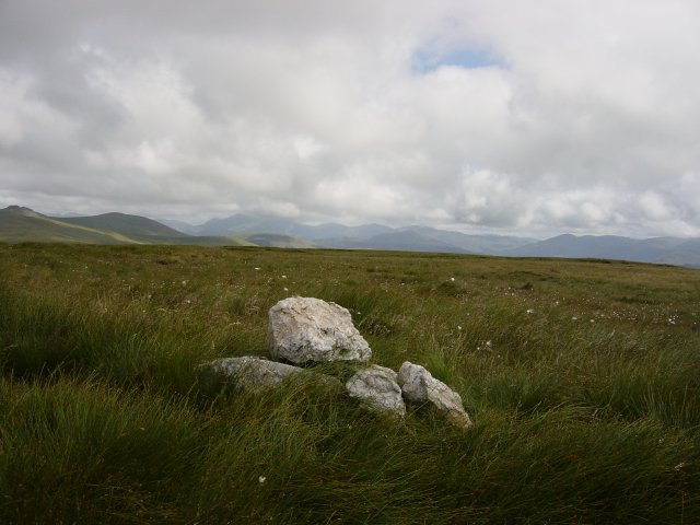
Black Combe from the summit of White Combe. From White Combe, it was an easy, pathless ascent over lush grassy moor to the summit of Stoupdale Head marked by a small pile of white quartz. The views to the Scafell range from here were stunning.

The Scafell Pikes from Stoupdale Head summit.

Zooming in on the Scafells. The Buttermere fells and Great Gable are to the left. From Stoupdale Head, it was back along the path following the rim of firstly Whitecombe and then Blackcombe Screes, up into the cloud at 550 metres and onto the summit of Black Combe.

Black Combe summit

and the summit tarn. From the summit, it was across the dip which holds the summit tarn and onto the South Top which has a large, round cairn which can be seen from the valley below.

The South Top of Black Combe summit

and a view through the mist to the Irish Sea and West Cumbrian coastline. Then it was along the shoulder and head for the Whitecombe Beck valley below. Once below the cloud, the views to the south were fantastic.

Barrow-in-Furness and Walney Island across the Duddon Estuary from the descent of Black Combe. From the steep descent to Whitecombe Beck, it was past Whicham Mill and through Rallis Farm and back to the start point of the walk at Beckside.

The lovely Whicham Mill.

Black Combe across the Duddon Estuary.