Height: 553 metres / 1814 feet Grid reference: NY 34757 30170
Bowscale Fell from The Tongue
Height: 553 metres / 1814 feet Grid reference: NY 34757 30170
Bowscale Fell from The Tongue
Start point: Mungrisdale (NY 361 303)
Mungrisdale – Souther Fell – Scales Fell – Blencathra – Bannerdale Crags – Bowscale Fell – The Tongue – Mungrisdale
Distance: 8.1 miles Total Ascent: 907 metres Time Taken: 4 hours Start Time: 08:40
Weather: An icy cold wind but clear. 5°C
There was a mighty cold and icy wind up on the top of Blencathra today and there was a fresh dusting of snow. The wind and ice were strong enough to keep me off Sharp Edge, that can wait until another day. To the south there was a big cloud build up and the way it lay right across the tops and kept changing made an intriguing backdrop throughout the walk.


The River Glenderamackin at Mungrisdale.

Sky over Great Mell Fell at the start of the climb to Souther Fell.

A bit leaden, but I wondered if it would brighten up?

Bowscale fell and The Tongue, the eventual route of descent.

Casper checks out Bannerdale and Bannerdale Crags. Blencathra is swathed in mist to the left.

The icy summit of Souther Fell. From here and right over Blencathra, the ice cold wind became quite strong.

The cairn at the south western end of Souther Fell.

Heading for Scales Fell.

Sharp Edge from Souther Fell.

The view of Sharp Edge and Foule Crag from Mousthwaite Comb.

Looking back to Souther Fell across Mousthwaite Comb.

Saddleback from Scales Fell.

A zoom shot showing the way the cloud was building to the south and that large layer pouring over the tops and into the valleys seemed to be creeping northwards.

Sharp Edge profile from Scales Fell.

Scales Tarn.

Doddick Fell Top and Scales Fell.

The icy summit of Blencathra, Hallsfell Top.

Hall's Fell Ridge.

Keswick and Derwent Water with that big cloud cap now on the high fells to the west.

Casper and Dougal on the summit of Blencathra.

Looks like playtime for the boys heading to Atkinson Pike.

The Back o' Skiddaw from the part frozen summit tarn.

A contrast in colours from Atkinson Pike.

Mono Blencathra.

The intriguing cloud cap to the south.

At the top of Sharp Edge.

Dougal Doo.

Descending Foule Crag, Bowscale Fell ahead.

Glenderamackin Valley.

Blencathra from Bannerdale Crags.

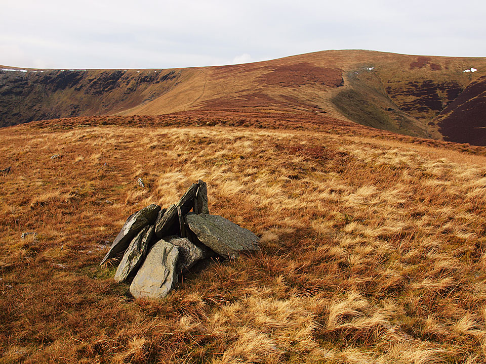
The main cairn to the north east.

Foule Crag on Blencathra from Bowscale Fell.

Skiddaw from Bowscale Fell summit.

Looks like that big cloud has overtaken Blencathra now as well.

Bowscale Fell from The Tongue.

Mungrisdale from the top of the steeper than steep descent.

Looking back to The Tongue from near Mungrisdale. By the time I got to the car and onto the A66, all the fells that I had been watching under cloud all morning were now clear with the exception of Blencathra which stood alone with its own cloud cap!
Start point: Bowscale (NY 358 317)
Bowscale – Bowscale Tarn – East Top on Bowscale Fell (387) – Bowscale Fell (388) – The Tongue (389) – Bannerdale Crags (390) – Blencathra – Mungrisdale Common – Cloven Stone – Lonscale Pike (391) – Lonscale Fell (392) – Jenkin Hill (393) – Skiddaw Lesser Man (394) – Skiddaw Little Man (395) – Skiddaw – Bakestall – Whitewater Dash – Little Calva (396) – Knott – Coomb Height (397) – Little Lingy Hill (398) – Great Lingy Hill (399) – Hare Stones (400) – High Pike (401) – Miton Hill (402) – Round Knott (403) – Carrock Fell (404) – Mungrisdale – Bowscale
Distance: 25.8 miles Total Ascent: 2447 metres Time Taken: 10 hours 50 minutes
Weather: Sunny and warm with a slight breeze. 25°C.
Today’s walk was a long circuit of the quiet fells known as ‘The Back o’ Skiddaw’. The weather was very pleasant, not as hot and muggy as it has been recently with a slight, welcome, cooling breeze. The views were absolutely superb at times and I was glad I chose today to do this long walk. The only problem was I forgot my food and 26 miles is a long way without any fuel…

Back O' Skiddaw route map.

Early morning light on Carrock Fell. This was to be the last fell of the walk, some 11 long hours later.

Looking along the Mosedale valley.

Bowscale Tarn, keeper of two immortal fish so legend has it and mentioned by Wordsworth in his poem 'Song at the Feast of Brougham Castle', 1807. '...And both the undying fish that swim, Through Bowscale Tarn did wait on him, The pair were servants of his eye, In their immortality, They moved about in open sight, To and fro, for his delight...'

Strange light and a band of thick low lying cloud to the south from Bowscale Fell's subsidiary east top.

The north western fells seen between Blencathra and Skiddaw.

Blencathra from Bannerdale Crags.

Skiddaw across the summit tarn on Blencathra.

The summit of Blencathra.

Skiddaw from that most derided of Wainwright fells (for not being a true summit), Mungrisdale Common.

Lonscale Fell from Mungrisdale Common. It was a sharp drop off from Blencathra down to Mungrisdale Common then an incredibly steep pull to get back up onto Lonscale Fell via Burnt Horse.

Great Calva from the climb to Lonscale Fell.

The view from Lonscale Pike, the east peak of Lonscale Fell. In the centre is High Rigg with Tewet Tarn visible and Thirlmere behind.

Skiddaw Lesser Man. Little Man and Skiddaw from Jenkin Hill.

There were superb, breath taking views from the climb up to Skiddaw.

The north-western fells from Skiddaw.

Bassenthwaite Lake and Sale Fell from Skiddaw. Not as cold as the last time we were here.

The view reached as far as Scotland over the Solway Firth to Criffel.

Binsey along the Dash Valley. To reach this point was another steep drop off from Bakestall down Birkett Edge and then a hard climb following the fence up to Little Lingy Fell.

The path to Knott.

A quick rest on Coomb Height, Carrock Fell in the background.

High Pike had a welcoming seat...

Evening light and the cloud begins to form on Skiddaw, seen from Round Knott.