Height: 514 metres / 1686 feet Grid reference: NY 33016 23023
Blencathra from Threlkeld Knotts
Height: 514 metres / 1686 feet Grid reference: NY 33016 23023
Blencathra from Threlkeld Knotts
Start point: Wanthwaite (NY 316 232)
Wanthwaite – Fisher’s Wife’s Rake – Jim’s Fold – Clough Head – Red Screes – Threlkeld Knotts – Wanthwaite
Distance: 3.5 miles Total Ascent: 601 metres Time Taken: 2 hours 30 minutes Start Time: 12:25
Weather: Sunny and warm. 15ºC
It was a dogless walk today as I took the opportunity to get up to Clough Head in sunny weather with Robin. We ascended by the steep Fisher’s Wife’s Rake and descended by the even steeper Red Screes north face of Clough Head. Looking around, there were a few fells that were in and out of cloud and I think we caught best part of the day as well.

Clough Head route map.

First view of Skiddaw and Lonscale Fell from the Old Coach Road.

There were some big clouds to the south, here looking into St. John's in the Vale.

High Rigg.

Following the wall to Fisher's Wife's Rake beneath Wanthwaite Crags.

Skiddaw and Blencathra from the foot of Fisher's Wife's Rake.

Climbing the rake.

The key to finding the rake is the single Rowan tree at the bottom of these crags.

The view down Fisher's Wife's Rake - it's a steep climb but not as bad as it looks on this photo as the path crosses from right to left across this scree run.

A panoramic view from the rake.

The view from the top of the rake.

Skiddaw and Blencathra.

High Rigg and layers of fells beyond.

Standing on the edge.

That's one way to get down quick!

Thirlmere across Sandbed Gill with the distant Scafells in cloud.

Jim's Fold.

Sky.

Fells.

Skiddaw from Clough Head, back in sunshine now.

A mono view of the Vale of Keswick.

Robin does a Wainwright (Clough Head 7).

The Skiddaw massif.

Great Mell Fell.

Blencathra.

A glimpse of Derwent Water and Bassenthwaite Lake, Tewet Tarn in the centre.

At the top of the steep descent.

Looking back, it seems almost impossible to descend the north face of Clough Head but we came straight down the centre in this photo.

Threlkeld Knotts summit.

Hall's Fell Ridge.

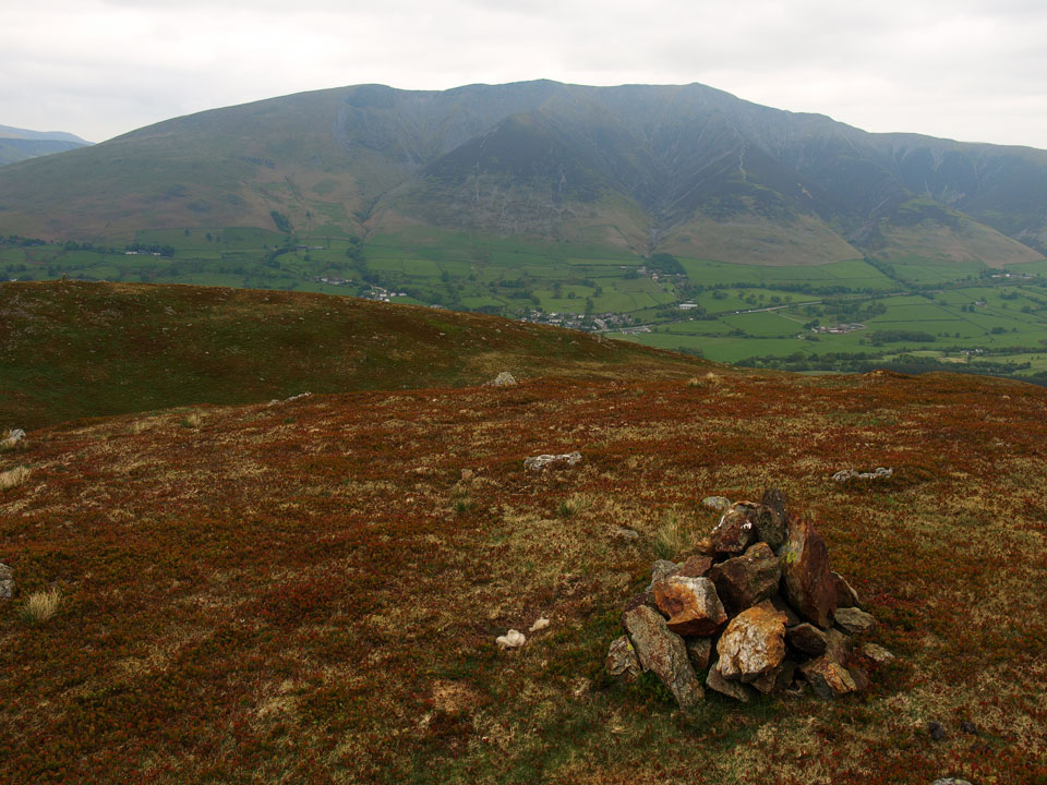
The more substantial cairn further north of Threlkeld Knotts. Much later, on the way home...

...a beautiful sunset over Windermere.
Start point: Wanthwaite (NY 315 232)
Wanthwaite – Threlkeld Knotts (535) – Wanthwaite
Distance: 2.2 miles Total Ascent: 365 metres Time Taken: 1 hour
Weather: Dull. 14ºC.
It has been wall to wall sunshine all week, with lovely blue skies and brilliant days to be out walking – not for me though, unfortunately; I did manage to find a spare couple of hours today for a walk up to Threlkeld Knotts bit it’s a bit of a shame the weather has taken a turn for the worse. Great to be out once again though even if the views weren’t stunning today – this is an area on the end of the Helvellyn ridge which offers really good views of Skiddaw and Blencathra and is famous for its granite mines and quarries.


Threlkeld Knotts from Wanthwaite. The route was through the spoil heaps and gorse on the right and over the wall above.

High Rigg from Hilltop Quarries.

Wrong way Casper! Looking towards Fisher' Wife's Rake - I was tempted but I'll do that another day.

Latrigg, Lonscale Fell and the Skiddaw massif from the climb to Threlkeld Knotts.

Blencathra from Threlkeld Knotts.

Skiddaw and beyond.

Maverick and (An) Goose! (a starter for 10 - which film?).

The westerly view from Threlkeld Knotts.

To the north-west, there is a more substantial cairn and a much better view of Blencathra.

There is a much better view of Skiddaw too.

Great Mell Fell and Threlkeld Common.

Threlkeld Knotts dwarfed by Red Screes on Clough Head.
Wanthwaite – Threlkeld Knotts – Clough Head (113) – Calfhow Pike – Little Dodd (St John’s Common) – Great Dodd (114) – Watson’s Dodd (115) – Great Dodd – Randerside – Mariel Bridge – Old Coach Road – Wanthwaite

Skiddaw from Wanthwaite, the start of the walk.

High Rigg from the climb to Threlkeld Knotts. The colours have just started to turn autumnal.

Skiddaw from Threlkeld Knotts summit.

Blencathra from the summit of Clough Head.

Great Dodd from the summit of Clough Head.

Calfhow Pike from the descent of Clough Head.

Thirlmere from Calfhow Pike, High Seat in the far distance.

Great Dodd summit.

Watson's Dodd from Great Dodd.

Skiddaw and Blencathra from Watson's Dodd summit.

The summit of Randerside on the descent of Great Dodd, Catstycam and Helvellyn are in the distance.

The old coach road crossing the Mosedale Beck, Blencathra is in the distance.