Height: 222 metres / 630 feet Grid reference: SD 27272 89621 Category: The Outlying Fells
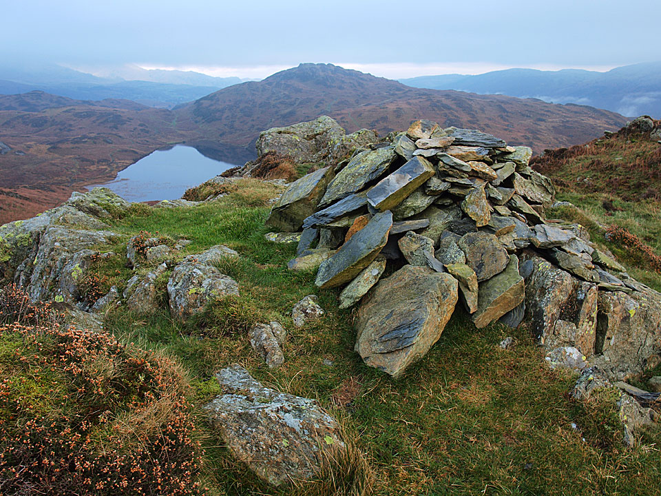
Beacon Fell and Tarn from the summit of Wool Knott
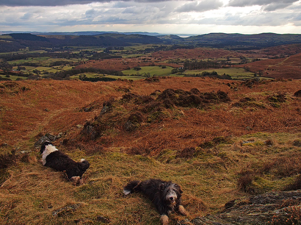
Looking southwards along the Crake Valley
Height: 222 metres / 630 feet Grid reference: SD 27272 89621 Category: The Outlying Fells
Beacon Fell and Tarn from the summit of Wool Knott
Looking southwards along the Crake Valley
Start point: Woodland Fell road (SD 256 879)
Woodland Fell Road – Blawith Knott (OF) – Angus Tarn – Tottlebank Height (OF) -Round Haw – Wool Knott (OF) – Slatestone Fell – Tottlebank Height (OF) – Woodland Fell Road
Distance: 4.7 miles Total Ascent: 417 metres Time Taken: 2 hours Start Time: 09:25
Weather: Cold and changeable with showers. 2C
The weather was completely odd in the south west Lakes this morning – when I set off it was cold and clear with an inversion over Coniston Water but I was soon overtaken by higher level cloud which was constantly clearing then dropping down again. At one point it started raining as well and you couldn’t tell what it would be like from one minute to the next. It was good to get out on a walk today though – it is Casper’s 7th birthday today, so Happy Birthday to him!

Blawith route map.

All looks nice and sunny on Blawith Knott at the start of the walk...

...but, looking the other way - look what's coming right for us across Kirkby Moor!

On the summit of an eerie Blawith Knott.

I don't know what you have been licking (ugh!) but Happy Birthday Casper, 7 today!

A glimpse of the Coniston Fells.

Dougal heads for Tottlebank Height. Beyond, there is a temperature inversion over Coniston Water and the Crake Valley.

Beacon Fell left, Angus Tarn centre and Tottlebank Height on the right with the Coniston Water inversion visible along its length.

Angus Tarn is frozen today Dougal!

A frozen pool on the way to Tottlebank Height.

Wool Knott and Beacon Fell.

Inversion in the Crake Valley.

Casper and Dougal don't know what to make of the strange light.

Beacon Fell and Tarn from the summit of Wool Knott.

Sunlight over Morecambe Bay.

The light is giving the inversion an other worldly look.

The clouds above are thickening now.

Crake Valley panorama.

Dramatic sky, dramatic inversion from Slatestone Fell. Now there's an odd thing - it was absolutely chucking it down now and freezing cold but I didn't think you could get an inversion in those conditions.

Coniston Water in the rain from Slatestone Fell.

Walking the damp, walled highway on the way back - Tottlebank Height ahead.

It's all change over Wool Knott now!

Looking back to Slatestone Fell, the mist now clearing and the rain has gone.

A panoramic view from the same place.

The mist is constantly clearing and then reforming.

Dead tree on Tottlebank Height.

I climbed back to the top of Tottlebank Height to have another look around, here looking to Wool Knott and Beacon Fell.

Clearing Coniston Fells from Tottlebank Height.

Kirkby Moor.

Big sky looking towards Black Combe now under a thick blanket of cloud.

A final dip and a drink for the boys at the foot of Blawith Knott.
Start point: At the end of the minor road from Brown Howe (SD 281 916)
Tottle Bank – Beacon Fell (OF) – Beacon Tarn – Wool Knott (OF) – Tottle Bank
Distance: 3 miles Total Ascent: 245 metres Time Taken: 1 hour
Weather: Cool, clouding over. 5°C
This morning was lovely and clear with wall to wall blue sky…by the time I eventually made it out all that was gone and had been replaced by quite thick, grey cloud. There was the odd sunny spell but nothing like earlier conditions and I managed a quick walk up to Beacon Fell which turned out to be a muddy and squelchy one too.

The Coniston fells and the holly tree at the start of the climb to Beacon Fell.

Blue sky over towards Caw and Dunnerdale.

Moody skies over Wetherlam and beyond in complete contrast to earlier this morning.

Casper and Dougal patiently wait for me at the gully.

Coniston Water.

High Nibthwaite and the southern end of Coniston Water.

Beacon summit.

The Coniston fells from Beacon - there is no treasure tin here now.

There is, however, a muddy pool and these two have just found it again!

Almost a full length view of Coniston Watrer.

Beacon Tarn and Wool Knott above it, to the left.

A brief iinterlude of bright sunshine looking back to Beacon Fell.

The Coniston fells across Beacon Tarn. This end of the tarn is still frozen.

Beacon Tarn and Beacon Fell from Wool Knott.

Looking southwards along the Crake Valley.

Down at the tarn - time to get cleaned up a bit in here for Casper and Dougal.

Coniston in winter.
Start point: Woodland (SD 248 895)
Woodland – Yew Bank (OF) – Beacon Tarn – Wool Knott (OF) – Green Moor Farm – Woodland
Distance: 5.3 miles Total Ascent: 464 metres Time Taken: 2 hours 30 minutes
Weather: Overcast but warm with rain showers. 19oC.
After being ill this week, I was just about stir crazy today – as indeed were Angus and Casper! This was a gentle walk which allowed us to get some fresh air without unnecessary exertion. The views today were virtually non-existent, firstly the haze smothered everything and later the rain came to finalise it. I really like it round here though, and it’s certainly quiet and tranquil – only a distant group of people across Beacon Tarn broke the solitude today.


Yew Bank from Hause, the route of ascent is the path in the centre of the photo.

The two sentinels guard the bridge over Strands Beck, Yew Bank beyond.


Foxgloves on the way to Yew Bank.

Not a good day for views today, the Coniston fells are just a silhouette and the rain is coming.

The summit of Yew Bank.

A large transporter plane heading towards Caw and Pikes. See how Casper gets through the heather in this movie...like a porpoise of course!

Beacon Tarn and Wool Knott in the rain.

The rain won't bother Angus though, he's getting very wet (spot him?).

Casper prefers to watch.

Looking the other way from Wool Knott to Beacon Fell over Beacon Tarn.

A pool on Green Moor Beck.

Footbridge over Green Moor Beck.
Start point: Woodland (SD 248 895)
Woodland – Yew Bank (OF) – Beacon Tarn – Wool Knott (OF) – Green Moor Farm – Woodland
Distance: 5.3 miles Total Ascent: 464 metres Time Taken: 2 hours
Weather: Dull and drizzly, 12°C.
Today’s walk is over little known and little frequented Woodland Fell which lies between Torver and Broughton. It is a lovely secluded place, very quiet, with great views to the Coniston fells in clear weather. Today, the weather was not kind with constant drizzle and grey skies – it felt like November, not June! Here is a snippet of how A.Wainwright described Woodland Fell ‘….the walk here described is a connoisseurs piece, every step an uninhibited joy, every corner a delight. No footmarks, no litter…’. I must say I agree with him.
This walk follows Wainwright’s Woodland Fell chapter in his book ‘The Outlying Fells of Lakeland’, page 102.

Woodland Fell route map.

Yew Bank from Strands Beck.

Foxgloves in abundance on Woodland Fell.

The summit of Yew Bank.

Beacon Fell from the cairn above Beacon Tarn.

Beacon Tarn - re-christened 'Sparkly Tarn' by Connie two weeks ago - not looking quite so sparkly today.


Green Moor Farm.

The footbridge, Green Moor Beck.
Start point: Woodland (SD 248 895)
Woodland – Yew Bank (OF) – Beacon Tarn – Wool Knott (OF) – Green Moor Farm – Woodland
Weather: Dull and overcast.
A short walk today following Wainwright’s Woodland Fell chapter in his book ‘The Outlying Fells of Lakeland’, page 102. This is a very quiet area indeed – a good place to get away from it all. Woodland Fell is the area covered in the walk, not actually the name of a fell; the summits visited are named Yew Bank and Wool Knott


Yew Bank from Strands Beck. The narrow tarmac road from the main Woodland road goes through a pleasant wood and across open pasture until Strands Beck is reached. Here Yew Bank is straight ahead and it is short climb up the pass between The Knott and Yew Bank and a right turn up to the impressive cairn on Yew Bank.

Modern cairn on Yew Bank looking to Beacon Fell. Some 100 metres east of the main cairn is an ancient cairn, marked on the O.S map.

The ancient cairn on Yew Bank. From here, it is over undulating ground and a final steep ascent to Tarn Riggs and then down to the lovely Beacon Tarn.

The twin peaks of Wool Knott across Beacon Tarn. From here it is an easy climb to Wool Knotts summit.

Beacon Tarn from Wool Knotts.

Beacon Fell and Beacon Tarn from the summit cairn on Wool Knotts. Back down to the depression and follow the easy bridleway to Green Moor Farm.

The slate footbridge over Green Moor Beck and Green Moor Farm. Follow the track through the farm and then a pleasant old wood abundant with flowers, almost back to the car.


Church of St John the Evangelist, Woodland.