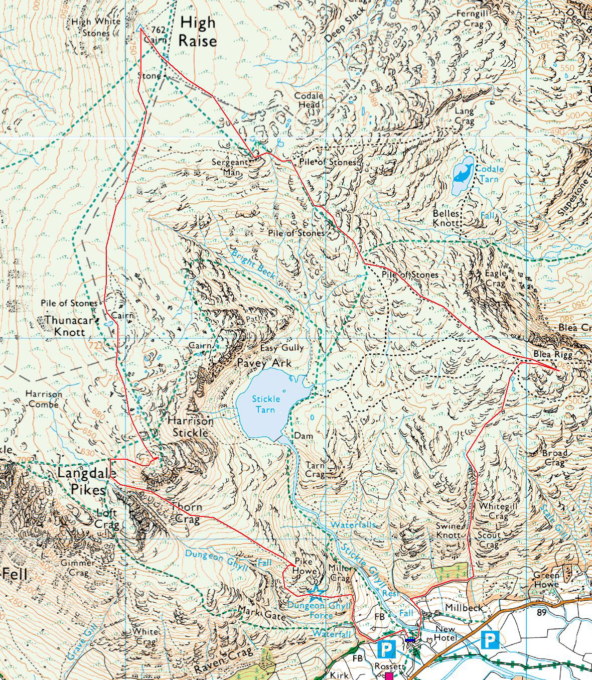
Start point: New Dungeon Ghyll Car Park (NY 295 064)
New Dungeon Ghyll – Whitegill Crag (ravine) – Blea Rigg – Sergeant Man – High Raise – Thunacar Knott – Harrison Stickle – Pike Howe – New Dungeon Ghyll
Distance: 6.4 miles Total Ascent: 778 metres Time Taken: 4 hours 15 minutes Start Time: 08:30
What a fantastic morning, the sky and light were excellent today and it was a great day to try out a scramble up to Blea Rigg using the Whitegill Crag ravine. If you like it steep and rough, then this is the way for you. Using this route I hardly saw a soul all morning (only from afar using the more popular paths) but I did bump into Striding Edge stalwarts Pat & Emrys on the way down – nice to see you both up there today.

Looking along Langdale from the path above Millbeck - what a beautiful and clear morning.

The way up today via the Whitegill Crag ravine. I'm not sure if the token on top of the rock has some significance!

Steep and rocky.

A wider view of Whitegill Crag.

Looking down, Lingmoor Fell across the valley.

The view from higher up...

...and from the top.

Looking across to the Langdales.

I had a bit of fun looking around for some of the items mentioned by Wainwright in the Blea Rigg chapter today - this is the sheepfold taken from 'small shelter on top of crag' (Blea Rigg 8).

...and this is the tarn a little further up on the map.

Blea Rigg summit.

The Shelter Stone on the top of Blea Rigg (Blea Rigg 12)

Codale and Easdale Tarns.

Looking in the opposite direction to the Langdale Pikes.

The miniature pool (Blea Rigg 11).

At least someone has found a use for it.

Pavey Ark and Stickle Tarn.

Sergeant Man from the east.

Crinkle Crags and Bowfell from Sergeant Man.

A beautiful pool on High Raise.

Skiddaw and Bassenthwaite Lake from High Raise.

Bowfell, the Scafells and Great Gable from High Raise.

Fletch and Dougal looking very regal with new haircuts.

Thunacar Knott.

Hello you two.

Windermere from Harrison Stickle.

Pavey Ark and Stickle Tarn (and way beyond).

What a great view from Harrison Stickle looking in the opposite direction.

Lots of families around today which was great to see.

The view from Harrison Stickle - Crinkle Crags and Bowfell beyond Loft Crag and Pike o' Stickle.

Harrison Stickle from Pike Howe.

Loft Crag and Harrison Stickle seperated by Dungeon Ghyll.

Whitegill Crag (the lower peak). The path used at the start of the walk was below the Larch plantation.

The Langdale Pikes looking radiant.