Start point: St Anthony’s Church, Cartmel Fell (SD 416 898)
Cartmel Fell (Raven’s Barrow) (OF)
Weather: Sunny and bright.
Today’s walk follows Wainwright’s Cartmel Fell chapter in his book ‘The Outlying Fells of Lakeland’, page 42.
Walked on
Start point: St Anthony’s Church, Cartmel Fell (SD 416 898)
Cartmel Fell (Raven’s Barrow) (OF)
Weather: Sunny and bright.
Today’s walk follows Wainwright’s Cartmel Fell chapter in his book ‘The Outlying Fells of Lakeland’, page 42.
Walked on
Start point: Roadside parking on The Droomer Estate, Windermere (SD 419 980)
Windermere – School Knott (OF) – Grandsire (OF) – a nameless summit 806′ – Windermere
Weather: Dull and overcast with the odd sunny spell.
Today’s walk follows Wainwright’s School Knott chapter in his book ‘The Outlying Fells of Lakeland’, page 30.
Walked on
Start point: Bowness Knott Car Park (NY 109 153)
Bowness Knott Car Park – Bowness Knott (148) – Brown How (Ennerdale) (149) – Herdus (150) – Great Borne (151) – Gale Fell (152) – Starling Dodd (153) – Little Dodd (Ennerdale) (154) – Bowness Knott Car Park
Weather: Dull and overcast with the odd sunny spell.
Today’s walk takes in part of the High Stile group of fells from Ennerdale Water.
Walked on
Start point: The back road, Bowston (SD 490 980)
Bowston – a nameless summit 1262′ – Brunt Knott (147)(OF) – a nameless summit 1266′ – Ulgraves (OF) – Bowston
Weather: Started off bright but worsening with one heavy shower.
Today’s walk follows Wainwright’s Potter Fell chapter in his book ‘The Outlying Fells of Lakeland’, page 8.
There are spaces for parking on the back road between Bowston and Staveley 100m beyond Hagg Foot Farm. A footpath signposted ‘Side House’ shows the way from the road, and the grassy path leads through woodland to reach it.
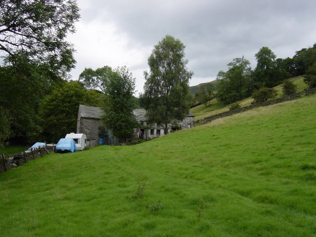
Side House. Round the back of the house, the path follows a walled lane. A 'no access' sign blocks the way of the Wainwright route; another signs points the permitted way to Potter Tarn. It is only a slight detour as you can then follow the wall up and resume the route above Potter Tarn.
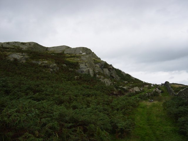
Rocky outcrop en-route to a nameless summit 1262'. Turning left at the rocky outcrop, there are many false summits before you reach the nameless grass summit. Directly ahead lies Brunt Knott, its cairn visible on the horizon.
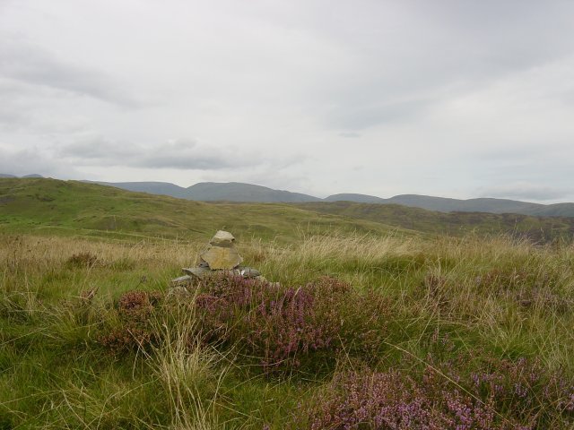
irkstone Pass and The Eastern Fells from a nameless summit 1262'. Following the wall down to a depression, note the wall running through a pool on the right, cross it and head for the steepening summit of Brunt Knott.
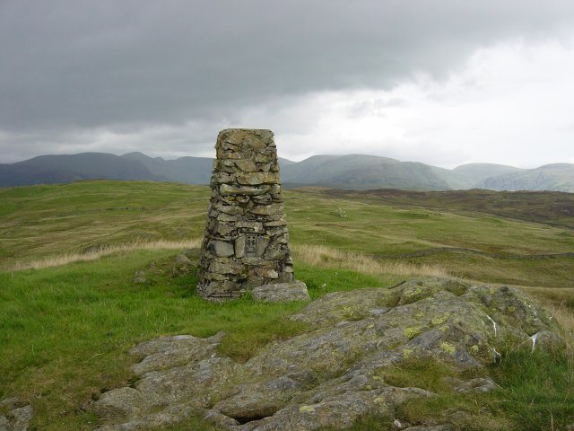
From Brunt Knott summit: Yoke, Ill Bell and Froswick to the left, the flat summit of Thornthwaite Crag, centre, and Harter Fell, Kentmere Pike and Shipman Knotts to the right. I headed boggily eastwards, over a stile in the wire fence to a junction of walls, crossed it at the stile and then followed another wall to a heathery nameless summit.
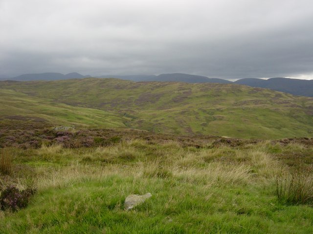
The Eastern Fells from a nameless summit 1266'. The way to Ulgraves basically follows the line of the walls. I had to hunt for ways through all the cross walls and access here is difficult. On reaching the Ulgraves enclosure, there is gated access and it is a steep grassy climb past the cows to the large cairn on the summit. As I arrived here the heavens opened but there was still a magnificent full length view of the Longsleddale valley.
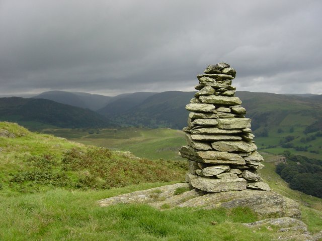
Looking along Longsleddale from the summit of Ulgraves. From Ulgraves, Gurnal Dubs reservoir can be seen below. I headed for this, crossed a fence and went around the south side of Gurnal Dubs although the path goes either way. The major path takes at its outlet takes you down to Potter Tarn.
Walked on
Start point: Grasmere (NY 337 076)
Grasmere – Easedale – Easedale Tarn – Tarn Crag (140) – Codale Head (141) – Sergeant Man (142) – High Raise (143) – Calf Crag (144) – Gibson Knott (145) – Helm Crag (146) – Grasmere
Weather: Sunny at first, rain later.
Today’s walk is a circuit of Grasmere Common, taking in the ever popular Easedale Tarn and the high point of High Raise.
Car parking for this walk is in the village of Grasmere, the popular car park for walks in this area on the Easedale Road has now been transformed into a mini housing estate!
Setting off in bright sunshine (surprising as it was pouring down earlier), I followed the Easedale Road up to Easedale, over the bridge and through an iron gate onto the well defined rocky path.
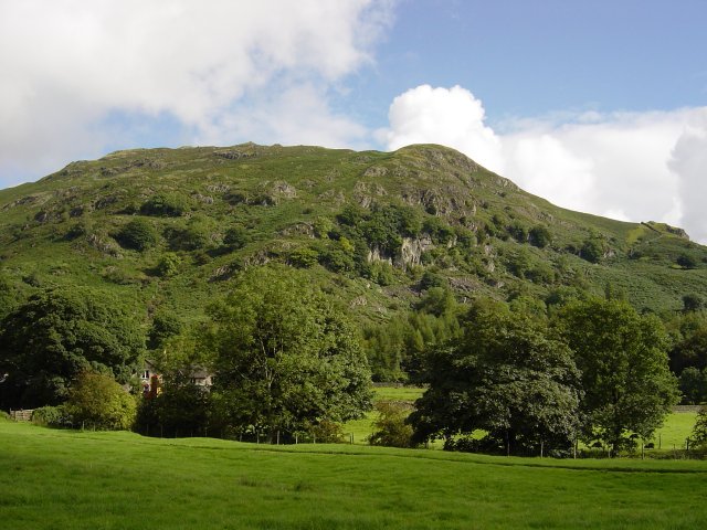
Helm Crag from Easedale. The path follows the stream with Sourmilk Gill waterfalls visible ahead and ascends adjacent to them. The falls were in full spate due to the amount of rain over the past few days.
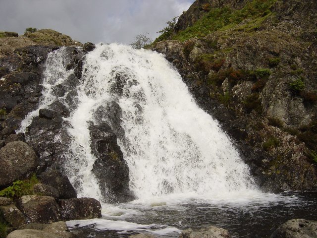
Sourmilk Gill waterfalls. Continuing upwards, the still well defined path leads to the lovely and popular Easedale Tarn.
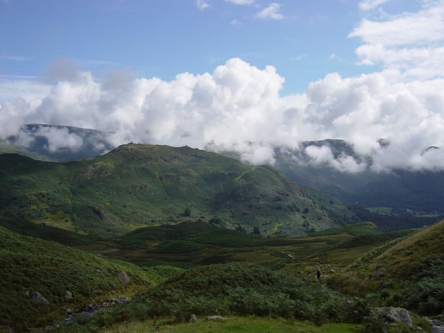
Helm Crag from Easedale Tarn. Visible up to the right is Tarn Crag; I crossed Sourmilk Gill where it exits the tarn and followed the path around the tarn and then a diagonal ascent through the bracken to Tarn Crag.
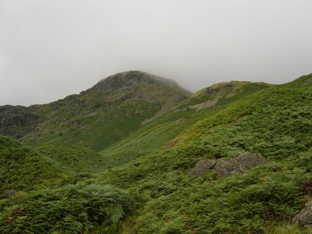
Tarn Crag from Easedale Tarn. The summit of Tarn Crags is not easy to determine at the best of times as there are many rocky knolls, it was made harder as the mist descended over the top as I arrived. The highest point is up to the right as you arrive on the summit plateau.
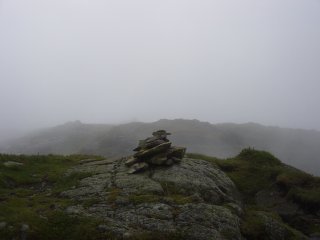
Tarn Crag summitCodale Tarn, right. Carrying on westerly along the plateau, Codale Head can be seen ahead with Codale Tarn down to the left. There is an easy ascent to the large cairn; the remains of an old fence leads the way to the summit from half way up.
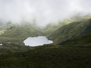
Codale Tarn, right. Carrying on westerly along the plateau, Codale Head can be seen ahead with Codale Tarn down to the left. There is an easy ascent to the large cairn; the remains of an old fence leads the way to the summit from half way up.
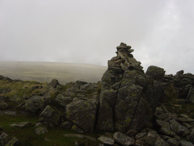
High Raise from Codale Head. To the south-west lies the attractive pyramid of Sergeant Man and it is an easy traverse to reach it.
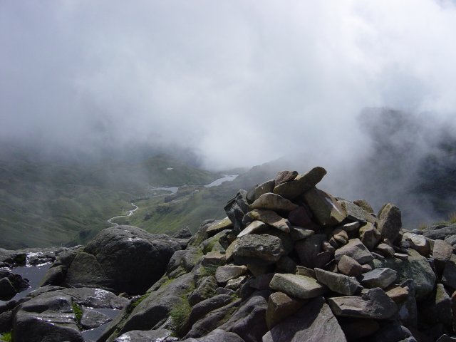
Bright Beck from Sergeant Man. The clouds were lifting now giving fabulous glimpses of Bright Beck and the Langdale Pikes. From Sergeant Man, High Raise was an easy, if somewhat boggy, stroll - there is a trig column on the bouldery summit. From High Raise summit the views were clear - it looked as though it was raining elsewhere, especially over Keswick.
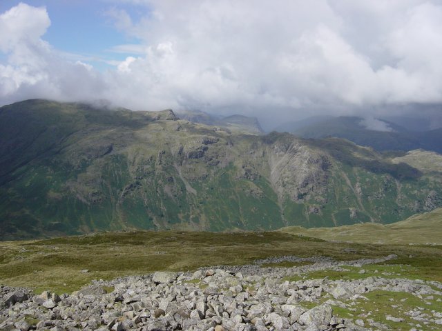
Looking across the Langstrath Valley to Glaramara with the High Stile ridge beyond. From High Raise I headed towards Codale Head again; I missed the path here and ended up descending a bit too far to Ferngill Crag. Once I realised my mistake, I contoured across to Broadstone Head and across the Greenup Edge/Far Easedale pass and an easy ascent to the summit of Calf Crag. Here the heavens opened as I arrived and from here on it was a monsoon all the way.
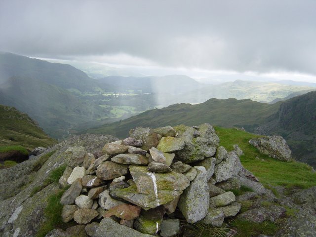
Loughrigg in the centre distance from the summit of Calf Crag. From Calf Crag, it is a pleasant walk along an undulating ridge to reach Gibson Knott, the summit being marked by a large cairn.
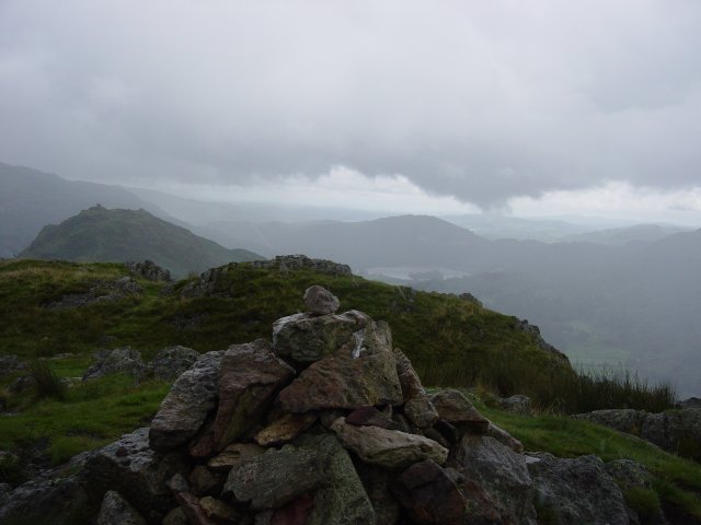
Helm Crag from the summit of Gibson Knott. Helm Crag can now be seen in the distance and it is another undulating walk to reach it followed by a sharp climb at the end. Once on Helm Crag ridge, the first large piece of rock is known as 'The Howitzer' due to its appearance from Dunmail Raise. The top of these rocks is the true summit of Helm Crag.
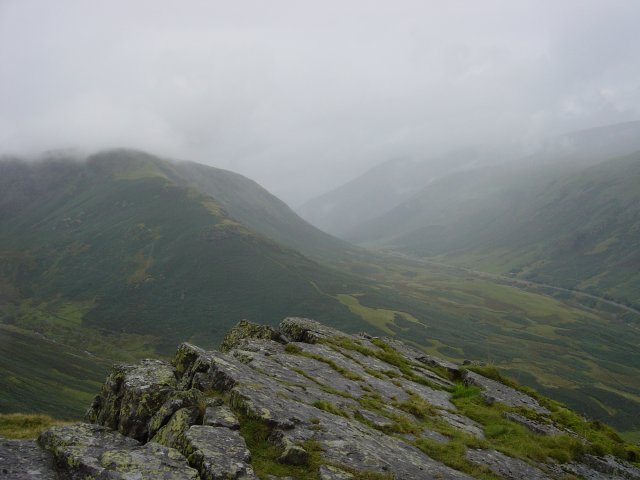
Steel Fell and Dunmail Raise from The Howitzer. Further along the ridge there are two lumps of rock, one large and one small. These are referred to as 'The Lion and The Lamb' due to their appearance from below.
The Lion and The Lamb on the summit of Helm Crag. Carrying on along the ridge, the obvious path descends toward Grasmere. Taking the path at the gap in the wall, down past the houses, across the road to another path which takes you to Easedale and the original path at the start of the walk. From here it is an easy walk back to Grasmere.
Walked on
Start point: Blea Tarn Car Park (NY 296 043)
Blea Tarn – Brown How on Lingmoor Fell (138) – Side Pike (139) – Blea Tarn
Weather: Showers with sunny spells.
Today’s walk is a lovely circuit of Lingmoor Fell taking in Side Pike and Blea Tarn. There are magnificent views of the nearby Langdale Pikes from here; in fact it is arguably the best view you can get of them.
There is a car park conveniently situated for this walk on the Side Gates road adjacent to Blea Tarn. From the car park, I turned left and followed the tarmac until just above the lower cattle grid, a grassy track bears left over a low wooden barrier and follows the contour for some distance. The first obstacle was a beck; I crossed it and followed the path to the right, following the wall along the contour until the sharp ascent up to Lingmoor began.
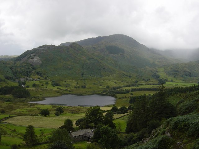
Little Langdale Tarn and Wetherlam from the ascent of Lingmoor Fell. Once onto the ridge, the path passes some old mine workings; the stone wall leads all the way to the summit from here.
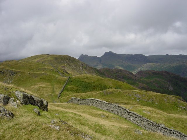
The summit ridge and the wall leading to Brown How, the summit of Lingmoor Fell. The Langdale Pikes are behind. There is a stile to cross on the summit fence and the large summit cairn lies beyond.
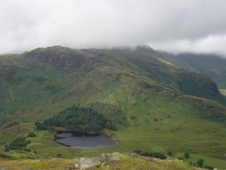
and Blea Tarn from Lingmoor Fell. The path carries on from the summit and descends quite sharply to a shoulder beneath the large, rocky knoll of Side Pike.
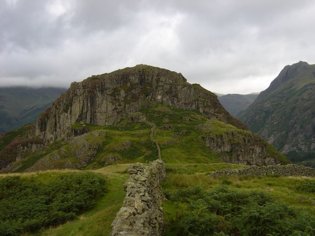
Side Pike looms ahead along the wall. From the shoulder, the path bears left, behind a narrow rock flake (breathe in!) and then ascends to the summit of Side Pike. It feels as though you can touch the Langdale Pikes from here.
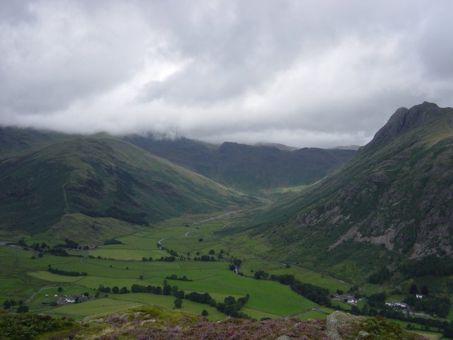
Mickleden from Side Pike with The Band, left, Rossett Pike at the Head of the valley and the Langdale Pikes to the right. I descended to the main road, across by the cattle grid and then followed the path to the little wood behind Blea Tarn. Once through the wood, the path leads around Blea Tarn to the start point of the walk.
Walked on
Two short walks this morning to Newton Fell at the Southern end of the Lake District. The first to Newton Fell South starts from the village of Lindale, the summit being Dixon Heights. The second walk to Newton Fell North starts from the Whitestone Caravan site on the main A590 and visits Newton Fell high point and White Stone. This walk follows Wainwright’s Newton Fell chapter in his book ‘The Outlying Fells of Lakeland’, page 52.
Start point: Lindale (SD 413 807)
(i) Newton Fell South (Dixon Heights) (OF) from Lindale
Weather: Foggy at first, clearing later.
There are spaces for parking on the road near to the Royal Oak pub on the way into Lindale. The area around here has significantly changed since Wainwright described the walk in the early seventies in that Lindale now has a bypass. This major dual carriageway cuts through the description given by Wainwright near to the start of the walk and it is an extremely hazardous task crossing this busy road.
I was interested to see how much of the original walk I could follow so I set off as the AW description through a ginnel south of the Royal Oak, past a workshop and into a field with a large pylon but the path ended abruptly due to the dual carriageway here so I followed the path over a stream and past some cottages to come back out onto the main road, north of my starting point – basically a large U around the car. I then carried on up to the dual carriageway, took my life in my hands and crossed over to resume the path over a wall. The large lump ahead is Raven’s Barrow – I made a pathless ascent through thick bracken and gorse (ouch!). With hindsight it would have been better to skirt the foot of it and ascend from the north. Once at the top of Raven’s Barrow, there are views over Lindale and the Kent Estuary, the fog was just starting to clear when I reached here.
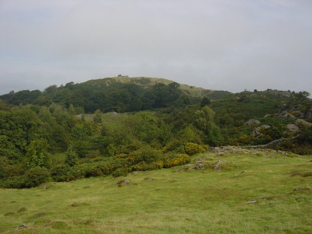
Dixon Heights from Raven's Barrow. Dixon Heights can be seen ahead from the top of Raven's Barrow with the ruined tower perched on its summit. Newton Fell is a sanctuary for wild ponies and I met these while crossing the hollow prior to the ascent of Dixon Heights.
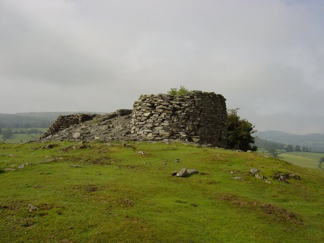
The ruined tower on the top of Dixon Heights. Descending north, a tarn with a wall running through it marks the limit of the walk.
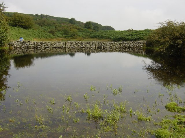
An un-named tarn complete with wall running through it. The path to the left of the tarn adjacent to the wall improves all the way and leads back to the A590 through Eller How. On the way, the path passes by a battlement ruin up to the left.
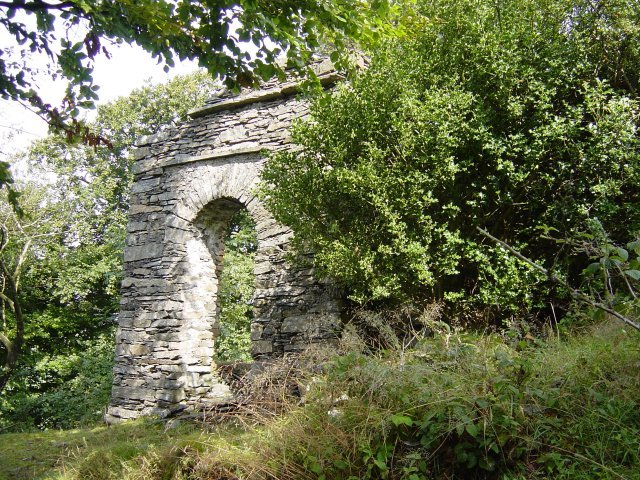
Ruin with battlements, Eller How estate. Taking my life in my hands once again, I crossed the A590 and back towards Lindale along the tarmac. Start point: Lane opposite Whitestone caravan site (SD 392 840) (ii) Newton Fell North (White Stone) (OF) from Whitestone Caravan site The second part of the walk takes in White Stone on Newton Fell. There is road verge parking on the minor road directly opposite Whitestone caravan site. I walked through the site following the public footpath which bears round to the right and leaves the main track to ascend first through woodland and then through bracken. Whilst climbing through the bracken here, I spotted half a dozen red deer further up the slope. I followed the wall up the side of the slope and climbed over it to find high point of Newton Fell. This is marked by a small cairn. I then followed the wall which carries on along the ridge all the way to White Stone through the thick bracken.
Taking my life in my hands once again, I crossed the A590 and back towards Lindale along the tarmac.
Start point: Lane opposite Whitestone caravan site (SD 392 840)
(ii) Newton Fell North (White Stone) (OF) from Whitestone Caravan site
The second part of the walk takes in White Stone on Newton Fell. There is road verge parking on the minor road directly opposite Whitestone caravan site. I walked through the site following the public footpath which bears round to the right and leaves the main track to ascend first through woodland and then through bracken. Whilst climbing through the bracken here, I spotted half a dozen red deer further up the slope. I followed the wall up the side of the slope and climbed over it to find high point of Newton Fell. This is marked by a small cairn. I then followed the wall which carries on along the ridge all the way to White Stone through the thick bracken.
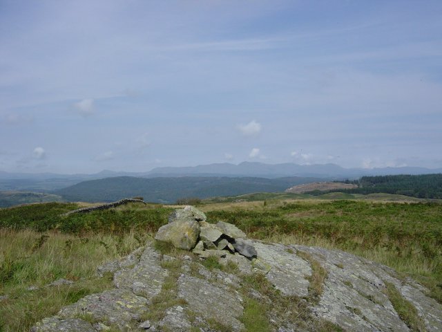
The Coniston Fells from the summit of Newton Fell. Caw is the pyramid left of centre and Dow Crag and Coniston Old Man are either side of the centre vee (Goat's Hawse).
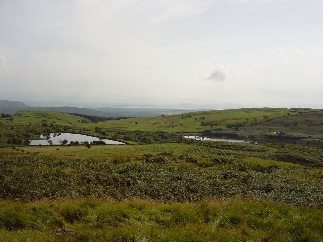
High Newton Reservoirs from Newton Fell. Followed the wall through the bracken across two small depressions, I came to a wall with a stile which gave access to the White Stone enclosure.
Walked on
Start point: Glen Mary Bridge, Yewdale (NY 321 999)
Glen Mary Bridge – Holme Fell (136) – Hodge Close – Oxen Fell – Black Crag on Black Fell (137) – Tarn Hows – Glen Mary Bridge
Weather: Drizzle at first, clearing later.
Today’s walk takes in the lower fells of Yewdale – Holme Fell and Black Crag. Holme Fell offers great views of the Coniston range whist Black Crag gives a fine panorama of distant fells.
The walk starts from the car park at Glen Mary Bridge adjacent to the A593 Ambleside to Coniston road. Turning left from the car park, it is a short walk to Yew Tree Farm, across the bridge and right through the gate.
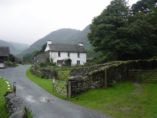
Yew Tree Farm. It was then through another gate on the right and I followed the track until a fork, at which I kept left and started ascending Holme Fell through Uskdale Gap above Yew Tree Tarn.
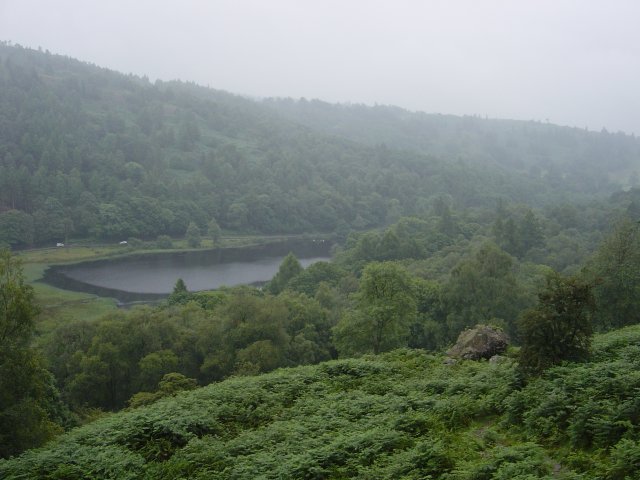
Yew Tree Tarn from Uskdale Gap. Turning left at the shoulder, the first ascent was to the large cairn on Ivy Crag then a descent across a basin to the summit outcrop of Holme Fell.
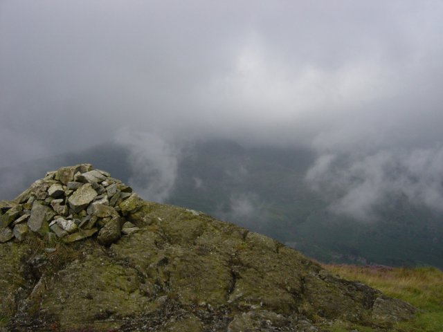
Looking to Wetherlam through the mist and drizzle from the summit of Holme Fell. Descending northwards, I threaded my way through the disused reservoirs, trees and past an old quarry to pick up a main path heading for Hodge Close.
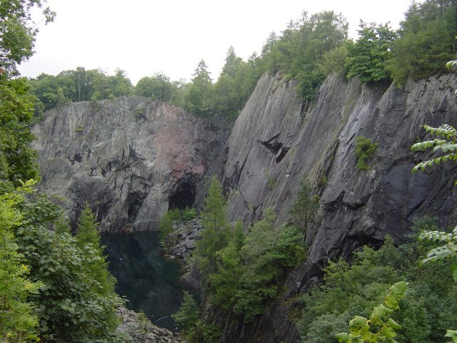
The large hole of the eerie Hodge Close Quarry with its copper sulphate blue lake. After skirting Hodge Close, I picked up another main path which headed for High Oxen Fell Farm; through the farm the path becomes a surfaced road.
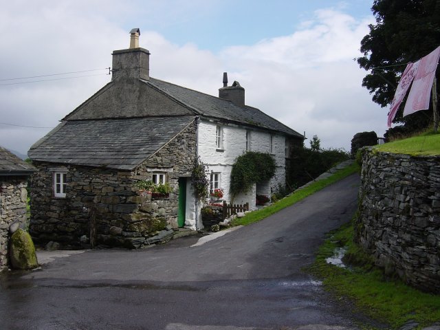
High Oxen Fell Farm. Bearing left, I then headed through Low Oxen Fell down to the main A593 and straight across to the track leading to Hollin Bank. I followed the wall up to the top of the field, through a gate on the left and up to a path past Low Arnside. Turning left at the gate before Iron Keld plantation and up onto Arnside plantation, Black Crag summit was now in view ahead. A steep climb alongside a wall took me to the summit and superb views of the surrounding area now that the drizzle had lifted.
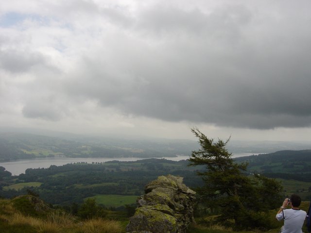
Windermere from the summit of Black Crag. A large cairn is visible to the south east and I headed for this before my descent.
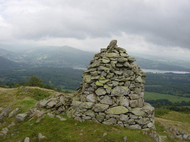
Wansfell Pike across Windermere from the south-east cairn. From here, I headed southwards to the Iron Keld plantation. This has changed beyond recognition recently, last time I was here at Christmas it was a dark forest. Things have now come full circle since Wainwright's days when this was an immature plantation.
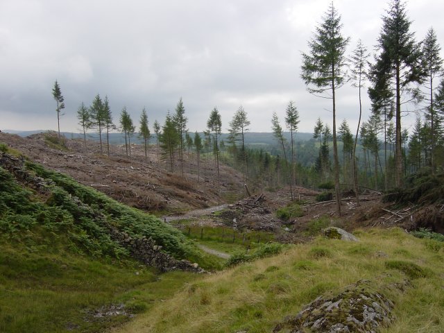
Iron Keld plantation - nearly gone. I headed on through the plantation and turning right, set off down a steep path until the crossroads for Tarn Hows. There is also tree felling work ongoing in Tarn Hows itself, but with a difference as they are using a horse and cart to move the logs. I followed the main Tarn Hows path on its western shore until the outfall stream.
Walked on
Start point: Cold Fell road (NY 060 138)
Cold Fell Road – Blakeley Raise (127) – Grike (128) – Crag Fell (129) – Whoap (130) – Lank Rigg (131) – Kinniside (132) – Latter Barrow (133) – Swarth Fell (Kinniside) (134) – Burn Edge (135) – Cold Fell Road
Weather: Rain.
Another muggy, overcast day today and a walk where solitude is virtually guaranteed on the western fringe of the Lake District – a round of the Lank Rigg group of fells.
The walk starts from The Cold Fell road where there are plenty of verge parking places available. I made a direct ascent from the road up the grassy slope of Blakely Raise.
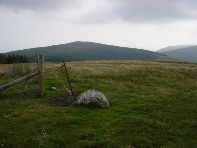
Grike from Blakely Raise summit. From the summit, I followed the fence down to a sheep intake and a gate which had to be climbed as it would not open and onto the main forest road. Following the road to a gate on the left, it was then up more grassy slopes to the summit of Grike, stepping over a wire fence en-route.
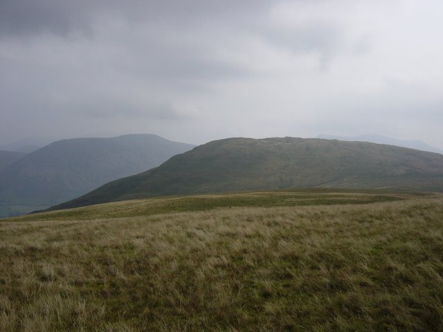
Crag Fell and Great Borne from the summit of Grike. An easy descent past a weather station and then a simple climb took me to the summit of Crag Fell with Ennerdale Water below and silhouettes of Pillar, Scoat Fell and Haycock visible through the murk.
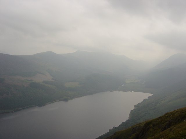
Looking to the head of Ennerdale Water from Crag Fell, the High Stile ridge to the left and Pillar just visible on the right. I followed the track down another easy descent to a forest fire break, through the break and over a stile to the stone wall of the Ennerdale Fence. This wall continues for many miles over many summits.
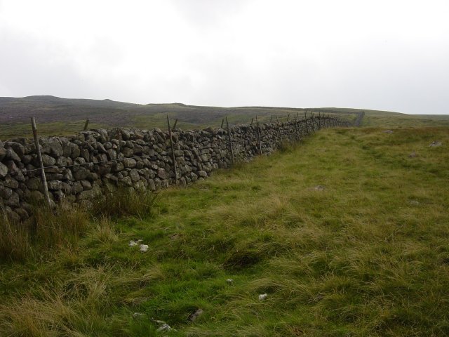
The Ennerdale Fence. I followed the fence until the first gate and then swung right to ascend another grassy slope, Whoap.
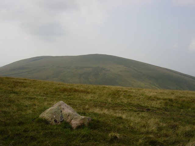
Lank Rigg from the stone marking the summit of Whoap. From Whoap, another descent to a dip and then steeply up to the summit Lank Rigg, the high point of this round.
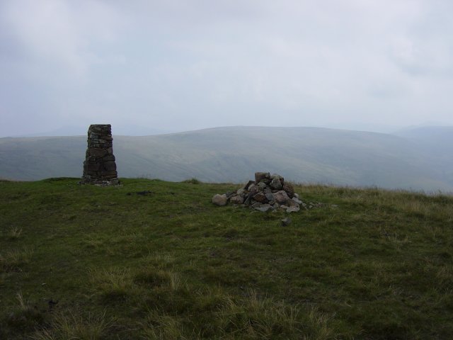
Whoap from the summit of Lank Rigg. From here, I passed an un-named summit tarn and then descended past an ancient cairn on a grassy track between the rocks. Across the very wet Poukes Moss to an un-named grassy mound on O.S maps - Birkett has christened it Kinniside.
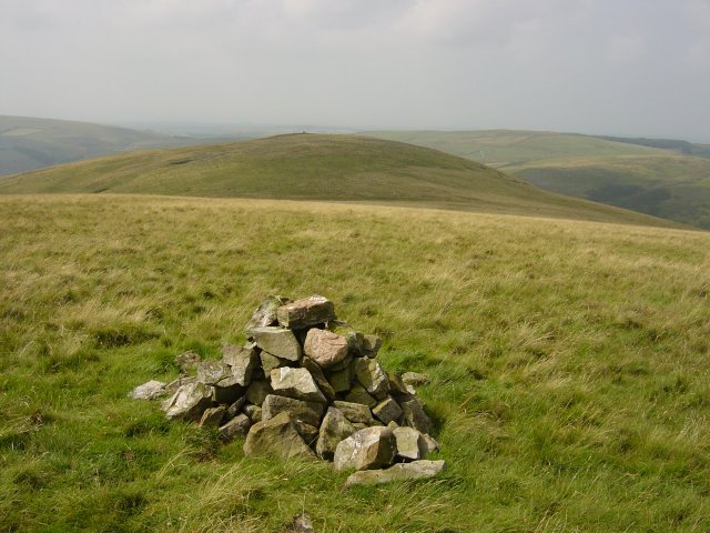
Latter Barrow from the summit cairn on Kinniside. From here it's an easy traverse to Latter Barrow, clearly visible ahead.
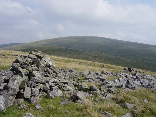
Kinniside and Lank Rigg from Latter Barrow. From Latter Barrow, I had a steep descent to the River Calder, decisions-decisions on the best place to cross and then steeply up the bracken slopes to Swarth Fell. For this part of the journey I was accompanied by a buzzard soaring overhead - I'm not sure if he thought I was on my last legs...
Walked on
Start point: Newby Bridge (SD 367 864)
Finsthwaite Heights (OF Walk – no definite summit) from Newby Bridge
Weather: Rain.
A short walk on this wet morning to Finsthwaite and High Dam from Newby Bridge. This walk follows Wainwright’s Finsthwaite Heights chapter in his book ‘The Outlying Fells of Lakeland’, page 74.
‘Everywhere the surroundings are delightful. But this is not fellwalking’ – AW
There are spaces for parking on the Rusland road adjacent to the River Leven and The Lakeside and Haverthwaite (L&H) Railway line.
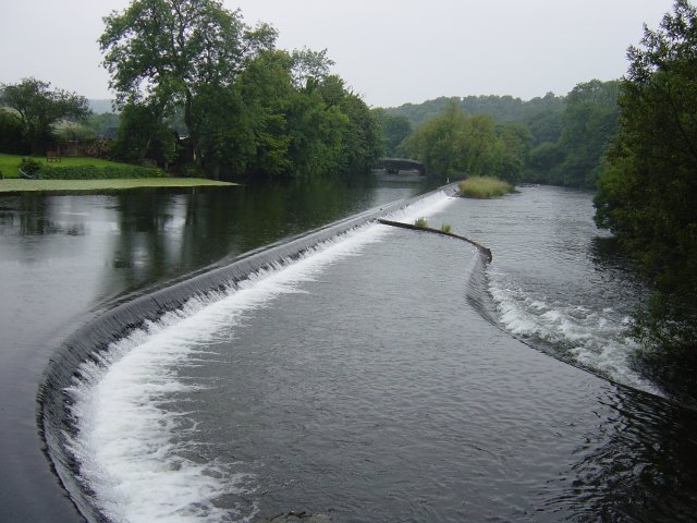
Weir on the River Leven. I tried to follow the Wainwright description as closely as possible but things have changed over the last 30 years. I crossed over the L&H bridge and then immediately left down a narrow lane which leads top private houses. The path is signposted to the right from this lane and climbs steeply upwards with stone steps along the way to help. I followed the path to a branch to the right which led to the only high viewpoint of the walk on Summer House Knott - no views today though. Then it was back to the main path and up to the right to Finsthwaite Tower almost hidden by dense foliage. This is a lovely woodland walk, whatever the weather.
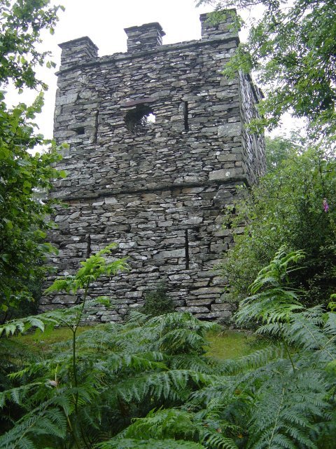
Finsthwaite Tower - 'Erected to honour the officers, seamen and marines of the Royal Navy whose matchless conduct and irresistible valour decisively defeated the fleets of France, Spain and Holland and preserved and protected liberty and commerce 1799'. It's a pity it has now fallen into disrepair. From the tower, I followed the obvious path which deviates from the Wainwright route and in fact ended up coming into Finsthwaite the way he describes for the return leg. Not to worry, only a field full of bulls to contend with once free from the woods!
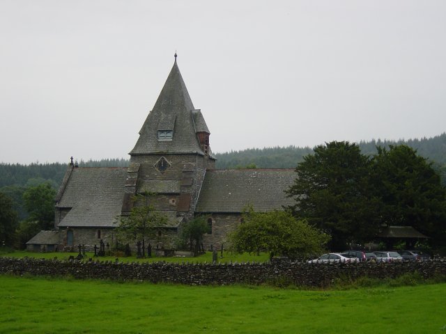
Finsthwaite Church. The off-license in Finsthwaite mentioned by Wainwright has long gone but the signposted path is still there and indeed it seems to go through the gardens of private dwellings. There is no danger of getting lost on this route - just follow the painted white arrows!
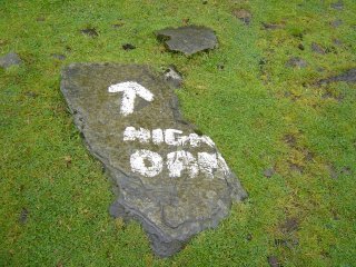
Where am I? Once through the gate and over the bridge, the path from the new-ish car park to High Dam is unmissable. As Wainwright said of High Dam 'it is a much nicer place than the over-populated Tarn Hows'.
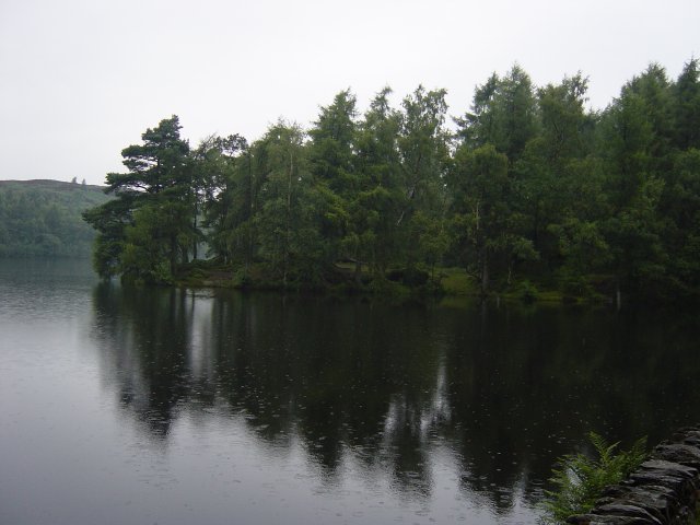
High Dam. I then crossed the High Dam Wall for a circuit of Low Dam before another deviation from Wainwright's route - rather than retuning by the same path I came up, it was down to the car park and back along the road to Finsthwaite.
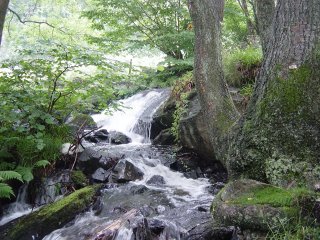
High Dam outflow and the 3D map of the area on the right explains that High Dam was constructed to turn the water wheels at Stott Park Bobbin Mill, the bobbins being used in the cotton mills in Lancashire. The map itself is on top of a large wooden bobbin. From Finsthwaite Church again, it was back across the two open fields (past the bulls again) and then a climb to below Finsthwaite tower and then a sharp descent to the road near Lakeside and an easy walk along the path back to Newby Bridge.
Walked on
Start point: Ambleside – Rydal Road Car Park (NY 376 046)
Ambleside – Rydal Park – Nab Scar (118) – Heron Pike (119) – Rydal Fell (120) – Stone Arthur (121) – Great Rigg (122) – Fairfield – Hart Crag (123) – Dove Crag (124) – High Pike (Scandale) (125) – Low Pike (126) – High Sweden Bridge – Ambleside
Weather: Very warm, mainly overcast.
After a short lay off, it was good to get back out on the fells today with a classic round – The Fairfield Horseshoe. The weather looked promising but the haze never lifted although it was lovely and warm
From the car park at Ambleside, I followed the A591 to the delightful Rydal Park and walked through here to Rydal Mount.
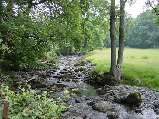
Scandale Beck in Rydal Park. From Rydal Mount (Wordsworth's old residence) the path is a steep stairway up to Nab Scar. On the way, there is a great view over Rydal Water over to Loughrigg.
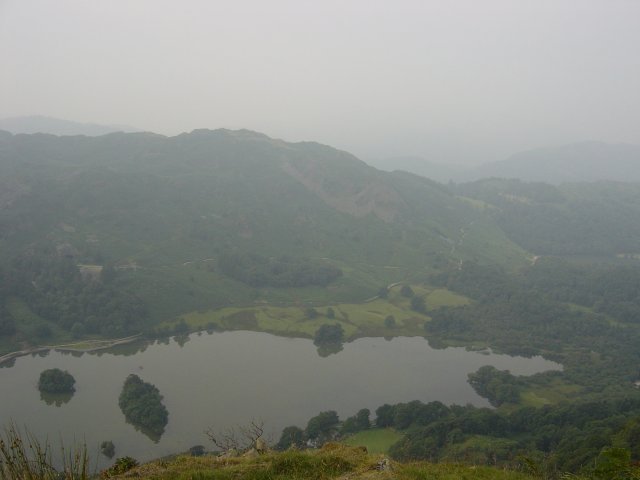
Loughrigg and Rydal Water from the ascent of Nab Scar. The summit cairn of Nab Scar is to the left of the main path - it was too hazy for views today.
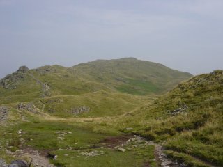
and the path to Heron Pike. The path climbs again from Nab Scar to Heron Pike and flattens off to reveal a quartz summit stone.
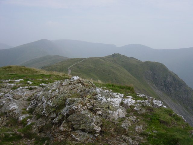
Rydal Fell from Heron Pike summit. Great Rigg, Fairfield and Hart Crag are on the horizon. From Heron Pike, the path descends then ascends again. To the right of the main path at the end of a wall is another cairn. The actual top is not named on O.S maps, only the whole fell. Birkett has named the summit after the fell, namely Rydal Fell.
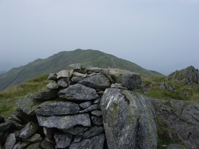
Heron Pike from Rydal Fell summit. From Rydal Fell, I made a detour from the usual Fairfield Horseshoe circuit by contouring around Greenhead Gill and striding out to Stone Arthur (which overlooks Grasmere) by picking up the main Stone Arthur - Great Rigg path.
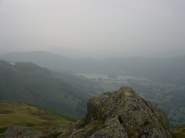
Grasmere from the summit of Stone Arthur. The tarn on the left is Alcock Tarn. From Stone Arthur, it was back along the main path and a steep ascent to Great Rigg.
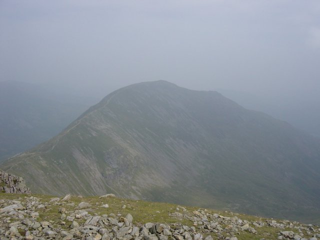
Saint Sunday Crag from Fairfield summit. From Fairfield it is a rocky descent then another ascent to Hart Crag to begin the return leg of the horseshoe.
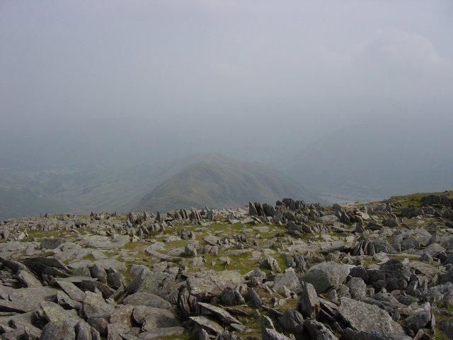
Hartsop above How from the rocky summit of Hart Crag. From the descent of Hart Crag, a wall guides you virtually all the way now. It is an easy ascent to Dove Crag from here.
Walked on
Start point: Hartsop (NY 410 130)
Hartsop – Gray Crag (110) – Thornthwaite Crag (111) – High Street – The Knott (112) – Rest Dodd (113) – The Nab (114) – Satura Crag – Angle Tarn Pike South (115) – Angletarn Pike North (116) – Brock Crags (117) – Hartsop
Weather: Overcast, some rain later.
Another walk chosen by my 13 year old son today, principally to take in some wildlife; the promise of wild ponies on Thornthwaite Crag, a Golden Eagle over Riggindale and deer in the Martindale Deer Forest spurring him into action. Of course, there was also the lure of walking in the footsteps of Roman soldiers across High Street.
From the car park through the hamlet of Hartsop, we followed the old mine road along Hayeswater Gill and over Wath Bridge.
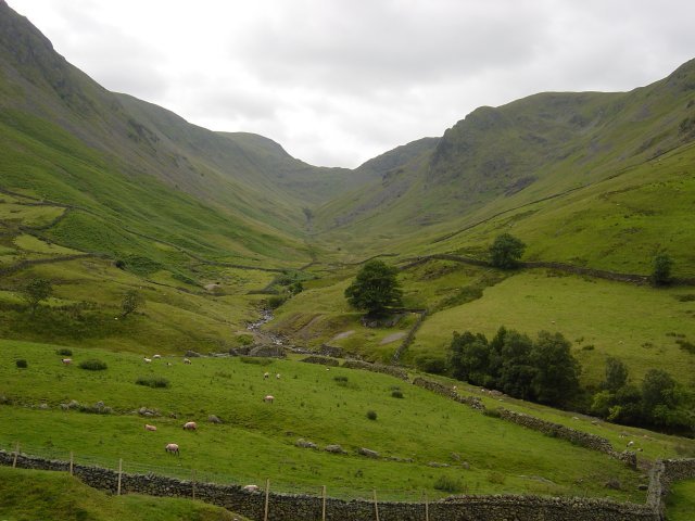
Threshwaite Mouth from the Hayeswater Gill path. We decided to ascend Gray Crag by the direct route - straight up the sickeningly steep nose leading directly to the summit.
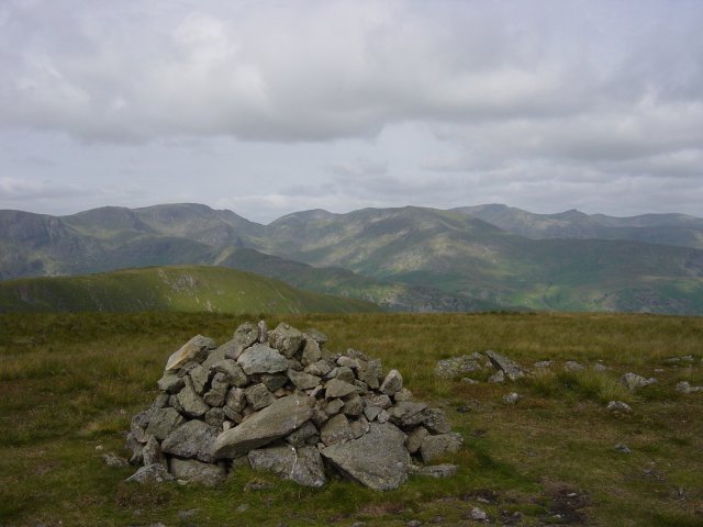
The Eastern Fells from the summit of Gray Crag, Catstycam is the conical peak on the right. From the summit, it is a simple stroll along the grassy undulations to Thornthwaite Crag, sometimes referred to as Thornthwaite Beacon due to the distinctive 14 feet high column on its summit.
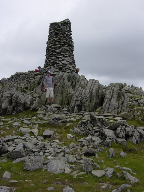
Thornthwaite Beacon. From the beacon the path U-turns on to the Roman road and follows the gentle rise to the summit of High Street.
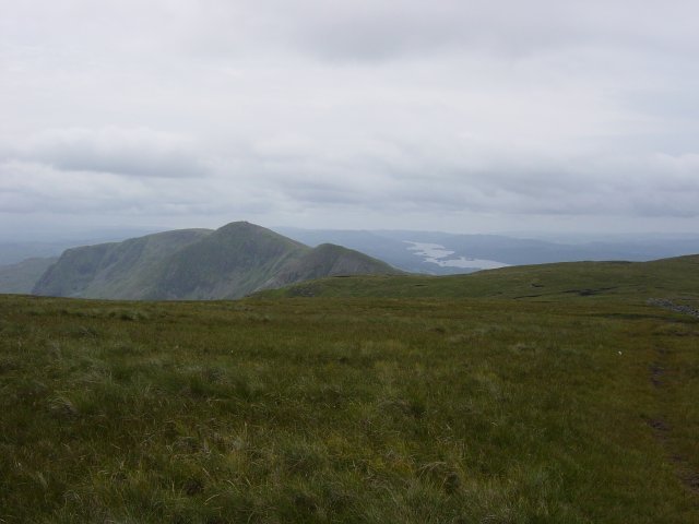
Yoke, Ill Bell, Froswick and Windermere from the Roman road on High Street. We then left the Roman road to cross the wall which traverses the summit plateau and headed for the trig. column that marks the highest point.
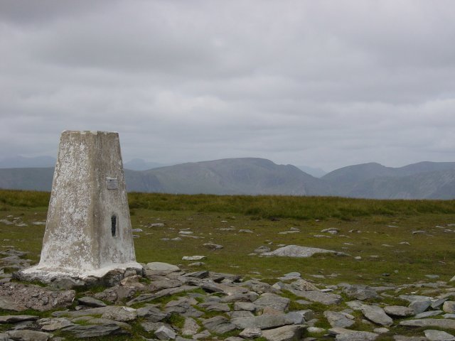
The summit of High Street looking to Fairfield and Dollywagon Pike. From the summit, we headed over to the Eastern side of the fell to look over Haweswater and along Riggindale with binoculars out trying to spot the Golden Eagle. Oh dear, no wild ponies and no eagle!
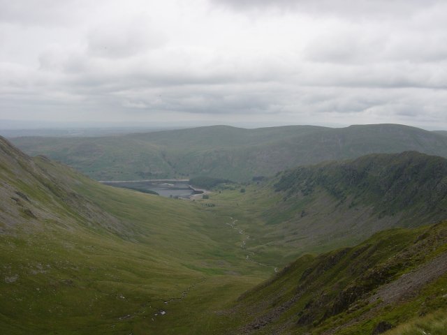
A view along Riggindale to Haweswater. After returning to the Roman road, it was a simple climb to the summit of The Knott.
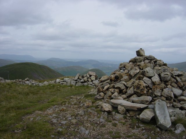
The Knott summit with Rest Dodd near left and The Nab to the right. From The Knott, a steep descent/ascent following the wall took us to the summit of Rest Dodd.
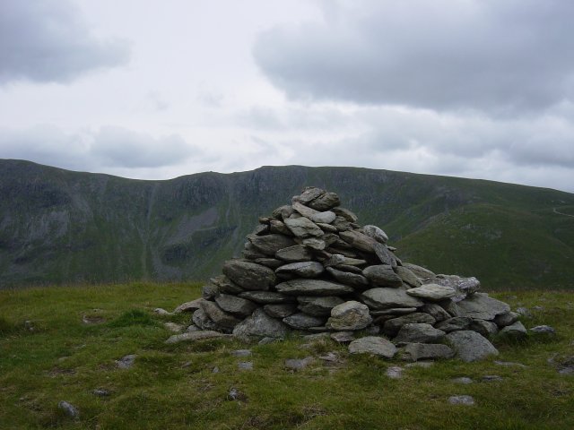
Rampsgill Head from the summit of Rest Dodd. Again from Rest Dodd, it was straight over the nose and onward over the difficult peat hag terrain of the Deer Forest to The Nab.
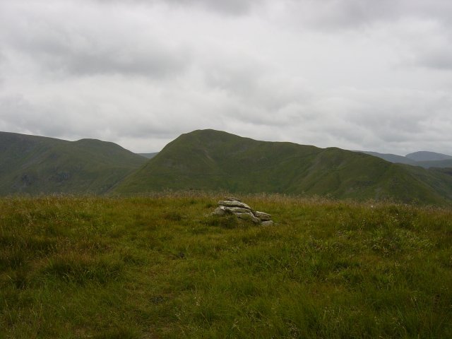
Rest Dodd from the summit of The Nab. Then it was back along the same peaty path to the wall - at last we were rewarded with the sight of a deer herd. We then followed the wall over to Satura Crag and then skirted Angle Tarn to ascend the northern top of Angletarn Pikes quickly followed by the southern top as the rain set in.
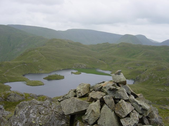
Angle Tarn from the southern summit of Angletarn Pikes. Skirting around the other side of Angle Tarn, we ascended directly to the summit Brock Crags with views over Hartsop and Brothers Water.
Walked on
Start point: Broughton Mills (SD 222 906)
Broughton Mills – Great Stickle (107) (OF) – The Dunnerdale Fells – Tarn Hill (108) (OF) – Stickle Pike (109) (OF) – The Knott (OF) – Broughton Mills
Weather: Sunny and bright.
A short walk in the sunshine today around Broughton Mills taking in a lovely round including Stickle Pike – well worth visiting for the views of the high fells, especially the Scafell and Bowfell ranges.
As well as taking in the Birkett tops, parts of this walk are described in Wainwright’s Stickle Pike chapter in his book ‘The Outlying Fells of Lakeland’, page 126.
From Broughton Mills, I crossed the River Lickle over the bridge and followed the tarmac up to Green Bank Farm where the road petered out into a track and then an overgrown path. Through the woods, the path changed into a walled green lane which skirts the base of Hovel Knott.
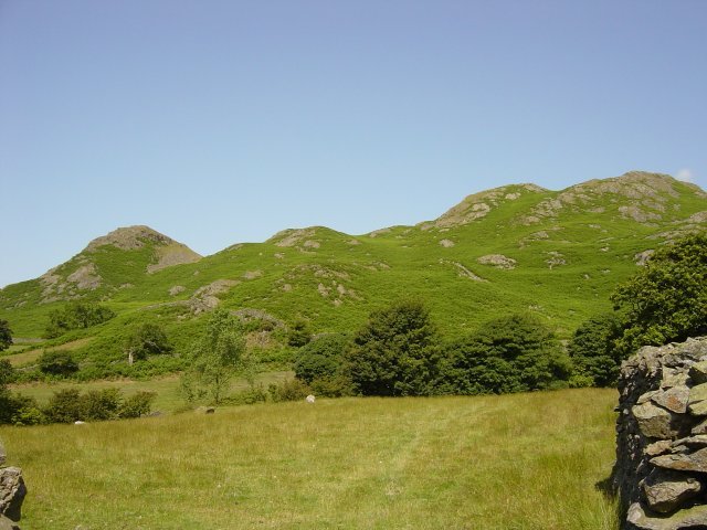
Hovel Knott and Great Stickle from the green lane. The path bears off to the right and heads up to the summit of Great Stickle.
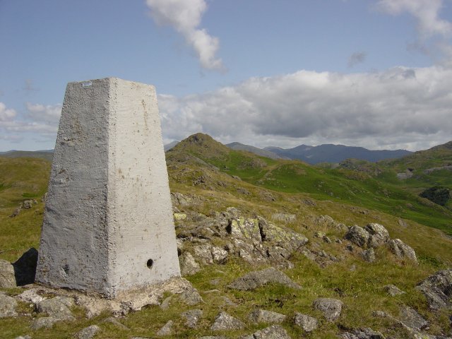
Stickle Pike from Great Stickle. From Great Stickle, the path either heads directly to Stickle Pike or traverses the Tarn Hill ridge. I headed for the ridge after making a slight detour to the Dunnerdale Fells summit after confusion arose from my Dunnerdale Fells walk on 1.7.04 when it appeared I never quite reached the correct summit. This turned out to be the case and the correct summit is about 200 metres north west of my original position.
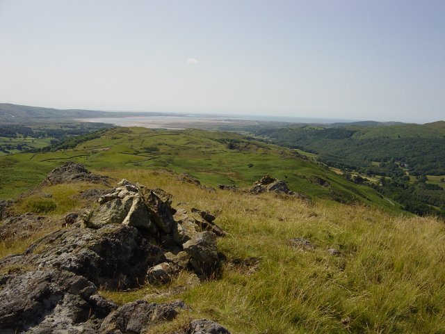
Looking from the cairned summit of the Dunnerdale Fells to the Duddon Estuary. A quick walk past a couple of un-named tarns took me to the summit cairn of Tarn Hill.
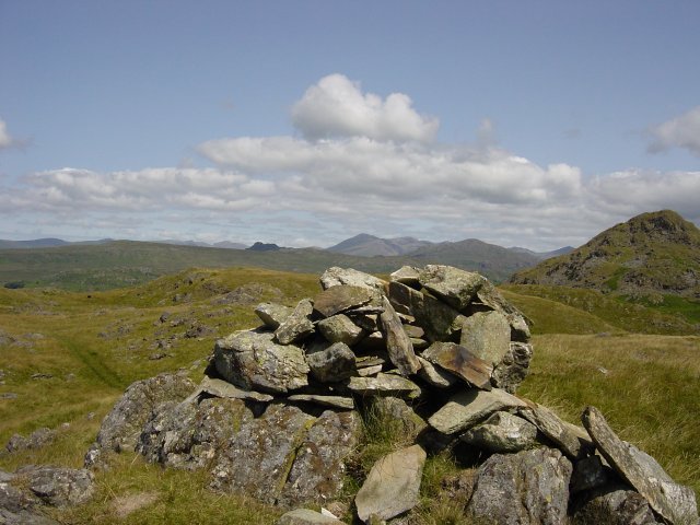
The Scafell range and Stickle Pike from Tarn Hill summit. An easy traverse of the ridge where tarns abound brought me to the foot of Stickle Pike.
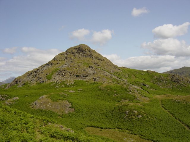
Stickle Pike from the Tarn Hill ridge. Note the ancient stone circle cairn at the foot of the picture. It was down to the stone circle in the grass depression and up the path to the right of Stickle Pike to the col and then left up the very steep path to the summit of Stickle Pike. The view of Bowfell and the Scafell range from the col and from the summit of Stickle Pike is absolutely magnificent.
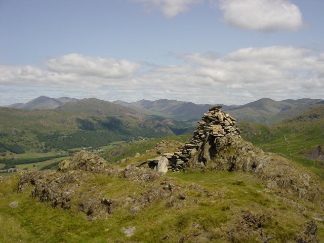
Harter Fell in the foreground, the Scafell range to the left and Bowfell in the centre from the summit of Stickle Pike. I then descended back to the col using the same path, past Stickle Tarn down to the fell road.
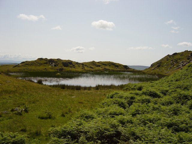
Stickle Tarn. Across the fell road and along the spoil heaps with the ridge above being the target. I contoured along the low level path longer than the AW route and ascended directly to Raven's Crag. It was interesting to note that the nameless summit 1183' quoted by Wainwright is actually called Raven's Crag by Birkett and Wainwright's Raven's Crag is not named by Birkett!
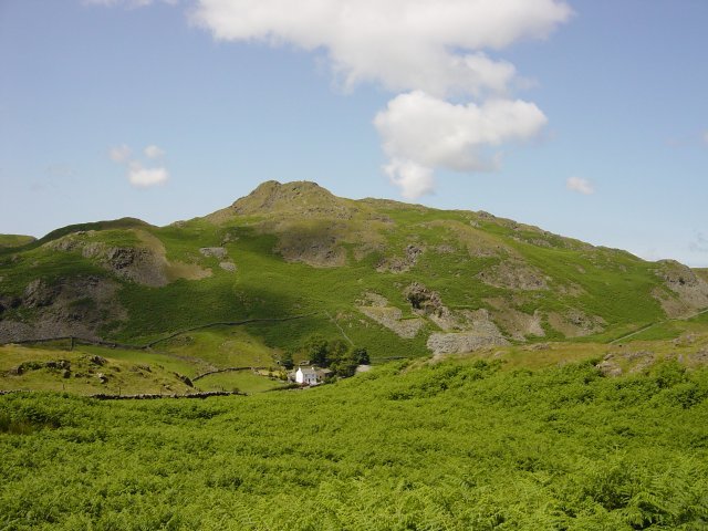
Stickle Pike over Hoses farm from the low level path. From Raven's Crag there is a descent to a large depression and the an easy, grassy walk to The Knott.
Walked on
Start point: Car Park above The White Horse Inn (NY 349 272)
Scales – Sharp Edge – Blencathra (100 – 105) (Atkinson Pike – Hallsfell Top – Gategill Fell – Blease Fell – Doddick Fell – Scales Fell) – Souther Fell (106) – Scales
Weather: Overcast, raining by the end.
As it is the first day of the school summer holidays, today’s walk was chosen by my 13 year old – an ascent of Blencathra via Sharp Edge; an excellent choice, I must say.
Bill Birkett counts the 6 separate tops on Blencathra as individual fells, so after ascending Sharp Edge we traversed the full Blencathra ridge and then crossed over onto Souther Fell.
The path starts from the car park above The White Horse, just off the A66 and immediately it is straight into a cruelly steep climb until the col is reached overlooking Mousthwaite Comb.
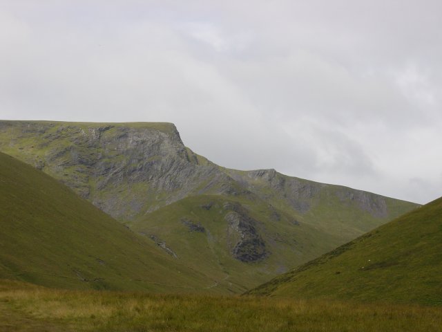
Sharp Edge from the col. From the col, the path follows the contour along the valley of the River Glenderamackin and then climbs up with Scales Beck to Scales Tarn.
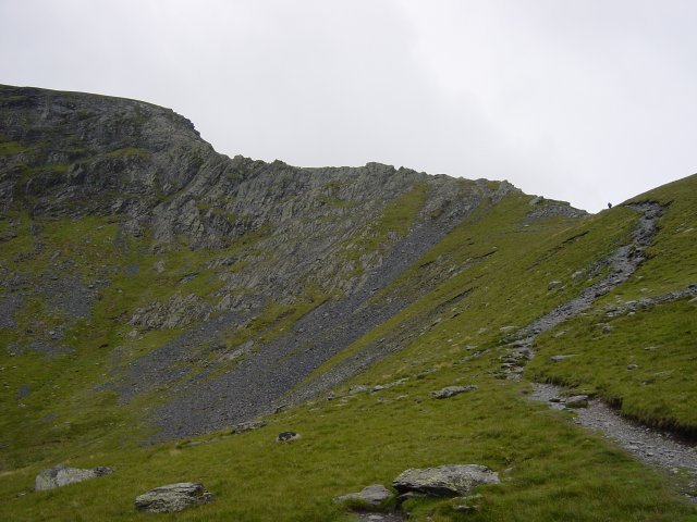
Sharp Edge from Scales Tarn. From Scales Tarn, there is an excellent profile of Sharp Edge which looms menacingly. A left turn up the side of the slope and the bottom of Sharp Edge is reached.

Looking up Sharp Edge. The final part of the Edge is the steepest; it is an exhilarating feeling looking down from this climb.
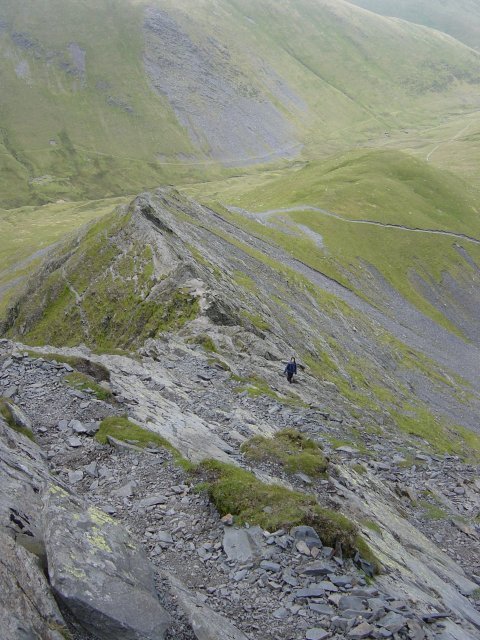
Sharp Edge from the top. At the top of Sharp Edge, it was straight up to the highest point, Atkinson Pike.
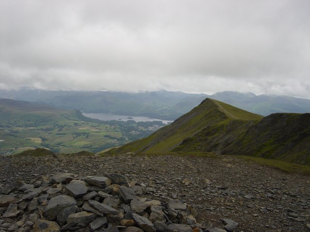
The highest point on Blencathra is Hallsfell Top. This view is from the summit overlooking Derwent Water with the rest of the Blencathra ridge to the right. Walking along the undulating ridge, the next top is Gategill Fell.
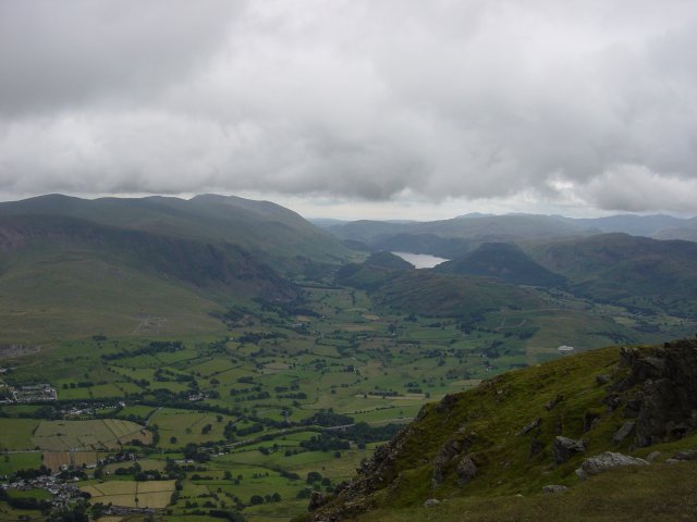
St. John's in the Vale and Thirlmere from Gategill Fell. Traversing right to the end of the ridge, the farthest point is Blease Fell. From Blease Fell, we retraced our footsteps along to the main summit and the descended via Doddick Fell and Scales Fell.
Walked on
Start point: New Road, Dockray (NY 380 218)
New Road, Dockray – Low How (88) – High Brow (89) – Randerside (90) – Great Dodd (91) – Watson’s Dodd (92) – Stybarrow Dodd (93) – White Stones on Green Side (94) – Hart Side (95) – Birkett Fell (96) – Brown Hills (97) – Swineside Knott (98) – Common Fell (99) – New Road, Dockray
Weather: Rain and mist. Strong winds on The Dodds
Today’s walk was The Dodds from the end of the Old Coach Road joining Dockray and St. John’s in The Vale. The day started off dull and grew much worse as height was gained.
Entrance to Matterdale Common is through a gate and onto the coach road, then it’s an immediate left to ascend the grassy shoulder to Low How.

Great Mell Fell and Little Mell Fell from the top of Low How. From Low How, there is a descent into a dip and then a climb alongside the wall, past an old mine level to the broad, grassy top of High Brow.

Stybarrow Dodd, Great Dodd and Randerside from the summit of High Brow. Immediately after this picture was taken, the heavens opened and the cloud set in on the tops for the day. From here it was a slight descent and then a climb up to Randerside after joining the main path. The main path continues, steepening until the summit of Great Dodd is reached.
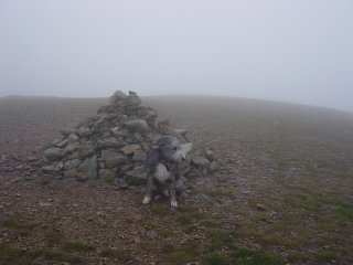
and 'dog not impressed by the wind and rain' on Great Dodd. From Great Dodd summit, I took the path south east to the wind shelter; from here it's an easy traverse to Watson's Dodd. A simple climb follows to reach the summit of Stybarrow Dodd.
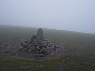
and Stybarrow Dodd. It was an easy descent west which took me to a grassy col, from there an ascent to the bouldery top of White Stones on Green Side.
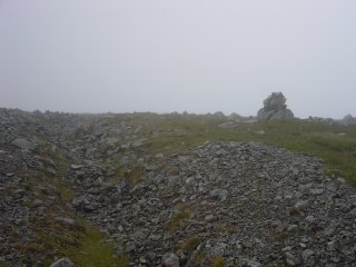
and Hart Side, complete with ditch mentioned in detail by AW. Another rise to the top of Hart Side, still in the mist. From Hart Side it was another grassy traverse to Birkett Fell, named after Lord Birkett who did much to preserve the environment of Ullswater from the demands of the Water Authority.

Birkett Fell complete with name plaque. The descent from Birkett Fell followed the line of a recently renovated wall. Through the clearing mist I caught sight of Ullswater. Over the new stile and onward to Brown Hills, a grassy, indistinct top.

The southern end of Ullswater from Swineside Knott looking to Hartsop Dodd and Thornthwaite Crag. From Brown Hills, it's another grassy traverse to Swineside Knott and then across the boggy expanse of Watermillock Common to ascend Common Fell.
Walked on
Start point: Beckside (SD 153 847)
Beckside – White Hall Knott (83) – White Combe (84) (OF) – Whitecombe Moss – Stoupdale Head (85) (OF) – Black Combe (86) (OF) – South Top of Black Combe (87) – Whicham Mill – Beckside
Weather: Sunny and bright, misty on Black Combe summit.
A walk in the sunshine today around the Cirque of Black Combe, a remote fell in the extreme south west of the Lake District. Its detachment from other fells makes it unique and its unobstructed view allows great views of the high fells and to the Irish Sea.
“the amplest range of unobstructed prospect may be seen that British ground commands” – said William Wordsworth about Black Combe.
As well as taking in the Birkett tops, parts of this walk are described in Wainwright’s Black Combe chapter in his book ‘The Outlying Fells of Lakeland’, page 162.
The walk started at Beckside on the A595 where there are parking spaces by the side of the road. I followed the tarmac for a short way until just before the Fox and Goose cottages, and then a track almost hidden by dense trees and signposted for White Combe lead to the heavily brackened fell side. The track went up the side of the fell, I followed it to the col and then cut back left to the grassy, flat summit of White Hall Knott
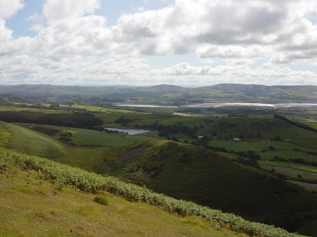
Kirkby Moor over the Duddon Estuary from the ascent of White Hall Knott. The water in the foreground is Baystone Bank Reservoir.
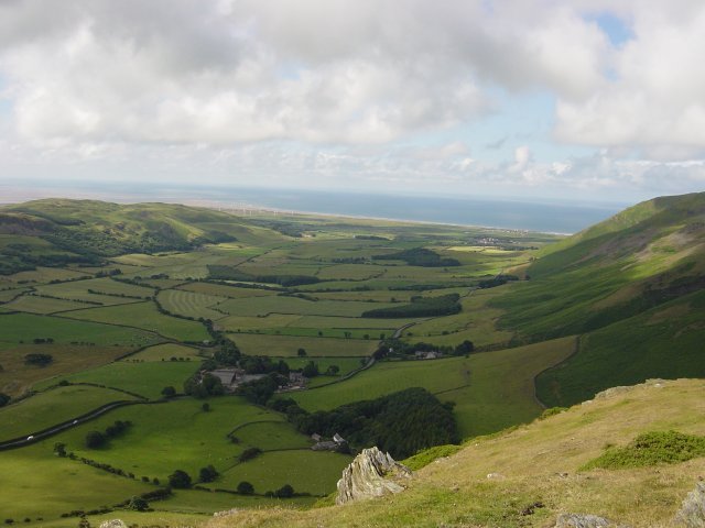
Looking down the Whicham Valley from White Hall Knott. From White Hall Knott, it was back along the shoulder and an easy ascent to the summit of White Combe, topped with a large stone cairn and wind shelter.
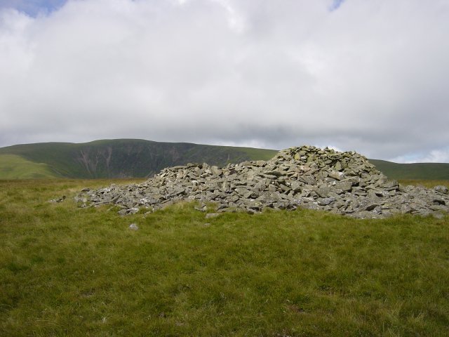
Black Combe from the summit of White Combe. From White Combe, it was an easy, pathless ascent over lush grassy moor to the summit of Stoupdale Head marked by a small pile of white quartz. The views to the Scafell range from here were stunning.
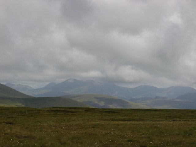
Zooming in on the Scafells. The Buttermere fells and Great Gable are to the left. From Stoupdale Head, it was back along the path following the rim of firstly Whitecombe and then Blackcombe Screes, up into the cloud at 550 metres and onto the summit of Black Combe.
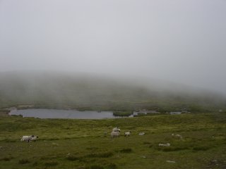
and the summit tarn. From the summit, it was across the dip which holds the summit tarn and onto the South Top which has a large, round cairn which can be seen from the valley below.
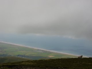
and a view through the mist to the Irish Sea and West Cumbrian coastline. Then it was along the shoulder and head for the Whitecombe Beck valley below. Once below the cloud, the views to the south were fantastic.
Walked on
Start point: Stonestar (SD 202 912)
The Dunnerdale Fells (OF) from Stonestar
Weather: Dull and overcast, some sunny spells.
A short walk this morning to the Dunnerdale Fells from Stonestar on the Duddon Bridge – Ulpha road. This walk follows Wainwright’s Dunnerdale Fells chapter in his book ‘The Outlying Fells of Lakeland’, page 132.
NOTE (added 13th July 2004) – The summit of The Dunnerdale Fells described in this walk is incorrect – see 13th July walk for an update.
The walk starts opposite Stonestar and follows a distinct path, almost like a terrace following a rocky ravine to the ridge.
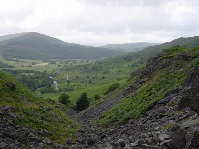
Looking down the rocky ravine to the River Duddon and the fell road. At the top of the ravine after following the stream, it's a sharp right turn across level ground. There is plenty of evidence of old civilisation along here as there is an abundance of ancient cairns and stone walls. Follow the path until a solitary holly tree and then the path joins with one from the left and veers to the right.
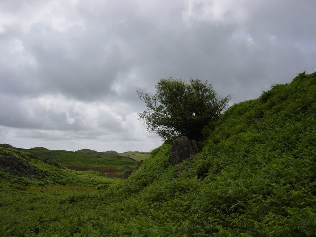
The solitary holly tree. When the path reaches a high point, strike out for the rocky, cairned summit knoll which is un-named on O.S maps, this whole area being given the general name of Dunnerdale Fells.
Walked on
Start point: Greendale (NY 144 056)
Greendale – Buckbarrow (79) – Glade How (80) – Cat Bields – Seatallan (81) – Greendale Tarn – Middle Fell (82) – Greendale
Weather: Mist and rain.
Today’s walk is to some of the unfashionable fells overlooking Wast Water; Buckbarrow, Seatallan and Middle Fell. When I completed this round last year, it was teeming with rain and I really wanted to do theses fells in nice, clear weather. However….
I parked at Greendale by the side of the road and followed the tarmac west to Harrow Head. The path to Buckbarrow isn’t obvious from the road; it is a grassy track between the wall and Gill Beck immediately before the road triangle at Harrow Head. If you walk slightly past Harrow Head and look over the wall, you will see the hidden Tosh Tarn.
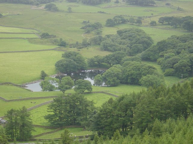
Tosh Tarn from further up the path. At the top of the path, the crags to the right of the summit are worth climbing for the view of Wast Water - if it is clear! From this point, the summit is across the dip on a rocky knoll.
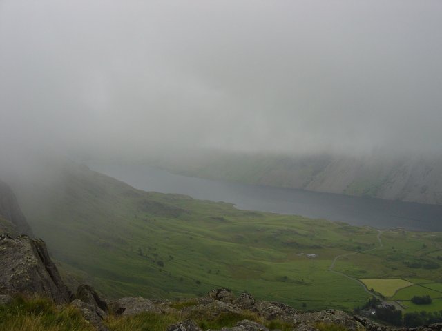
Wast Water through the mist from Buckbarrow. From Buckbarrow, head north for Glade How where there is a prominent cairn. From Glade How, the next target is Cat Bields which lies to the north west and here lies another cairn which marks the ascent of Seatallan.
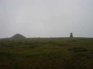
Seatallan summit - no views today then! The large pile of stones is an ancient burial mound, reputed to be 1000 years old. From Seatallan, I headed east to the hause marked on the map at 465 metres. From here I made a slight detour south to Greendale Tarn, back to the hause for the easy ascent to the summit of Middle Fell.
Walked on
Start point: Colthouse (SD 360 988)
Latterbarrow (OF) from Colthouse
Weather: Dull and overcast.
A short walk this morning to Latterbarrow from Colthouse close to Hawkshead. This walk follows Wainwright’s Latterbarrow chapter in his book ‘The Outlying Fells of Lakeland’, page 84. The large obelisk on the summit of Latterbarrow is clearly visible from Hawkshead.
Colthouse lies a short distance east of Hawkshead, the walk starts outside Colthouse on the road heading north west. The bridleway starts at a gate and the track, which is clearly defined, passes through another gate and a lily tarn lies to the right.
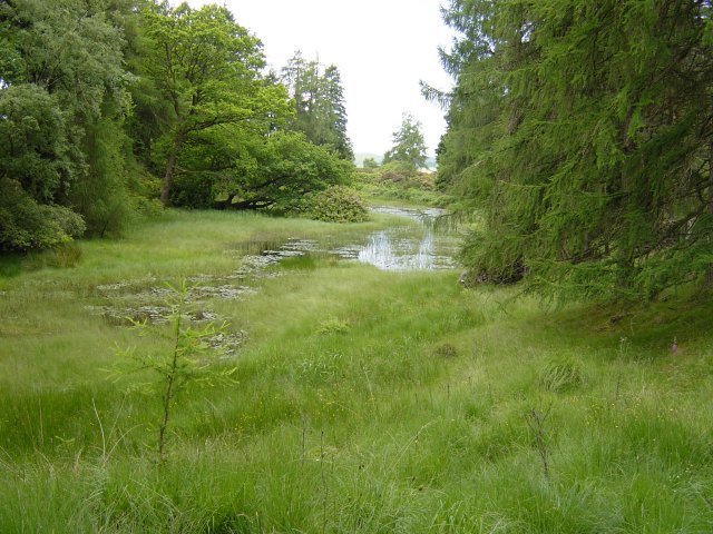
The lily tarn, Colthouse Heights. Following the track to another gate, there is a signposted left turn to Latterbarrow. Wainwrights young plantations have now matured and the way ahead is through dense forest. At the stile, the way to the summit lies up a bracken slope, the summit monument becoming visible as you rise. At the top, there are stunning views to the high fells.
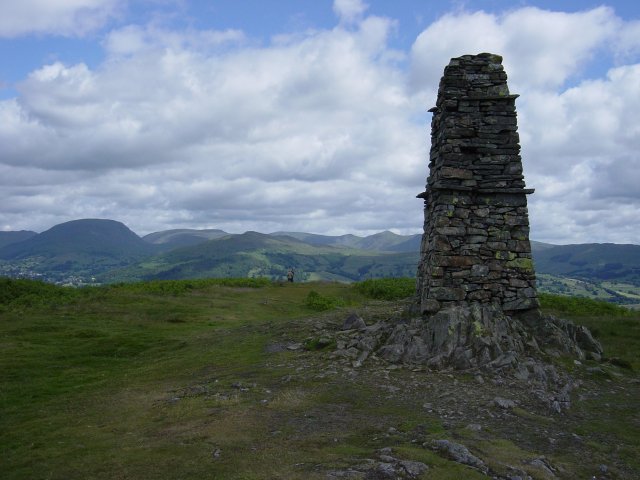
The summit of Latterbarrow, looking north east. Red Screes is on the left, High Street in the centre and Froswick and Ill Bell are on the right.
Walked on
Start point: Troutbeck (NY 409 032)
Troutbeck – Nanny Lane – Wansfell (77) – Wansfell Pike (78) – Nanny Lane – Troutbeck
Weather: Dull and overcast.
A short walk this morning to Wansfell and Wansfell Pike on a murky day, a complete contrast to yesterday. Wansfell overlooks Ambleside and gives fantastic views of Windermere.
The route starts at Troutbeck and follows a track known as Nanny Lane.
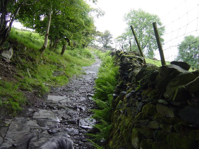
Nanny Lane at the beginning of the walk. Follow the walled lane as far as it goes - approximately a mile and a half.
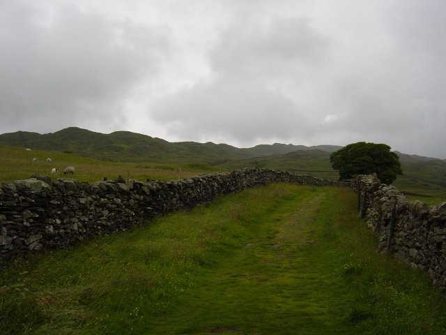
The Wansfell ridge from further up the lane. Over a stile and follow the right angle of the wall all the way to the cairned summit of Wansfell, on the right hand side of the wall.
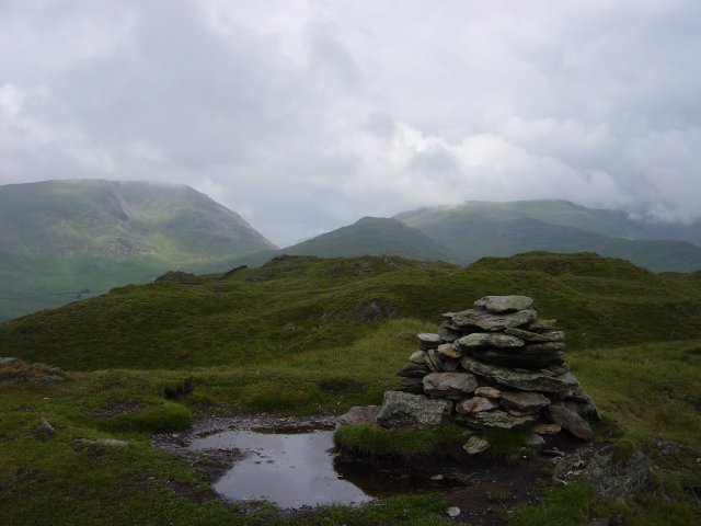
Red Screes, Kirkstone Pass and Caudale Moor from the summit of Wansfell. Then it's a south-westerly traverse over grassy hummocks to Wansfell Pike.
We use cookies to improve your experience on our site. By using our site, you consent to cookies.
Manage your cookie preferences below:
Essential cookies enable basic functions and are necessary for the proper function of the website.
These cookies are needed for adding comments on this website.
You can find more information in our Cookie Policy and .
