Height: 673 metres / 2208 feet Grid reference: NY 26647 30740 Category: The Northern Fells
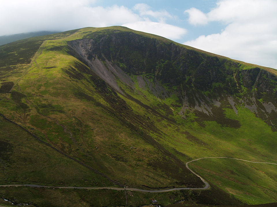
Descending to Bakestall from Skiddaw
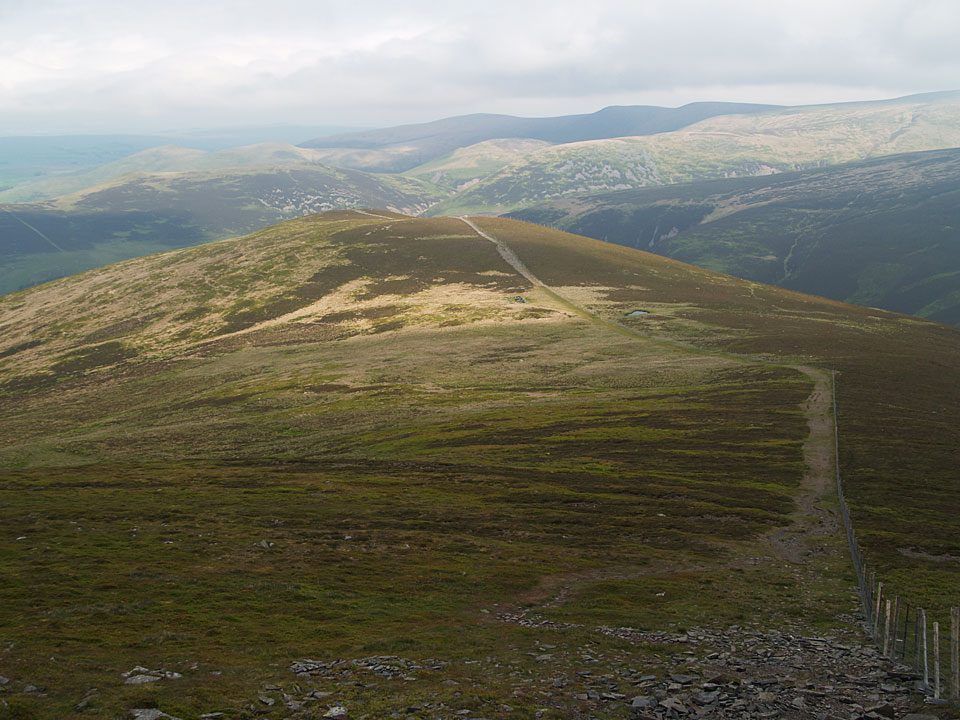
The Back of Skiddaw from Bakestall
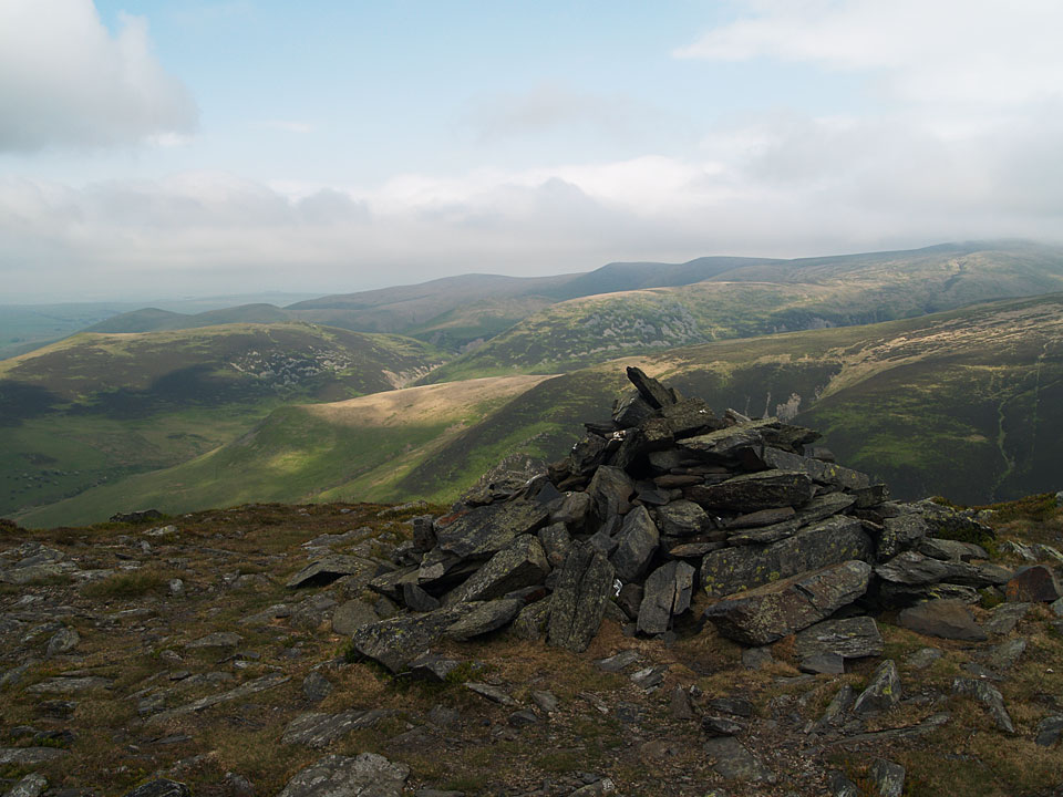
Bakestall from Little Calva
Height: 673 metres / 2208 feet Grid reference: NY 26647 30740 Category: The Northern Fells
Descending to Bakestall from Skiddaw
The Back of Skiddaw from Bakestall
Bakestall from Little Calva
Start point: Gale Road End (NY 281 253)
Gale Road – Lonscale Fell – Lonscale Pike – Jenkin Hill – Skiddaw Lesser Man – Skiddaw Little Man – Skiddaw – Bakestall – Birkett Edge – Whitewater Dash – Little Calva – Great Calva (514) – Skiddaw house – Lonscale Crags – Gale Road
Distance: 13 miles Total Ascent: 1190 metres Time Taken: 5 hours
Weather: Overcast, clearing. 20oC.
After the sunshine and blue skies of the last few days, the clouds were hanging ominously over Skiddaw when I set off for a circuit of Skiddaw Forest from Gale Road this morning. From Lonscale Fell onwards, I was in the clouds with Skiddaw being windswept and cold as it so often is. The main objective today was Great Calva as I completed my second recorded set of 214 Wainwright fells on it. I haven’t been actively pursuing that goal and it has taken me 3 years to get round them all again.


A cloud covered Skiddaw at the start of the walk, the blue sky looked promising though.

The Hawell monument and the path to Skiddaw. We weren't going this way though as we descended right to Whit Beck and then continued along the bridleway below Lonscale Fell.

Descending to Whit Beck.

Latrigg and Derwent Water from the steep climb to Lonscale Fell, just before disappearing into the clouds.

Casper at the summit of Lonscale Fell. Someone has been doing a bit of cairn building.

Sat in the bog cotton on Jenkin Hill.

A windswept Skiddaw summit.

Descending the north end of Skiddaw, the clouds fleetingly parted here looking to Lonscale Fell...

...and a glimpse of Bassenthwaite Lake.

Ullock Pike across Southerndale.

Descending to Bakestall.

The Back of Skiddaw from Bakestall.

The route from Bakestall - descend Birkett Edge then climbing steeply with the fence before heading to Little Calva then Great Calva.

The steep descent of Birkett Edge.

Dash Beck, above the main falls.

Looking back to Dead Crags on Bakestall from the steep climb to Little Calva.

Oops! A bit deeper than you though Casper?

214 Wainwrights completed for the second time on Great Calva.

The summit of Great Calva.

The south cairn of Great Calva looking down the fault line that should have a view to Windermere. Skiddaw House is to the right of the post, encircled by trees with Lonscale Fell beyond.

Skiddaw House.

All that remains of Skiddaw Forest, Skiddaw House behind.

Great Calva.

Passing below Lonscale Fell on the Cumbria Way.

Mungrisdale Common.

The Glenderaterra Valley from Lonscale Crags.

A familiar silhouette - the Coledale fells.

That made me jump! Of course, Skiddaw is clear now as well.
Start point: Orthwaite Road, near Bassenthwaite (NY 237 311)
Nr.Bassenthwaite – Watches – The Edge – Ullock Pike – Longside Edge – Long Side – Carl Side – Skiddaw – Broad End – Bakestall – Nr.Bassenthwaite
Distance: 7.5 miles Total Ascent: 885 metres Time Taken: 4 hours
Weather: Wet and windy. 7oC.
This is a great way to reach Skiddaw, walking along The Edge and Longside Edge culminating in the steep, slate path cutting diagonally across the western face of Skiddaw – but it was not so great today as the weather was pretty atrocious! Today I was joined by my friend Nick with his dog Busta, both novices of the 3000 footers – I hope it didn’t put them off for life! Needless to say we didn’t see another soul for the whole walk either (apart from Andy Lang in the car park at the end – he did the same walk!).


Binsey from the climb to Watches.

Broad End and Skiddaw across Southerndale.

Looking from Watches to The Edge and Ullock Pike with Long Side and Carl Side beyond.

The cloud is down on Skiddaw from the rock formations on Watches.

Walking towards The Edge, with Busta, Angus and Casper leading the way.

On The Edge with Ullock Pike ahead.

Ullock Pike, the wind is starting to blow and the drizzle approaching from the west.

Bassenthwaite Lake through the mist. This is the last view of the day from Ullock Pike as the cloud came down and the relentless rain started.

Angus looking a bit fed up with the weather.

Casper on the climb to Skiddaw.

Here comes Nick out of the mist being battered by the wind on the slate path to Skiddaw. This view sums up the day nicely!

On the summit of Skiddaw in a really strong and cold wind. That's it! Camera away now and not to reappear as it was rain, rain, rain all the way back. From here we dropped down to Broad End then Bakestall before contouring Broad End to Barkbethdale and into Southerndale.
Start point: Bowscale (NY 358 317)
Bowscale – Bowscale Tarn – East Top on Bowscale Fell (387) – Bowscale Fell (388) – The Tongue (389) – Bannerdale Crags (390) – Blencathra – Mungrisdale Common – Cloven Stone – Lonscale Pike (391) – Lonscale Fell (392) – Jenkin Hill (393) – Skiddaw Lesser Man (394) – Skiddaw Little Man (395) – Skiddaw – Bakestall – Whitewater Dash – Little Calva (396) – Knott – Coomb Height (397) – Little Lingy Hill (398) – Great Lingy Hill (399) – Hare Stones (400) – High Pike (401) – Miton Hill (402) – Round Knott (403) – Carrock Fell (404) – Mungrisdale – Bowscale
Distance: 25.8 miles Total Ascent: 2447 metres Time Taken: 10 hours 50 minutes
Weather: Sunny and warm with a slight breeze. 25°C.
Today’s walk was a long circuit of the quiet fells known as ‘The Back o’ Skiddaw’. The weather was very pleasant, not as hot and muggy as it has been recently with a slight, welcome, cooling breeze. The views were absolutely superb at times and I was glad I chose today to do this long walk. The only problem was I forgot my food and 26 miles is a long way without any fuel…

Back O' Skiddaw route map.

Early morning light on Carrock Fell. This was to be the last fell of the walk, some 11 long hours later.

Looking along the Mosedale valley.

Bowscale Tarn, keeper of two immortal fish so legend has it and mentioned by Wordsworth in his poem 'Song at the Feast of Brougham Castle', 1807. '...And both the undying fish that swim, Through Bowscale Tarn did wait on him, The pair were servants of his eye, In their immortality, They moved about in open sight, To and fro, for his delight...'

Strange light and a band of thick low lying cloud to the south from Bowscale Fell's subsidiary east top.

The north western fells seen between Blencathra and Skiddaw.

Blencathra from Bannerdale Crags.

Skiddaw across the summit tarn on Blencathra.

The summit of Blencathra.

Skiddaw from that most derided of Wainwright fells (for not being a true summit), Mungrisdale Common.

Lonscale Fell from Mungrisdale Common. It was a sharp drop off from Blencathra down to Mungrisdale Common then an incredibly steep pull to get back up onto Lonscale Fell via Burnt Horse.

Great Calva from the climb to Lonscale Fell.

The view from Lonscale Pike, the east peak of Lonscale Fell. In the centre is High Rigg with Tewet Tarn visible and Thirlmere behind.

Skiddaw Lesser Man. Little Man and Skiddaw from Jenkin Hill.

There were superb, breath taking views from the climb up to Skiddaw.

The north-western fells from Skiddaw.

Bassenthwaite Lake and Sale Fell from Skiddaw. Not as cold as the last time we were here.

The view reached as far as Scotland over the Solway Firth to Criffel.

Binsey along the Dash Valley. To reach this point was another steep drop off from Bakestall down Birkett Edge and then a hard climb following the fence up to Little Lingy Fell.

The path to Knott.

A quick rest on Coomb Height, Carrock Fell in the background.

High Pike had a welcoming seat...

Evening light and the cloud begins to form on Skiddaw, seen from Round Knott.
Start point: Orthwaite Road, near Bassenthwaite (NY 237 311)
Bassenthwaite – Watches (300) – The Edge – Ullock Pike (301) – Longside Edge – Long Side (302) – Carl Side (303) –Skiddaw (304-308) – Broad End (309) – Bakestall (310) – Cockup (311)– Bassenthwaite
Distance: 7.9 miles Total Ascent: 1229 metres Time Taken: 3 hours 40 minutes
Weather: Cold, many snow showers with blizzard conditions on Skiddaw.
Today’s walk is to Skiddaw via The Edge and Longside Edge – a really great route of ascent. The weather worsened throughout the walk and crampons were required for the steep ascent to Skiddaw. Once on the top, the blizzard whipped up and there was a complete white-out.


Elevation profile of the route.

3D image of the walk route.

Summit panorama from Watches. See below for an annotated version of this photo.


Bassenthwaite Lake from The Edge.

Longside Edge from Ullock Pike.

Looking back to Ullock Pike from Longside Edge.

Carl Side and Skiddaw Little Man from Long Side.

Looking towards Borrowdale from Carl Side.

A frozen Carlside Tarn.

The steep path to Skiddaw. Crampons and ice axe were required for this ascent (for me, not Angus!).

Panoramic view of the route - Carl Side is on the left, then Long Side, Longside Edge and Ullock Pike.

White out on Skiddaw. Birkett counts five separate tops on Skiddaw - South Top, Middle Top, High Man, North Top and Broad End.

Bakestall from Cockup.

Binsey through a snow shower.

Panorama of The Edge and Bassenthwaite Lake from the Southerndale side.

Ullock Pike and Long Side from Southerndale.
Near Bassenthwaite (NY 237311) – Watches – Ullock Pike (170) – Long Side (171) – Carl Side (172) – Skiddaw – Broad End – Bakestall – Cockup – Near Bassenthwaite
A gloomy day, the cloud base being at a very low level, so no good views today unfortunately.


A view of Bassenthwaite Lake from the beginning of the walk on the climb to Watches.

The summit cairn of Watches.

The strange rock formation on Watches.

Ullock Pike summit cairn.

Long Side summit cairn.

Carl Side summit.

Carlside Tarn.

Skiddaw summit trig and viewpoint columns.

I wish...!

Bakestall summit.

Southerndale Beck.
Bowscale – Bowscale Tarn – Bowscale Fell (71) – Bannerdale Crags (72) – Blencathra (73) – Lonscale Fell (74) – Skiddaw Little Man (75) – Skiddaw (76) – Bakestall (77) – Little Calva – Knott (78) – Great Lingy Hill – High Pike (79) – Carrock Fell (80) – Mungrisdale – Bowscale

Bowscale Tarn.

Blencathra from Bowscale Fell summit.

Looking over Troutbeck from Bannerdale Crags' summit.

Blencathra from Bannerdale Crags.

Derwent Water from Blencathra summit.

Skiddaw from the summit of Blencathra.

Lonscale Fell summit.

Derwent Water from Skiddaw Lesser Man summit cairn.

Derwent Water from Skiddaw Little Man.

Bassenthwaite Lake from Skiddaw summit.

Horse shape in the heather on Little Calva from Bakestall.

Bakestall summit.

Looking back to Skiddaw from Bakestall's Southern Cairn.

Knott summit.

Seat, shelter and trig. column on High Pike summit.

Millenium detail on High Pike trig. column.

Carrock Fell from High Pike.

Carrock Fell summit.