Striding Edge

A photo diary of Lake District fell walks

  • Walks
  • Fells
    • Wainwrights
      • Eastern Fells
      • Far Eastern Fells
      • Central Fells
      • Southern Fells
      • Northern Fells
      • North Western Fells
      • Western Fells
      • Outlying Fells
    • Birketts
  • Dogs
  • Love The Lakes
  • Contact

Silver How

Height: 394 metres / 1293 feet Grid reference: NY 32479 06641 Category: The Central Fells
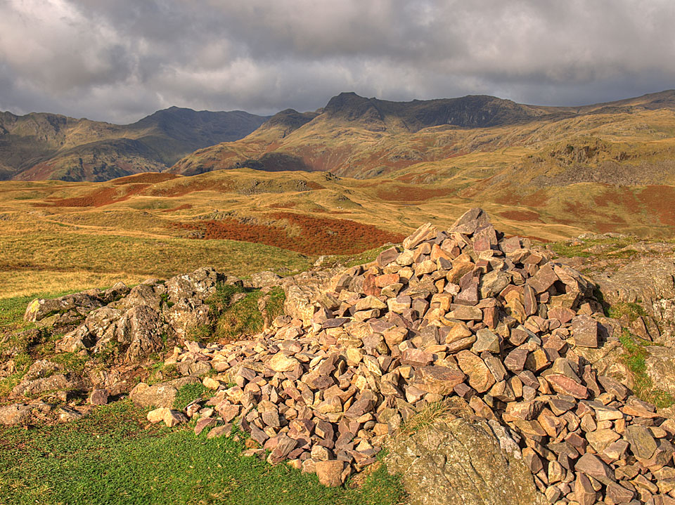
Bowfell and the Langdale Pikes from the summit of Silver How
Bowfell and the Langdale Pikes from the summit of Silver How

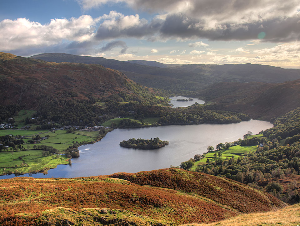
Grasmere and Rydal Water from the summit

Grasmere and Rydal Water from the summit

Silver How

Walked on 13/11/2014

Start Point: Grasmere Church (NY 336 073)

Grasmere – Allan Bank – Silver How – Kelbarrow – Grasmere

Distance: 2.75 miles     Total Ascent: 325 metres     Time Taken: 1 hour 15 minutes     Start Time: 10:00

Weather: Overcast, windy, 12°C

Time for another short walk with Fletcher in tow today, he seems to enjoy the outdoor life and it is interesting to watch him grow when everything is new – crossing a stream, climbing a stile etc are all part of the fell walking experience and something you take for granted but having a new new boy along for the walk reminds you that there are always new hurdle to overcome. It was pretty windy up on the top today too, Fletcher overcame that new experience by barking at it!
Silver How

610_6409

Helm Crag

610_6416

A wider view

610_6424

Looking back to Grasmere from the path above Allan Bank

610_6434

Helm Crag, Seat Sandal and Fairfield (in cloud)

610_6445

The Helvellyn ridge is also under cloud beyond the Lion and the Lamb

610_6447

Heading for Silver How and there is a solitary figure on the top. When we got there he recognised us ( actually when I say 'us' I mean 'them'!)

610_6448

Silver How summit

610_6455

Looking in the opposite direction over Great Langdale

610_6460

Dougal checks out all the bodies of water he can see - Grasmere, Rydal Water, Windermere, Loughrigg Tarn and Elter Water with Loughrigg Fell central

610_6463

It was a bit breezy up there young Fletcher!

610_6477

Blimey Fletcher, I think you've gone and done it now!

610_6487

The steep descent

610_6493

Grasmere and Rydal Water

610_6495

Heading back to Grasmere

Silver How, Grasmere

Walked on 04/03/2013

Start point: Grasmere Church (NY 336 073)

Grasmere – Allan Bank – Silver How – Kelbarrow – Grasmere

Distance: 2.75 miles     Total Ascent: 325 metres     Time Taken: 1 hour 15 minutes     Start Time: 10:50

Weather: Murky and misty. 4oC

It was a murky morning, the sun was ever threatening and did indeed come out much later (i.e. when I went home!). This is a nice enough walk though and there seemed to be one or two out and about enjoying the fresh air.

01 Silver How

P3041937-Edit

A Grasmere panorama, from Allan Bank.

P3041939

Helm Crag.

P3041943

Murky and misty looking across to Heron Pike.

P3041944

Climbing higher.

P3041947

Grasmere and Loughrigg.

P3041950

Caught in the act!

P3041963-Edit

The path to Silver How.

P3041965

No Langdales view from Silver How summit.

P3041967

Dougal, the fell dog.

P3041975

Grasmere and Rydal Water.

P3041976

Dougal waits for me, surveying his kingdom.

P3041980

The Monarch of the Glen.

Silver How

Walked on 15/10/2012

Start point: Grasmere Church (NY 336 073)

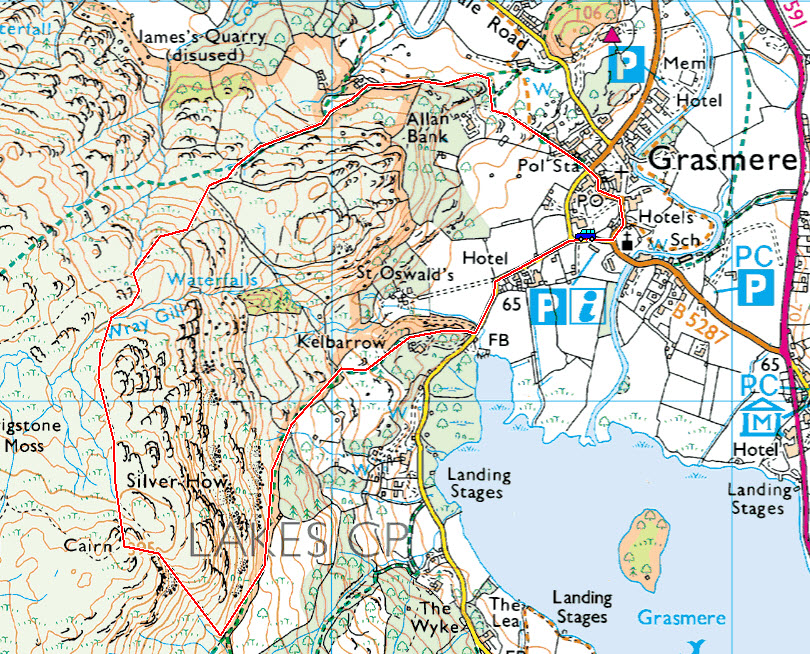
Grasmere – Allan Bank – Silver How – Spedding Crag – Dow Bank – Grasmere

Distance: 3.7 miles     Total Ascent: 363 metres     Time Taken: 2 hours     Start Time: 09:40

Weather: Changeable. 8C

It was a strange morning that didn’t look as though it would ever dry up with heavy rain early on. Up on high, things did change for the better though, much better.
Silver How

Silver How route map.

013

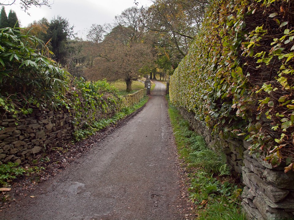
It was quite a gloomy start through Grasmere, here on the road towards Allan Bank (Wordsworth's residence 1808-1811).
014

Seat Sandal above the rooftops of Grasmere.

015

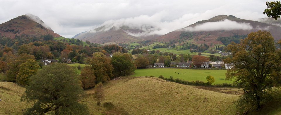
A panoramic view from Helm Crag to Stone Arthur with lots of interesting and quickly shifting clouds around.
016

Following the ancient path.

017

Raining now at the top of the path looking back towards Grasmere.

018

Panoramic from the gate.

019

The way ahead, following the green path between the bracken.

020

Helm Crag.

021

More shifting clouds, this time looking across to Stone Arthur and Great Rigg.

022

Silver How ahead.

023

It seemed to be brightening up a little here now.

024

The Vale of Grasmere.

025

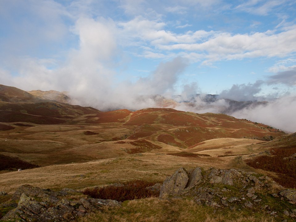
Wow, what happened there? It was like a different day in the blink of an eye with blue sky and sunshine.
026

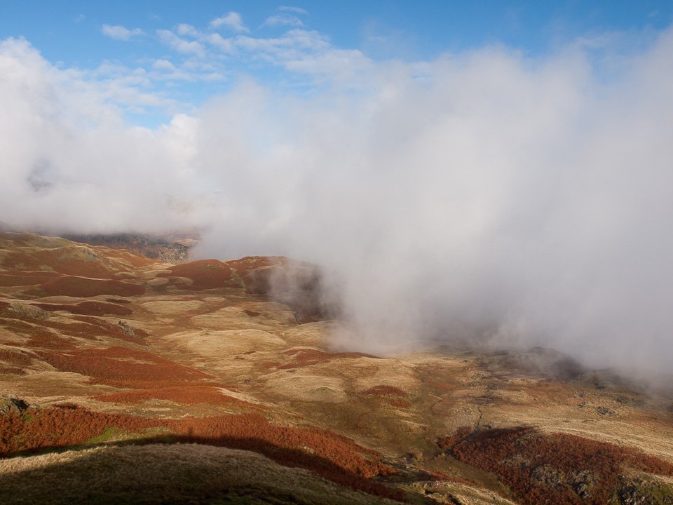
Silver How summit, the Coniston fells rising above the cloud.

027

Casper and Dougal - sun kissed and muddy.

028

Looking northwards, that big bank of cloud was over Grasmere and spreading my way. The Langdales to the west weren't visible all morning so I seemed to be in a small sunny pocket.

029

The path towards Elterwater - I wasn't sure where I was going to end up really, it depended on the weather so I had a bit of an aimless wander around.

030

Eventually I descended southwards here looking towards Dow Bank from the big cairn.

031

Grasmere and Rydal Water.

032

Autumn in the Vale of Grasmere.

033

Spedding Crag.

034

Lovely colours in the sunshine.

035

The path to Silver How (summit to the left) from the wall corner.

036

Following the wall to Grasmere.

037

Mirrored Grasmere.

038

Access to the Silver How lane, right.

039

Island reflection.

040

Silver How.

041

Silver How across Grasmere and a bit of sunlight on the trees. Later...

042

Low Wood jetty.

043

The Langdale Pikes making a brief appearance, taken from Low Wood.

044

Crinkle Crags and Bowfell.

045

Windermere - paradise?

Silver How

Walked on 07/10/2011

Start point: Grasmere Church (NY 336 073)

Grasmere – Allan Bank – Silver How – Lang How – Brigstone Moss – Allan Bank – Grasmere

Distance: 3.8 miles     Total Ascent: 377 metres     Time Taken: 1 hour 30 minutes     Start Time: 09:30

Weather: Sunny, cold wind. 12ºC

The day certainly didn’t promise much as I set off this morning when everything was flat and dull. As I climbed towards Silver How, the skies began parting and the sun came out to light up the fells in autumnal glory. A great little walk this turned out to be and I wished I had more time to let me walk a while longer. The wind that accompanied the sunshine and blew away all the clouds was a cold one though, bringing a little touch of winter to the proceedings. Today I had some new Scarpa Trek GTX to try out too so we’ll see how they fare over the next couple of months.

Silver How

Silver How

07.10.11-004

Dull Seat Sandal over Grasmere rooftops.

07.10.11-034

After the initial rather dull climb past Allan Bank from Grasmere, that looks more like it as a patch of sunshine lights up Tarn Crag.

07.10.11-046

Now the sun has caught us, looking across the Vale of Grasmere. Perhaps today will turn out okay after all.

07.10.11-055

Helm Crag.

07.10.11-061

Looking to Helm Crag from further up the climb, Seat Sandal beyond.

07.10.11-064

Come on Casper.

07.10.11-073

Once up onto Brigstone Moss the sun was shining brightly, here looking to Lang How.

07.10.11-088

Dappled Langdale Pikes.

07.10.11-094

A lovely view opening up to Crinkle Crags and Bowfell.

07.10.11-100

Helvellyn and Fairfield from Silver How.

07.10.11-106

Bowfell and the Langdale Pikes from the summit.

07.10.11-109

Windswept Casper and Dougal on Silver How.

07.10.11-110

Wassat?

07.10.11-139

Grasmere and Rydal Water.

07.10.11-145

Absolutely clear over on the Coniston fells now too. When I set off they were covered in cloud.

07.10.11-148

Doggone Dougal.

07.10.11-157

Lang How.

07.10.11-160

Helvellyn and Fairfield across a tarn below Lang How.

07.10.11-166

The Fairfield group.

07.10.11-172

Looking back to Silver How.

07.10.11-178

Bowfell and the Langdale Pikes.

07.10.11-184

Closer.

07.10.11-196

Great Langdale from the climb to Lang How.

07.10.11-202

Silver How and Windermere looking into the bright sun.

07.10.11-208

Dougal leads the way on the steep and pathless descent back to Brigstone Moss.

07.10.11-241

Fairfield, Great Rigg and Stone Arthur across sunny Grasmere.

07.10.11-244

A peep over the wall.

07.10.11-253

Helm Crag.

07.10.11-268

Autumn colours in Grasmere.

07.10.11-271

Stone Arthur.

Blea Rigg

Walked on 06/01/2011

Start point: Grasmere (NY 336 073)

Grasmere – Silver How – Blea Rigg – Easedale Tarn – Easedale – Grasmere

Distance: 6.3 miles     Total Ascent: 562 metres     Time Taken: 3 hours 15 minutes     Start Time: 08:30

Weather: Rain at first then clearing. 3°C

This wasn’t where I intended to go today but in the northern half of the Lakes, over Dunmail Raise it was raining heavily and continued to do so all morning. Back at Grasmere it was also raining when I set off but it soon cleared with the clouds swirling on and off the high fells leaving behind a fresh carpet of snow on them. The backdrop to today’s walk was the sound of the hunt – the horn, the shouts and the dogs. I think Dougal and Casper quite fancied joining in!

Blea Rigg

Blea Rigg route map.

06.01.11-011

Early Silver How across Grasmere.

06.01.11-013

Misty Grasmere - taken from the opposite side to the first photo.

06.01.11-027

Looking back along the path from the climb to Kelbarrow.

06.01.11-030

Sunrise over Loughrigg Fell.

06.01.11-064

The mist is clinging over Rydal Water and to the side of Loughrigg.

06.01.11-068

Helm Crag from the Silver How ridge.

06.01.11-079

Casper and Dougal on Silver How.

06.01.11-082

Grasmere and Rydal Water.

06.01.11-088

Low lying mist in the valleys below.

06.01.11-100

The Langdale Pikes appear across Lang How Tarn from thick cloud with a fresh covering of snow

06.01.11-114

Dougally Doo.

06.01.11-116

Looking back to Silver How.

06.01.11-121

Looking down on Great Langdale.

06.01.11-123

Wetherlam and the Tilberthwaite Fells also have new snow, Lingmoor Fell between me and them.

06.01.11-125

Pike o' Blisco dwarfs Side Pike.

06.01.11-132

The weather is constantly changing, from sun to cloud.

06.01.11-139

A close up on the Langdales - that's the last I saw of them today.

06.01.11-144

Great Castle How.

06.01.11-146

Crinkle Crags at the head of Oxendale with rising cloud from Great Langdale.

06.01.11-148

Great Carrs in sunshine.

06.01.11-150

The icy climb.

06.01.11-152

Heading for Blea Rigg.

06.01.11-159l

Wetherlam from the un named tarn below Blea Rigg.

06.01.11-161

All sorts going on here, looking down from Blea Rigg.

06.01.11-163

The frozen summit of Blea Rigg.

06.01.11-184

Looking the other way, the Langdales have disappeared in the cloud.

06.01.11-195

Which way Dougal? Heading down to Easedale Tarn.

06.01.11-244

Helvellyn revealed.

06.01.11-214

Easedale Tarn reflections.

06.01.11-215

Tarn Crag reflected.

06.01.11-221_stitch

Tarn Crag and Easedale Tarn panoramic.

06.01.11-243

Blue skies and sunshine - for now - descending into Easedale.

Silver How

Walked on 26/01/2010

Start point: Grasmere Church (NY 336 073)

Grasmere – Allan Bank – Silver How – Kelbarrow – Grasmere

Distance: 2.75 miles     Total Ascent: 325 metres     Time Taken: 1 hour 15 minutes

Weather: Overcast. 3°C

It was another grey day today though not nearly so cold as there was little wind. We had a quick jaunt up to Silver How from Grasmere and even this normally popular fell was quiet today – there was no one around up there.

26.01.10-004

Seat Sandal above Grasmere.

26.01.10-006

Stone Arthur.

26.01.10-009

Helm Crag and Seat Sandal.

26.01.10-013

Dougal licks his lips at the prospect of this walk on the climb from Allan Bank.

26.01.10-015

Looking back along the path.

26.01.10-023

Jennifer Juniper.

26.01.10-025

Wray Gill.

26.01.10-032

Heading for Silver How.

26.01.10-038

These two have found a solitary patch of snow to play on - Dougal watches as his piece of snow gets away from him!

26.01.10-040

The Langdale Pikes from Silver How.

26.01.10-046

Casper and Dougal at the summit.

26.01.10-049

Casper checks out Wetherlam and the Coniston fells (and the sheep in the foreground, no doubt).

26.01.10-052

A view through to Fairfield, lost in the murk.

26.01.10-054

Grasmere and Rydal Water.

26.01.10-056

Loughrigg Fell from the descent.

26.01.10-061

Loughrigg again, from the bottom of Silver How.

26.01.10-070

Mucky pups on the way back to Grasmere.

Silver How

Walked on 18/03/2009

Start point: Grasmere Church (NY 336 073)

Grasmere – Allan Bank – Silver How – Kelbarrow – Grasmere

Distance: 2.75 miles     Total Ascent: 325 metres     Time Taken: 1 hour 15 minutes

Weather: Warm but overcast. 11°C.

Everywhere was overcast and gray this morning but I felt sure the sun would burn through eventually, though not during my walk unfortunately. Despite the lack of views and apparent gloominess it was a lovely day – very still and peaceful – and this turned out to be a really easy walk and a good circular route.
Silver How

Silver How route map.

18.03.09-004

Grasmere.

18.03.09-008

Helm Crag from Allan Bank.

18.03.09-012

The path to Silver How.

18.03.09-016

Snaking walls on Silver How.

18.03.09-017

The boy enjoys a roll around in the bracken.

18.03.09-032

Silver How directly ahead.

18.03.09-036

The summit of Silver How, no view today.

18.03.09-040

Grasmere and a glimpse of Rydal Water through the mist.

18.03.09-045

Grasmere and Loughrigg Fell from the descent.

18.03.09-048

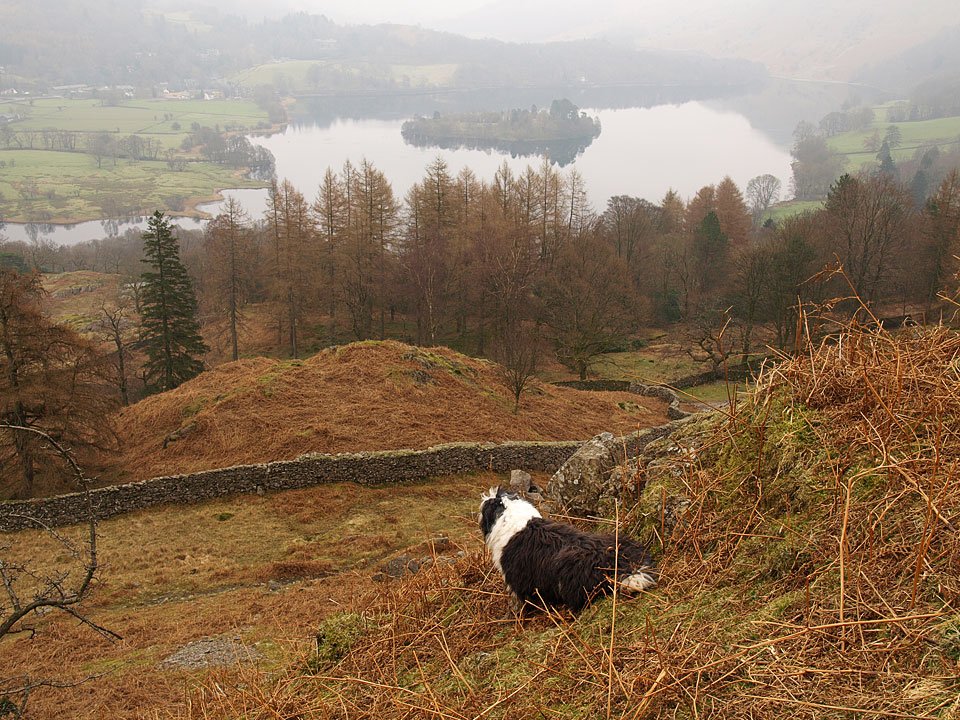
Grasmere Island.

18.03.09-051

Casper leads the way on the final steep section. I knew the sun would burn through eventually! Later, when I was out and about there were signs of Spring around everywhere...

18.03.09-089_2

Wordsworth's Daffodils were out by Ullswater - here is an extract from his 1804 poem that made them famous: When all at once I saw a crowd, A host, of golden daffodils; Beside the lake, beneath the trees, Fluttering and dancing in the breeze.

18.03.09-126

The Duke of Portland Boathouse, Ullswater. Around Furness Abbey...

18.03.09-133

Crocus in the woods.

18.03.09-153_2

This lamb is keeping warm with his nice orange jacket on - a 'North Face' one I think it is!

18.03.09-167_1

Happy to pose for a photo.

18.03.09-176

The daffs are out around the abbey too.

18.03.09-183

18.03.09-193

Easedale Circuit

Walked on 18/10/2007

Start point: Grasmere (NY 337 074)

Grasmere – Easedale – Tarn Crag – Codale Head – High Raise – Sergeant Man – Blea Rigg – Silver How – Grasmere

Distance: 9.7 miles     Total Ascent: 850 metres     Time Taken: 5 hours

Weather: Generally bright. 13oC.

Today I met up with Andy Lang nice and early for a walk around Easedale and up onto High Raise, the centre of the Lake District. It was very clear this morning but the best of the sunshine was early on and once up onto High Raise the wind was icy. On the way up to Grasmere, all the  stretches of water I passed were covered in a thick blanket of mist – here comes winter.

Easedale Circuit

18.10.07-002

All was frozen in Easedale before the sun came up...

18.10.07-005

...but when it did, it certainly gave a lovely golden glow.

18.10.07-008

Sourmilk Gill.

18.10.07-009

Looking into Easedale from the top falls of Sourmilk Gill.

18.10.07-017

Beginning the climb of the Tarn Crag ridge - the second peak from the left is the summit.

18.10.07-019

Autumn in Far Easedale.

18.10.07-035

Easedale Tarn with reflected contrail.

18.10.07-039

Casper summits Tarn Crag - hot work in the sunshine!

18.10.07-044

Looking over to Helvellyn from Tarn Crag, Gibson Knott and Steel Fell in the foreground.

18.10.07-047

Looking into the sun, Grasmere and Windermere under a thick blanket of mist.

18.10.07-050

Easedale Tarn.

18.10.07-055

Codale Tarn from the Tarn Crag ridge with the Coniston fells beyond.

18.10.07-058

The Helvellyn massif from Codale Head.

18.10.07-062

On the skyline are Crinkle Crags, Bowfell and the Scafells with the pointed Sergeant Man in the middle distance.

18.10.07-077

Great Gable and Pillar beyond the Glaramara ridge from High Raise.

18.10.07-079

Scafell Pike and Great End above Langstrath.

18.10.07-082

Skiddaw and Blencathra from High Raise, Derwent Water covered in mist. High Raise is the central point of the Lake District and there are great views from here.

18.10.07-085

A close-up of Skiddaw and Derwent Water.

18.10.07-087

Great Gable.

18.10.07-088

Bowfell.

18.10.07-094

Casper finds a comfortable place to sit on High Raise.

18.10.07-097

Fleetwith Pike in the centre with the High Stile ridge behind.

18.10.07-108

Looking back to the grassy dome of High Raise from Sergeant Man.

18.10.07-109

Descending Sergeant Man.

18.10.07-113

Stickle Tarn and Harrison Stickle from the ridge to Blea Rigg.

18.10.07-115

Looking down on two tarns - Codale and Easedale.

18.10.07-124

Heading for Blea Rigg, Windermere beyond.

18.10.07-127

Harrison Stickle from Blea Rigg.

18.10.07-128

Looking across to Crinkle Crags.

18.10.07-136

Having a rest on the way to Silver How.

18.10.07-140

Seat Sandal and Fairfield over Helm Crag.

18.10.07-149

Great Langdale.

18.10.07-161

Crinkle Crags, Bowfell and the Langdale Pikes.

18.10.07-172

Grasmere and Rydal Water from Silver How.

18.10.07-175

The Vale of Grasmere, Helvellyn to the left and Fairfield to the right.

18.10.07-177

The view from the summit of Silver How.

18.10.07-191

Reflected island on Grasmere.

18.10.07-194

Helm Crag from the descent.

18.10.07-200

Helm Crag in Autumn.

Blea Rigg

Walked on 09/01/2007

Start point: Grasmere (NY 337 074)

Grasmere – Easedale – Easedale Tarn – Blea Rigg – Silver How – Grasmere

Distance: 9 miles    Total Ascent: 650 metres     Time Taken: 3 hours 40 minutes.

Weather: Windy and surprisingly warm. 11°C

The cobwebs were well and truly blown off today for my first long walk of the year. It was good to get out again, even though I knew the weather was not going to be the best. It was more than a bit blustery at times, but at least I never got wet on the deserted central fells today!
Blea Rigg

09.01.07-003

It's looking a bit grey over Tarn Crag from Easedale. The falls on Sour Milk are in the centre.

09.01.07-007

...and looking back to Easedale from the falls.

09.01.07-010

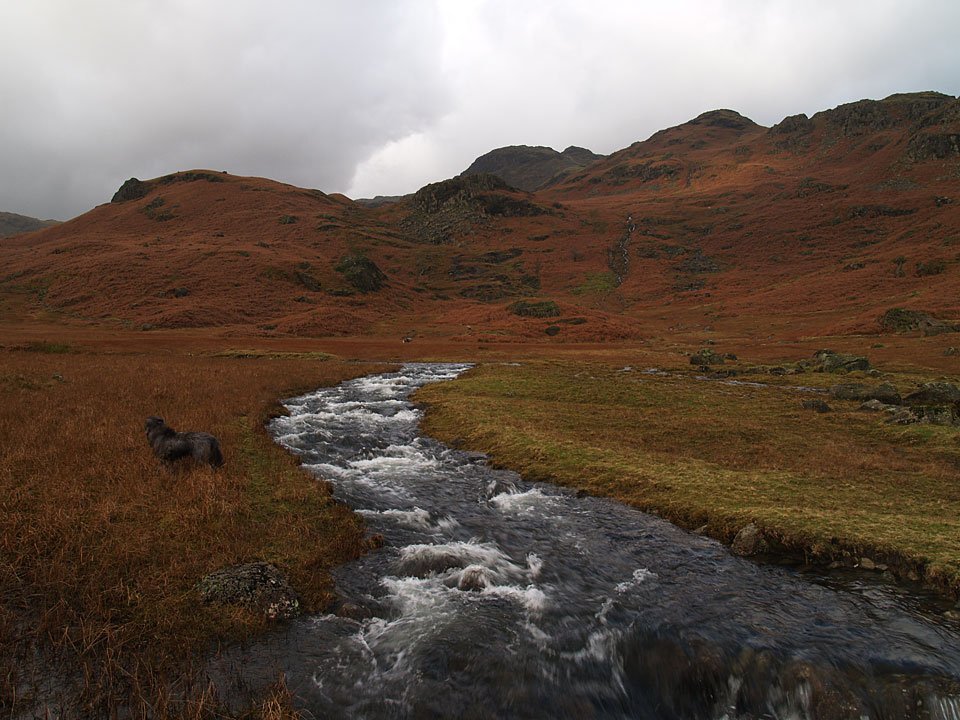
The falls are in spate today after all he rain of the last week or so.

09.01.07-016

I had intended crossing Sour Milk Gill here, above the falls, but there was no chance with it being this full. Tarn Crag is in the distance.
09.01.07-018

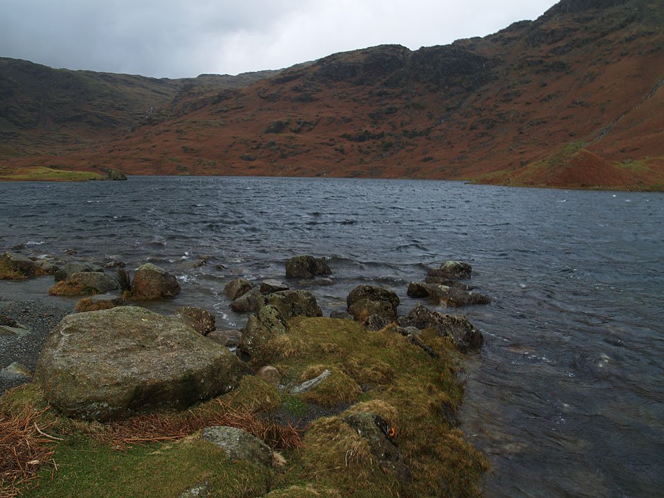
A bit of sunshine over the east ridge to Tarn Crag.

09.01.07-021

Tarn Crag over Easedale Tarn.

09.01.07-031

No chance of crossing Sourmilk Gill here on the edge of Easedale Tarn either, the stepping stones were completely covered. A change of plan was required!
09.01.07-038

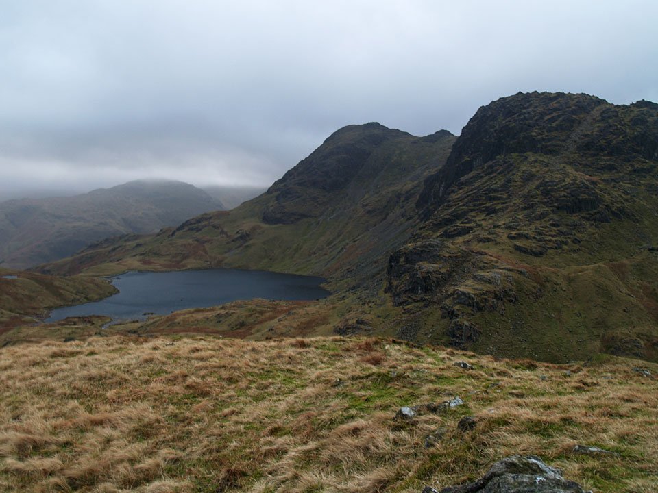
Looking back to Easedale Tarn to Seat Sandal and Fairfield.

09.01.07-044

Walking towards Belles Knott.

09.01.07-054

Codale Tarn, left and Easedale Tarn, right, split by Belles Knott.

09.01.07-058

As soon as we got onto the Blea Rigg ridge, the wind really whipped up and made walking difficult at times. This is a great view of Harrison Stickle, Pavey Ark and Stickle Tarn but it is hard to convey just how windy it was..

09.01.07-078

...but Angus can do a pretty good job!

09.01.07-067

Another view of Codale Tarn and Easedale Tarn from higher up, the eastern fells mainly clear for now.

09.01.07-082

Easedale Tarn.

09.01.07-086

On the summit of Blea Rigg.

09.01.07-089

Lingmoor Fell and Side Pike across Langdale from Blea Rigg, Lingmoor Tarn visible below the summit.

09.01.07-098

Looking along the ridge to Silver How with Windermere beyond, Elter Water to the right.

09.01.07-103

Looking across to Seat Sandal and Fairfield.

09.01.07-108

Great Langdale.

09.01.07-113

Angus looking into Great Langdale - still doing a great job of showing conditions up here!

09.01.07-114

Looking to Great Langdale from the large tarn below Lang How.

09.01.07-119

Water, water, everywhere. Grasmere, Rydal Water, Loughrigg Fell and Windermere.

Silver How

Fairfield, Great Rigg and Stone Arthur above Grasmere from Silver How.

09.01.07-133

Angus and Casper on Silver How looking to Windermere.

09.01.07-135

Looking back to the Langdale Pikes from Silver How with Sergeant Man the distant bump to the right.

09.01.07-138

Descending to Grasmere through the Juniper trees.

Silver How

Walked on 30/09/2004

Start point: Grasmere (NY 338 078)

Grasmere – Easedale Tarn – Blea Rigg (174) – Castle How (175) – Swinescar Pike (176) – Lang How (177) – Silver How (178) – Grasmere

Weather: Rain with low lying cloud.

Today’s walk was a damp traverse of the Langdale Edge and Silver How; the cloud was so low that there was no chance of a decent view today from the tops except for a brief clearing of the cloud towards the end of the walk.

Silver How

30th September - Silver How 005

Sourmilk Gill in full spate.

30th September - Silver How 009

The power...

30th September - Silver How 007

...and the glory...

30th September - Silver How 017

Easedale Tarn.

30th September - Silver How 022

The Matterhorn shape of Belles Knott above Easedale Tarn.

30th September - Silver How 033

The cloud lifts briefly to give a glimpse of Lingmoor Fell across Great Langdale from Lang How.

30th September - Silver How 035

A wet Silver How from Lang How.

30th September - Silver How 038

One of the many grassy knolls reflected in a tarn beneath Lang How.

30th September - Silver How 044

Looking across Brigstone Moss from the summit of Silver How.

30th September - Silver How 051

Helm Crag from the descent back into Grasmere.

30th September - Silver How 052

Grasmere below Silver How.

Grasmere Epic

Walked on 11/03/2004

Grasmere – Steel Fell (186) – Calf Crag – Greenup Edge – Ullscarf (187) – Long Crag – Sergeant’s Crag (188) – Eagle Crag (189) – Sergeant’s Crag – Low White Stones – High Raise – Thunacar Knott (190) – Sergeant Man – Blea Rigg (191) – Silver How (192) – Grasmere

A raw and bitterly cold day, icy wind on the tops with lots of snow.

Grasmere Epic

Grasmere Epic - 11th March 1001

Helm Crag from the ascent of Steel Fell. Loughrigg is to the distant left.

Grasmere Epic - 11th March 1007

Steel Fell summit cairn.

Grasmere Epic - 11th March 1013

Two un-named tarns on the walk to Calf Crag, Greenup Edge behind.

Grasmere Epic - 11th March 1016

Calf Crag summit.

Grasmere Epic - 11th March 1017

A frozen Ullscarf summit cairn.

Grasmere Epic - 11th March 1025

Greenup Valley.

Grasmere Epic - 11th March 1028

Ullscarf.

Grasmere Epic - 11th March 1033

Sergeant's Crag summit.

Grasmere Epic - 11th March 1034

Borrowdale from Eagle Crag.

Grasmere Epic - 11th March 1038

Icicle formation on Low White Stones.

Grasmere Epic - 11th March 1041

High Raise Trig. column.

Grasmere Epic - 11th March 1044

High Raise from Thunacar Knott.

Grasmere Epic - 11th March 1047

Sergeant Man summit looking towards Stickle Tarn and Pavey Ark.

Grasmere Epic - 11th March 1054

Stickle Tarn, Harrison Stickle and Pavey Ark across Bright Beck.

Grasmere Epic - 11th March 1056

Two Tarns - Codale Tarn.....

Grasmere Epic - 11th March 1057

and Easedale Tarn.

Grasmere Epic - 11th March 1059

Pike O'Stickle from Blea Rigg summit.

Grasmere Epic - 11th March 1061

Grasmere and Rydal Water from Silver How.

Walking Diary

  • The Mosedale Horseshoe 01/03/2022
  • Caw 18/01/2022
  • Coniston sunset 17/01/2022
  • Blencathra 15/01/2022
  • Scafell Pike 14/01/2022

Social

  • Facebook
  • Twitter

Information

  • Striding Edge
  • T&C’s
  • Privacy
  • Links