Striding Edge

A photo diary of Lake District fell walks

  • Walks
  • Fells
    • Wainwrights
      • Eastern Fells
      • Far Eastern Fells
      • Central Fells
      • Southern Fells
      • Northern Fells
      • North Western Fells
      • Western Fells
      • Outlying Fells
    • Birketts
  • Dogs
  • Love The Lakes
  • Contact

Sour Howes

Height: 483 metres / 1585 feet Grid reference: NY 42830 03203 Category: The Far Eastern Fells
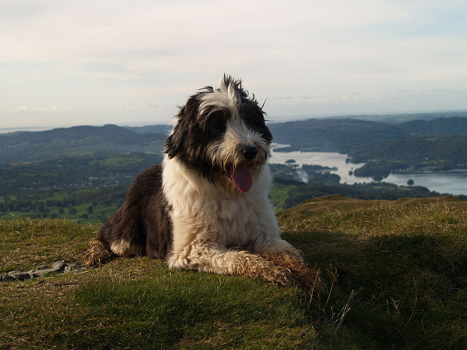
Casper on the summit of Sour Howes - the cairn that used to be here has disappeared

Casper on the summit of Sour Howes – the cairn that used to be here has disappeared

Sour Howes and Sallows

Walked on 27/11/2009

Start point: Troutbeck (NY 413 028)

Troutbeck – Garburn Road – Sour Howes – Moor Head – Sallows – Garburn Road – Troutbeck

Distance: 4.7 miles     Total Ascent: 434 metres     Time Taken: 2 hours

Weather: Showers, clearing. 8oC

Hopefully, everything is returning to normal for most in the Lake District whilst further north at Cockermouth and Workington, things will take a little longer to straighten out. We walked a couple of the smaller Far Eastern fells today, Sour Howes and Sallows. We started the walk in the rain but surprisingly it brightened up towards the end of it and there was even a sprinkling of snow visible across on the western fells.
Sallows

Sallows route map.

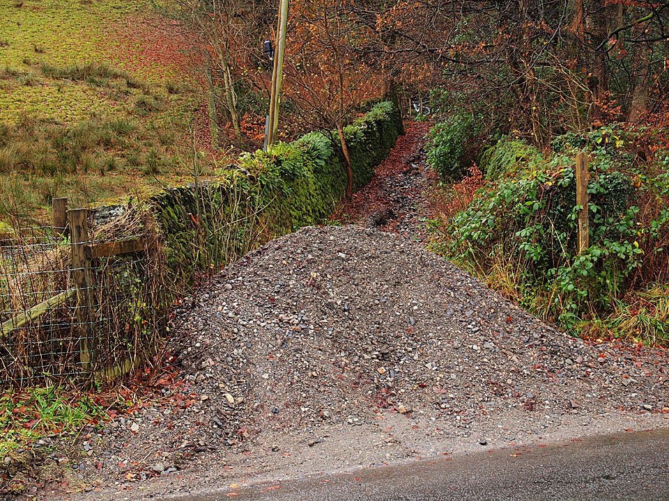
27.11.09-001

First we had to scale this new Lake District summit at the foot of the Garburn Road! This pile of shale was washed down from the track across the road last week. The Garburn Road was deeply rutted making going (especially in descent) a bit tricky at times.
27.11.09-010

Troutbeck Park from the Garburn Road.

27.11.09-022

The Tongue.

27.11.09-037

Looking across Troutbeck to a misty Wansfell.

27.11.09-055

Wansfell from Applethwaite Common.

27.11.09-056

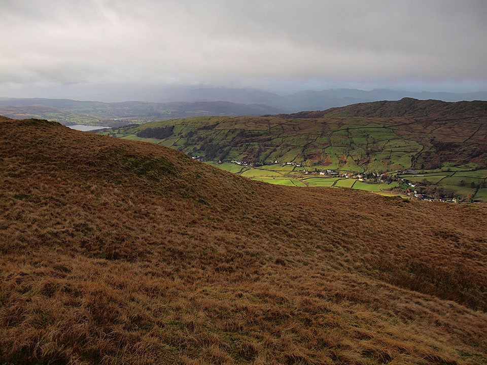
The head of Troutbeck Park from the climb to Sour Howes.

27.11.09-057

Sour Howes ahead.

27.11.09-067

It is all a bit drizzly at the moment.

27.11.09-070

Windermere.

27.11.09-071

I think that shower is heading straight for me.

27.11.09-078

A panoramic view of Windermere.

27.11.09-100

Damp Dougal on Sour Howes.

27.11.09-101

Miraculously, Troutbeck is bathed in sunshine below while beyond the ominous clouds are hanging over the western fells.

27.11.09-105

Dougal takes the lead on Moor Head.

27.11.09-108

Following the wall to Sallows and it is raining heavily now.

27.11.09-111

Over to the west though, there is sunshine with a fresh sprinkling of snow on Bowfell with the Langdale Pikes to the right.

27.11.09-115

The cloud drifting across Yoke. Perhaps that sunshine will come this way.

27.11.09-131

Dougal and Casper on Sallows.

27.11.09-134

Looking towards Coniston from the summit mound of Sallows.

27.11.09-141

Red Screes and the ribbon of the Kirkstone Pass road below it.

27.11.09-149

The skies are clearing over Sour Howes to the south now.

27.11.09-152

Sunshine and a clear view.

27.11.09-153

The Coniston fells.

27.11.09-154

Sour Howes.

27.11.09-156

Casper takes in the view from the descent back to the Garburn Road.

27.11.09-158

Red Screes, Caudale Moor and Dougal.

27.11.09-181

Thornthwaite Crag, Froswick, Ill Bell and Yoke.

27.11.09-188

Water spout on the way down.

27.11.09-191

Sunshine through the trees in the old quarry.

27.11.09-193

Troutbeck Park, a clearer view than at the start of the walk.

27.11.09-200

Back to Troutbeck.

Sallows

Walked on 18/09/2007

Start point: Troutbeck (NY 413 028)

Troutbeck – Garburn Road – Sour Howes – Capple Howe (515) – Moor Head – Sallows – Garburn Road – Troutbeck

Distance: 5.2 miles     Total Ascent: 470 metres     Time Taken: 2 hours

Weather: Clear and cool. 12oC.

After a dull start it eventually turned sunny and bright but it was so cold this morning. A step change I thought and Autumn is most definitely upon us now. This is quite a gentle walk and I managed to pick up a Birkett straggler – one that I had somehow managed to miss previously. I don’t know what has happened to the cairn on Sour Howes, somehow it has completely disappeared without trace.

Sallows

18.09.07-005

Troutbeck Park from the Garburn Road, The Tongue centre.

18.09.07-009

Getting higher up the Garburn Road.

18.09.07-026

Looking across to Scafell, through the Three Tarns gap, and Bowfell.

18.09.07-029

The Coniston fells from the climb to Applethwaite Common.

18.09.07-030

Windermere from the ridge.

18.09.07-035

Thornthwaite Crag, Froswick, Ill Bell and Yoke.

18.09.07-036

Red Screes and Caudale Moor across Troutbeck Park.

18.09.07-040

The sky is clearing now as the sun gets higher giving clear views.

18.09.07-044

A close-up of Bowness and Windermere.

18.09.07-045

Distant Black Combe over Windermere.

18.09.07-046

Crinkle Crags, Scafell and Bowfell. Pike o' Blisco can just be seen to the left of the first Crinkle.

18.09.07-048

Casper on the summit of Sour Howes. The cairn that used to be here has disappeared so Casper will have to do instead!

18.09.07-053

The view to the north from Sour Howes.

18.09.07-057

Sallows from the top of Capple Howe. I managed to miss this new (for me) Birkett last time round.

18.09.07-064

Sunshine and blue skies heading for Sallows.

18.09.07-068

The western fells over Wansfell Pike.

18.09.07-069

Red Screes with the Kirkstone Pass road below.

18.09.07-071

The Kentmere Horseshoe fells from Sallows.

18.09.07-073

Yoke over the Garburn Pass.

18.09.07-075

Casper on the summit mound of Sallows, Kentmere Pike beyond.

18.09.07-087

Scafell Pike now visible in the distant centre, Great End over the Langdale Pikes to the right.

18.09.07-090

The Coniston range.

18.09.07-091

Troutbeck Tongue.

18.09.07-096

Descending to the Garburn Road.

18.09.07-098

Black Combe and the Coniston fells from the Garburn Road.

18.09.07-102

Wansfell.

Sallows

Walked on 01/02/2005

Start point: Troutbeck (NY 413 028)

Troutbeck – Garburn Road – Backstone Barrow – Sour Howes (283) – Sallows (284) – Garburn Road – Troutbeck

Weather: Clearing throughout the walk, ending with sunshine and blue skies!

Today’s walk is a short round from Troutbeck to two tops on Applethwaite Common, namely Sour Howes and Sallows. The weather started clearing almost as soon as I set off after initially being rather overcast…hooray! There are superb views along almost the whole length of Windermere and along Troutbeck Park throughout the walk.
Sallows

Elevation

Elevation profile of the route.

Sallows 3D

3D image of the walk route.

Dsc04077

The Garburn Road at the start of the walk.

Dsc04086

The clouds start to lift from Coniston Old Man and Wetherlam.

Dsc04092

The ascent to Sour Howes.

Dsc04104

Windermere from the summit of Sour Howes.

Dsc04111

Caudale Moor and the Kentmere Pikes from Sour Howes. The wall running from the centre up to the right leads to Sallows.

Dsc04112

Red Screes from Sour Howes.

Dsc04123

Soaking up the sunshine on Sallows summit mound, Kentmere Pike behind.

Dsc04126

Wansfell Pike and Wansfell from Sallows.

Dsc04138

Looking along Troutbeck Park from the Garburn Road. See below for an annotated version of this photo.

Dsc04138 annotated


Troutbeck

Walked on 12/01/2004

Troutbeck Church – The Howe – Sour Howes (162) – Sallows (163) – Hagg Gill –  Troutbeck Park- Troutbeck Tongue (164) – Ing – Town Head – Troutbeck – Nanny Lane – Wansfell (165) – Nanny Lane – Troutbeck – Troutbeck Church

A fine day with some low lying cloud.

Troutbeck

Dsc01756

Troutbeck Tongue in the sunshine, Yoke in the clouds.

Sour Howes

Sour Howes summit, Windermere behind.

Dsc01768

Windermere from Sallows with Sour Howes in the foreground.

Sallows

The summit mound of Sallows looking East to Longsleddale.

Dsc01772

Wansfell from Sallows.

Dsc01770

Mines a.. - set in stone off the Garburn Road

Dsc01773

Waterfall on the descent of Sallows.

Dsc01776

Looking up Hagg Gill and the High Street Roman Road, Caudale Moor on the left, Thornthwaite on the right.

Dsc01781

Looking over to Heron Pike and High Pike from Troutbeck Tongue.

Troutbeck Tongue

Thornthwaite Crag, Froswick and Ill Bell from Troutbeck Tongue summit.

Dsc01786

Caudale Moor behind Troutbeck Tongue and on the right, Thornthwaite, Froswick, Ill Bell and Yoke from Ing Lane.

Dsc01788

Sallows on the left and Sour Howes on the right from the ascent of Wansfell.

Wansfell

Thornthwaite, Froswick, Ill Bell and Yoke from Wansfell summit.

Dsc01795

Windermere from Wansfell, as Wainwright's drawing.

Dsc01804

Troutbeck Church.

Walking Diary

  • The Mosedale Horseshoe 01/03/2022
  • Caw 18/01/2022
  • Coniston sunset 17/01/2022
  • Blencathra 15/01/2022
  • Scafell Pike 14/01/2022

Social

  • Facebook
  • Twitter

Information

  • Striding Edge
  • T&C’s
  • Privacy
  • Links