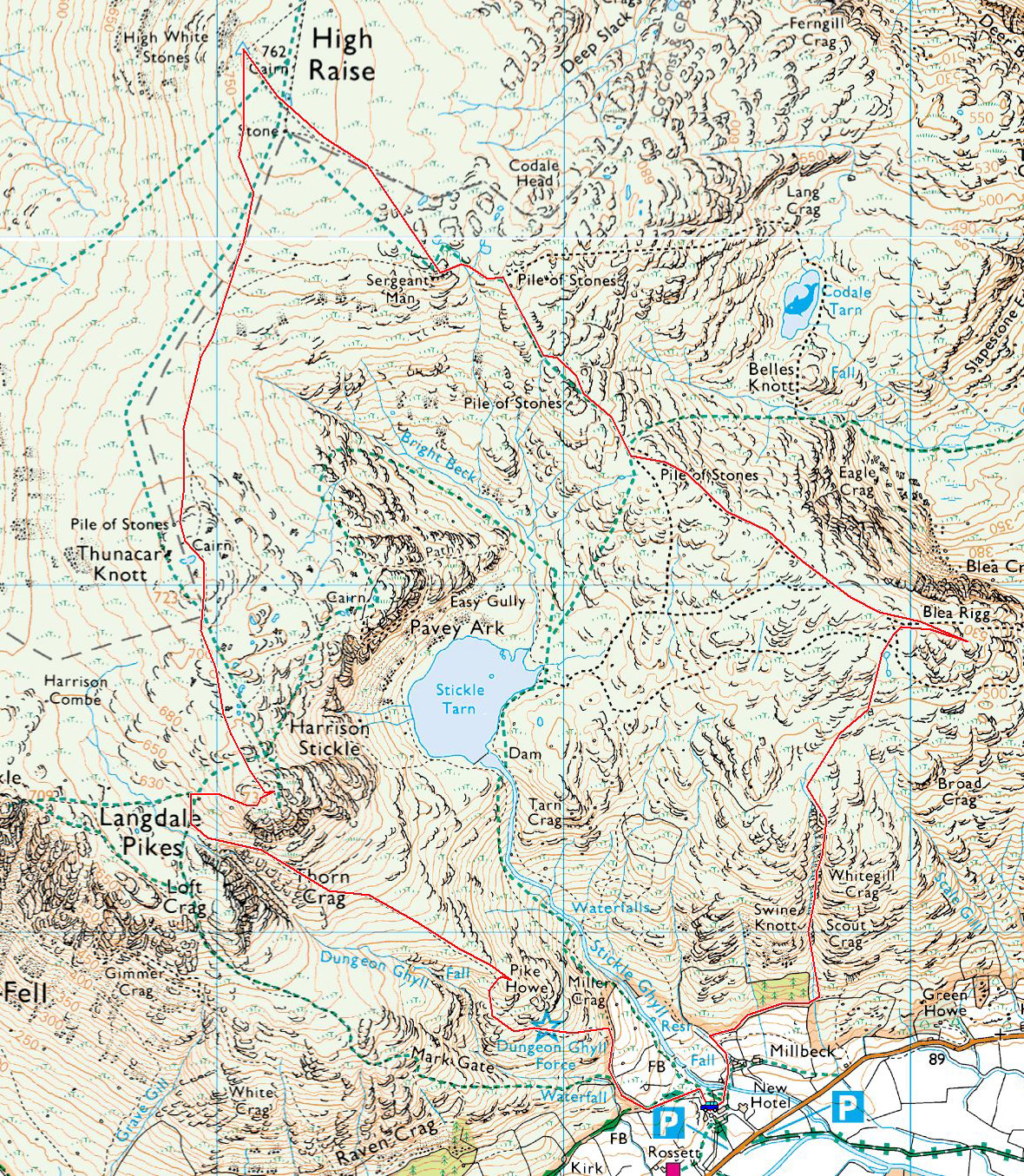
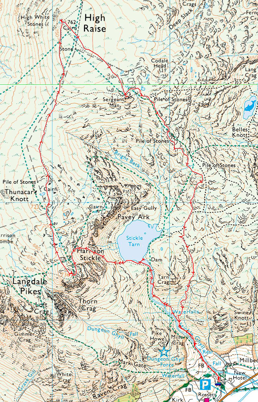
New Dungeon Ghyll – Stickle Tarn – North Rake – Pavey Ark – Thunacar Knott – Harrison Stickle – Dungeon Ghyll – New Dungeon Ghyll
Distance: 5.4 miles Total Ascent: 725 metres Time Taken: 3 hours 50 minutes Start Time: 10:25
Winter has certainly hit with a vengeance – what a morning. In Great Langdale the roads were treacherous and icy with the temperature down at -5C. The sky was blue and there were no clouds, just snow and lots of it. It turned out to be quite strenuous at times with knee deep snow on much of the route. I carried crampons and ice axe but wore micro-spikes throughout and didn’t resort to full crampons. This was a fantastic winter day on the fells and ones like this don’t come along very often, that’s for sure.

Fletcher is checking out the route up to Stickle Tarn.

Looking to Lingmoor Fell from the top of the waterfalls on Stickle Ghyll. Time for a breather here as it was boiling hot on this section of the walk, with the full sun reflected on the snow and not a breath of wind to cool me.

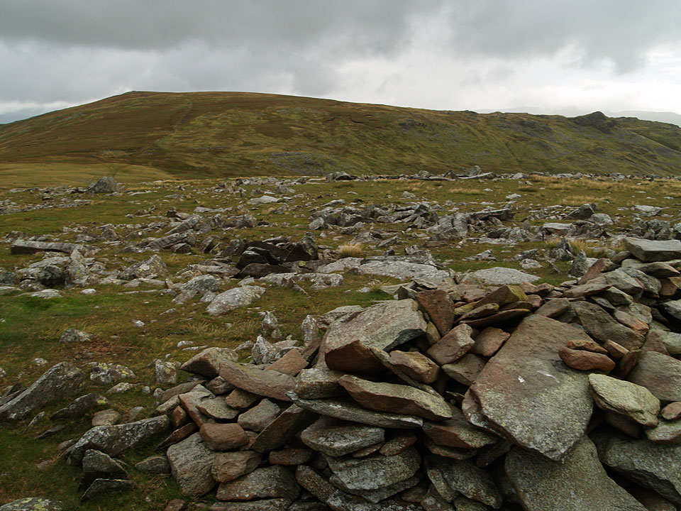
The view after crossing the Ghyll - I opted to cross lower down than usual as it is easier, although the climb was not necessarily so as the snow was knee deep for much of it.

As soon as we reached Stickle Tarn the wind picked up and of course it was biting and icy. Time to layer up before continuing, this photo is Harrison Stickle looking sugar coated.

Pavey Ark with Jacks Rake running Bottonm right to top left of the craggy face. I didn't fancy that today, conditions were hard enough as it was.

Harrison Stickle across Stickle Tarn...

...and Pavey Ark again, from further round the tarn.

Fletcher blazes a trail towards the North Rake.

Fantastic conditions, looking from the foot of the rake.

Looking across to Blea Rigg..

The snow in the North Rake was knee deep and it made for tough going. Can you spot 2 people halfway up in this photo? They give it some scale.

Made it! On Pavey Ark looking to Harrison Stickle and the Coniston fells beyond.

It is clear for miles and miles looking towards Windermere.

A panorama of the fells to the east,

No need to look at me like that Fletcher my lad!

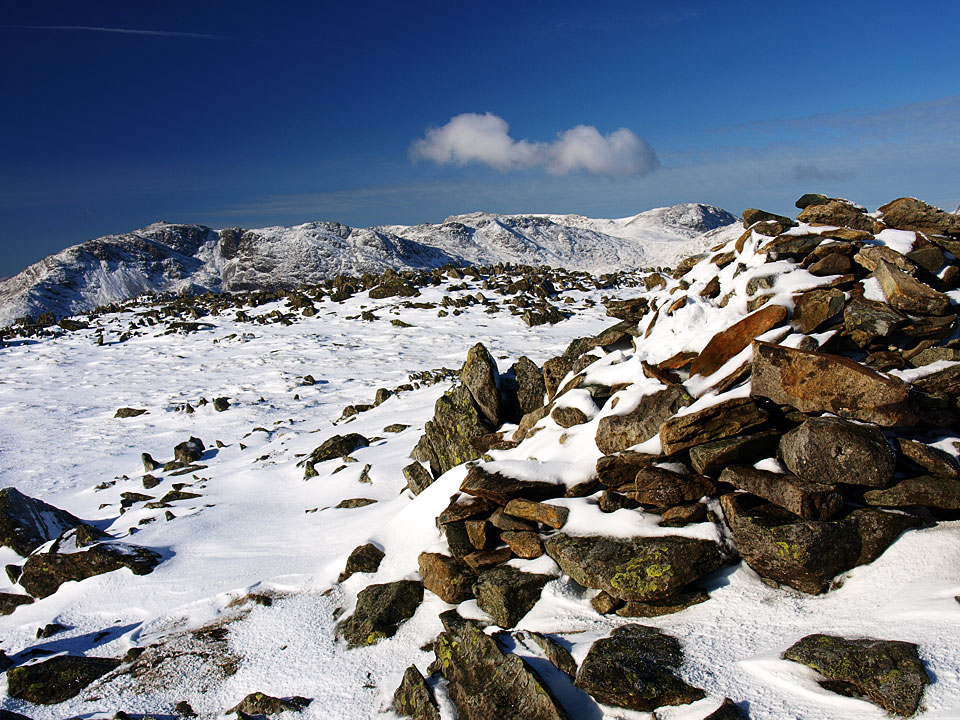
Thunacar Knott.

Heading for Harrison Stickle.

Bowfell and Esk Pike.

Bowfell and the Band.

A biscuit please.

Pike o' Stickle and Rosett Pike overshadowed by Bowfell and Esk Pike.

Harrison Stickle.

All the fells to the west - Great Gable central.

What a great view to Bowfell, Scafell Pike and Esk Pike across Mickleden with Pike o'Stickle and Rossett Pike in the foreground.

Great Langdale.

On the descent from Harrison Stickle.

Found someone else on the Dungeon Ghyll descent.

New cairn - looking back to Loft Crag and Thorn Crag on the descent.

A Herdwick welcome.

The sun is setting already but we are nearly down now.

The Langdale Pikes.