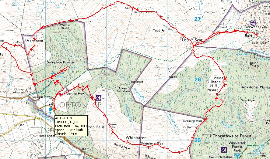
Striding Edge

A photo diary of Lake District fell walks

  • Walks
  • Fells
    • Wainwrights
      • Eastern Fells
      • Far Eastern Fells
      • Central Fells
      • Southern Fells
      • Northern Fells
      • North Western Fells
      • Western Fells
      • Outlying Fells
    • Birketts
  • Dogs
  • Love The Lakes
  • Contact

Loadpot Hill

Walked on 09/12/2003

St. Peter’s Church, Martindale – Hallin Fell (148) – Martindale Hause – Steel Knotts (Pikewassa) (149) – Brownthwaite Crag – Wether Hill (150) – Loadpot Hill (151) – Arthur’s Pike (152) – Bonscale Pike (154) – St. Peter’s Church, Martindale

013.jpg

Hallin Fell summit cairn.

014.JPG

Shrouded in mist, L-R: Steel Knotts, The Nab, Beda Fell.

015.JPG

Hallin Fell stands behind St.Peter's church, Martindale.

016.JPG

Beda Fell from the top of Steel Knotts.

017.JPG

The Nab from Steel Knotts summit.

018.jpg

Steel Knotts rock tor Pikeawassa, 'the sharpest in Lakeland'.

019.JPG

Looking back on Steel Knotts from the steep ascent of Wether Hill.

020.jpg

Wether Hill summit cairn. Raise can just be seen in the far distance.

021.JPG

All that remains of the ruins of Lowther House on the way to Loadpot Hill summit.

022.JPG

View from Wether Hill summit.

023.jpg

Loadpot Hill summit cairn.

024.jpg

Arthur's Pike summit cairn with Ullswater below.

025.JPG

The two towers on the side of Bonscale Pike. AW - 'The lower one is the work of a craftsman, the upper one the effort of amateurs'.

026.jpg

Bonscale Pike summit cairn looking along Ullswater to Dunmallard Hill.

027.JPG

The sun sets over Hallin Fell from Sharrow Bay.

Loughrigg Fell

Walked on 28/11/2003

Ambleside – Ivy Crag – Loughrigg Fell – Loughrigg Terrace – Rydal – Ambleside

013.jpg

Ivy Crag from Ambleside.

014.jpg

Ambleside from the ascent of Ivy Crag.

015.jpg

Windermere.

016.jpg

Waterhead and Windermere.

017.jpg

The Roman fort at Ambleside.

018.jpg

Tarn on Ivy Crag.

019.jpg

Looking to Loughrigg summit.

020.jpg

Loughrigg Tarn from Loughrigg summit.

021.jpg

Elterwater from Loughrigg summit.

022.jpg

Trig. point on Loughrigg.

023.jpg

Grasmere from Loughrigg.

024.jpg

Grasmere from the descent of Loughrigg terrace.

Angletarn Pikes

Walked on 10/11/2003

Hartsop – Hayeswater – The Knott – Rest Dodd (144) – The Nab (145) – Satura Crag – Angletarn Pikes (146) – Brock Crags (147) – Hartsop

013.JPG

Looking towards Hayeswater from the climb up Hayeswater Gill .

014.JPG

Hayeswater from the ascent of The Knott.

015.JPG

The Knott summit cairn shrouded in mist.

016.JPG

Rest Dodd from the descent of The Knott.

017.jpg

Rest Dodd summit cairn shrouded in mist.

018.JPG

View of The Nab with the peat hags in the foreground.

019.jpg

The Nab summit cairn looking towards Rest Dodd.

020.jpg

Brock Crags summit overlooking Brothers Water.

021.JPG

Angle Tarn from Brock Crags.

022.JPG

Deer on Brock Crags.

023.jpg

Angle Tarn from Angletarn Pikes southern summit.

024.JPG

View of Gray Crag from Brock Crags.

025.JPG

Looking up Pasture Beck to Threshwaite Mouth.

Helvellyn

Walked on 07/11/2003

Patterdale – Birkhouse Moor (140) – Striding Edge – Helvellyn – Nethermost Pike (141) – Dollywaggon Pike (142) – Seat Sandal (143) Fairfield – Cofa Pike – Saint Sunday Crag – Birks – Patterdale

013.JPG

Dollywagon Pike and Nethermost Pike from the Grisedale Valley.

014.JPG

View of Ullswater from the climb up to Birkhouse Moor. Glenridding Dodd is on the left with Place Fell over the water.

015.JPG

The Helvellyn ridge from Birkhouse Moor. L-R Striding Edge, Helvellyn, Swirral Edge and Catstycam

016.jpg

...and the same view from Birkhouse Moor summit cairn.

017.JPG

Striding Edge.

018.JPG

View from Helvellyn summit.

019.JPG

Birkhouse Moor and Ullswater from Helvellyn.

020.JPG

Striding Edge from Nethermost Pike summit.

021.jpg

Place Fell and Beda Fell from Nethermost Pike summit.

022.JPG

Dollywagon Pike overlooking Saint Sunday Crag.

023.jpg

Grasmere and Coniston from Seat Sandal summit.

024.JPG

Looking back from Fairfield summit towards Dollywagon Pike, Nethermost Pike and Helvellyn.

025.JPG

Grisedale Tarn from Cofa Pike.

026.JPG

Looking towards the High Street range from the summit of St. Sunday Crag.

027.JPG

The sun descending behind St. Sunday Crag from Birks summit.

Mellbreak

Walked on 30/10/2003

Scalehill Bridge – Loweswater – Mellbreak (133) – Scale Knott – Starling Dodd (134) – Great Borne (135) – Floutern Tarn – Hen Comb (136) – Gavel Fell (137) – Blake Fell (138) – Burnbank Fell (139) – Holme Wood – Loweswater – Scalehill Bridge

013.JPG

From AW 'The Western Fells' - "A negative signpost (intended to help motorists) Kirkstile Inn road junction.

014.JPG

View from the ascent of Mellbreak looking towards Loweswater with Low Fell to the right. Note the ancient earthworks in the centre.

015.JPG

Wainwrights "...a lovely peep around a corner..." from Mellbreak on the direct ascent from Loweswater.

016.JPG

Grasmoor from Mellbreak summit.

017.JPG

Whiteside and Grasmoor from Mellbreak.

018.JPG

The Northern summit of Mellbreak with Starling Dodd behind the Southern summit.

019.JPG

Buttermere from the South summit of Mellbreak.

020.JPG

Starling Dodd summit looking towards Pillar. Note the ironwork has been separated from the stone in the main summit cairn.

021.jpg

The summit column of Great Borne looking over Banna Fell.

022.JPG

Floutern Tarn from Great Borne summit, with Gavel Fell, Low Fell and Hen Comb in view.

023.jpg

Hen Comb summit looking over Buttermere. Background L-R: Robinson, Dale Head, Fleetwith Pike and Starling Dodd.

024.jpg

Looking over Mellbreak to Grasmoor from Gavel Fell summit. Hen Comb is to the left.

025.jpg

The summit cairn shelter on Blake Fell looking North towards the Solway Firth.

026.jpg

Burnbank Fell 'summit', the summit being the old fence corner post! Carling Knott is to the left of the picture.

027.JPG

The final descent with Loweswater and Crummock Water visible. In the centre is Grasmoor flanked by Whiteside and Robinson.

Newlands Round

Walked on 23/10/2003

Little Town – Chapel Bridge – Low High Snab – High Snab Bank – Robinson (127) – Littledale Edge – Hindscarth (128) – Hindscarth Edge – Dale Head (129) – Dalehead Tarn – High Spy (130) – Maiden Moor (131) – Hause Gate – Catbells (132) – Hause Gate – Little Town

013.JPG

Newlands Church at the start of the walk.

014.JPG

Scope End from Newlands.

015.JPG

Ard Crags and Knott Rigg with Crag Hill and Sail behind.

016.JPG

Robinson from High Snab bank.

017.jpg

Buttermere and Crummock Water from Robinson's summit. Mellbreak is to the left and Whiteless Pike to the right.

018.JPG

Kirk Fell and the Scafells over the Ennerdale Valley from the summit of Robinson.

019.JPG

Maiden Moor and Catbells from Hindscarth.

020.jpg

Hindscarth summit.

021.jpg

Dale Head summit cairn.

022.jpg

High Spy summit cairn.

023.jpg

Derwent Water from Maiden Moor summit.

024.JPG

The Coledale Fells from Maiden Moor.

025.jpg

Skiddaw, Blencathra and Derwent Water from Cat Bells summit.

026.JPG

Return to Little Town: L-R Hindscarth, Scope End, Robinson, High Snab Bank.

027.JPG

Causey Pike from Little Town.

High Seat

Walked on 22/10/2003

Armboth – Armboth Fell (122) – High Tove (123) – High Seat (124) – Bleaberry Fell (125) – Shoulthwaite – Raven Crag (126) – Castle Crag (Shoulthwaite) – Thirlmere Dam – Armboth

013.JPG

Thirlmere from the ascent of Armboth Fell.

014.JPG

Wainwrights " A balanced boulder, 12 feet high, alongside the footpath from Armboth ".

015.jpg

High Tove from Armboth Fell's summit in the first snow flurry of the winter!

016.jpg

High Seat from High Tove summit cairn.

017.JPG

Looking along the fence from High Seat to High Tove

018.jpg

Robinson shrouded in the mist from High Seat summit.

019.jpg

Bassenthwaite Lake from Bleaberry Fell summit. Broom Fell is to the left and Skiddaw is in the mist with Dodd visible.

020.jpg

Cat Bells across Derwent Water from Bleaberry Fell.

021.JPG

Clough Head, Calfhow Pike and Great Dodd from the descent of Bleaberry Fell.

022.jpg

Raven Crag summit cairn.

023.JPG

A half empty Thirlmere from Raven Crag.

024.JPG

Thirlmere dam from Raven Crag.

025.JPG

Raven Crag from Thirlmere.

026.JPG

Thirlmere from the dam.

027.JPG

View across Thirlmere dam.

Loughrigg Fell

Walked on 16/10/2003

Loughrigg Fell (121) from Oaks

013.jpg

Loughrigg Fell summit.

014.jpg

The Langdale Pikes from Loughrigg.

015.jpg

Windermere.

016.jpg

Loughrigg Tarn.

017.jpg

The Langdale Pikes.

018.jpg

Elterwater and the Coniston Fells.

Grasmoor

Walked on 15/10/2003

Lanthwaite Green – Whin Ben – Whiteside (116) – Hopegill Head – Sand Hill – Grasmoor (117) – Wandope (118) – Thirdgill Head Man – Whiteless Pike (119) – Whiteless Breast – Low Bank – Rannerdale Knotts (120) – Rannerdale – Lanthwaite Green

013.JPG

Whiteside and Whin Ben at the start of the walk.

014.JPG

Carling Knott and Burnbank Fell to the left of Loweswater, Low Fell to the right.

015.JPG

The Hopegill Head Ridge from Whiteside's summit.

016.JPG

Mellbreak across Crummock Water from Whiteside's East summit cairn.

017.jpg

Shelter on Grasmoor summit.

018.JPG

The Scafell Pikes across Buttermere from Grasmoor.

019.jpg

The Helvellyn ridge in the distance from Wandope's summit.

020.JPG

Knott Rigg from Wandope.

021.JPG

Mellbreak across Crummock Water from Thirdgill Head Man.

022.JPG

Thirdgill Head and Wandope from Whiteless Pike's summit.

023.JPG

Rannerdale Knotts, Mellbreak, Crummock Water and Loweswater.

024.JPG

Crummock Water and Loweswater from Rannerdale Knotts summit.

025.jpg

Buttermere from Rannerdale Knotts summit.

026.jpg

Mellbreak.

027.JPG

Whiteless Pike from Lanthwaite Green.

The Dodds

Walked on 13/10/2003

Wanthwaite – Threlkeld Knotts – Clough Head (113) – Calfhow Pike – Little Dodd (St John’s Common) – Great Dodd (114) – Watson’s Dodd (115) – Great Dodd – Randerside – Mariel Bridge – Old Coach Road – Wanthwaite

013.JPG

Skiddaw from Wanthwaite, the start of the walk.

014.JPG

High Rigg from the climb to Threlkeld Knotts. The colours have just started to turn autumnal.

015.JPG

Skiddaw from Threlkeld Knotts summit.

016.JPG

Blencathra from the summit of Clough Head.

017.JPG

Great Dodd from the summit of Clough Head.

018.JPG

Calfhow Pike from the descent of Clough Head.

019.JPG

Thirlmere from Calfhow Pike, High Seat in the far distance.

020.jpg

Great Dodd summit.

021.JPG

Watson's Dodd from Great Dodd.

022.JPG

Skiddaw and Blencathra from Watson's Dodd summit.

023.JPG

The summit of Randerside on the descent of Great Dodd, Catstycam and Helvellyn are in the distance.

024.JPG

The old coach road crossing the Mosedale Beck, Blencathra is in the distance.

Raise

Walked on 02/10/2003

Glenridding – Glenridding Dodd (107) – Heron Pike (Glenridding) – Sheffield Pike (108) – Glencoyne Head – Hart Side (109) – Stybarrow Dodd (110) – Sticks Pass – Raise (111) – White Side (112) – Greenside Road – Glenridding

013.JPG

Birks and Keldas from the ascent of Glenridding Dodd.

014.JPG

Raise from the climb to Glenridding Dodd.

015.JPG

The summit of Glenridding Dodd L-R: Birkhouse Moor, Catstycam, Helvellyn, White Side and Raise.

016.JPG

Ullswater from Glenridding Dodd.

017.JPG

Catstycam and the Helvellyn ridge.

018.jpg

Ullswater from Sheffield Pike summit.

019.jpg

Great Dodd from Hart Side summit.

020.jpg

High Seat and Bleaberry Fell from the summit of Stybarrow Dodd.

021.JPG

Raise from Sticks Pass.

022.jpg

The summit of Raise with Skiddaw in the distance.

023.JPG

White Side from Raise with Helvellyn Lower Man behind.

024.jpg

White Side summit looking across to Helvellyn.

025.JPG

The Greenburn Road. L-R: Sheffield Pike, Place Fell, Birkhouse Moor. In the far distance is the High Street ridge.

026.JPG

Kepplecove Tarn beneath Helvellyn.

027.JPG

Looking up Swart Beck and the disused mine workings from the bridge.

Binsey

Walked on 25/09/2003

Binsey Cottage – Binsey (106) – Binsey Cottage

013.jpg

Binsey from Longlands Fell.

014.jpg

The summit of Binsey.

015.jpg

Binsey Cottage.

The Uldale Fells

Walked on 25/09/2003

Longlands – Charleton Wath – Brae Fell (100) – Great Sca Fell (101) – Great Calva (102) – Knott – Meal Fell (103) – Trusmador – Great Cockup (104) – Little Sca Fell – Lowthwaite Fell – Longlands Fell (105) – Longlands

013.JPG

Skiddaw from Brae Fell summit.

014.jpg

Brae Fell summit.

015.jpg

Knott from Great Scafell summit.

016.JPG

Great Calva and Skiddaw from Knott.

017.JPG

Great Calva.

018.JPG

Ascending Great Calva.

019.jpg

Great Calva summit.

020.jpg

Great Cockup summit.

021.jpg

Meal Fell summit.

022.jpg

Longlands Fell summit.

Grike

Walked on 15/09/2003

Coldfell Road – Grike (96) – Crag Fell (97) – Iron Crag – Caw Fell (98) – Iron Crag – Whoap – Lank Rigg (99) – Whoap Beck – Coldfell Road

013.jpg

Grike summit cairn.

014.JPG

Looking towards Crag Fell from Grike.

015.jpg

Crag Fell summit cairn.

016.JPG

Ennerdale Water visible through the mist with Great Borne beyond.

017.JPG

Grike from Crag Fell summit.

018.JPG

Iron Crag summit.

019.jpg

Caw Fell summit.

020.JPG

Whoap summit stone.

021.JPG

Looking down Whoap beck.

022.JPG

Lank Rigg summit cairn and Trig Point.

023.JPG

Wainwright's flat stone on Lank Rigg.....

024.JPG

complete with buried treasure, now up from 2 shillings to 4!

025.JPG

Lank Rigg from the walk down Whoap Beck.

026.JPG

Looking back up Whoap Beck with Whoap on the left, Lank Rigg to the right.

027.jpg

Kinniside Stone Circle - a fake.

Great Gable

Walked on 05/09/2003

Wasdale Head – Black Sails Pass – Kirk Fell (93) – Great Gable (94) – Green Gable (95) – Windy Gap – Styhead Tarn – Wasdale Head

013.JPG

Looking up Mosedale Beck towards Black Sails.

014.JPG

Looking over the Black Sails Pass to Haystacks and Fleetwith Pike with Robinson, Dale Head and Hinsdscarth in the far distance.

015.JPG

High Crag and Haystacks from Black Sails Pass with Robinson behind.

016.JPG

Wastwater from Kirk Fell summit, Illgill Head to the left and Yewbarrow to the right.

017.JPG

Great Gable from Kirk Fell.

018.jpg

Scafell and Lingmell from Kirk Fell summit.

019.JPG

Kirk Fell Tarn.

020.JPG

A dried up Beckhead Tarn from Kirk Fell.

021.jpg

Great Gable summit overlooking Wastwater.

022.JPG

Wastwater from the Westmorland cairn.

023.JPG

The Scafell Pikes from Great Gable.

024.JPG

View from Green Gable summit with Pillar on the left with Haystacks and High Crag on the right.

025.JPG

Great Gable from Green Gable.

026.JPG

Styhead Tarn from Windy Gap.

027.JPG

The 'cat rock' on Great Gable from the Lingmell Beck path.

Coledale Round

Walked on 03/09/2003

Braithwaite – Kinn – Grisedale Pike (85) – Hopegill Head (86) – Sand Hill – Coledale Hause – Eel Crag (Crag Hill) (87) – Sail (88) – Scar Crags (89) – Causey Pike (90) – Outerside (91) – Stile End – Barrow (92) – Braithwaite

013.JPG

Looking over Braithwaite from the ascent of Kinn.

014.JPG

Grisedale Pike from Kinn.

015.jpg

Grisedale Pike summit overlooking Keswick.

016.JPG

Hopegill Head from Grisedale Pike.

017.JPG

Eel Crag from Grisedale Pike.

018.jpg

Grisedale Pike from Hopegill Head summit.

019.JPG

Causey Pike from Sand Hill.

020.JPG

Eel Crag from Coledale Hause.

021.JPG

Eel Crag summit, Grisedale Pike behind.

022.JPG

Sail summit looking back along the path to Eel Crag.

023.JPG

Skiddaw and Bassenthwaite Lake from Scar Crags summit.

024.JPG

Derwent Water from Causey Pike summit.

025.jpg

Outerside summit.

026.JPG

Derwent Water from Barrow summit.

027.jpg

Skiddaw from Barrow summit.

Back o’ Skiddaw

Walked on 19/08/2003

Bowscale – Bowscale Tarn – Bowscale Fell (71) – Bannerdale Crags (72) – Blencathra (73) – Lonscale Fell (74) – Skiddaw Little Man (75) – Skiddaw (76) – Bakestall (77) – Little Calva – Knott (78) – Great Lingy Hill – High Pike (79) – Carrock Fell (80) – Mungrisdale – Bowscale

013.JPG

Bowscale Tarn.

014.jpg

Blencathra from Bowscale Fell summit.

015.jpg

Looking over Troutbeck from Bannerdale Crags' summit.

016.JPG

Blencathra from Bannerdale Crags.

017.JPG

Derwent Water from Blencathra summit.

018.jpg

Skiddaw from the summit of Blencathra.

019.jpg

Lonscale Fell summit.

020.JPG

Derwent Water from Skiddaw Lesser Man summit cairn.

021.jpg

Derwent Water from Skiddaw Little Man.

022.JPG

Bassenthwaite Lake from Skiddaw summit.

023.jpg

Horse shape in the heather on Little Calva from Bakestall.

024.jpg

Bakestall summit.

025.JPG

Looking back to Skiddaw from Bakestall's Southern Cairn.

026.jpg

Knott summit.

027.jpg

Seat, shelter and trig. column on High Pike summit.

028.JPG

Millenium detail on High Pike trig. column.

029.JPG

Carrock Fell from High Pike.

030.jpg

Carrock Fell summit.

Holme Fell and Black Fell

Walked on 07/08/2003

Two short walks, Holme Fell (69) and Black Fell (70)

013.JPG

Ivy Crag on Holme Fell.

014.JPG

A hazy view from Holme Fell.

015.JPG

Holme Fell highest point.

016.JPG

Iron Keld plantation, currently being demolished.

017.JPG

Black Crag, the summit of Black Fell.

018.JPG

Windermere from Black Fell.

019.JPG

Holme Fell from Black Fell.

020.JPG

Black Fell South-East cairn.

Haystacks

Walked on 03/07/2003

Gatesgarth – Fleetwith Pike (60) – Haystacks (61) – High Crag (62) – High Stile (63) – Red Pike (Buttermere) (64) – Gatesgarth

013.JPG

Memorial cross on the ascent of Fleetwith Pike.

014.JPG

Mellbreak across Buttermere.

015.JPG

High Crag and High Stile from Fleetwith Pike summit.

016.JPG

Buttermere and Crummock Water from Fleetwith Pike.

017.JPG

Pillar and Haystacks from Fleetwith Pike.

018.JPG

Pillar behind Innominate Tarn.

019.JPG

Kirk Fell from Haystacks.

020.JPG

Crummock Water from the summit of Haystacks.

021.JPG

Robinson and Hindscarth from Haystacks.

022.JPG

Bleaberry Tarn and Crummock Water.

023.JPG

Haystacks.

024.JPG

High Crag.

025.JPG

Ennerdale from the summit of High Crag.

026.JPG

High Stile summit.

027.JPG

Robinson over Buttermere.

028.JPG

Crummock Water.

029.JPG

Red Pike summit.

030.JPG

Fleetwith Pike on the descent of Red Pike.

031.JPG

Fleetwith Pike across Buttermere.

032.JPG

Haystacks across Buttermere.

Kentmere Horseshoe

Walked on 24/06/2003

Kentmere – Garburn Pass – Yoke (53) – Ill Bell (54) – Froswick (55) – Mardale Ill Bell (56) – Harter Fell (Mardale) (57) – Kentmere Pike (58) – Shipman Knotts (59) – Kentmere

013.JPG

Thornthwaite, Ill Bell and Yoke from the Garburn road.

014.JPG

Cairn on Yoke.

015.JPG

Ill Bell from Yoke.

016.JPG

Windermere from Ill Bell, Troutbeck Tongue in the centre, Wansfell to the right.

017.JPG

Thornthwaite Crag from Froswick summit.

018.JPG

Kentmere Reservoir.

019.JPG

Windermere from Froswick.

020.JPG

Wild ponies on Thornthwaite.

021.JPG

Mardale Ill Bell summit, Haweswater Reservoir behind.

022.JPG

Small Water and the southern end of Haweswater Reservoir from Mardale Ill Bell.

023.JPG

The Nan Bield Pass - Mardale or Kentmere?

024.JPG

Harter Fell summit.

025.JPG

Kentmere Pike summit.

026.JPG

Shipman Knotts summit looking over to Yoke and Ill Bell.

  • « Previous Page
  • 1
  • …
  • 50
  • 51
  • 52
  • 53
  • Next Page »

Walking Diary

  • Devoke Water 25/08/2025
  • Torver Common 24/08/2025
  • Meet Finlay! 23/08/2025
  • Walla Crag 27/03/2025
  • Bowfell 19/03/2025

Social

  • Facebook
  • Twitter

Information

  • Striding Edge
  • T&C’s
  • Privacy
  • Links